About tags on Geograph

Public Tags

Related Tags | Coverage Map
Prefix: near    Tag:  Whitby  
Other tags: Whitby     place:Whitby     town scene:Whitby    

Showing latest 50 of 133 images tagged with near:Whitby tag.

View all tagged images - In Browser
:

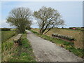
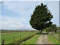
NZ8909 : Glen Esk Road, near Whitby by Malc McDonald Glen Esk Road, near Whitby by Malc McDonald
geograph for square NZ8909
Glen Esk Road is a minor road leading out of Whitby to the nearby village of... (more)
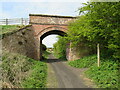
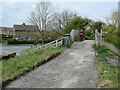
NZ8909 : Ruswarp Bridge by Malc McDonald Ruswarp Bridge by Malc McDonald
geograph for square NZ8909
Ruswarp Bridge carries the B1416 road across the River Esk, near Whitby. The... (more)
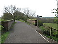
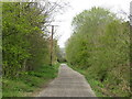
NZ8909 : Glen Esk Road, near Ruswarp by Malc McDonald Glen Esk Road, near Ruswarp by Malc McDonald
geograph for square NZ8909
Glen Esk Road is on the route of National Cycle Network route 165.
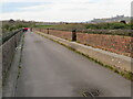
NZ8909 : Larpool Viaduct, near Whitby by Malc McDonald Larpool Viaduct, near Whitby by Malc McDonald
geograph for square NZ8909
Larpool viaduct, built to carry a railway line into Whitby, now forms part of... (more)
NZ8909 : Larpool Viaduct, near Whitby by Malc McDonald Larpool Viaduct, near Whitby by Malc McDonald
geograph for square NZ8909
The Larpool Viaduct and the River Esk, on the outskirts of Whitby. The viaduct... (more)
NZ9208 : Cinder Track near Hawsker by Malc McDonald Cinder Track near Hawsker by Malc McDonald
geograph for square NZ9208
A view along the Cinder Track, a walking and cycling trail which follows the... (more)
Tags: long distance path:Cinder Track   Cinder Track   Course of Dismantled Railway   Cycling and Walking Trail   Dismantled Railway Line   type:Geograph   near:Hawsker   National Cycle Network   National Cycle Network Route 1   NCN   NCN Route 1   NCN1   county:North Yorkshire   subject:Path   top:Paths   national cycle network:Route 1   near:Stainsacre   near:Whitby  
NZ8909 : Larpool Viaduct, near Whitby by Malc McDonald Larpool Viaduct, near Whitby by Malc McDonald
geograph for square NZ8909
The Larpool Viaduct and the River Esk on the outskirts of Whitby. The viaduct... (more)
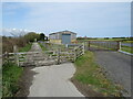
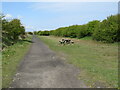
NZ8909 : Cinder Track near Whitby by Malc McDonald Cinder Track near Whitby by Malc McDonald
geograph for square NZ8909
The Cinder Track follows the route of a former railway between Whitby and... (more)
NZ9207 : Cinder Track, Hawsker, near Whitby by Malc McDonald Cinder Track, Hawsker, near Whitby by Malc McDonald
geograph for square NZ9207
The Cinder Track is a walking and cycling trail linking Scarborough with Whitby,... (more)
Tags: Cinder Track   long distance path:Cinder Track   Course of Dismantled Railway   Cycling and Walking Trail   Dismantled Railway Line   type:Geograph   place:Hawsker   National Cycle Network   National Cycle Network Route 1   NCN   NCN Route 1   NCN1   county:North Yorkshire   top:Paths   national cycle network:Route 1   near:Stainsacre   subject:Trail   near:Whitby  
NZ9407 : Cinder Track near Robin Hood's Bay by Malc McDonald Cinder Track near Robin Hood's Bay by Malc McDonald
geograph for square NZ9407
The Cinder Track is a walking and cycling trail linking Scarborough with Whitby,... (more)
NZ9407 : Cinder Track near Hawsker by Malc McDonald Cinder Track near Hawsker by Malc McDonald
geograph for square NZ9407
The Cinder Track is a walking and cycling trail linking Scarborough with Whitby,... (more)
Tags: Cinder Track   long distance path:Cinder Track   Course of Dismantled Railway   Cycling and Walking Trail   Dismantled Railway Line   type:Geograph   near:Hawsker   National Cycle Network   National Cycle Network Route 1   NCN   NCN Route 1   NCN1   county:North Yorkshire   top:Paths   near:Robin Hoods Bay   national cycle network:Route 1   subject:Trail   near:Whitby  
NZ9207 : Cinder Track near Hawsker by Malc McDonald Cinder Track near Hawsker by Malc McDonald
geograph for square NZ9207
The Cinder Track is a walking and cycling trail linking Scarborough with Whitby,... (more)
NZ8909 : Cinder Track near Whitby by Malc McDonald Cinder Track near Whitby by Malc McDonald
geograph for square NZ8909
A view along the Cinder Track, a walking and cycling trail which follows the... (more)
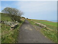
NZ8811 : England Coast Path near Whitby by Malc McDonald England Coast Path near Whitby by Malc McDonald
geograph for square NZ8811
This paved track is on the route of the England Coast Path and the Cleveland Way... (more)
NZ9307 : Cinder Track near Hawsker by Malc McDonald Cinder Track near Hawsker by Malc McDonald
geograph for square NZ9307
The Cinder Track is a walking and cycling trail linking Scarborough with Whitby,... (more)
NZ9307 : Cinder Track near Hawsker by Malc McDonald Cinder Track near Hawsker by Malc McDonald
geograph for square NZ9307
The Cinder Track is a walking and cycling trail linking Scarborough with Whitby,... (more)
Tags: Cinder Track   long distance path:Cinder Track   Course of Dismantled Railway   Cycling and Walking Trail   Dismantled Railway Line   type:Geograph   near:Hawsker   National Cycle Network   National Cycle Network Route 1   NCN   NCN Route 1   NCN1   county:North Yorkshire   top:Paths   national cycle network:Route 1   subject:Trail   near:Whitby  
NZ9108 : Cinder Track near Stainsacre by Malc McDonald Cinder Track near Stainsacre by Malc McDonald
geograph for square NZ9108
A view along the Cinder Track, a walking and cycling trail which follows the... (more)
NZ8909 : Larpool Viaduct, near Whitby by Malc McDonald Larpool Viaduct, near Whitby by Malc McDonald
geograph for square NZ8909
The River Esk passing under the Larpool Viaduct on the outskirts of Whitby. The... (more)
NZ8712 : Sandsend Road, near Whitby by Malc McDonald Sandsend Road, near Whitby by Malc McDonald
geograph for square NZ8712
Sandsend Road forms part of the route of the A174, heading out of Whitby towards... (more)
Tags: road:A Road   road:A174   ldp:Cleveland Way   long distance path:Cleveland Way   Cleveland Way   national trail:Cleveland Way   Coast Road   top:Coastal   Coastal Road   long distance path:England Coast Path   England Coast Path   path:England Coast Path   type:Geograph   county:North Yorkshire   subject:Road   top:Roads, Road Transport   Route of England Coastal Path   near:Sandsend   The Cleveland Way   near:Whitby  
NZ8711 : Sandsend Road, near Whitby by Malc McDonald Sandsend Road, near Whitby by Malc McDonald
geograph for square NZ8711
Sandsend Road forms part of the route of the A174 heading north along the coast... (more)
Tags: road:A Road   road:A174   Cleveland Way   national trail:Cleveland Way   ldp:Cleveland Way   long distance path:Cleveland Way   Coast Road   top:Coastal   Coastal Road   path:England Coast Path   long distance path:England Coast Path   England Coast Path   type:Geograph   county:North Yorkshire   subject:Road   top:Roads, Road Transport   Route of England Coastal Path   near:Sandsend   The Cleveland Way   near:Whitby  
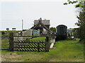
NZ9208 : Cinder Track and former railway station, Hawsker by Malc McDonald Cinder Track and former railway station, Hawsker by Malc McDonald
geograph for square NZ9208
The Cinder Track is a walking and cycling trail linking Scarborough with Whitby,... (more)
NZ9208 : Cinder Track, Hawsker by Malc McDonald Cinder Track, Hawsker by Malc McDonald
geograph for square NZ9208
The Cinder Track is a walking and cycling trail linking Scarborough with Whitby,... (more)
Tags: long distance path:Cinder Track   Cinder Track   Course of Dismantled Railway   Cycling and Walking Trail   Dismantled Railway Line   type:Geograph   place:Hawsker   National Cycle Network   National Cycle Network Route 1   NCN   NCN Route 1   NCN1   county:North Yorkshire   top:Paths   national cycle network:Route 1   near:Stainsacre   subject:Trail   near:Whitby  
NZ9208 : Cinder Track at Hawsker by Malc McDonald Cinder Track at Hawsker by Malc McDonald
geograph for square NZ9208
The Cinder Track is a walking and cycling trail which follows the route of a... (more)
NZ8811 : Path to the shore near Whitby by Malc McDonald Path to the shore near Whitby by Malc McDonald
geograph for square NZ8811
A path leading to the seashore near Whitby.
Tags: top:Coastal   type:Geograph   county:North Yorkshire   subject:Path   top:Paths   near:Sandsend   near:Whitby  
NZ8909 : River Esk near Whitby by Malc McDonald River Esk near Whitby by Malc McDonald
geograph for square NZ8909
A view of the River Esk on the outskirts of Whitby. This image was taken from... (more)
NZ8909 : Shadows on the river Esk near Whitby by Malc McDonald Shadows on the river Esk near Whitby by Malc McDonald
geograph for square NZ8909
A view of the River Esk on the outskirts of Whitby, taken from the Larpool... (more)
NZ8909 : Captain Cook's Haven, Whitby by Malc McDonald Captain Cook's Haven, Whitby by Malc McDonald
geograph for square NZ8909
Captain Cook's Haven is a small development of holiday cottages on the bank... (more)
NZ8909 : Captain Cook's Haven, Whitby by Malc McDonald Captain Cook's Haven, Whitby by Malc McDonald
geograph for square NZ8909
Captain Cook's Haven is a small development of holiday cottages on the bank... (more)
NZ8909 : Larpool viaduct, near Whitby by J.Hannan Larpool viaduct, near Whitby by J.Hannan
geograph for square NZ8909
Built for the Scarborough and Whitby Railway to carry a single track line over... (more)
Tags: type:Geograph   top:Historic Sites and Artefacts   place:Larpool Viaduct   top:Railways   subject:Viaduct   near:Whitby  
NZ8712 : Driveway to Raithwaite Estate, near Whitby by Malc McDonald Driveway to Raithwaite Estate, near Whitby by Malc McDonald
geograph for square NZ8712
A driveway leading into the Raithwaite estate, on the North Yorkshire coast near Whitby.
Tags: subject:Drive   Driveway   Entrance Drive   Entrance Driveway   type:Geograph   county:North Yorkshire   top:Roads, Road Transport   near:Sandsend   near:Whitby  
NZ8809 : Ruswarp Lane, near Whitby by Malc McDonald Ruswarp Lane, near Whitby by Malc McDonald
geograph for square NZ8809
Ruswarp Lane descends a steep gradient into the village of Ruswarp, near Whitby.... (more)
Tags: road:B Road   road:B1416   type:Geograph   county:North Yorkshire   subject:Road   top:Roads, Road Transport   near:Ruswarp   Steep Hill 1 in 5   warning sign:Steep Hill Downwards   Warning Sign Steep Hill Downwards   near:Whitby  
NZ8811 : Cleveland Way near Whitby by Malc McDonald Cleveland Way near Whitby by Malc McDonald
geograph for square NZ8811
This path clinging to the coastline near Whitby is on the route of The Cleveland... (more)
Tags: Cleveland Way   ldp:Cleveland Way   long distance path:Cleveland Way   national trail:Cleveland Way   Coast Path   top:Coastal   Coastal Path   path:England Coast Path   long distance path:England Coast Path   England Coast Path   type:Geograph   county:North Yorkshire   top:Paths   Route of England Coastal Path   The Cleveland Way   near:Whitby  
NZ8811 : Cleveland Way near Whitby by Malc McDonald Cleveland Way near Whitby by Malc McDonald
geograph for square NZ8811
This path near Whitby is on the route of the Cleveland Way and the England Coast Path.
Tags: Cleveland Way   national trail:Cleveland Way   long distance path:Cleveland Way   ldp:Cleveland Way   Coast Path   Coastal Path   path:England Coast Path   long distance path:England Coast Path   England Coast Path   type:Geograph   county:North Yorkshire   subject:Path   top:Paths   Route of England Coastal Path   The Cleveland Way   near:Whitby  
NZ8512 : Cottages at Sandsend, near Whitby by Malc McDonald Cottages at Sandsend, near Whitby by Malc McDonald
geograph for square NZ8512
Cottages at Sandsend, near Whitby in North Yorkshire.
Tags: Cottages   housing:Cottages   subject:Cottages   type:Geograph   top:Housing, Dwellings   county:North Yorkshire   place:Sandsend   top:Village, Rural Settlement   near:Whitby  
NZ8711 : Cliff Lane, near Whitby by Malc McDonald Cliff Lane, near Whitby by Malc McDonald
geograph for square NZ8711
A view along Cliff Lane, a minor road near Whitby, looking towards the North Sea.
NZ8711 : Cliff Lane, near Whitby by Malc McDonald Cliff Lane, near Whitby by Malc McDonald
geograph for square NZ8711
Cliff Lane is a minor road in countryside near Whitby in North Yorkshire. Here... (more)
Tags: top:Coastal   type:Geograph   subject:Lane   Minor Country Lane   Minor Lane   road:Minor Road   Minor Road   county:North Yorkshire   top:Roads, Road Transport   Rural Lane   Rural Road   View to Sea   near:Whitby  
NZ8610 : Cliff Lane, near Whitby by Malc McDonald Cliff Lane, near Whitby by Malc McDonald
geograph for square NZ8610
Cliff Lane passing Greystone Farmhouse in countryside near Whitby, North Yorkshire.
NZ8610 : Stile near Whitby by Malc McDonald Stile near Whitby by Malc McDonald
geograph for square NZ8610
A stile taking a public footpath onto a field in countryside near Whitby, in... (more)
NZ8610 : Cliff Lane, near Whitby by Malc McDonald Cliff Lane, near Whitby by Malc McDonald
geograph for square NZ8610
Cliff Lane is a minor road in countryside near Whitby in North Yorkshire.
Tags: type:Geograph   subject:Lane   Minor Country Lane   Minor Lane   Minor Road   road:Minor Road   county:North Yorkshire   top:Roads, Road Transport   Rural Lane   Rural Road   near:Whitby  
NZ8610 : Bennison Lane, Newholm, near Whitby by Malc McDonald Bennison Lane, Newholm, near Whitby by Malc McDonald
geograph for square NZ8610
Bennison Lane leading into the village of Newholm, near Whitby in North Yorkshire.
Tags: type:Geograph   subject:Lane   Minor Country Lane   Minor Lane   Minor Road   road:Minor Road   place:Newholm   county:North Yorkshire   top:Roads, Road Transport   Rural Lane   Rural Road   near:Whitby  
NZ8610 : Cliff Lane, near Whitby by Malc McDonald Cliff Lane, near Whitby by Malc McDonald
geograph for square NZ8610
Cliff Lane is a minor road in countryside near Whitby in North Yorkshire.
Tags: type:Geograph   subject:Lane   Minor Country Lane   Minor Lane   Minor Road   road:Minor Road   county:North Yorkshire   top:Roads, Road Transport   Rural Lane   Rural Road   near:Whitby  
NZ8610 : Barker's Lane, near Whitby by Malc McDonald Barker's Lane, near Whitby by Malc McDonald
geograph for square NZ8610
Barker's Lane is a minor road in countryside near Whitby in North... (more)
NZ9108 : Cinder Track, Stainsacre by Malc McDonald Cinder Track, Stainsacre by Malc McDonald
geograph for square NZ9108
A view of the Cinder Track, a walking and cycling trail which follows the route... (more)
Tags: long distance path:Cinder Track   Cinder Track   Course of Dismantled Railway   Cycling and Walking Trail   Dismantled Railway Line   type:Geograph   National Cycle Network   National Cycle Network Route 1   NCN   NCN Route 1   NCN1   county:North Yorkshire   subject:Path   top:Paths   national cycle network:Route 1   place:Stainsacre   near:Whitby  
NZ8710 : Barker's Lane, near Whitby by Malc McDonald Barker's Lane, near Whitby by Malc McDonald
geograph for square NZ8710
Barker's Lane is a minor lane in countryside near Whitby in North Yorkshire.
NZ9111 : Saltwick Nab, near Whitby by Malc McDonald Saltwick Nab, near Whitby by Malc McDonald
geograph for square NZ9111
Rock formations at Saltwick Nab, on the Yorkshire coast near Whitby.
Tags: top:Coastal   type:Geograph   county:North Yorkshire   subject:Rock   place:Saltwick Nab   Saltwick Nab   near:Whitby  
NZ9110 : Beach at Saltwick, near Whitby by Malc McDonald Beach at Saltwick, near Whitby by Malc McDonald
geograph for square NZ9110
A view over a small beach at Saltwick, near Whitby. In the background is... (more)
Tags: subject:Beach   Beach   ldp:Cleveland Way   top:Coastal   path:England Coast Path   type:Geograph   county:North Yorkshire   Saltwick Bay   near:Whitby  
NZ9210 : Coastline near Whitby by Malc McDonald Coastline near Whitby by Malc McDonald
geograph for square NZ9210
A view of the Yorkshire coastline near Whitby. The rick stack jutting out of... (more)
Tags: subject:Coast   top:Coastal   type:Geograph   county:North Yorkshire   Rock Stack   near:Whitby  
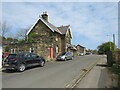
NZ9405 : Former railway station, Robin Hood's Bay by Malc McDonald Former railway station, Robin Hood's Bay by Malc McDonald
geograph for square NZ9405
The building in the foreground is the former railway station at Robin... (more)
NZ8711 : Whitby Golf Club by Malc McDonald Whitby Golf Club by Malc McDonald
geograph for square NZ8711
Whitby Golf Club, perched on the North Sea coastline.
Tags: building type:Club House   Club House   Clubhouse   type:Geograph   subject:Golf Club   Golf Club   Golf Club House   Golf Clubhouse   county:North Yorkshire   near:Sandsend   top:Sport, Leisure   near:Whitby  
NZ8612 : A174 at Sandsend by Malc McDonald A174 at Sandsend by Malc McDonald
geograph for square NZ8612
The A174 road hugging the coast as it passes through Sandsend, near Whitby. The... (more)
Tags: road:A Road   road:A174   Cleveland Way   ldp:Cleveland Way   national trail:Cleveland Way   long distance path:Cleveland Way   England Coast Path   path:England Coast Path   type:Geograph   county:North Yorkshire   subject:Road   top:Roads, Road Transport   Route of England Coastal Path   place:Sandsend   The Cleveland Way   top:Village, Rural Settlement   near:Whitby  
View more in the Image Search or in Browser
View images matching 'Whitby' anywhere in the tags
Don't click these: PotMel 1 PotMel 2