
|
A5093 near Millom Castle
by Andy Deacon
for square SD1681
Traffic on A5093 near Millom Castle. In the distance is Low House and Millom... (more)
|

|
Hodbarrow Lighthouse
by Adrian Taylor
geograph for square SD1777
Beside the King Charles III England Coast Path, Hodbarrow or Haverigg Lighthouse... (more)
|

|
Hodbarrow Lighthouse
by Adrian Taylor
geograph for square SD1777
Hodbarrow or Haverigg Lighthouse was built on the Outer Barrier in 1905 to... (more)
|

|
Boats at Borwick Rails Harbour, Millom
by Andy Deacon
for square SD1880
Boats moored at Borwick Rails Harbour near Millom Ironworks Local Nature... (more)
|

|
Duddon Sands near Millom, Cumbria
by Andy Deacon
for square SD2081
View from Cumbria Coastal Way near Millom Ironworks Local Nature Reserve.
11k x... (more)
|

|
Cattle graze near Millom Castle
by Andy Deacon
geograph for square SD1681
|

|
Track near Beck Farm, Millom
by Andy Deacon
geograph for square SD1681
View east along the track towards Beck Farm with Millom housing and the spire of... (more)
|

|
Lowscales Bank
by Andy Deacon
geograph for square SD1582
Lowscales Bank seen from edge of Millom Park. In the distance is Black Combe.
|

|
Steel Green, Haverigg
by M J Richardson
for square SD1778
Looking west from over Furness, with Millom at lower right.
|

|
Farmland to West of Beck Farm
by Andy Deacon
for square SD1681
Beck and farmland west of Beck Farm, Millom
|

|
Path on the Outer Barrier
by Adrian Taylor
geograph for square SD1678
Following the course of a former tramway, the King Charles III England Coast... (more)
|
|
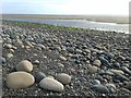
Large stones on beach near Silecroft
by Andy Deacon
geograph for square SD1378
Wide angle shot to show both close-up of representative stones and an overview... (more)
|

|
Strands House near Green Road Station
by Andy Deacon
geograph for square SD1884
Mix of white render and attractive exposed stone wall. The stone wall part is... (more)
|
|
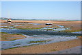
Low tide at Haverigg, Cumbria
by Andy Deacon
geograph for square SD1678
Boats rest on the sands near the mouth of the River Lazy also known as Haverigg... (more)
|
|
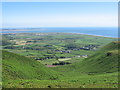
Silecroft and Kirsanton from Black Combe
by Andy Deacon
for square SD1381
Vantage point is about half way to the summit of Black Combe. Walney Island just... (more)
|
|
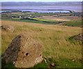
Remains of stone circle at Great Knott
by Andy Deacon
geograph for square SD1581
Part of a small collection of stones that once formed a stone circle. In the... (more)
|
|
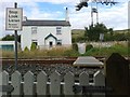
Private pedestrian level crossing Cumbria Coast Line
by Andy Deacon
geograph for square SD1480
Small private level crossing to house. There is a public level crossing to the... (more)
|

|
Beach access at Kirksanton
by Andy Deacon
geograph for square SD1279
This track provides access to the beach from Kirksanton village.
Just visible... (more)
|

|
House with stone gable wall Roanlands Brow
by Andy Deacon
geograph for square SD1885
Stone gable wall on an otherwise rendered building. Several properties along... (more)
|

|
Haverigg inshore rescue team
by Andy Deacon
geograph for square SD1578
Haverigg inshore service and beach access ramp on left.
The stone sculpture... (more)
|
|
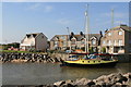
High Tide at Haverigg
by Andy Deacon
geograph for square SD1678
High tide at Haverigg Pool looking across to Sea View.
|

|
Old lighthouse, Hodbarrow
by Andrew Hill
geograph for square SD1778
Category: Lighthouse
The old lighthouse from the days before the building of the outer sea wall.
|

|
Triangulation Pillar and Old Windmill
by Adrian Taylor
geograph for square SD1878
The Ordnance Survey triangulation pillar and the remains of a windmill at... (more)
|

|
Old field gateway
by Adrian Taylor
geograph for square SD1679
An abandoned field gateway beside the public footpath from Steel Green to Moor... (more)
|

|
Brambles by the path
by Adrian Taylor
for square SD1678
Although the Outer Barrier is largely constructed with blast furnace slag over a... (more)
|

|
Flush Bracket Benchmark, Hodbarrow
by Adrian Taylor
for square SD1878
Detail of the flush bracket benchmark on the Ordnance Survey triangulation... (more)
|

|
Duddon Sands
by M J Richardson
for square SD1979
With Askham in Furness on the left and Haverigg on the right.
|

|
Haverigg Pool Panorama
by Andy Deacon
geograph for square SD1678
The River Lazy at high tide.
To see the full 14k pixel wide 180 degree... (more)
|
|
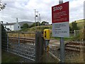
Small level crossing, Cumbria Coast Line
by Andy Deacon
geograph for square SD1480
This level crossing provides access for walkers to the public footpath and... (more)
|

|
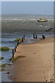
White Rock Beach at Hodbarrow Point
by Andy Deacon
geograph for square SD1878
View across the small sandy beach to Hodbarrow Point from the sea wall and the... (more)
|
|
Haverigg Pool and Duddon Estuary at high tide
by Andy Deacon
geograph for square SD1678
The Duddon estuary has a large tidal range and this photograph was shot shortly... (more)
|
|
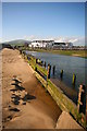
The Front Haverigg from River Lazy
by Andy Deacon
geograph for square SD1678
The properties at The Front, Haverigg are seen from the sandy west bank of the... (more)
|
|
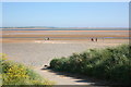
Beach access at Haverigg
by Andy Deacon
geograph for square SD1578
This ramp provides emergency access for the Haverigg Inshore Rescue Service.
In... (more)
|
|
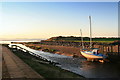
River Lazy Haverigg Pool
by Andy Deacon
geograph for square SD1678
The River Lazy flows out to the Duddon Channel.
|
