Public Tags
Other tags: Station
area:Station
building type:Station
entrance:Station
exit:Station
former:Station
railway:Station
Showing images tagged with near:Station tag.

|
Near the top of Thompson's Path, Dawlish
by Robin Stott geograph for square SX9676 This view is the reverse of SX9676 : Top of Thompson's Path, Dawlish. Turning right through the arch brings... (more)
|

|
Viewpoint above the station, Dawlish
by Robin Stott geograph for square SX9676 The tree below Thompson's Path is a Holm Oak (Quercus ilex), perhaps... (more)
Tags:
top:Coastal
place:Dawlish
postcode district:EX7
Footpath
type:Geograph
top:Paths
Public Open Space
near:Station
top:Suburb, Urban Fringe
|

|
Top of Thompson's Path, Dawlish
by Robin Stott geograph for square SX9676 This view is the reverse of SX9676 : Near the top of Thompson's Path, Dawlish. Behind the camera is a wall on whose... (more)
Tags:
top:Coastal
place:Dawlish
postcode district:EX7
near:Exeter Road
type:Geograph
top:Paths
near:Station
top:Suburb, Urban Fringe
|

|
Seats at a viewpoint, Dawlish
by Robin Stott for square SX9676 Above the station is this very exposed feature on the clifftop path... (more)
Tags:
type:Close Look
top:Coastal
place:Dawlish
postcode district:EX7
top:Paths
Public Open Space
Seats
near:Station
top:Suburb, Urban Fringe
|

|
Clifftop open space narrows, Dawlish
by Robin Stott geograph for square SX9676 Thompson's Path heads northeast to a viewpoint overlooking the station and... (more)
Tags:
top:Coastal
place:Dawlish
postcode district:EX7
Footpath
type:Geograph
top:Paths
Public Open Space
near:Station
top:Suburb, Urban Fringe
|

|
Clifftop open space, Dawlish
by Robin Stott geograph for square SX9676 A footpath known as Thompson's Path winds along the clifftop above the... (more)
Tags:
top:City, Town Centre
top:Coastal
place:Dawlish
postcode district:EX7
type:Geograph
top:Park and Public Gardens
top:Paths
Public Open Space
near:Station
|

|
Light at the turn of the stairs, Dawlish
by Robin Stott geograph for square SX9676 A flight of steps climbs from Richmond Place, giving access to the Lanherne... (more)
Tags:
top:City, Town Centre
top:Coastal
place:Dawlish
postcode district:EX7
Flight of Steps
type:Geograph
top:Paths
near:Station
|

|
Exeter Road houses overlooking Lanherne parking, Dawlish
by Robin Stott geograph for square SX9676 Lanherne is a sheltered housing complex on the site of a Regency villa. The... (more)
Tags:
3-Storey Terrace
top:City, Town Centre
top:Coastal
place:Dawlish
postcode district:EX7
Footpath
type:Geograph
top:Housing, Dwellings
top:Park and Public Gardens
Public Open Space
Sheltered Housing
near:Station
|

|
A bend in the clifftop path, Dawlish
by Robin Stott geograph for square SX9676 Thompson's Path passes the Lanherne sheltered housing complex and its... (more)
Tags:
top:City, Town Centre
top:Coastal
place:Dawlish
postcode district:EX7
Footpath
type:Geograph
top:Paths
Public Open Space
Sheltered Housing
near:Station
|

|
This way to Dawlish Warren from Dawlish
by Robin Stott geograph for square SX9676 A fingerpost for cyclists points towards the A379 Exeter Road. Geographically,... (more)
|

|
Roundabout near the railway station, Long Eaton
by Robin Stott geograph for square SK4832 Station car park, left. Wilsthorpe Road ahead. Tamworth Road runs across the... (more)
Tags:
Closed Shop
type:Geograph
place:Long Eaton
top:Lowlands
top:Roads, Road Transport
near:Station
top:Suburb, Urban Fringe
Suburban Road Junction
|

|
Empty units, Bicester
by Robin Stott for square SP5822 These units are on the McKay Trading Estate; the view is from Station Approach:... (more)
Tags:
place:Bicester
near:Bicester Village
top:Business, Retail, Services
type:Cross Grid
top:Derelict, Disused
Hardstanding
top:Lowlands
postcode district:OX26
near:Station
top:Suburb, Urban Fringe
former:Trading Estate
|

|
Station Approach, Dorridge
by Robin Stott geograph for square SP1674 Leading from the B4101 Station Road, the main road through the village. This and... (more)
Tags:
Arden
postcode district:B93
place:Dorridge
type:Geograph
top:Lowlands
Mixed Use
top:Roads, Road Transport
near:Station
top:Village, Rural Settlement
|
|
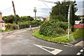
Gated access, Bicester
by Robin Stott geograph for square SP5822 This may give a rear access to Coach House Mews housing. The view is from London... (more)
Tags:
place:Bicester
near:Bicester Village
top:Boundary, Barrier
type:Geograph
top:Lowlands
postcode district:OX26
Private Track
near:Station
top:Suburb, Urban Fringe
|

|
Empty units, Bicester
by Robin Stott geograph for square SP5821 These units are on the McKay Trading Estate; the view is from Station Approach.... (more)
Tags:
place:Bicester
near:Bicester Village
top:Derelict, Disused
type:Geograph
Hardstanding
top:Lowlands
near:Station
top:Suburb, Urban Fringe
former:Trading Estate
|

|
South to city centre on foot, Plymouth
by Robin Stott geograph for square SX4755 A broad footway from near the station takes visitors through the North Cross... (more)
Tags:
type:Geograph
top:Lowlands
top:Paths
place:Plymouth
Postcode District PL4
Public Open Space
Shared Path
near:Station
top:Suburb, Urban Fringe
|

|
Station Approach, Ulverston
by Adrian Taylor geograph for square SD2877 The junction with Prince’s Street and Springfield Road is at the top of the... (more)
Tags:
Cumbria
long distance footpath:Cumbria Way
Cumbria Way
ldp:Cumbria Way
long distance path:Cumbria Way
type:Geograph
top:Lowlands
Metal Fence
On-Street Parking
Parking
subject:Pavement
Railway Noticeboard
Road
top:Roads, Road Transport
near:Station
Station Approach
Street Parking
top:Suburb, Urban Fringe
place:Ulverston
Ulverston
Walking Route
|

|
Kerb, Station Road, Dawlish
by Robin Stott geograph for square SX9676 The stones are of Torquay 'marble', partly-metamorphosed Devonian... (more)
Tags:
top:City, Town Centre
top:Coastal
place:Dawlish
Detail
postcode district:EX7
type:Geograph
top:Geological Interest
Kerb
top:Paths
top:Roads, Road Transport
near:Station
|

|
Kerb, Station Road, Dawlish
by Robin Stott geograph for square SX9676 The stones are of Torquay 'marble', partly-metamorphosed Devonian... (more)
Tags:
top:City, Town Centre
top:Coastal
top:Construction, Development
place:Dawlish
Detail
postcode district:EX7
type:Geograph
top:Geological Interest
Kerb
top:Roads, Road Transport
near:Station
|

|
Parade of shops, Station Approach, Dorridge
by Robin Stott geograph for square SP1674 In the same distinctive style as the Forest Hotel but not listed SP1674 : The Forest Hotel, Dorridge.... (more)
Tags:
Arden
postcode district:B93
top:Business, Retail, Services
place:Dorridge
type:Geograph
top:Lowlands
Parade of Shops
near:Station
road:Station Approach
top:Village, Rural Settlement
|

|
Forest Hotel, Station Approach, Dorridge
by Robin Stott geograph for square SP1674 A distinctive building with a parade of shops in the same style but not listed.... (more)
Tags:
Arden
postcode district:B93
top:Business, Retail, Services
place:Dorridge
type:Geograph
Hotel and Restaurant
top:Lowlands
near:Station
road:Station Approach
top:Village, Rural Settlement
|

|
Glen Park Avenue, Plymouth
by Robin Stott geograph for square SX4755 A residential street close to Plymouth station.
Photo number 7577939
Tags:
top:Coastal
type:Geograph
top:Housing, Dwellings
top:Lowlands
place:Plymouth
Postcode District PL4
Residential Area
near:Station
top:Suburb, Urban Fringe
|

|
Top of the town, Plymouth
by Robin Stott geograph for square SX4755 To the north of the North Cross roundabout the postwar city centre ends at a... (more)
Tags:
top:City, Town Centre
top:Coastal
type:Geograph
top:Lowlands
top:Paths
Pedestrian Route
postcode district:PL1
place:Plymouth
near:Station
|

|
Torquay 'marble', Richmond Place, Dawlish
by Robin Stott for square SX9676 The following website... (more)
Tags:
top:City, Town Centre
type:Close Look
top:Coastal
place:Dawlish
Drainage Channel
postcode district:EX7
top:Geological Interest
Kerbstones
Local Stone
Marble
top:Paths
near:Station
Surface Water Drainage
|

|
Dawlish station car park
by Robin Stott geograph for square SX9676 Tags:
Car Park
top:City, Town Centre
top:Coastal
place:Dawlish
postcode district:EX7
type:Geograph
top:Railways
top:Roads, Road Transport
near:Station
|

|
Dorridge Road, Dorridge
by Robin Stott geograph for square SP1674 Towards Norton Green from Dorridge station.
Tags:
Arden
postcode district:B93
place:Dorridge
type:Geograph
top:Lowlands
Residential Area
top:Roads, Road Transport
near:Station
top:Village, Rural Settlement
|

|
Avenue Road, Dorridge
by Robin Stott geograph for square SP1674 Leading from the station to the Knowle Grove area.
Tags:
Arden
road:Avenue Road
postcode district:B93
place:Dorridge
type:Geograph
top:Lowlands
Residential Area
top:Roads, Road Transport
near:Station
top:Village, Rural Settlement
|

|
Forest Hotel, Station Approach, Dorridge
by Robin Stott geograph for square SP1674 A distinctive building with a parade of shops in the same style but not listed.... (more)
Tags:
Arden
postcode district:B93
top:Business, Retail, Services
place:Dorridge
type:Geograph
Hotel
top:Lowlands
Restaurant
near:Station
top:Village, Rural Settlement
|

|
Outside the railway station, Long Eaton
by Robin Stott geograph for square SK4832 Tamworth Road in the foreground, in the shadow of the railway bridge; Wilsthorpe... (more)
Tags:
type:Geograph
place:Long Eaton
top:Lowlands
Public Space
near:Station
top:Suburb, Urban Fringe
|

|
Offices to let, Newport
by Robin Stott geograph for square ST3088 This grey office block (opposite another, also to let, across the tracks)... (more)
Tags:
top:Business, Retail, Services
top:City, Town Centre
type:Geograph
top:Lowlands
place:Newport
postcode district:NP20
Offices to Let
near:Station
|

|
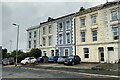
Open space, North Road East, Plymouth
by Robin Stott geograph for square SX4755 It can also be reached by steps from Saltash Road. There are some unusual trees... (more)
Tags:
type:Geograph
top:Lowlands
place:Plymouth
Postcode District PL4
Public Open Space
near:Station
top:Suburb, Urban Fringe
|
|
North Road East, Plymouth
by Robin Stott geograph for square SX4755 Judging by the provision for parking, and the number of cars, these houses are... (more)
Tags:
type:Geograph
HMO
top:Housing, Dwellings
top:Lowlands
Multiple Occupation
place:Plymouth
Postcode District PL4
near:Station
top:Suburb, Urban Fringe
Three-Storey Terrace
|

|
Saltash Road summit, Plymouth
by Robin Stott geograph for square SX4755 (Or is it Pennycomequick Hill?). It could be said that these trees on the... (more)
Tags:
Dual Carriageway
type:Geograph
top:Lowlands
place:Plymouth
Postcode District PL4
top:Roads, Road Transport
near:Station
top:Suburb, Urban Fringe
|

|
Fence, Victoria Street, St Albans
by Robin Stott for square TL1507 An old but still effective iron fence keeps pedestrians on the footpath by a... (more)
Tags:
postcode district:AL1
top:Boundary, Barrier
type:Close Look
Iron
top:Lowlands
top:Paths
Post and Rail Fence
place:St Albans
near:Station
top:Suburb, Urban Fringe
road:Victoria Street
|

|
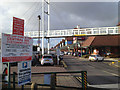
Footbridge to Grosvenor Road over Central Six retail park and the railway, Coventry
by Robin Stott geograph for square SP3278 The footbridge connects Grosvenor Road on the north side with Spencer Park and... (more)
Tags:
top:City, Town Centre
place:Coventry
postcode district:CV3
Footbridge Over Car Park
Footbridge Over Railway
top:Lowlands
top:Paths
Retail Park
near:Station
colour:White
|
|
Central Six retail park beyond a footbridge, Coventry
by Robin Stott geograph for square SP3278 The footbridge crosses the site and the railway, connecting Grosvenor Road on... (more)
Tags:
top:Business, Retail, Services
top:City, Town Centre
place:Coventry
postcode district:CV3
Footbridge Over Car Park
Footbridge Over Railway
top:Lowlands
top:Paths
Shops
near:Station
Stores
colour:White
|

|
The Rocket, a closed public house, Warwick Road, Coventry
by Robin Stott geograph for square SP3378 Tags:
top:City, Town Centre
Closed Pub
place:Coventry
postcode district:CV3
top:Derelict, Disused
top:Lowlands
near:Station
|
