Public Tags
Other tags: The Spouts Burn
place:The Spouts Burn
Showing images tagged with near:The Spouts Burn tag.

|
Enclosure around ruin of Spouts
by Lairich Rig geograph for square NS4278 Category: Enclosure The lower half of the photo shows the eastern (the upper) side of the enclosure,... (more)
Tags:
Archaeology
landmark:Carman Reservoir
ruin:Enclosure
top:Historic Sites and Artefacts
near:The Spouts Burn
|

|
Small mound beside the Spouts Burn
by Lairich Rig geograph for square NS4278 Category: Mound The small mound that is visible at the centre of the image lies on the western... (more)
Tags:
period:18th Century
Archaeology
ruin:Clamp Kiln
top:Historic Sites and Artefacts
Limestone Industry
near:The Spouts Burn
|

|
The ruin of Spouts
by Lairich Rig geograph for square NS4278 Category: Ruins "Spouts (in ruins) – the ruins of an old shepherd's house on the... (more)
|

|
Small circular feature beside the Spouts Burn
by Lairich Rig geograph for square NS4278 Category: Enclosure This is similar to the mounds that are described at NS4278 : Signs of former industry at the Spouts Burn, but, unlike... (more)
Tags:
period:18th Century
Archaeology
top:Historic Sites and Artefacts
Limestone Industry
near:The Spouts Burn
|

|
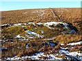
Small mound beside the Spouts Burn
by Lairich Rig geograph for square NS4278 Category: Mound Visible in the lower half of the photo, and standing on the eastern side of the... (more)
Tags:
period:18th Century
Archaeology
ruin:Clamp Kiln
top:Historic Sites and Artefacts
Limestone Industry
near:The Spouts Burn
|
|
Mound beside the Spouts Burn
by Lairich Rig geograph for square NS4278 Category: Mound This is the large mound that is shown, left of centre, in NS4278 : Signs of former industry at the Spouts Burn; see that... (more)
Tags:
period:18th Century
Archaeology
top:Historic Sites and Artefacts
ruin:Lime-Kiln
Limestone Industry
near:The Spouts Burn
|

|
Ancient trackway
by Lairich Rig geograph for square NS4379 A hollow way takes up the width of the lower edge of the image, and leads... (more)
Tags:
period:18th Century
Archaeology
Braided Trackway
Limestone Industry
top:Paths
near:The Spouts Burn
|

|
Geological dyke crossing glen of the Black Burn
by Lairich Rig geograph for square NS4278 The dark wall of rock jutting out from the side of the glen is a geological... (more)
Tags:
Geological Dyke
top:Geological Interest
top:Rivers, Streams, Drainage
place:The Black Burn
near:The Spouts Burn
|

|
Moorland disturbed by former limestone industry
by Lairich Rig geograph for square NS4379 This is the same area as appears in the middle distance in NS4379 : Ancient trackway. The... (more)
|

|
Cornstone outcrop
by Lairich Rig geograph for square NS4278 Category: Rock outcrops There are many limestone deposits of various sizes on this slope, which is... (more)
|

|
Small-scale limestone quarrying
by Lairich Rig geograph for square NS4278 Category: Quarry The area on the slope that lies above the enclosure of the ruin of Spouts... (more)
Tags:
Cornstone
top:Derelict, Disused
Limestone
top:Quarrying, Mining
Rock Outcrop
near:The Spouts Burn
|

|
Cornstone outcrop
by Lairich Rig geograph for square NS4278 Category: Rock outcrops This is an end-on view of NS4278 : Cornstone outcrop.
|

|
Moorland disturbed by former limestone industry
by Lairich Rig geograph for square NS4379 This is the same area is shown in NS4379 : Moorland disturbed by former limestone industry, but viewed in the opposite... (more)
|
