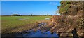
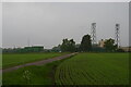
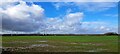
|
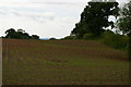
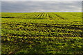
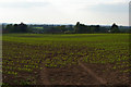
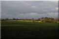
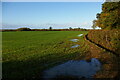
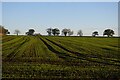
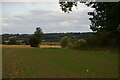
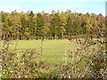
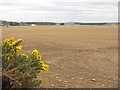
Newly-sown field off Wood Orchard Lane, Kinsey Heath
by Christopher Hilton
geograph for square SJ6642
|
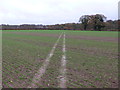
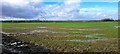
|
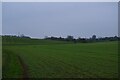
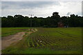
Newly-sown field along Hawthorn Road
by Christopher Hilton
geograph for square TM4266
The tractor tracks in the field mirror the twisting course of Hawthorn Road to... (more)
|
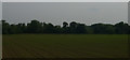
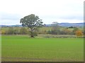
|
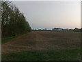
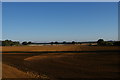
Newly-sown field at Friday Street
by Christopher Hilton
geograph for square TM3760
|
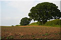
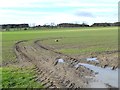
|
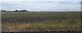
Newly-sown field at Gromford
by Christopher Hilton
geograph for square TM3858
|
|
Newly-sown field off Tiggins Lane
by Christopher Hilton
geograph for square TM3865
|
|
Newly-sown fields either side of Red Lane, Sternfield
by Christopher Hilton
geograph for square TM3961
|
|
Newly-sown field north of Foxhall Road
by Christopher Hilton
geograph for square TM2344
|
|
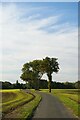
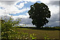
Track from Carlton village down towards the church
by Christopher Hilton
geograph for square TM3864
The willow trees at the bottom of the slope mark the course of the Gull Stream.
|
|
View towards Swanbach from Bagley Lane
by Christopher Hilton
geograph for square SJ6542
On the horizon, the Peckforton Hills in mid-Cheshire.
|
|
View down the valley at Bentley
by Christopher Hilton
geograph for square TM1236
|
|
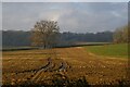
Tree and field from the lane near Iron Mills
by Christopher Hilton
geograph for square SJ3133
The large oak tree marks the course of the lane towards Hindford.
|
|
View south-west off the A144
by Christopher Hilton
geograph for square TM4071
|
|
Field west of Scotland Wood
by Christopher Hilton
geograph for square SP7378
|
|
Field off Dazeley's Lane
by Christopher Hilton
geograph for square TM0833
|
|
View across the Alde valley from the west
by Christopher Hilton
geograph for square TM3067
|
|
Fields below Purser's Hills
by Christopher Hilton
geograph for square SP7175
|
|
Fields and barn on Haselbech Hill
by Christopher Hilton
geograph for square SP7176
|
|
View down the Ore valley at Durrant's Bridge
by Christopher Hilton
geograph for square TM2865
|
|
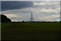
Newly-sown fields off the Sandlings Walk
by Christopher Hilton
geograph for square TM4459
In the distance, the pylon lines carrying electricity from the nuclear power... (more)
|
|
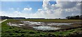
The Dams, north of Manea, from the railway
by Christopher Hilton
geograph for square TL4791
|
|
Looking up the western edge of Scotland Wood
by Christopher Hilton
geograph for square SP7378
|
|
View across the field towards Old Covert
by Christopher Hilton
geograph for square SP7075
|
|
Fields below Purser's Hills
by Christopher Hilton
geograph for square SP7075
|
|
View down the Ore valley near Durrant's Bridge
by Christopher Hilton
geograph for square TM2865
Just visible over the trees on the left of the picture is the roof of... (more)
|
|
Seedlings coming through, off Tiggins Lane
by Christopher Hilton
geograph for square TM3966
|

|
View towards Sizewell from The Walks
by Christopher Hilton
geograph for square TM4661
Beyond the field covered by sheeting, a low earth bank marks a small reservoir,... (more)
|
|
Looking towards Kelmarsh wind farm from Scotland Wood
by Christopher Hilton
geograph for square SP7378
|
|
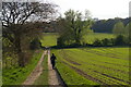
Track towards Carlton church
by Christopher Hilton
geograph for square TM3864
|
|
Path dropping from Snape to Gromford
by Christopher Hilton
geograph for square TM3858
|
|
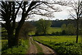
Looking south over the Stour valley
by Christopher Hilton
geograph for square TM0834
A footpath runs along the northern edge of the Stour valley in East Bergholt and... (more)
|
|
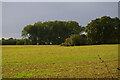
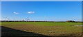
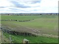
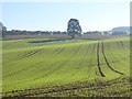
Track running north from Foxhall Road
by Christopher Hilton
geograph for square TM2344
|
|
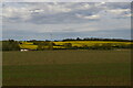
Ash Grove, north of Framlingham
by Christopher Hilton
geograph for square TM2864
|
|
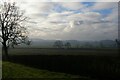
View north from the railway east of Allscott
by Christopher Hilton
geograph for square SJ6212
At the bottom end of the long field is the sewage works located in SJ6113. |
|
Drive leading to the Suffolk Aviation Museum, Foxhall Heath
by Christopher Hilton
geograph for square TM2244
|
|
Footpath near New Mercote
by Nigel Mykura
geograph for square SP2379
The farmer had driven a vehicle across the newly planted field to mark out the... (more)
|
|
Field north of Albrighton
by Christopher Hilton
geograph for square SJ8104
|
|
Field north of the A529, Corbrook
by Christopher Hilton
geograph for square SJ6644
Between Audlem and Hankelow.
|
|
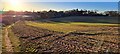
Recently Sown Field
by Nigel Mykura
geograph for square ST8288
Oldbury village is just over the horizon and in the next grid square ST8188 in... (more)
|
|
Field west of Scotland Wood
by Christopher Hilton
geograph for square SP7378
|
|
Field west of Scotland Wood
by Christopher Hilton
geograph for square SP7378
|
|
Autumn-sown cereal crop below Pishillbury Wood
by Simon Mortimer
geograph for square SU7289
Looking south-east from the Oxfordshire Way. A strip of game cover runs along... (more)
|
|
Looking towards Kelmarsh wind farm from Scotland Wood
by Christopher Hilton
geograph for square SP7378
|
|
Looking towards Kelmarsh wind farm from Scotland Wood
by Christopher Hilton
geograph for square SP7378
|
|
Newly-sown field west of Swinton
by Oliver Dixon
geograph for square NT8247
The line of trees at the far side of the field lies along the Leet Water. The... (more)
|
|
Newly-sown field at Barmoor Ridge Farm
by Oliver Dixon
geograph for square NT9639
|
|
Plantation near Camp Field
by Oliver Dixon
geograph for square NT9543
Hedgerow, newly-sown field and mixed plantation.
|
|
Newly-sown fields at Shoresfield Farm
by Oliver Dixon
geograph for square NT9346
An extensive view over the Merse of Berwick extending to the Lammermuir Hills.... (more)
|
|
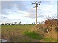
Newly-sown field at Morrishall Farm
by Oliver Dixon
geograph for square NT9147
Criss-crossed by power lines.
|
|
Newly sown field at Coombe Eden
by Oliver Dixon
geograph for square NY4944
|
|
Newly sown and rolled field at East Fortune
by M J Richardson
geograph for square NT5378
Looking east towards the old East Fortune airfield.
|