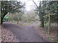
|
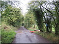
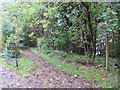
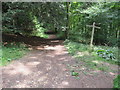
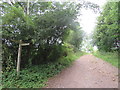
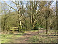
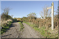
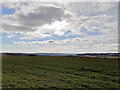
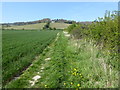
Track near Caterham
by Malc McDonald
geograph for square TQ3553
A track on the North Downs near Caterham. The wooden signpost to the right of... (more)
|
|
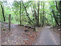
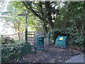
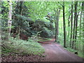
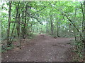
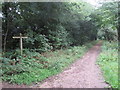
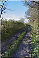
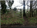
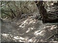
Track through woodland near Caterham
by Malc McDonald
geograph for square TQ3553
A track through woodland on the North Downs near Caterham. A public footpath... (more)
|
|
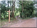
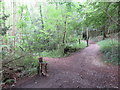
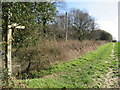
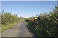
North Downs Way near Godstone
by Malc McDonald
geograph for square TQ3553
The wooden signpost indicates the route of a footpath. The path forms part of... (more)
|
|
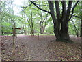
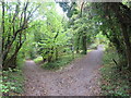
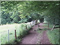
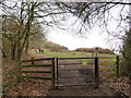
Paths in Marden Park, near Godstone
by Malc McDonald
geograph for square TQ3653
Paths through woodland on the North Downs, near Godstone. The signpost and... (more)
|

|
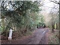
Path into Marden Park, near Godstone
by Malc McDonald
geograph for square TQ3653
A path leading into Marden Park, a wood managed by the Woodland Trust. The path... (more)
|
|
Pilgrim's Way near Godstone
by Malc McDonald
geograph for square TQ3653
This path through woodland on the North Downs forms part of two long distance... (more)
|
|
Paths through woodland, near Godstone
by Malc McDonald
geograph for square TQ3353
Paths through woodland on the North Downs. The path to the left forms part of... (more)
|
|
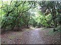
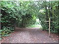
Path through woodland near Godstone
by Malc McDonald
geograph for square TQ3353
A path through woodland on the North Downs, near Godstone.
This path forms... (more)
|
|
North Downs Way and Pilgrim's Way near Godstone
by Malc McDonald
geograph for square TQ3453
The path leading off into the trees, to the left of the road, forms part of both... (more)
|
|
North Downs Way, near Snodland
by Malc McDonald
geograph for square TQ6762
A gate on the North Downs Way in woodland near Snodland in Kent.
|
|
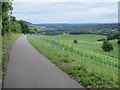
North Downs Way near Dorking
by Malc McDonald
geograph for square TQ1550
A view eastwards along the North Downs Way, looking along the North Downs ridge... (more)
|
|
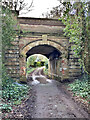
Path near Caterham
by Malc McDonald
geograph for square TQ3453
A footpath heading onto a bridge which will carry it over the trunk A22 road... (more)
|
|
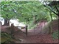
North Downs Way, near Dorking
by Malc McDonald
geograph for square TQ1249
A gate on the North Downs Way in woodland near Dorking.
|
|
North Downs Way, near Dorking
by Malc McDonald
geograph for square TQ1249
The signpost indicates that a public bridleway crosses the North Downs Way here,... (more)
|
|
North Downs Way, near Dorking
by Malc McDonald
geograph for square TQ1349
The North Downs Way passing through woodland near Dorking, in Surrey.
|
|
North Downs Way, near Dorking
by Malc McDonald
geograph for square TQ1350
The North Downs Way passing through woodland near Dorking.
|
|
North Downs Way near Dorking
by Malc McDonald
geograph for square TQ1350
The North Downs Way entering woodland as it heads west, near Dorking.
|
|
North Downs Way, near Dorking
by Malc McDonald
geograph for square TQ1350
The North Downs Way in woodland near Dorking, in Surrey.
|
|
North Downs Way, near Dorking
by Malc McDonald
geograph for square TQ1550
A view of the North Downs Way as it turns northwards for a short distance,... (more)
|
|
North Downs Way, near Dorking
by Malc McDonald
geograph for square TQ1550
A view eastwards along the North Downs Way, looking towards Box Hill further... (more)
|
|
North Downs Way, near Dorking
by Malc McDonald
geograph for square TQ1551
A view eastwards on the North Downs Way, with a public footpath heading off to the left.
|
|
North Downs Way, near Dorking
by Malc McDonald
geograph for square TQ1651
A signpost on the North Downs Way, near the village of Westhumble.
|
|
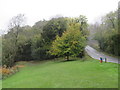
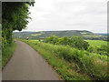
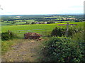
View near Tatsfield
by Malc McDonald
geograph for square TQ4155
A view from near Tatsfield, high up on the North Downs Ridge, looking southwards... (more)
|

|
North Downs Way, near Wrotham
by Malc McDonald
geograph for square TQ5859
The North Downs Way in Kent countryside. This path is also on the route of... (more)
|

|
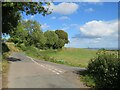
Pilgrims' Way, near Wrotham
by Malc McDonald
geograph for square TQ6259
This minor lane in countryside near Wrotham is on the route of Pilgrims'... (more)
|
|
Pilgrims' Way, near Wrotham
by Malc McDonald
geograph for square TQ6259
A junction on Pilgrims' Way, in the Kent countryside near the village of... (more)
|
|
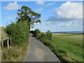
Pilgrims' Way, near Wrotham
by Malc McDonald
geograph for square TQ6259
A minor lane in Kent countryside near Wrotham. Its name, Pilgrims' Way,... (more)
|
|
North Downs Way near Reigate
by Malc McDonald
geograph for square TQ2352
The North Downs Way, and a bridleway leading off to the right, near Reigate.
|
|
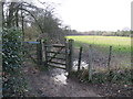
Gate on the North Downs Way, near Knockholt Pound
by Malc McDonald
for square TQ4759
A gate on the North Downs Way long distance footpath, near Knockholt Pound in Kent.
|
|
North Downs Way near Knockholt Pound
by Malc McDonald
geograph for square TQ4758
A gate on the North Downs Way near Knockholt Pound.
|
|
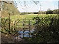
North Downs Way at Knockholt
by Malc McDonald
geograph for square TQ4759
A metal kissing gate on the North Downs Way at Knockholt, in Kent.
|
|
North Downs Way at Knockholt
by Malc McDonald
geograph for square TQ4758
The North Downs Way heading into woodland at Knockholt, in Kent.
|
|
North Downs Way at Knockholt
by Malc McDonald
geograph for square TQ4758
A public footpath along the edge of a field at Knockholt, in Kent. The path... (more)
|
|
North Downs Way at Colley Hill, near Reigate
by Malc McDonald
geograph for square TQ2452
The North Downs Way at Colley Hill, overlooking Reigate.
Colley Hill is... (more)
|
|
North Downs Way near Reigate
by Malc McDonald
geograph for square TQ2352
A view eastwards along the North Downs Way as it passes through woodland near... (more)
|
|
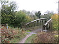
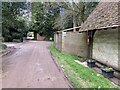
Denbies east carriage drive railway bridge
by Hugh Craddock
geograph for square TQ1651
The Denbies east carriage drive just below Denbies Lodge passed through this... (more)
|
|
North Downs Way, Merstham
by Stephen McKay
geograph for square TQ2853
Leading off Quality Street in the centre of the old village this track forms a... (more)
|
|
North Downs Way looking toward Birches Wood
by PAUL FARMER
geograph for square TQ5859
|

|
Sign North Downs Way near Kemsing Road, Fawkham Green
by PAUL FARMER
geograph for square TQ5859
|
|
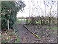
Chevening Lane, near Knockholt Pound
by Malc McDonald
geograph for square TQ4859
The North Downs Way passes through the gate to the left of the lane.
|
|
North Downs Way track
by Julian P Guffogg
geograph for square TR1043
Clearly signposted off the road.
|
|
The North Downs Way
by Julian P Guffogg
geograph for square TR0943
A track leading past Partridge Wood at this point.
|
|
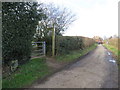
Lane towards Hastingleigh
by Julian P Guffogg
geograph for square TR0844
The sign points to an entrance to the North Downs Way, leading to Wye in three... (more)
|
|
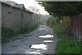
Postbox at Hollister Farm
by Hugh Craddock
geograph for square TQ0748
Hollister Farm is accessible only by means of bridleways (one of them the North... (more)
|
|
Kingston village in Kent from the North Downs Way
by Phil Brandon Hunter
for square TR1951
The view south-west from Barham Downs on the North Downs Way, looking towards... (more)
|
|
Alongside the Pilgrim's Way and North Downs Way near Harrietsham
by Marathon
geograph for square TQ8753
The Pilgrim's Way, which is just to the left here, is also followed in this... (more)
|
|
The North Downs Way along Lower Ensden Road
by Marathon
geograph for square TR0755
The origin of the name of Old Wives Lees is not clear but in 1870-72, John... (more)
|
|
The North Downs Way at the eastern end of Old Wives Lees
by Marathon
geograph for square TR0755
The origin of the name of Old Wives Lees is not clear but in 1870-72, John... (more)
|
|
Sunken lane on the North Downs
by Marathon
geograph for square TQ6561
With its high banks, this is clearly an old trackway. It is now followed by both... (more)
|
|
The North Downs Way near Chevening
by Marathon
geograph for square TQ4958
This is the North Downs Way near Chevening on the way to the North Downs.
|