Public Tags
Tag: North·Kent·Coast
Showing images tagged with North Kent Coast tag.
|
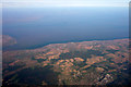
Thames Estuary from the Air
by Christine Matthews for square TR0568 With the North Kent Coast and Essex with part of the Isle of Sheppey to the left.
|
|
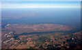
Isle of Sheppey from the Air
by Christine Matthews for square TQ9667 With the North Kent Coast and Thames Estuary, as seen from a flight from Heathrow Airport.
|