Public Tags
Tag: Paper·Mill
Other tags: former:Paper Mill
Showing latest 50 of 105 images tagged with Paper Mill tag.

|
Sculpture at the former Wycombe Paper Mill site, Wycombe Marsh
by David Hillas for square SU8891 This metal sculpture is located by the Wycombe Retail Park off the A40 London... (more)
Tags:
type:Close Look
Former Paper Mill
Former Paper Mill Site
off:London Road
sculpture:Metal
Metal Sculpture
former:Paper Mill
top:Suburb, Urban Fringe
near:Wycombe
Wycombe Marsh
|
|
Star Mill Demolition
by David Dixon geograph for square SD6425 Part of the remains of the former Star Paper Mill which closed in November 2008... (more)
|
|
Remains of Star Mill
by David Dixon geograph for square SD6425 The site of the former Star Paper Mill which closed in November 2008 and is... (more)
|

|
Croxley Paper Mills being demolished
by David Hillas geograph for square TQ0895 Taken in April 1982, this photo shows the former Croxley Paper Mills being... (more)
|

|
Croxley Paper Mills from Common Moor
by David Hillas geograph for square TQ0895 Taken in April 1982, this photo shows the Croxley Paper Mills in the process of... (more)
|
|
Manchester, Bolton and Bury Canal, Creams Paper Mill Site.
by David Dixon geograph for square SD7506 A part of Creams Paper Mill was constructed in 1956, just to the east of Bailey... (more)
Tags:
Canal
top:Canals
top:Derelict, Disused
Foundations
top:Industry
canal:Manchester Bolton and Bury
Paper Mill
|

|
Oakenholt Paper Mill
by Eirian Evans geograph for square SJ2671 In 1870 McCorquodale, the well-established paper-making firm of Liverpool,... (more)
|

|
Devon Valley Mill, Hele
by Chris Allen geograph for square SS9902 This paper mill is visible from the M5 motorway and appears deceptively small.... (more)
|

|
Frogmore Mills - pulping machine
by Chris Allen for square TL0505 This paper heritage centre remains a working paper mill and this pulping machine... (more)
|

|
Older building, Langcliffe High Mill
by Christine Johnstone geograph for square SD8165 This building is shown on the large-scale OS map surveyed in 1847, and was... (more)
Tags:
Cotton Spinning Mill
type:Geograph
top:Historic Sites and Artefacts
Paper & Packaging Suppliers
former:Paper Mill
|
|
Langcliffe High Mill and its mill pond
by Christine Johnstone geograph for square SD8165 Langcliffe High Mill was built in 1783-4. When it opened it was entirely... (more)
Tags:
Cotton Spinning Mill
type:Geograph
top:Industry
subject:Mill Pond
former:Millpond
Paper & Packaging Suppliers
former:Paper Mill
|

|
East Lancashire Paper Mill Gates
by David Dixon geograph for square SD7907 These gates and gateposts on Rectory Lane/Church Street East, are all that... (more)
|

|
Lakeside Business Centre, Lifford
by A J Paxton geograph for square SP0579 Seen from across the Worcester & Birmingham Canal, this building on the... (more)
Tags:
Canal
top:Canals
top:Derelict, Disused
Former Factory
type:Geograph
top:Industry
former:Paper Mill
Paper Mill
top:Suburb, Urban Fringe
|

|
Boiler at Rag Mill
by David Corking for square ST8373 Category: Paper mill Disused iron boiler at Rag Mill, a few metres north of the By Brook in... (more)
Tags:
Boiler
top:Derelict, Disused
top:Energy Infrastructure
top:Industry
Paper Mill
top:Rivers, Streams, Drainage
Slaughterford
top:Woodland, Forest
|

|
Paper mill, Beetham
by Chris Allen geograph for square SD4979 Seen from Heron Mill on the other side of the River Bela. This is Waterhouse... (more)
|

|
Frogmore Mills - process plant
by Chris Allen for square TL0505 This preserved paper mill is still making recycled paper using a Fourdrinier... (more)
|
|
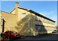
The former paper mill in Mill Road
by Steve Daniels geograph for square SP4809 Wolvercote Paper Mill is awaiting redevelopment.
|

|
New Hythe station
by Marathon geograph for square TQ7159 The Medway Valley Line was built in two stages by the South Eastern Railway. The... (more)
|

|
Caledonian Paper Mill
by Richard Sutcliffe for square NS3335 The paper mill in Irvine stands out, seen here across Irvine Bay from nearly 8km... (more)
|

|
Weir and paper mill, Beetham
by Chris Allen geograph for square SD4979 This is on the River Bela with Heron Mill out of sight to the right. The... (more)
Tags:
river:Bela
type:Geograph
top:Industry
Microhydropower
Paper Mill
subject:River
top:Rivers, Streams, Drainage
top:Water Resources
Weir
|

|
No access to the old bridge, Chirnsidebridge
by Jim Barton geograph for square NT8556 The old mill bridge is within the boundary of the Ahlstrom paper mill, so there... (more)
|

|
Former paper mill Creech St Michael
by Chris Allen geograph for square ST2625 Opened in 1875 and operated for much of its life by the Somerville family, it... (more)
|

|
Another development site
by John Winder geograph for square SE2045 This was until relatively recently the site of Garnett's paper mill, which... (more)
Tags:
top:City, Town Centre
top:Construction, Development
subject:Demolition Site
Development Site
Garnetts Paper Mill
Housing Estate
former:Industrial Site
place:Otley
former:Paper Mill
|

|
Demolished paper mill, Polton.
by Richard Webb geograph for square NT2864 Category: Industrial landscape In the Roslin Glen, the site of a paper mill that must have been demolished a... (more)
|
|
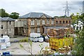
Cartside Mill
by Lairich Rig geograph for square NS4162 The building shown here is part of Smith and McLaurin's Paper Mill, but the... (more)
|

|
New Hythe paper mills
by Stephen Craven for square TQ7159 Category: Paper mill A view from about 1.5km away to the north-east.
Tags:
top:Industry
Paper Mill
|

|
Stubbins Paper Mill
by Chris Allen geograph for square SD7917 This site is undergoing considerable remodelling. Owned by Essity UK Ltd and... (more)
|

|
Former paper mill, Tuckenhay
by Chris Allen geograph for square SX8155 A large hand-made paper mill that is now holiday accommodation in the hamlet of Tuckenhay.
Tags:
county:Devon
Holiday Accommodation
top:Housing, Dwellings
top:Industry
former:Paper Mill
top:Village, Rural Settlement
|

|
Creech St Michael - former paper mill
by Chris Allen geograph for square ST2625 Opened in 1875 and operated for much of its life by the Somerville family, it... (more)
|

|
Paper Mill on River Culm at Hele
by Martin Dawes geograph for square SS9902 Paper mills were first established on the river in 1762
Tags:
river:Culm
top:Industry
Paper Mill
top:Rivers, Streams, Drainage
top:Village, Rural Settlement
|

|
Greenfield Mill and Hey Top
by David Dixon geograph for square SE0003 Looking down towards Greenfield Mill from Bank Lane.
Greenfield Mill was... (more)
|

|
The offices of King's Mill paper mill
by David Smith geograph for square ST0308 The company has been making paper since the mid-eighteenth century - but not in... (more)
|
|
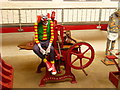
Wookey Hole - Paper Mill
by Chris Talbot for square ST5347 Part of the Halloween display in the paper mill.
|

|
Heron Mill, Beetham
by Chris Allen geograph for square SD4979 A water mill dating back to 1740 on a site where milling dates back to at least... (more)
Tags:
place:Beetham
river:Bela
type:Geograph
top:Historic Sites and Artefacts
top:Industry
Microhydropower
subject:Mill
Paper Mill
Water Mill
top:Water Resources
Weir
|

|
Tuckenhay Mill
by Derek Harper geograph for square SX8155 One of two mills here, both converted to paper mills in 1829 and now converted... (more)
Tags:
top:Farm, Fishery, Market Gardening
former:Flax Mill
type:Geograph
plant:Gorse
Grass Fields
top:Heath, Scrub
top:Historic Sites and Artefacts
Holiday Accommodation
top:Housing, Dwellings
top:Industry
Listed Building
top:Lowlands
former:Paper Mill
Roadside Trees
Trees
Trees on Field Boundary
Valley
|

|
Devon Valley Mill, Hele
by Chris Allen geograph for square SS9902 A specialist paper mill with a long history. The nearest single storey building... (more)
|
|
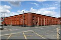
Linden Mills, Castleton
by Alan Murray-Rust geograph for square SD8810 OS mapping shows that this was the first mill to be built in Castleton, dating... (more)
Tags:
building material:Brick
period:Early 20th Century
type:Geograph
top:Industry
Paper Mill
top:Suburb, Urban Fringe
former:Textile Mill
Weaving Shed
|

|
Stowford Paper Mill
by Chris Allen geograph for square SX6356 The main mill block is dated 1862 and the mill was powered by water. In 1914 it... (more)
|

|
Rag Mill water wheel among trees
by David Corking geograph for square ST8373 Category: Waterwheel Disused iron water wheel at Rag Mill, in a dry leat (millrace) a few metres... (more)
Tags:
top:Derelict, Disused
top:Energy Infrastructure
top:Industry
Ironwork
Leat
Paper Mill
Slaughterford
top:Village, Rural Settlement
top:Water Resources
Water Wheel
top:Woodland, Forest
|

|
Rag Mill water wheel
by David Corking for square ST8373 Category: Waterwheel Disused iron water wheel at Rag Mill, in a dry leat (millrace) a few metres... (more)
Tags:
top:Derelict, Disused
top:Energy Infrastructure
top:Industry
Ironwork
Leat
Paper Mill
top:Rivers, Streams, Drainage
Slaughterford
top:Water Resources
Water Wheel
top:Woodland, Forest
|

|
Rigid paper Container, Selby
by Chris Allen geograph for square SE6231 This paper mill has moved perhaps a quarter to half a mile further out of town... (more)
|

|
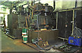
James Cropper & Sons Ltd.
by Mick Garratt geograph for square SD5095 A paper mill.
|
|
John Hargreaves, Tameside Paper Mills - steam engines
by Chris Allen for square SJ9698 A pair of Ashworth and Parker of Bury inverted vertical (enclosed) steam engines... (more)
Tags:
top:Industry
subject:Machinery
Paper Mill
place:Stalybridge
Stationary Steam Engine
Steam Engines
|

|
Frogmore Mills - wheel pits
by Chris Allen for square TL0505 This site was the first in the UK to use the Fourdrinier paper machine. It was... (more)
Tags:
top:Historic Sites and Artefacts
top:Industry
Paper Making
Paper Mill
top:Water Resources
Wheel Pit
|

|
Frogmore Mills - Fourdrinier paper machine
by Chris Allen for square TL0505 This site was the first in the UK to use the Fourdrinier machine (not this one)... (more)
|

|
Former paper mill at Wookey Hole
by Bill Boaden geograph for square ST5347 The famous cave is round the back of this mill, and part of the mill has been... (more)
Tags:
type:Geograph
top:Industry
top:Lowlands
Paper Mill
top:Roads, Road Transport
top:Village, Rural Settlement
|
|
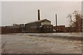
Otley weir and Garnett's paper mill
by John Winder geograph for square SE2046 Taken when the mill was still active in late 1992 (I think). The river is a good... (more)
Tags:
Garnetts
top:Industry
Otley
Paper Mill
top:Park and Public Gardens
River Wharfe
top:Rivers, Streams, Drainage
top:Water Resources
Weir
|

|
Bridge and Mill, Overton Station
by Des Blenkinsopp geograph for square SU5150 An enormous paper mill is right behind Overton Station.
|

|
North Esk Reservoir
by Richard Webb geograph for square NT1558 The surrounding hillsides have been partly covered in new plantations and there... (more)
Tags:
top:Derelict, Disused
type:Geograph
top:Industry
top:Lakes, Wetland, Bog
Midlothian
top:Moorland
Paper Mills
Peeblesshire
Reservoir
river:River North Esk
top:Woodland, Forest
|

|
North Esk Reservoir
by Richard Webb geograph for square NT1558 Built to ensure a water flow in the North Esk to power the paper mills. Now the... (more)
Tags:
top:Derelict, Disused
type:Geograph
top:Industry
top:Lakes, Wetland, Bog
Midlothian
Paper Mills
Peeblesshire
Reservoir
river:River North Esk
|
