Public Tags
Tag: Park·Railings
Showing images tagged with Park Railings tag.
|
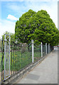
Park Railings, Springfield Gardens
by Des Blenkinsopp geograph for square TQ2080 This is the park boundary beside Horn Lane. The Gardens were opened in 1934 and... (more)
|

|
Road past Chillingham Castle
by Des Blenkinsopp geograph for square NU0525 Along the edge of the park at Chillingham Castle. The railings give a vista into... (more)
|

|
Old Epsom road at the ice house
by Hugh Craddock geograph for square TQ0651 The old road to Epsom, near the path to the ice house. With the cutting dug on... (more)
Tags:
Cutting
type:Geograph
National Trust Property
Old Road
Old Turnpike
Park Railings
top:Paths
subject:Road
top:Roads, Road Transport
top:Woodland, Forest
|

|
Banners on park railings above a telecoms cabinet, Waterloo Road, Newport
by Jaggery geograph for square ST3087 At the edge of Belle Vue Park, the banner on the left advertises Parc Pantry in... (more)
Tags:
top:Communications
type:Geograph
top:Park and Public Gardens
Park Banners
Park Railings
Telecoms Cabinet
|
|
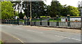
Ornate perimeter railings, Cyfarthfa Park, Merthyr Tydfil
by Jaggery geograph for square SO0407 Viewed across Brecon Road towards this Link entrance.
|

|
West along Park Lane, Caerphilly
by Jaggery geograph for square ST1586 From Cardiff Road along Park Lane towards Crescent Road.
Dafydd Williams Park... (more)
|

|
Site of a car crash
by Stephen Craven geograph for square TQ3677 The location is the railings round Folkestone gardens on Trundleys Road,... (more)
|

|
Railings at the eastern edge of Bargoed Park, Bargoed
by Jaggery geograph for square ST1499 Viewed across Vicarage Lane.
Tags:
type:Geograph
top:Park and Public Gardens
Park Railings
top:Roads, Road Transport
top:Suburb, Urban Fringe
|

|
Gate and Railings, Eshton Park
by Des Blenkinsopp geograph for square SD9355 This was once part of the estate of Eshton Hall, a country house built in the... (more)
|

|
Park Railings, Burton Constable
by Des Blenkinsopp geograph for square TA1936 Burton Constable Hall doesn't lurk behind tall trees or hedges. There is a... (more)
|

|
Old Epsom Road on ascent to the ice house
by Hugh Craddock geograph for square TQ0651 The old Epsom Road ascends towards the ice house around the south side of... (more)
Tags:
Cutting
type:Geograph
National Trust Property
Old Road
Old Turnpike
Park Railings
top:Paths
subject:Road
top:Roads, Road Transport
top:Woodland, Forest
|

|
Fenton Park: Morville Close entrance
by Jonathan Hutchins geograph for square SJ8945 Tags:
Autumn Leaves
subject:Entrance
place:Fenton
Fenton Park
type:Geograph
top:Park and Public Gardens
Park Entrance
Park Entrance Gate
Park Railings
top:Paths
|

|
Railings and Garden Ornaments
by Des Blenkinsopp geograph for square SW4531 The entrance gates to the driveway up to Trengwainton House.
On the lawn are... (more)
|
|
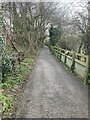
Bottom of Rifle Butts Alley
by Hugh Craddock geograph for square TQ2159 Looking up Rifle Butts Alley from near the catch-pit TQ2159 : Rifle Butts Alley (3): the sump, following the... (more)
|

|
Gate to Lower Fitz Park
by Rose and Trev Clough geograph for square NY2623 Fitz Park was officially opened in 1887, coinciding with celebrations for Queen... (more)
|

|
Old Epsom Road
by Hugh Craddock geograph for square TQ0651 The old Epsom Road, formerly the turnpike, along the south side of Hatchlands... (more)
Tags:
top:Country Estates
type:Geograph
National Trust Property
Old Turnpike
Park Railings
top:Paths
Permissive Path
subject:Road
top:Roads, Road Transport
|

|
Footpath 1420
by Hugh Craddock geograph for square TQ1434 Footpath 1420 from Northlands Road to Mayes Lane and Little London Hill, passes... (more)
Tags:
type:Geograph
top:Lowlands
Park Railings
subject:Path
top:Paths
Public Footpath
top:Woodland, Forest
|

|
Notice on Cossins Road
by Derek Harper for square ST5775 The programme of events from Avon Organic Group is on the fence surrounding... (more)
|

|
Play area and recreation ground on SW side of Stonegate Road
by Roger Templeman geograph for square SE2937 There is a small standing stone on the verge
Tags:
Childrens Playground
path:Footpath
type:Geograph
top:Park and Public Gardens
Park Railings
top:Paths
top:Suburb, Urban Fringe
Trees
|

|
Pavement at Albury Street/Sherbourne
by Hugh Craddock for square TQ0648 Pavement on the east side of Sherbourne, also known as Albury Street, between... (more)
Tags:
type:Cross Grid
Park Railings
top:Paths
Pavement
subject:Pavement
top:Roads, Road Transport
Segregated Pavement
|

|
St Paul's Church, Cwmtillery
by M J Roscoe geograph for square SO2106 The small late Victorian church viewed from the edge of the lower lake. Note at... (more)
Tags:
place:Cwmtillery
top:Housing, Dwellings
Park Railings
top:Religious Sites
top:Suburb, Urban Fringe
Trees in Spring
top:Uplands
|
