|
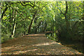
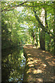
Drake's Walk
by Derek Harper
geograph for square SX4773
The towpath by the Tavistock Canal, followed by Tavistock footpath 61, is so... (more)
|
|
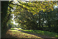
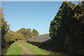
Drake's Walk
by Derek Harper
geograph for square SX4772
Looking along the towpath walk beside the Tavistock Canal from beside the farm... (more)
|
|
Tavistock Canal
by Derek Harper
geograph for square SX4773
|
|
Drake's Walk
by Derek Harper
geograph for square SX4773
|
|
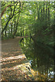
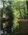
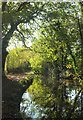
Tavistock Canal
by Derek Harper
geograph for square SX4773
Sunlight picks out a tree on the opposite bank. Drake's Walk follows... (more)
|
|
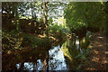
Tavistock Canal
by Derek Harper
geograph for square SX4773
With Drake's Walk following Tavistock footpath 61 along the towpath.
|
|
Drinking place, Tavistock Canal
by Derek Harper
geograph for square SX4772
|
|
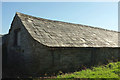
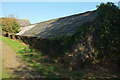
Stable range, Crowndale Farm
by Derek Harper
geograph for square SX4772
"Stabling has two-storey central gable end fronted bay with central door... (more)
|
|
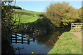
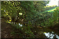
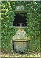
Drinking place, Tavistock Canal
by Derek Harper
geograph for square SX4772
Timber fencing allows livestock access to the canal at Crowndale farm. Seen from... (more)
|
|
Tavistock Canal
by Derek Harper
geograph for square SX4772
|
|
Tavistock Canal
by Derek Harper
geograph for square SX4772
Bordered by Drake's Walk following Tavistock footpath 61 along the towpath.
|
|
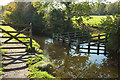
Drinking place, Tavistock Canal
by Derek Harper
geograph for square SX4773
Fences provide access to the canal for livestock. Taken from Drake's Walk... (more)
|
|
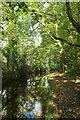
Tavistock Canal
by Derek Harper
geograph for square SX4773
Running through woodland, with Drake's Walk following Tavistock footpath 61... (more)
|
|
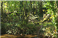
Tavistock Canal
by Derek Harper
geograph for square SX4773
Is this a winding hole on the far side of the canal, I wonder? Or perhaps the... (more)
|
|
Farm building, Crowndale
by Derek Harper
for square SX4772
The north end of the range of stabling along the west side of the farmyard in... (more)
|
|
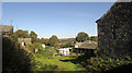
Crowndale Farm
by Derek Harper
geograph for square SX4772
The farmyard ranges described at... (more)
|
|
Crowndale Farm
by Derek Harper
geograph for square SX4772
In the foreground is the north end of the farm buildings described at... (more)
|
|
Tavistock Canal
by Derek Harper
geograph for square SX4773
|
|
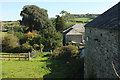
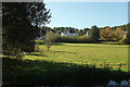
Green space by the Tavistock Canal
by Derek Harper
geograph for square SX4773
|
|
Stable range, Crowndale Farm
by Derek Harper
geograph for square SX4772
|
|
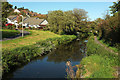
Tavistock Canal
by Derek Harper
geograph for square SX4772
Emerging at this kink from being enclosed by mature trees on both banks.
|
|
Tavistock Canal
by Derek Harper
geograph for square SX4773
|
|
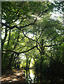
Tavistock Canal
by Derek Harper
geograph for square SX4773
Sunlight filters through canalside trees.
|
|
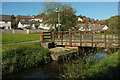
Bridge over Tavistock Canal
by Derek Harper
geograph for square SX4773
|
|
Green space by the Tavistock Canal
by Derek Harper
geograph for square SX4773
|
|
Detail of stable range, Crowndale Farm
by Derek Harper
for square SX4772
|
|
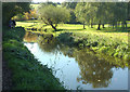
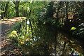
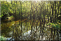
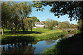
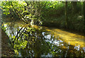
Pond by Tavistock Canal
by Derek Harper
geograph for square SX4772
The green-covered waters of the small pond can be seen through the vegetation,... (more)
|