Public Tags
Other tags: near:Alyth
Showing images tagged with place:Alyth tag.
|
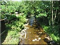
The Alyth Burn
by M J Richardson geograph for square NO2448 Having passed under Bamff Road in Alyth.
Tags:
place:Alyth
Alyth BurnX
type:GeographX
top:LowlandsX
place:Perth and KinrossX
top:Rivers, Streams, DrainageX
StrathmoreX
subject:StreamX
TreesX
top:Village, Rural SettlementX
top:Woodland, ForestX
|
|
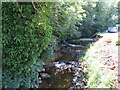
The Alyth Burn
by M J Richardson geograph for square NO2448 By-passing a weir on the left side.
Tags:
place:Alyth
Alyth BurnX
type:GeographX
top:LowlandsX
place:Perth and KinrossX
top:Rivers, Streams, DrainageX
StrathmoreX
subject:StructureX
TreesX
top:Village, Rural SettlementX
WeirX
top:Woodland, ForestX
|
|
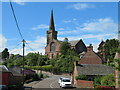
Alyth High Parish Church
by M J Richardson geograph for square NO2448 A Neo-Norman style building designed by Thomas Hamilton in 1839. Viewed from the... (more)
Tags:
place:Alyth
subject:ChurchX
type:GeographX
top:Housing, DwellingsX
top:LowlandsX
place:Perth and KinrossX
top:Roads, Road TransportX
StrathmoreX
StreetX
TreesX
top:Village, Rural SettlementX
|
|
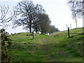
Green drove, near Alyth
by Maigheach-gheal geograph for square NO2451 The sunken track is the old road to Alyth.
|
|
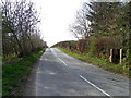
B952, Alyth
by Maigheach-gheal geograph for square NO2549 The B952 heading towards Alyth. There is an Ordnance Survey cut mark on the... (more)
Tags:
place:Alyth
B Road (Classified B)X
top:Boundary, BarrierX
GatepostsX
top:Roads, Road TransportX
|
|
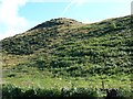
Barry Hill
by James Allan geograph for square NO2650 Although a mere 208 metres high this is a prominent feature of the countryside... (more)
|
|
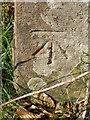
Bench Mark, Alyth
by Maigheach-gheal for square NO2549 The Ordnance Survey bench mark is to be found on the southwest side of the... (more)
|
|
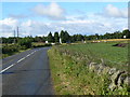
Field beside a roundabout
by James Allan geograph for square NO2547 Arable land outside Alyth, near the intersection of the A926 and B954.
Tags:
place:Alyth
Arable LandX
top:Farm, Fishery, Market GardeningX
subject:FieldX
top:Flat LandscapesX
top:Woodland, ForestX
|
|
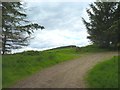
One of five
by James Allan geograph for square NO2547 This roundabout outside Alyth is the junction of five roads of which this one is... (more)
Tags:
place:Alyth
top:Farm, Fishery, Market GardeningX
top:LowlandsX
top:Roads, Road TransportX
RoundaboutX
|
|
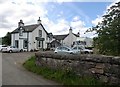
Bend in the track
by James Allan geograph for square NO2349 Near Kirklandbank south of the Hill of Alyth.
|
|
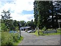
Glenisla Hotel, Kirkton of Glenisla
by Stanley Howe geograph for square NO2160 By B951.
|
|
Entrance to Lintrathen sawmill
by Stanley Howe geograph for square NO2855 Off B951.
|
|
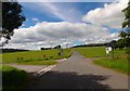
Crossroads near Loch of Lintrathen
by Stanley Howe geograph for square NO2755 B951 junction, right for Balintore and left for Formal via the west shore of the... (more)
|
