About tags on Geograph

Public Tags

Related Tags | Coverage Map
Prefix: place    Tag:  Ashdown·Forest  
Other tags: Ashdown Forest    

Showing images tagged with place:Ashdown Forest tag.

View all tagged images - In Browser
:

TQ4627 : Duddleswell Tea Room, Ashdown Forest by Malc McDonald Duddleswell Tea Room, Ashdown Forest by Malc McDonald
geograph for square TQ4627
Duddleswell Tea Room in Ashdown Forest.
Tags: place:Ashdown Forest   top:Business, Retail, Services   county:East Sussex   type:Geograph   Place of Refreshment   subject:Tearoom   Tearoom   near:Uckfield  
TQ4031 : Suttons Farm, Ashdown Forest by Malc McDonald Suttons Farm, Ashdown Forest by Malc McDonald
geograph for square TQ4031
Houses at Suttons Farm, in Ashdown Forest.
Tags: Ashdown Forest   place:Ashdown Forest   county:East Sussex   near:Forest Row   type:Geograph   subject:Houses   top:Village, Rural Settlement  
TQ4032 : Bench with a view, Ashdown Forest by Malc McDonald Bench with a view, Ashdown Forest by Malc McDonald
geograph for square TQ4032
A bench with a view, in Ashdown Forest.
Tags: place:Ashdown Forest   Ashdown Forest   Bench   type:Geograph   Public Bench   top:Uplands   subject:View  
TQ4731 : Ashdown Forest by Malc McDonald Ashdown Forest by Malc McDonald
geograph for square TQ4731
A view taken from the B2026 road looking over Ashdown Forest.
Tags: place:Ashdown Forest   near:Crowborough   county:East Sussex   type:Geograph   top:Uplands   View   subject:View  
TQ4631 : B2026 in Ashdown Forest by Malc McDonald B2026 in Ashdown Forest by Malc McDonald
geograph for square TQ4631
The B2026 near the highest point in Ashdown Forest, 229 metres above sea level.
Tags: place:Ashdown Forest   road:B Road   B2026   near:Crowborough   county:East Sussex   type:Geograph   subject:Road   top:Roads, Road Transport   top:Uplands  
TQ4729 : B2026 road in Ashdown Forest by Malc McDonald B2026 road in Ashdown Forest by Malc McDonald
geograph for square TQ4729
The B2026 road approaching a junction in Ashdown Forest.
Tags: place:Ashdown Forest   road:B Road   B2026   near:Crowborough   county:East Sussex   type:Geograph   subject:Road   Road Direction Sign   top:Roads, Road Transport   near:Uckfield  
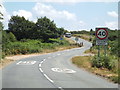
TQ4729 : B2026 through Ashdown Forest by Malc McDonald B2026 through Ashdown Forest by Malc McDonald
geograph for square TQ4729
The B2026 road in Ashdown Forest. Here, the road is about 200 metres above sea... (more)
Tags: 40mph   place:Ashdown Forest   road:B Road   B2026   near:Crowborough   county:East Sussex   type:Geograph   subject:Road   top:Roads, Road Transport   Speed Limit 40mph   near:Uckfield  
TQ4728 : New Road, Ashdown Forest by Malc McDonald New Road, Ashdown Forest by Malc McDonald
geograph for square TQ4728
New Road leading off the B2026 in Ashdown Forest.
TQ4728 : Crowborough Road, Ashdown Forest by Malc McDonald Crowborough Road, Ashdown Forest by Malc McDonald
geograph for square TQ4728
Crowborough Road leading off the B2026 in Ashdown Forest. The triangular... (more)
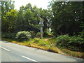
TQ4030 : Road junction in Ashdown Forest by Malc McDonald Road junction in Ashdown Forest by Malc McDonald
geograph for square TQ4030
A junction of four country lanes in Ashdown Forest. This junction lies on the... (more)
TQ4030 : Ford on Twyford Lane, in Ashdown Forest by Malc McDonald Ford on Twyford Lane, in Ashdown Forest by Malc McDonald
geograph for square TQ4030
A ford on Twyford lane, in Ashdown Forest.
TQ4031 : Twyford Lane, Ashdown Forest by Malc McDonald Twyford Lane, Ashdown Forest by Malc McDonald
geograph for square TQ4031
Twyford lane in Ashdown Forest, in East Sussex.
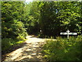
TQ4032 : Priory Road, Ashdown Forest by Malc McDonald Priory Road, Ashdown Forest by Malc McDonald
geograph for square TQ4032
Priory Road approaching a road junction in Ashdown Forest.
TQ4631 : Dead Tree, Ashdown Forest by PAUL FARMER Dead Tree, Ashdown Forest by PAUL FARMER
geograph for square TQ4631
Tags: place:Ashdown Forest   Ashdown Forest   subject:Forest   Forest   type:Geograph   subject:Tree   Tree   top:Woodland, Forest  
TQ4730 : Car park and view, Ashdown Forest by Malc McDonald Car park and view, Ashdown Forest by Malc McDonald
geograph for square TQ4730
A car parking area with a view, in Ashdown Forest.
Tags: place:Ashdown Forest   subject:Car Park   Car Park   Car Parking Area   near:Crowborough   county:East Sussex   type:Geograph   top:Uplands   View  
TQ4729 : Waterholes car park, Ashdown Forest by Malc McDonald Waterholes car park, Ashdown Forest by Malc McDonald
geograph for square TQ4729
A cattle grid at the entrance to Waterholes car park in Ashdown Forest. This... (more)
Tags: place:Ashdown Forest   Car Park   subject:Cattle Grid   Cattle Grid   near:Crowborough   county:East Sussex   type:Geograph   top:Roads, Road Transport   near:Uckfield   top:Uplands   View  
TQ4628 : Cattle grid on Crowborough Road, Ashdown Forest by Malc McDonald Cattle grid on Crowborough Road, Ashdown Forest by Malc McDonald
geograph for square TQ4628
A cattle grid on Crowborough Road in Ashdown Forest.
Tags: place:Ashdown Forest   Cattle Grid   subject:Cattle Grid   Country Road   county:East Sussex   Fingerpost   type:Geograph   near:Nutley   top:Roads, Road Transport   Rural Road   milestoneid:SX TQ4728B   near:Uckfield  
TQ4628 : Cattle on the road, Ashdown Forest by Malc McDonald Cattle on the road, Ashdown Forest by Malc McDonald
geograph for square TQ4628
A car and a cyclist encountering cattle on Crowborough Road, in Ashdown Forest.
Tags: place:Ashdown Forest   Bend in Road   Bend in the Road   subject:Cattle   Cattle   Cattle on Road   Country Road   Cows   Cyclist   county:East Sussex   type:Geograph   near:Nutley   top:Roads, Road Transport   Rural Road   near:Uckfield  
TQ4628 : Cattle in the road, Ashdown Forest by Malc McDonald Cattle in the road, Ashdown Forest by Malc McDonald
geograph for square TQ4628
Cattle wandering along Crowborough Road in Ashdown Forest.
Tags: place:Ashdown Forest   subject:Cattle   Cattle   Cattle on Road   Cows   county:East Sussex   type:Geograph   near:Nutley   top:Roads, Road Transport   near:Uckfield  
TQ4428 : Footpath in Ashdown Forest by Malc McDonald Footpath in Ashdown Forest by Malc McDonald
geograph for square TQ4428
A footpath leading into Ashdown Forest.
Tags: place:Ashdown Forest   county:East Sussex   Footpath   Forest Path   type:Geograph   near:Nutley   subject:Path   top:Paths   near:Uckfield  
TQ4030 : Narrow lane in Ashdown Forest by Malc McDonald Narrow lane in Ashdown Forest by Malc McDonald
geograph for square TQ4030
This narrow lane appears to be un-named.
TQ4032 : Hindleap Lane, Ashdown Forest by Malc McDonald Hindleap Lane, Ashdown Forest by Malc McDonald
geograph for square TQ4032
Hindleap Lane in Ashdown Forest, in East Sussex.
Tags: place:Ashdown Forest   county:East Sussex   near:Forest Row   type:Geograph   subject:Road   top:Roads, Road Transport   Rural Road  
TQ4631 : Four Counties car park by Malc McDonald Four Counties car park by Malc McDonald
geograph for square TQ4631
Four Counties is at the highest point in Ashdown Forest, 229 metres above sea... (more)
Tags: place:Ashdown Forest   Car Park   subject:Car Park   Car Parking Area   near:Crowborough   county:East Sussex   type:Geograph   top:Roads, Road Transport   top:Uplands  
TQ4627 : Driveway and footpath, Ashdown Forest by Malc McDonald Driveway and footpath, Ashdown Forest by Malc McDonald
geograph for square TQ4627
The wooden signpost to the left of the image indicates that the driveway is also... (more)
TQ4528 : Crowborough Road, near Nutley by Malc McDonald Crowborough Road, near Nutley by Malc McDonald
geograph for square TQ4528
Crowborough Road approaching a cattle grid, in Ashdown Forest.
Tags: place:Ashdown Forest   Country Road   county:East Sussex   type:Geograph   near:Nutley   subject:Road   top:Roads, Road Transport   Rural Road   near:Uckfield  
TQ4528 : Crowborough Road, near Nutley by Malc McDonald Crowborough Road, near Nutley by Malc McDonald
geograph for square TQ4528
Crowborough Road near Nutley, in Ashdown Forest. The sign indicates a 40mph speed limit.
TQ4428 : Ashdown Chase, Nutley by Malc McDonald Ashdown Chase, Nutley by Malc McDonald
geograph for square TQ4428
Ashdown Chase is a modern housing development in the village of Nutley, in Ashdown Forest.
TQ4130 : Red Lion, Chelwood Gate by Malc McDonald Red Lion, Chelwood Gate by Malc McDonald
geograph for square TQ4130
The Red Lion pub in the village of Chelwood Gate, in Ashdown Forest.
TQ4633 : Ashdown Forest by PAUL FARMER Ashdown Forest by PAUL FARMER
geograph for square TQ4633
Tags: place:Ashdown Forest   Ashdown Forest   subject:Forest   Forest   Forest Track   type:Geograph   top:Woodland, Forest  
TQ4030 : Road junction in Ashdown Forest by Malc McDonald Road junction in Ashdown Forest by Malc McDonald
geograph for square TQ4030
A road junction in Ashdown Forest.
TQ4631 : Kidd's Hill, Ashdown Forest by Malc McDonald Kidd's Hill, Ashdown Forest by Malc McDonald
geograph for square TQ4631
Kidd's Hill approaching its junction with the B2026 in Ashdown Forest.
TQ4528 : Track at Stonehills, in Ashdown Forest by Malc McDonald Track at Stonehills, in Ashdown Forest by Malc McDonald
geograph for square TQ4528
A track leading to a car park in Ashdown Forest, with a view southwards to the... (more)
Tags: place:Ashdown Forest   county:East Sussex   type:Geograph   near:Nutley   subject:Track   Track   near:Uckfield   top:Uplands   View  
TQ4328 : Chelwood Gate Road, Ashdown Forest by Malc McDonald Chelwood Gate Road, Ashdown Forest by Malc McDonald
geograph for square TQ4328
Chelwood Gate Road in Ashdown Forest. The sign warns of a double bend ahead.
TQ4229 : Scene near Braberry Hatch - Ashdown Forest, Sussex by Ian Hawfinch Scene near Braberry Hatch - Ashdown Forest, Sussex by Ian Hawfinch
geograph for square TQ4229
Tags: place:Ashdown Forest   subject:Bridge   type:Geograph   top:Paths   place:Sussex   top:Woodland, Forest  
TQ4627 : Heath Spotted Orchid - Dactylorhiza maculata - Ashdown Forest, Sussex by Ian Hawfinch Heath Spotted Orchid - Dactylorhiza maculata - Ashdown Forest, Sussex by Ian Hawfinch
for square TQ4627
TQ4628 : Broad-leaved arrowhead - Sagittaria latifolia - Ashdown Forest, Sussex by Ian Hawfinch Broad-leaved arrowhead - Sagittaria latifolia - Ashdown Forest, Sussex by Ian Hawfinch
for square TQ4628
Growing by a pond
TQ4727 : Wood Anemone - Anemone nemorosa - Ashdown Forest, Sussex by Ian Hawfinch Wood Anemone - Anemone nemorosa - Ashdown Forest, Sussex by Ian Hawfinch
for square TQ4727
TQ4428 : Restaurant in Nutley by Malc McDonald Restaurant in Nutley by Malc McDonald
geograph for square TQ4428
An Indian restaurant in the village of Nutley, in Ashdown Forest.
Tags: place:Ashdown Forest   top:Business, Retail, Services   county:East Sussex   type:Geograph   restaurant:Indian   Indian Restaurant   place:Nutley   subject:Restaurant   Restaurant   building type:Restaurant   near:Uckfield  
TQ4130 : Private road in Chelwood Gate by Malc McDonald Private road in Chelwood Gate by Malc McDonald
geograph for square TQ4130
A private road in the village of Chelwood Gate, in Ashdown Forest.
TQ4733 : Sign for Diverted Footpath, Chuck Hatch by PAUL FARMER Sign for Diverted Footpath, Chuck Hatch by PAUL FARMER
geograph for square TQ4733
Tags: place:Ashdown Forest   Ashdown Forest   path:Footpath   Footpath   Footpath Sign   Footpath Through Woods   Gate   subject:Gate   type:Geograph   top:Paths   subject:Sign   top:Woodland, Forest  
TQ4732 : Wrens Warren car park, Ashdown Forest by Malc McDonald Wrens Warren car park, Ashdown Forest by Malc McDonald
geograph for square TQ4732
Tags: place:Ashdown Forest   subject:Car Park   Car Park   Car Parking Area   near:Crowborough   county:East Sussex   type:Geograph   near:Hartfield   top:Roads, Road Transport  
TQ4428 : Road junction in Nutley by Malc McDonald Road junction in Nutley by Malc McDonald
geograph for square TQ4428
The road to the left is Chelwood Gate Road, the road to the right is the trunk A22 road.
Tags: A22   road:A22   place:Ashdown Forest   county:East Sussex   type:Geograph   place:Nutley   Road Junction   subject:Road Junction   top:Roads, Road Transport   near:Uckfield  
TQ4428 : Crowborough Road, Nutley by Malc McDonald Crowborough Road, Nutley by Malc McDonald
geograph for square TQ4428
Crowborough Road in the village of Nutley, in East Sussex.
Tags: place:Ashdown Forest   county:East Sussex   type:Geograph   place:Nutley   near:Uckfield   subject:Village   top:Village, Rural Settlement  
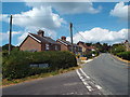
TQ4129 : Beaconsfield Road, Chelwood Gate by Malc McDonald Beaconsfield Road, Chelwood Gate by Malc McDonald
geograph for square TQ4129
Beaconsfield Road in the village of Chelwood Gate, in East Sussex.
Tags: place:Ashdown Forest   place:Chelwood Gate   county:East Sussex   type:Geograph   subject:Village   top:Village, Rural Settlement  
TQ4129 : Telephone kiosk outside Chelwood Gate village hall by Malc McDonald Telephone kiosk outside Chelwood Gate village hall by Malc McDonald
geograph for square TQ4129
A BT telephone kiosk outside the village hall in Chelwood Gate, in East Sussex.
TQ4229 : Driveway to Beaconwood Farm, near Chelwood Gate by Malc McDonald Driveway to Beaconwood Farm, near Chelwood Gate by Malc McDonald
geograph for square TQ4229
A driveway leading to Beaconwood Farm, near the village of Chelwood Gate in East Sussex.
Tags: place:Ashdown Forest   near:Chelwood Gate   subject:Drive   Driveway   county:East Sussex   Farm Driveway   type:Geograph   Private Driveway   top:Roads, Road Transport  
View more in the Image Search or in Browser
View images matching 'Ashdown Forest' anywhere in the tags
Don't click these: PotMel 1 PotMel 2