Public Tags
Other tags: Barrow-in-Furness
Showing latest 50 of 143 images tagged with place:Barrow-in-Furness tag.

|
Furness Abbey - Reredorter
by Rob Farrow geograph for square SD2171 The Reredorter was situated adjoining the "dorter" where the monks... (more)
Tags:
ruin:Abbey
place:Barrow in Furness
Furness Abbey
top:Historic Sites and Artefacts
top:Religious Sites
Reredorter
top:Rivers, Streams, Drainage
|

|
Furness Abbey - Mill Beck in grounds
by Rob Farrow geograph for square SD2171 Mediaeval abbeys such as this one at Furness, were usually built close to... (more)
Tags:
ruin:Abbey
place:Barrow in Furness
Furness Abbey
top:Historic Sites and Artefacts
top:Religious Sites
top:Rivers, Streams, Drainage
Stream
|

|
Furness Abbey - Chapter House
by Rob Farrow geograph for square SD2171 The Chapter House of Furness Abbey dates from the early to mid C13th. Above each... (more)
Tags:
ruin:Abbey
place:Barrow in Furness
Furness Abbey
top:Historic Sites and Artefacts
top:Religious Sites
|

|
Furness Abbey - Mill Beck enters the site
by Rob Farrow geograph for square SD2171 Mill Beck, the stream which was once so essential to the abbey's daily life... (more)
Tags:
ruin:Abbey
place:Barrow in Furness
Furness Abbey
top:Historic Sites and Artefacts
top:Religious Sites
top:Rivers, Streams, Drainage
Stream
|

|
Furness Abbey - Former custodian's hut
by Rob Farrow geograph for square SD2171 The quaint little structure on the right of this photo is the old hut that was... (more)
Tags:
ruin:Abbey
place:Barrow in Furness
Furness Abbey
top:Historic Sites and Artefacts
top:Religious Sites
|

|
Furness Abbey - Infirmary
by Rob Farrow geograph for square SD2171 Taken from the western end of the now-vanished infirmary at Furness Abbey at its... (more)
Tags:
ruin:Abbey
place:Barrow in Furness
Furness Abbey
top:Historic Sites and Artefacts
Infirmary
top:Religious Sites
|

|
Furness Abbey - Culverted stream
by Rob Farrow geograph for square SD2171 Mill Beck is seen here reappearing having passed in a culvert beneath the... (more)
Tags:
ruin:Abbey
place:Barrow in Furness
Furness Abbey
top:Historic Sites and Artefacts
top:Religious Sites
top:Rivers, Streams, Drainage
Stream
|

|
Furness Abbey - East Range
by Rob Farrow geograph for square SD2171 The red sandstone remains of the East Range of Furness Abbey leading to the... (more)
Tags:
ruin:Abbey
place:Barrow in Furness
Furness Abbey
top:Historic Sites and Artefacts
top:Religious Sites
top:Village, Rural Settlement
|

|
Furness Abbey - Archway to Chapter House
by Rob Farrow for square SD2171 According to the EH plan, both the Chapter House and the wall in which this arch... (more)
Tags:
ruin:Abbey
Arch
place:Barrow in Furness
Furness Abbey
top:Historic Sites and Artefacts
top:Religious Sites
|

|
Furness Abbey - Nave and Transepts
by Rob Farrow geograph for square SD2171 Little remains of the nave of the great abbey church at Furness, the grassed... (more)
Tags:
ruin:Abbey
place:Barrow in Furness
Furness Abbey
top:Historic Sites and Artefacts
top:Religious Sites
top:Village, Rural Settlement
|

|
Ambulance Station, Barrow in Furness
by Graham Robson geograph for square SD1968 Barrow in Furness ambulance station, the base for ambulances serving Barrow and... (more)
Tags:
Ambulance Station
place:Barrow in Furness
top:Health and Social Services
top:Roads, Road Transport
|
|
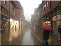
Dalton Road, Barrow in Furness
by Graham Robson geograph for square SD1969 Dalton Road, a shopping development in Barrow in Furness which is home to a... (more)
|

|
Cornerhouse Park, retail park, Barrow in Furness
by Graham Robson geograph for square SD1969 Looking across the car park towards the Halfords store at Cornerhouse Park,... (more)
|

|
Walney Channel and Devonshire Dock Hall
by Adrian Taylor geograph for square SD1868 Walney Channel separates Walney Island from Barrow-in-Furness; Devonshire Dock... (more)
Tags:
BAE Systems
Barrow-in-Furness
place:Barrow-in-Furness
subject:Building
Channel
top:Coastal
Cumbria
top:Docks, Harbours
type:Geograph
Shipyard
Shore
Walney Channel
Water
|

|
The Dock Museum - Barrow-in-Furness
by Chris Allen geograph for square SD1969 This museum is built in and over part of a former dry dock and celebrates the... (more)
Tags:
place:Barrow-in-Furness
former:Dry Dock
top:Educational Sites
type:Geograph
top:Historic Sites and Artefacts
subject:Museum
|

|
Dalton Road, Barrow in Furness
by Graham Robson geograph for square SD1969 Looking along Dalton Road, a pedestrianised street lined with shops in Barrow in... (more)
Tags:
place:Barrow in Furness
top:Business, Retail, Services
top:City, Town Centre
top:Paths
Pedestrianised Street
Shopping Street
|
|
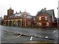
Former Fire Station, Barrow in Furness
by Graham Robson geograph for square SD1969 The fire station which until 1996 served the people of Barrow in Furness. It was... (more)
Tags:
place:Barrow in Furness
top:Business, Retail, Services
former:Fire Station
Grade II Listed
top:Historic Sites and Artefacts
|

|
DIY store, Barrow in Furness
by Graham Robson geograph for square SD1969 A large B & Q store selling DIY goods located off Hindpool Road, Barrow in Furness.
|

|
Apartment building on Michaelson Road, Barrow in Furness
by Graham Robson geograph for square SD1968 Looking across Michaelson Road, Barrow in Furness towards a large, stone built... (more)
|

|
BAE Systems, Barrow in Furness
by Graham Robson geograph for square SD1968 Looking from the High Level Bridge across Buccleuch Dock towards Devonshire Dock... (more)
Tags:
BAE Systems
place:Barrow in Furness
top:Business, Retail, Services
top:Docks, Harbours
Factory
top:Industry
|

|
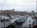
Morrisons Petrol Station, Barrow in Furness
by Graham Robson geograph for square SD1968 The Morrisons Petrol Station seen from Michaelson Road, Barrow in Furness. The... (more)
Tags:
place:Barrow in Furness
top:Business, Retail, Services
Petrol Station
top:Roads, Road Transport
|
|
Morrisons Supermarket, Barrow in Furness
by Graham Robson for square SD2068 The Morrisons supermarket in Barrow in Furness viewed from Michaelson Road.
Tags:
place:Barrow in Furness
top:Business, Retail, Services
Car Park
Morrisons Supermarket
top:Roads, Road Transport
top:Sport, Leisure
|

|
Barrow Promenade
by Adrian Taylor geograph for square SD1869 Barrow Promenade extends alongside Walney Channel and is also known as the... (more)
Tags:
place:Barrow-in-Furness
Barrow-in-Furness
top:Coastal
Cumbria
Cumbria Coastal Way
long distance path:Cumbria Coastal Way
long distance footpath:Cumbria Coastal Way
top:Estuary, Marine
type:Geograph
top:Paths
subject:Promenade
Walney Channel
Walney Island
Winter Sun
|

|
Barrow Promenade
by Adrian Taylor geograph for square SD1869 Barrow Promenade extends alongside Walney Channel and is also known as the... (more)
Tags:
BAE Systems
Barrow-in-Furness
place:Barrow-in-Furness
top:Coastal
Cumbria
long distance footpath:Cumbria Coastal Way
long distance path:Cumbria Coastal Way
Cumbria Coastal Way
top:Estuary, Marine
type:Geograph
top:Paths
subject:Promenade
Walney Channel
Winter Sun
|

|
Barrow-in-Furness, BAE Systems and Buccleuch Dock
by Chris Allen geograph for square SD1968 The road is an internal road that passes under the high level bridge I am stood... (more)
Tags:
BAE Systems
place:Barrow-in-Furness
Buccleuch Dock
top:Docks, Harbours
type:Geograph
top:Industry
subject:Shipyard
|

|
BAE Systems - Barrow-in-Furness
by Chris Allen geograph for square SD1968 The water is Devonshire Dock that was partly in-filled to construct the huge... (more)
Tags:
BAE Systems
place:Barrow-in-Furness
top:Defence, Military
type:Geograph
top:Industry
Nuclear Submarines
subject:Shipyard
Submarine
|

|
Jubilee Bridge
by Rude Health geograph for square SD1868 Jubilee Bridge is a bascule bridge in Barrow-in-Furness and was ompleted in... (more)
Tags:
road:A590
island:Barrow Island
place:Barrow-in-Furness
Bascule Bridge
subject:Bridge
top:Coastal
top:Estuary, Marine
top:Islands
Jubilee Bridge
top:Roads, Road Transport
island:Walney
|

|
The spirit of Barrow sculpture, Dalton Road, Barrow in Furness
by Graham Robson geograph for square SD2069 The sculpture sits in the centre of the Dalton Road shopping area. It was... (more)
Tags:
place:Barrow in Furness
top:City, Town Centre
top:Paths
top:Public Buildings and Spaces
Sculpture
|

|
Apartment Building on Michaelson Road, Barrow-in-Furness
by Chris Allen geograph for square SD1968 Built for workers in Barrow's industries. These are known as Devonshire... (more)
|

|
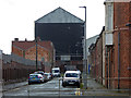
Barrow-in-Furness - cheek by jowl
by Chris Allen geograph for square SD1968 Houses and heavy industry. The industry is BAE systems and the big grey, black... (more)
Tags:
BAE Systems
place:Barrow-in-Furness
type:Geograph
Houses
top:Housing, Dwellings
top:Industry
subject:Shipyard
|
|
A flavour of Barrow-in-Furness
by Chris Allen geograph for square SD1968 This is Stanley Road and arguably captures Barrow in a shot - terraced housing,... (more)
|

|
Barrow-in-Furness - gun shop
by Chris Allen geograph for square SD1968 This huge building was instrumental in Britain's war effort as this is... (more)
|

|
Craven House, Barrow-in-Furness
by Graham Robson geograph for square SD1969 Craven House on Michaelson Road in Barrow. The building is owned by the Borough... (more)
|
|
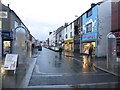
Cavendish Street, Barrow-in-Furness
by Graham Robson geograph for square SD1969 An edge of centre shopping street in Barrow pictured on a wet and miserable... (more)
Tags:
place:Barrow-in-Furness
top:Business, Retail, Services
top:Roads, Road Transport
Shopping Street
|

|
Portland Walk, Barrow-in-Furness
by Graham Robson geograph for square SD1969 A pedestrianised street of shops in the centre of Barrow, pictured on a wet and... (more)
Tags:
place:Barrow-in-Furness
top:Business, Retail, Services
top:Paths
Pedestrianised Street
top:Public Buildings and Spaces
Shopping Street
|

|
Portland Walk, Barrow-in-Furness
by Graham Robson geograph for square SD1969 Portland Walk is a pedestrianised shopping street in Barrow. Occupants include... (more)
Tags:
place:Barrow-in-Furness
top:Business, Retail, Services
top:Paths
Pedestrianised Street
top:Public Buildings and Spaces
Shopping Street
|

|
Barrow-in-Furness Railway Station
by Graham Robson geograph for square SD2069 The railway station, close to the centre of Barrow, has 3 platforms which trains... (more)
|
|
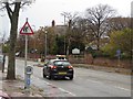
Abbey Road, Barrow-in-Furness
by Graham Robson geograph for square SD2070 Abbey road carries traffic into and out of the centre of Barrow. A sign warns of... (more)
|

|
Shell fuel filling station, Abbey Road, Barrow-in-Furness
by Graham Robson geograph for square SD2070 A Shell fuel filling station on Abbey Road in Barrow.
Tags:
place:Barrow-in-Furness
top:Business, Retail, Services
Fuel Filling Station
top:Roads, Road Transport
Shell Garage
|
|
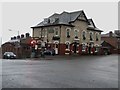
The Strawberry, Barrow-in-Furness
by Graham Robson geograph for square SD2070 The Strawberry, a large pub on the southern corner of the junction of Abbey Road... (more)
|

|
Postbox, Abbey Road, Barrow-in-Furness
by Graham Robson for square SD2171 A postbox in a garden wall on the side of Abbey Road, Barrow.
|

|
Abbey Road, Barrow-in-Furness
by Graham Robson geograph for square SD2171 A busy road taking traffic into and out of the centre of Barrow.
|
|
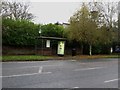
Bus stop, Abbey Road, Barrow-in-Furness
by Graham Robson geograph for square SD2171 A westbound bus stop and shelter on Abbey Road, Barrow.
|

|
Manor Farm, Barrow-in-Furness
by Graham Robson geograph for square SD2171 A range of traditional farm buildings at Manor Farm on the eastern edge of... (more)
|

|
Entrance to Hindpool Retail Park, Barrow in Furness
by Graham Robson geograph for square SD1969 Hindpool Retail Park is home to a number of stores belonging to a variety of... (more)
Tags:
shop:Aldi
place:Barrow in Furness
shop:Blockbuster
top:Business, Retail, Services
shop:Carpetright
shop:Harveys
Retail Park
top:Sport, Leisure
|

|
Club M, Barrow
by Graham Robson geograph for square SD1969 Club M, a nightclub in Barrow in Furness, at the junction of Hindpool Road and... (more)
Tags:
place:Barrow in Furness
top:Business, Retail, Services
Nightclub
top:Roads, Road Transport
top:Sport, Leisure
|

|
Nakhoda Ragam class Offshore Patrol Vessels, Ramsden Dock, Barrow in Furness
by Graham Robson geograph for square SD2068 The three vessels forming the Nakhoda Ragam class of Offshore Patrol Vessels... (more)
|
|
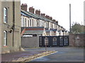
The back of James Watt Terrace, Barrow-in-Furness
by Chris Allen for square SD1967 The road extending off to the left out of sight is Siemen's Street. This is... (more)
|

|
Industrial building, Barrow-in-Furness
by Chris Allen geograph for square SD1969 This is across the road from BAE Systems' Devonshire Dock Hall and might be... (more)
|

|
Barrow-in-Furness - BAE Systems and Devonshire Dock
by Chris Allen geograph for square SD1968 Part of the huge shipyard where the UK's nuclear submarines are built. It... (more)
|
