Public Tags
Showing images tagged with place:Bescot tag.

|
Bescot Stadium Station
by Ian Capper geograph for square SP0096 Originally named Bescot Station, it was renamed in 1990 following the opening of... (more)
|

|
Bescot Junction in the early 1990s
by John Winder geograph for square SP0096 Bescot railway junction in 1993. The scene looks broadly similar today, except... (more)
|

|
M6 - Bescot Viaduct
by Ian Capper geograph for square SP0096 The M6 motorway in Bescot, with Bescot Stadium (see SP0096 : Bescot Stadium), home of... (more)
Tags:
Advertising Hoarding
Bankss Stadium
place:Bescot
Bescot Stadium
M6
top:Roads, Road Transport
top:Sport, Leisure
Walsall FC
|

|
Bescot Crescent
by Ian Capper geograph for square SP0096 Premises of Middleton Paper on Bescot Crescent.
|

|
Sign, Bescot Stadium
by Ian Capper for square SP0096 A sign outside Bescot Stadium (see SP0096 : Bescot Stadium), home of Walsall FC, proclaiming... (more)
Tags:
Bankss Stadium
place:Bescot
Bescot Stadium
person:Gilbert Alsop
top:Sport, Leisure
top:Suburb, Urban Fringe
Walsall FC
|

|
Bescot Stadium
by Ian Capper geograph for square SP0096 Officially known as the Banks's Stadium, it is home to Walsall Football... (more)
Tags:
Bankss Stadium
place:Bescot
Bescot Stadium
top:Sport, Leisure
top:Suburb, Urban Fringe
Walsall FC
|

|
Disused sidings at Bescot
by Adrian Taylor geograph for square SP0195 The disused Bescot Down Sorting Sidings in the closed Bescot Down Yard.
Tags:
place:Bescot
top:Derelict, Disused
Disused Railway Sidings
type:Geograph
Lighting Tower
Railway
subject:Railway Freight Yard
Railway Sidings
Railway Sidings (Disused)
Railway Yard
top:Railways
Sidings
West Midlands
|
|
Bescot Crescent
by Gerald England geograph for square SP0196 Leading to Lord Street.
|

|
Middleton Paper
by Ian Capper geograph for square SP0096 Paper merchant and convertor on Bescot Crescent.
|

|
Park Inn by Radisson Birmingham Walsall
by Ian Capper geograph for square SP0096 Hotel on Bescot Crescent.
Tags:
place:Bescot
Bescot Crescent
top:Business, Retail, Services
Hotel
Park Inn
top:Suburb, Urban Fringe
|

|
Bescot Yard
by Adrian Taylor geograph for square SP0195 In the foreground are the passenger lines from Birmingham to Walsall; beyond the... (more)
Tags:
place:Bescot
type:Geograph
Overhead Catenary
subject:Railway
Railway Sidings
Railway Track
Railway Yard
top:Railways
West Midlands
|

|
Park Inn
by Gerald England geograph for square SP0096
A Radisson hotel next to Walsall FC's football ground.
Tags:
place:Bescot
Bescot Crescent
top:Business, Retail, Services
type:Geograph
Hotel
Park Inn
Radisson Hotel
|
|
Grand Junction Way
by Ian Capper geograph for square SP0196 Part of a small housing estate off Lord Street. The name commemorates the Grand... (more)
|
|
Alongside the River Tame
by Ian Capper geograph for square SP0195 A footpath alongside the River Tame, with the M6 on the left and a lighting... (more)
|

|
Alongside the M6
by Ian Capper geograph for square SP0195 An area of grassland alongside the M6. To the right of the path on the right,... (more)
|

|
Loaded tilt wagons
by Adrian Taylor geograph for square SP0195 Loaded Network Rail tilt wagons on a siding in Bescot Up Yard. The wagons,... (more)
Tags:
place:Bescot
type:Geograph
Network Rail
Network Rail Train
Railway Sidings
subject:Railway Wagon
Railway Yard
top:Railways
Sidings
Track Maintenance
Track Maintenance Train
West Midlands
|

|
River Tame
by Ian Capper geograph for square SP0096 The River Tame flowing between the M6 motorway and Bescot railway yards, with... (more)
Tags:
place:Bescot
M6
top:Railways
River Tame
top:Rivers, Streams, Drainage
top:Roads, Road Transport
top:Suburb, Urban Fringe
|
|
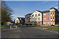
Walstead Road West
by Gerald England geograph for square SP0196 |
|
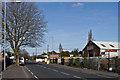
Lord Street
by Ian Capper geograph for square SP0196 New apartment block at the junction of Lord Street with Manorhouse Close.
|
|
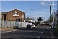
Walstead Road West
by Ian Capper geograph for square SP0196 A road of housing and light industry.
|
|
Brockhurst Crescent
by Ian Capper geograph for square SP0196 An industrial estate alongside the M6.
|

|
Alongside the M6
by Ian Capper for square SP0196 An area of grassland alongside the M6. In the background is the RAC Control... (more)
|

|
Alongside the M6
by Ian Capper geograph for square SP0195 An area of grassland alongside the M6. The overhead sign is for junction 8 of... (more)
|

|
Culvert under the M6
by Ian Capper geograph for square SP0096 A culvert carrying the Full Brook under the M6 near its confluence with the... (more)
Tags:
place:Bescot
Culvert
Full Brook
M6
RAC Control Centre
top:Rivers, Streams, Drainage
top:Roads, Road Transport
|
|
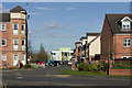
Manorhouse Close
by Ian Capper geograph for square SP0196 New apartment block and other housing, with part of Joseph Leckie Community... (more)
|

|
Culvert under the M6
by Ian Capper geograph for square SP0096 A culvert carrying the Full Brook under the M6 near its confluence with the... (more)
Tags:
place:Bescot
Culvert
Full Brook
M6
RAC Control Centre
River Tame
top:Rivers, Streams, Drainage
top:Roads, Road Transport
top:Suburb, Urban Fringe
|

|
Between the M6 and the River Tame
by Ian Capper geograph for square SP0096 A footpath running between the M6 motorway and the River Tame.
Tags:
place:Bescot
M6
top:Paths
top:Railways
River Tame
top:Rivers, Streams, Drainage
top:Suburb, Urban Fringe
|

|
Logo, RAC Control Centre
by Ian Capper for square SP0196 RAC logo on the side of the RAC Control Centre - see SP0196 : RAC Control Centre.
Tags:
place:Bescot
top:Business, Retail, Services
Logo
M6
RAC Control Centre
top:Roads, Road Transport
top:Suburb, Urban Fringe
|

|
RAC Control Centre
by Ian Capper for square SP0196 Opened in June 1989 and designed by Italian architect Gennaro Picardi, this... (more)
Tags:
place:Bescot
top:Business, Retail, Services
person:Gennaro Picardi
M6
RAC Control Centre
top:Roads, Road Transport
top:Suburb, Urban Fringe
|
