Public Tags
Showing images tagged with place:Brantham tag.

|
Pumping Station, Brantham Industrial Estate
by Roger Jones geograph for square TM1133 From the footpath that goes to the railway crossing.
I wonder if Constable... (more)
|

|
Industry by the Stour, nr Brantham (1)
by Roger Jones geograph for square TM1133 In the heart of Constable country is the Brantham Industrial Area, which was... (more)
|
|
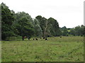
Field near Stutton Brook
by Roger Jones geograph for square TM1235 To the south of the brook, near Brantham Bridge.
|
|
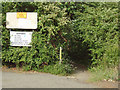
Stour Valley Walk; entrance from Factory Lane, Brantham Industrial Estate
by Roger Jones geograph for square TM1033 Considering this is a part of the national long distance path network, the lack... (more)
|

|
Decoy pond, nr Brantham Industrial Area
by Roger Jones geograph for square TM1133 Decoy pond just off Stour Valley Path. This path is not well marked, the... (more)
|

|
Arable land, north of the river
by Roger Jones geograph for square TM1333 Seen from footpath
Tags:
Arable
place:Brantham
top:Farm, Fishery, Market Gardening
top:Flat Landscapes
footpath:Stour and Orwell Walk
county:Suffolk
|

|
Newmills Lane and field with Hay Bales
by Roger Jones geograph for square TM1234 Newmills Lane footpath leads down to the Stour.
|

|
Cornfield near the river
by Roger Jones geograph for square TM1233 View towards the Stour from Newmill Lane footpath.
|

|
Keebles Sluice
by Roger Jones geograph for square TM1233 Running under the river bank defence and footpath
Tags:
place:Brantham
top:Estuary, Marine
top:Farm, Fishery, Market Gardening
footpath:Stour and Orwell Walk
county:Suffolk
|

|
Looking east along the footpath
by Roger Jones geograph for square TM1233 The footpath is The Stour and Orwell Walk
Tags:
place:Brantham
top:Estuary, Marine
Footpath
top:Paths
footpath:Stour and Orwell Walk
county:Suffolk
|
|
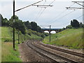
Rails, Catenary and Bridge
by Roger Jones geograph for square TM1234 The bridge is the A137 crossing the Great Eastern main line.
The term... (more)
Tags:
place:Brantham
Great Eastern Mainline
Overhead Catenary
top:Railways
Road Bridge Over Railway
top:Roads, Road Transport
county:Suffolk
bucket:Transport
|

|
Footpath to railway foot crossing
by Roger Jones geograph for square TM1234 Class 90 loco 90013: The Evening Star: Pride of Ipswich 1885 to 2010 - 125 years... (more)
Tags:
place:Brantham
locomotive:Class 90
Great Eastern Mainline
top:Paths
Public Footpath
Railway Foot Crossing
top:Railways
county:Suffolk
bucket:Transport
|

|
Pedestrian Crossing over railway
by Roger Jones geograph for square TM1234 Tags:
place:Brantham
Great Eastern Mainline
top:Paths
Railway Foot Crossing
top:Railways
county:Suffolk
|

|
Conifers at Mower's Spinney
by Roger Jones geograph for square TM1134 |
|
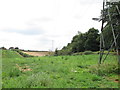
Pylons over the fields
by Roger Jones geograph for square TM1134 Seen from footpath
Tags:
place:Brantham
Electricity
top:Energy Infrastructure
top:Farm, Fishery, Market Gardening
Pylons
county:Suffolk
|

|
Corrugated Iron Barn
by Roger Jones geograph for square TM1134 Seen from footpath
Tags:
Barn
place:Brantham
top:Farm, Fishery, Market Gardening
top:Paths
Public Footpath
county:Suffolk
|

|
Crossing Closed
by Roger Jones geograph for square TM1133 This railway crossing should lead to the Stour. I'm guessing that some kind... (more)
|

|
The Only Way is Up
by Roger Jones for square TM1133 On the footpath to the railway crossing, you almost walk underneath this pylon.
|

|
Sitting duck, decoy pond
by Roger Jones geograph for square TM1133 Decoy on the pond TM1133 : Decoy pond, nr Brantham Industrial Area, seen from footpath
|
