About tags on Geograph

Public Tags

Related Tags | Coverage Map
Prefix: place    Tag:  Chilterns  
Other tags: Chilterns    

Showing latest 50 of 58 images tagged with place:Chilterns tag.

View all tagged images - In Browser
:

SP8901 : HS2 Display Board inside Missenden Abbey (2) by David Hillas HS2 Display Board inside Missenden Abbey (2) by David Hillas
for square SP8901
This display board is one of several provided by Align that were shown at an HS2... (more)
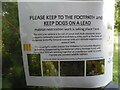
SP7901 : Chilterns AONB Notice by the Upper Icknield Way near Saunderton by David Hillas Chilterns AONB Notice by the Upper Icknield Way near Saunderton by David Hillas
for square SP7901
This notice is fixed on a post leading into a field on the Chiltern Way and has... (more)
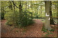
SU7189 : Footpath waymarkers on the edge of Long Wood by Simon Mortimer Footpath waymarkers on the edge of Long Wood by Simon Mortimer
geograph for square SU7189
Long Wood is a typical Chilterns beechwood with holly as an understorey shrub.... (more)
SP8901 : HS2 Display Board inside Missenden Abbey (3) by David Hillas HS2 Display Board inside Missenden Abbey (3) by David Hillas
for square SP8901
This display board is one of several provided by Align that were shown at an HS2... (more)
Tags: place:Chilterns   Chilterns   type:Close Look   Display Board   place:Great Missenden   Great Missenden   railway:HS2   HS2   HS2 Construction   type:Inside   top:Village, Rural Settlement  
SU7289 : Beech woodland south of Pishill by Simon Mortimer Beech woodland south of Pishill by Simon Mortimer
geograph for square SU7289
The Oxfordshire Way descends through these woods to the dry valley south of... (more)
Tags: Chiltern Green Road   Chiltern Hills   place:Chilterns   Chilterns   type:Geograph   top:Lowlands   long distance path:Oxfordshire Way   subject:Woodland   top:Woodland, Forest  
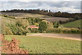
SP8403 : View towards Hampden Bottom from Lady Hampden's Wood by David Hillas View towards Hampden Bottom from Lady Hampden's Wood by David Hillas
for square SP8403
This photo is taken from the north edge of Lady Hampden's Wood and shows... (more)
Tags: Chilterns   place:Chilterns   type:Cross Grid   top:Grassland   subject:View   View   View Across Valley   View From Hillside   View of Hills  
SU7289 : Public footpath on the southern edge of Doyley Wood by Simon Mortimer Public footpath on the southern edge of Doyley Wood by Simon Mortimer
geograph for square SU7289
The path crosses horse-grazed field between wooden post and rail fences, towards... (more)
Tags: Chiltern Hills   place:Chilterns   Chilterns   Footpath   type:Geograph   top:Lowlands   subject:Path  
SU7289 : Striped fields near Pishill by Simon Mortimer Striped fields near Pishill by Simon Mortimer
geograph for square SU7289
Looking north east from near the church at Pishill. The weedy stubble field is... (more)
Tags: place:Chilterns   Chilterns   top:Farm, Fishery, Market Gardening   subject:Field   type:Geograph   top:Lowlands   field:Stubble   Stubble Field  
SU7288 : New house under construction at Maidensgrove by Simon Mortimer New house under construction at Maidensgrove by Simon Mortimer
geograph for square SU7288
Built in traditional Chilterns style, with brick and flint.
Tags: Brick and Flint   building materials:Brick and Flint   building:Brick and Flint   place:Chilterns   Chilterns   building material:Flint   Flint and Brick Cottages   type:Geograph   subject:House   House Building   House Under Construction   top:Village, Rural Settlement  
SU7288 : Pond on the edge of Russell's Water Common by Simon Mortimer Pond on the edge of Russell's Water Common by Simon Mortimer
geograph for square SU7288
Tags: Chiltern Hills   Chilterns   place:Chilterns   Common   Dew Pond   type:Geograph   top:Lakes, Wetland, Bog   top:Lowlands   subject:Pond  
SU7791 : View of Fingest from Fingest Wood by David Hillas View of Fingest from Fingest Wood by David Hillas
for square SU7791
This photo, taken from the edge of Fingest Wood, shows the village of Fingest... (more)
Tags: Chilterns   place:Chilterns   type:Cross Grid   Fingest   View   subject:View   top:Village, Rural Settlement  
SU7890 : Inscription on stile and gate at Fingest Wood by David Hillas Inscription on stile and gate at Fingest Wood by David Hillas
for square SU7890
This photo shows a metal inscription on a stile and gate at the edge of Fingest... (more)
SU7178 : Towards Chalkhouse Green by Graham Horn Towards Chalkhouse Green by Graham Horn
geograph for square SU7178
The Reading urban area is soon left behind and the lovely rolling South... (more)
Tags: place:Chilterns   top:Lowlands  
SU7295 : Dew pond, Bald Hill, Lewknor by Simon Mortimer Dew pond, Bald Hill, Lewknor by Simon Mortimer
geograph for square SU7295
The pond is on the edge of Aston Rowant National Nature Reserve, close to Cowleaze Wood.
Tags: place:Chilterns   Chilterns Escarpment   Dew Pond   type:Geograph   top:Lowlands   National Nature Reserve   subject:Pond  
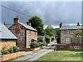
SU7499 : Brick and flint cottages, Crowell by Simon Mortimer Brick and flint cottages, Crowell by Simon Mortimer
geograph for square SU7499
Looking southeast from the village green along the lane leading to Crowell Hill.
Tags: place:Chilterns   Chilterns Escarpment   subject:Cottages   type:Geograph   top:Village, Rural Settlement  
SU7289 : Pishill Church by Simon Mortimer Pishill Church by Simon Mortimer
geograph for square SU7289
Parts of the building date back to Norman times and the mid 13th Century. The... (more)
Tags: Chilterns   place:Chilterns   subject:Church   type:Geograph   top:Religious Sites  
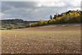
SU6687 : View from Nuffield Hill by Alan Murray-Rust View from Nuffield Hill by Alan Murray-Rust
geograph for square SU6687
Rolling Chiltern landscape with cereal crops and woodland.
Tags: crop:Barley   Cereal Crop   place:Chilterns   top:Farm, Fishery, Market Gardening   subject:Field   top:Lowlands  
SU7090 : Pishill Bottom and Greenfield Wood by Des Blenkinsopp Pishill Bottom and Greenfield Wood by Des Blenkinsopp
geograph for square SU7090
Dry valley and wooded slope. A typical Chiltern view.
Tags: place:Chilterns   top:Grassland   top:Lowlands   top:Woodland, Forest  
SU7289 : Autumn-sown cereal crop below Pishillbury Wood by Simon Mortimer Autumn-sown cereal crop below Pishillbury Wood by Simon Mortimer
geograph for square SU7289
Looking south-east from the Oxfordshire Way. A strip of game cover runs along... (more)
SU7289 : Fields in the dry valley below Pishill church by Simon Mortimer Fields in the dry valley below Pishill church by Simon Mortimer
geograph for square SU7289
Looking north east from the Oxfordshire Way long distance path on the lane... (more)
Tags: place:Chilterns   Chilterns   subject:Field   type:Geograph   top:Lowlands   long distance path:Oxfordshire Way   Oxfordshire Way  
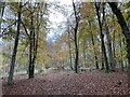
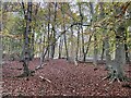
SU7289 : Beech trees, Doyley Wood by Simon Mortimer Beech trees, Doyley Wood by Simon Mortimer
geograph for square SU7289
Looking west from the public footpath between Maidensgrove and Pishill Bank.
Tags: trees:Beech   Beech Trees   Beech Woodland   Chilterns   place:Chilterns   type:Geograph   top:Lowlands   subject:Woodland   top:Woodland, Forest  
SU7288 : Country lane, Russell's Water Common by Simon Mortimer Country lane, Russell's Water Common by Simon Mortimer
geograph for square SU7288
This small lane cuts across the eastern edge of Russell's Water Common... (more)
Tags: Chiltern Hills   place:Chilterns   type:Geograph   subject:Lane   Lane   top:Lowlands   top:Roads, Road Transport  
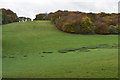
SU7189 : Empty pasture below Russell's Water Common by Simon Mortimer Empty pasture below Russell's Water Common by Simon Mortimer
geograph for square SU7189
Looking south across the dry valley below Nuttall's Farm towards the... (more)
Tags: Chalk Dry Valley   place:Chilterns   Chilterns   Dry Valley   type:Geograph   top:Grassland   subject:Grassland   top:Lowlands   Pasture   top:Woodland, Forest  
SU7189 : Woodland on the northern edge of Russell's Water Common by Simon Mortimer Woodland on the northern edge of Russell's Water Common by Simon Mortimer
geograph for square SU7189
Secondary woodland has developed on the northern edge of Russell's Water... (more)
Tags: Chalk Dry Valley   place:Chilterns   Chilterns   Dry Valley   type:Geograph   top:Grassland   top:Lowlands   Secondary Woodland   subject:Woodland   top:Woodland, Forest  
SU7189 : Dry valley below Nuttall's Farm by Simon Mortimer Dry valley below Nuttall's Farm by Simon Mortimer
geograph for square SU7189
Looking west through the beech trees on the edge of Doyley Wood.
Tags: Chalk Dry Valley   place:Chilterns   Chilterns   type:Geograph   subject:Grassland   top:Grassland   top:Lowlands   Pasture  
TL0930 : The north-west edge of Claypit Plantation by Christine Johnstone The north-west edge of Claypit Plantation by Christine Johnstone
geograph for square TL0930
At the northern edge of the Chilterns, south-west of Hexton.
TL0930 : Bridleway at Waytinghill Plantation by Christine Johnstone Bridleway at Waytinghill Plantation by Christine Johnstone
geograph for square TL0930
The plantation is mapped but not longer present, at the northern edge of the Chilterns.
Tags: Arable Field   subject:Bridleway   path:Bridleway   place:Chilterns   Hillside   top:Paths   former:Plantation   Public Bridleway  
TL0930 : Public bridleway at the northern edge of the Chilterns by Christine Johnstone Public bridleway at the northern edge of the Chilterns by Christine Johnstone
geograph for square TL0930
Climbing up Wayting Hill through an arable crop. Previously TL0930 : Public Bridleway this was... (more)
SU7791 : Fingest and the Hambleden Valley from the edge of Hanger Wood by Simon Mortimer Fingest and the Hambleden Valley from the edge of Hanger Wood by Simon Mortimer
geograph for square SU7791
Tags: place:Chilterns   subject:Farmland   type:Geograph   top:Grassland   top:Lowlands  
SU7791 : Churchyard and the Chequers Inn, Fingest by Simon Mortimer Churchyard and the Chequers Inn, Fingest by Simon Mortimer
geograph for square SU7791
Tags: place:Chilterns   subject:Churchyard   type:Geograph   top:Religious Sites   top:Village, Rural Settlement  
SU7791 : Trees lining the churchyard of Fingest church by Simon Mortimer Trees lining the churchyard of Fingest church by Simon Mortimer
geograph for square SU7791
Tags: place:Chilterns   subject:Churchyard   type:Geograph   top:Religious Sites  
SU7691 : Looking west up the Turville valley by Simon Mortimer Looking west up the Turville valley by Simon Mortimer
geograph for square SU7691
Tags: place:Chilterns   subject:Farmland   type:Geograph   top:Lowlands  
SU7592 : Autumn leaves, Park Wood, Ibstone by Simon Mortimer Autumn leaves, Park Wood, Ibstone by Simon Mortimer
geograph for square SU7592
Tags: place:Chilterns   type:Geograph   top:Lowlands   top:Woodland, Forest  
SU7592 : Church of St. Nicholas, Ibstone by Simon Mortimer Church of St. Nicholas, Ibstone by Simon Mortimer
geograph for square SU7592
The church dates back to the 11th Century and is a Grade II* Listed Building.
SU7592 : Graveyard, St. Nicholas's church, Ibstone by Simon Mortimer Graveyard, St. Nicholas's church, Ibstone by Simon Mortimer
geograph for square SU7592
Tags: place:Chilterns   subject:Churchyard   type:Geograph   top:Lowlands   top:Religious Sites  
SU7692 : Bridleway through the parkland of Ibstone House by Simon Mortimer Bridleway through the parkland of Ibstone House by Simon Mortimer
geograph for square SU7692
Tags: subject:Bridleway   place:Chilterns   top:Country Estates   type:Geograph   top:Lowlands  
SU7692 : Bridleway below Harecramp Farm by Simon Mortimer Bridleway below Harecramp Farm by Simon Mortimer
geograph for square SU7692
Tags: place:Chilterns   type:Geograph   top:Lowlands   subject:Track  
SU7692 : Bridleway below Harecramp Farm by Simon Mortimer Bridleway below Harecramp Farm by Simon Mortimer
geograph for square SU7692
Tags: place:Chilterns   type:Geograph   top:Lowlands   subject:Track  
SU7792 : Fields near Pound Farm, Cadmore End by Simon Mortimer Fields near Pound Farm, Cadmore End by Simon Mortimer
geograph for square SU7792
Looking north-west from the bridleway, towards Chequers Manor Farm.
Tags: place:Chilterns   subject:Farmland   type:Geograph   top:Grassland   top:Lowlands  
SU7892 : Pasture above Hanger Wood by Simon Mortimer Pasture above Hanger Wood by Simon Mortimer
geograph for square SU7892
Looking south from the bridleway between Fingest and Cadmore End.
Tags: place:Chilterns   type:Geograph   top:Grassland   subject:Grassland   top:Lowlands  
SU7792 : Woodland ride, Hanger Wood, Fingest by Simon Mortimer Woodland ride, Hanger Wood, Fingest by Simon Mortimer
geograph for square SU7792
Tags: Autumn Beech   Autumn Trees   Beech Leaves   Beech Woodland   place:Chilterns   type:Geograph   top:Lowlands   subject:Woodland   top:Woodland, Forest  
SU7791 : Autumn leaves, Hanger Wood, Fingest by Simon Mortimer Autumn leaves, Hanger Wood, Fingest by Simon Mortimer
geograph for square SU7791
Tags: Autumn Beech   Autumn Trees   Beech Leaves   Beech Woodland   place:Chilterns   type:Geograph   top:Lowlands   subject:Woodland   top:Woodland, Forest  
SU7791 : Horse paddocks at Manor Farm, Fingest by Simon Mortimer Horse paddocks at Manor Farm, Fingest by Simon Mortimer
geograph for square SU7791
Looking north-west from the footpath between Fingest and Hanger Wood.
Tags: place:Chilterns   type:Geograph   subject:Grassland   top:Grassland   Horse Paddocks   top:Lowlands   Pony Paddock  
SU7791 : Telephone box and cottages, Chequers Lane, Fingest by Simon Mortimer Telephone box and cottages, Chequers Lane, Fingest by Simon Mortimer
geograph for square SU7791
The telephone box in Fingest is an example of the K6 type, designed by Sir Giles... (more)
SU7791 : Church of St. Bartholomew, Fingest by Simon Mortimer Church of St. Bartholomew, Fingest by Simon Mortimer
geograph for square SU7791
The tower and nave of the parish church of Fingest date back to the early 12th... (more)
SU7691 : Chalk downland bank on the south-facing slope of Turville Hill by Simon Mortimer Chalk downland bank on the south-facing slope of Turville Hill by Simon Mortimer
geograph for square SU7691
Tags: Chalk Downland   place:Chilterns   type:Geograph   subject:Grassland   top:Grassland   top:Lowlands  
SU7691 : Recently-felled woodland above Turville by Simon Mortimer Recently-felled woodland above Turville by Simon Mortimer
geograph for square SU7691
Looking south-east across the valley from the footpath to Ibstone.
Tags: place:Chilterns   Felled Woodland   type:Geograph   top:Lowlands   subject:Woodland   top:Woodland, Forest  
SU7592 : Sheep grazing above Ashfield Barn, Ibstone by Simon Mortimer Sheep grazing above Ashfield Barn, Ibstone by Simon Mortimer
geograph for square SU7592
Looking south from the edge of Park Wood. The hedge marks the course of... (more)
Tags: place:Chilterns   type:Geograph   top:Grassland   top:Lowlands   subject:Sheep   Sheep Grazing  
SU7592 : Autumn leaves, Park Wood, Ibstone by Simon Mortimer Autumn leaves, Park Wood, Ibstone by Simon Mortimer
geograph for square SU7592
Tags: Beech Leaves   Beech Woodland   place:Chilterns   type:Geograph   top:Lowlands   subject:Woodland   top:Woodland, Forest  
View more in the Image Search or in Browser
View images matching 'Chilterns' anywhere in the tags
Don't click these: PotMel 1 PotMel 2