Public Tags
Other tags: Clent
Showing images tagged with place:Clent tag.
|
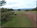
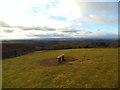
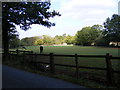
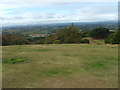
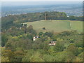
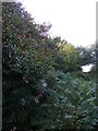
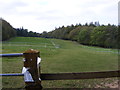
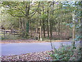
Clent Seat
by Gordon Griffiths geograph for square SO9280 The view on the Clent Hills.
Tags:
place:Clent
top:Heath, ScrubX
|
|
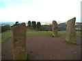
Four Stones View
by Gordon Griffiths geograph for square SO9380 The view from the top of the Clent Hills.
|
|
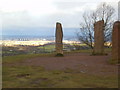
Midland View
by Gordon Griffiths geograph for square SO9380 The view from the top of the Clent Hills near to the Four Stones.
|
|
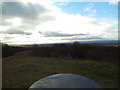
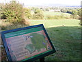
Toposcope Sky
by Gordon Griffiths geograph for square SO9380 The view from the top of the Clent Hills near to the Four Stones.
|
|
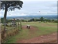
Seat with a View
by Gordon Griffiths geograph for square SO9380 The view from Clent Hills near the Four Stones.
|
|
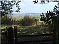
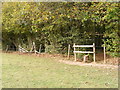
Clent Stile View
by Gordon Griffiths geograph for square SO9480 The view near Nimmings Visitor Centre on the Clent Hills Country Park.
|
|
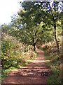
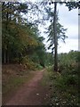
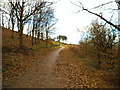
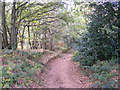
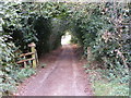
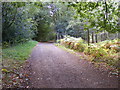
Clent Path
by Gordon Griffiths geograph for square SO9380 The footpath on the side of Clent Hills Country Park off Hagley Wood Lane.
|
|
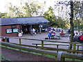
Clent Cafe
by Gordon Griffiths geograph for square SO9380 The National Trust Nimmings Visitor Centre part of the Clent Hills Country Park... (more)
|
|
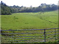
Clent Field
by Gordon Griffiths geograph for square SO9381 The Clent view from Hagley Wood Lane near the A456.
|
|
Clent Skyline
by Gordon Griffiths geograph for square SO9380 The Clent footpath view up to the Four Stones from near Short Wood.
|
|
Clent Deep Wood Path
by Gordon Griffiths geograph for square SO9379 The view in Clent Hills Country Park.
|
|
Clent Kites
by Gordon Griffiths geograph for square SO9380 The view from Clent Hills near the Four Stones.
|
|
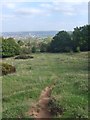
Clent View
by Gordon Griffiths geograph for square SO9280 The view south from Clent Hills Country Park.
|
|
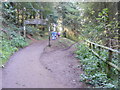
Clent Hill Path
by Gordon Griffiths geograph for square SO9380 The view up the path from the Nimmings Visitor Centre to the Four Stones.
|
|
Downhill Path
by Gordon Griffiths geograph for square SO9380 The view of the footpath near Nimmings Visitor Centre on the Clent Hills Country... (more)
|
|
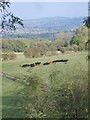
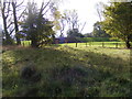
Lying Cows
by Gordon Griffiths geograph for square SO9380 The view from Nimmings Visitor Centre part of the Clent Hills Country Park off... (more)
|
|
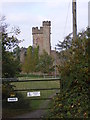
Hagley Obelisk
by Gordon Griffiths for square SO9281 The view from Clent Hills.
Tags:
place:Clent
top:Village, Rural SettlementX
|
|
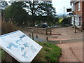
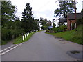
Clent Hills Sign
by Gordon Griffiths geograph for square SO9279 The view down Adam's Hill.
Tags:
place:Clent
top:Village, Rural SettlementX
|
|
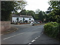
The Fountain
by Gordon Griffiths geograph for square SO9279 The Clent Pub on the corner of Adam's Hill.
|
|
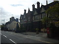
The French Hen
by Gordon Griffiths geograph for square SO9179 The view in Bromsgrove Road, Lower Clent.
|
|
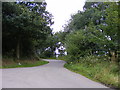
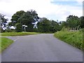
Ivy Lane Junction
by Gordon Griffiths geograph for square SO9480 A lane junction in the Clent Hills, Worcestershire.
|
|
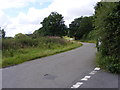
Fieldhouse Lane
by Gordon Griffiths geograph for square SO9579 The view from Holt Lane junction in the Clent Hills, Worcestershire.
|
|
Holt Lane View
by Gordon Griffiths geograph for square SO9579 The view to Fieldhouse Lane in the Clent Hills, Worcestershire.
|
|
Gorse Green Lane View
by Gordon Griffiths geograph for square SO9377 The lane view in the Clent Hills, Worcestershire.
|
|
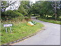
Whitehall Farm Junction
by Gordon Griffiths geograph for square SO9479 The junction of Spring Lane, Fieldhouse Lane and Shut Mill Lane in the Clent... (more)
|
|
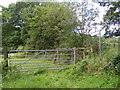
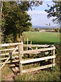
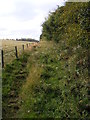
Shut Mill Lane Path
by Gordon Griffiths geograph for square SO9479 A path in the Clent Hills, Worcestershire.
|
|
Rumbow Cottages
by Gordon Griffiths geograph for square SO9479 The view of a lane in the Clent Hills, Worcestershire.
|
|
Reservoir View
by Gordon Griffiths geograph for square SO9481 The view of the covered reservoir on Clent Hills off Hagley Wood Lane.
|
|
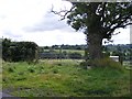
Berry Path
by Gordon Griffiths geograph for square SO9481 Loads of holly berries line the footpath hedge on the Penorchard Meadows nature... (more)
|
|
Reservoir Path
by Gordon Griffiths geograph for square SO9381 The view of the covered reservoir on Clent Hills off Hagley Wood Lane.
|
|
Welcome Path
by Gordon Griffiths geograph for square SO9380 The footpath from Nimmings Visitor Centre on the Clent Hills Country Park near... (more)
|
|
Clent Footpath
by Gordon Griffiths geograph for square SO9280 |
|
No Cycling
by Gordon Griffiths geograph for square SO9380 The footpath near the Castle folly on the side of Clent Hills.
|
|
Folly Drive
by Gordon Griffiths geograph for square SO9280 The Castle is a folly build in 1770s by the 1st Baron of Hagley Hall George... (more)
|
|
Wood Edge Path
by Gordon Griffiths geograph for square SO9481 The Clent Hills footpath near Hagley Wood.
|
|
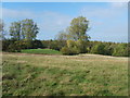
Penorchard Meadows
by Gordon Griffiths geograph for square SO9481 The view of the Nature Reserve on the side of Clent Hills.
|
|
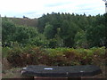
Short Wood Track
by Gordon Griffiths geograph for square SO9380 The view on the side of Clent Hills.
|
|
Path to Hagley Hill Farm
by Gordon Griffiths geograph for square SO9381 The Clent Hills footpath enters Hagley Wood.
|
|
Fenced Path
by Gordon Griffiths geograph for square SO9381 The Clent Footpath passes between Nimmings Plantation and Hagley Wood.
|
|
Hagley Wood Path
by Gordon Griffiths geograph for square SO9381 The wood edge footpath on the side of the Clent Hills.
|
|
Footpath Cross
by Gordon Griffiths geograph for square SO9381 The Clent Hills path crosses the Hagley Wood Lane.
|
|
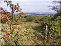
Berry View
by Gordon Griffiths geograph for square SO9481 The view from Clent Hills towards Turner's Hill across the West Midlands.
|
|
Suzannes Bench View
by Gordon Griffiths geograph for square SO9279 The view to Deep Wood in Clent Hills Country Park.
|
|
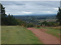
Malvern Hills View
by Gordon Griffiths geograph for square SO9279 The view from Clent Hills near Adam's Hill.
|