Public Tags
Showing latest 50 of 121 images tagged with place:Congleton tag.

|
The Congleton Steamboat
by Jonathan Hutchins geograph for square SJ8563 As might be expected, there is a story behind the presence of a 60-foot... (more)
Tags:
subject:Boat
Boat
top:City, Town Centre
Congleton
place:Congleton
river:Dane
Derelict Boat
top:Derelict, Disused
type:Geograph
River Dane
top:Rivers, Streams, Drainage
|
|
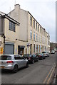
Bridge Mill, Congleton
by Chris Allen geograph for square SJ8563 A former fustian cutting mill. This shows the three storey brick built block of... (more)
Tags:
place:Congleton
Former Textile Mill
Fustian
type:Geograph
top:Historic Sites and Artefacts
top:Industry
subject:Mill
|
|
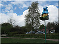
Sandy Bear, Astbury Mere Country Park
by Stephen Craven geograph for square SJ8462 The bear is the symbol of Congleton, and this one keeps watch over the mere at... (more)
|
|
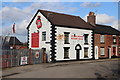
Congleton Rugby Club, Park Street
by Chris Allen geograph for square SJ8662 Although I was concentrating on Congleton's textile past, this pleasing... (more)
|
|
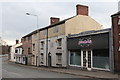
Silk Weavers' Cottage, Congleton
by Chris Allen geograph for square SJ8563 A row of three, three storey weavers' cottages with top storey multi-light... (more)
Tags:
place:Congleton
subject:Cottages
type:Geograph
top:Historic Sites and Artefacts
top:Housing, Dwellings
top:Industry
former:Weavers Cottages
|
|
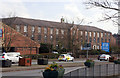
Riverside Mill, Congleton
by Chris Allen geograph for square SJ8563 Fustian cutting mil built 1878-1887. The central gabled bay and the clock tower... (more)
Tags:
top:Business, Retail, Services
place:Congleton
Fustian
type:Geograph
top:Historic Sites and Artefacts
subject:Mill
Offices
former:Textile Mill
|
|
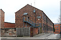
Providence Mill, Congleton
by Chris Allen geograph for square SJ8563 Fustian cutting mill built in 1913. Now apartments. Congleton has a rich textile... (more)
Tags:
Apartments
place:Congleton
Fustian
type:Geograph
top:Historic Sites and Artefacts
top:Housing, Dwellings
subject:Mill
former:Textile Mill
|

|
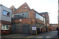
The Congleton Kitchen
by Jonathan Hutchins for square SJ8662 The Congleton Kitchen offer kitchen meals, wine and beer sales, kitchen... (more)
Tags:
top:Business, Retail, Services
top:City, Town Centre
type:Close Look
place:Congleton
Cookery School
Kitchenware Shop
subject:Shop
|
|
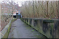
Lower Park Street Mills from Centenary Place, Congleton
by Chris Allen geograph for square SJ8663 Former silk mills.
|
|
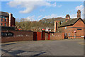
Site of Dane Bridge Mill
by Chris Allen geograph for square SJ8563 On the left is the River Dane while on the right the wall marks the remains of... (more)
|
|
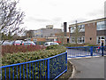
The site of Brook Mill, Congleton
by Chris Allen geograph for square SJ8563 The empty space in the middle is where Brook Mill stood. The tower on the right... (more)
|
|
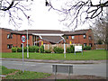
Congleton High School
by Richard Dorrell geograph for square SJ8363 Located in Box Lane. The school was established in September 2000 as an 11-18... (more)
|
|
Mountview Care Home, Congleton
by Richard Dorrell geograph for square SJ8363 Located in Melton Drive. Mountview is a Cheshire Council owned residential care... (more)
|

|
Canal Milestone, Congleton
by Mr Red for square SJ8661 A quarter stone just NE of a footbridge on the Macclesfield Canal towpath.
The... (more)
Tags:
top:Canals
type:Close Look
bucket:Closeup
place:Congleton
top:Historic Sites and Artefacts
milestoneid:MAC-22 1/4
subject:Milepost or Milestone
|

|
Canal Milestone, Congleton
by Mr Red geograph for square SJ8661 A full stone on the towpath of the Macclesfield Canal looking SW.
The obverse... (more)
Tags:
top:Canals
bucket:Closeup
place:Congleton
type:Geograph
top:Historic Sites and Artefacts
milestoneid:MAC-22
subject:Milepost or Milestone
|

|
Canal Milestone, Congleton
by Mr Red geograph for square SJ8763 A full stone on the towpath of the Macclesfield Canal looking towards Buxton... (more)
Tags:
top:Canals
bucket:Closeup
place:Congleton
type:Geograph
top:Historic Sites and Artefacts
subject:Milepost or Milestone
|

|
Canal bridges in Congleton
by Christine Johnstone geograph for square SJ8762 The photographer is looking eastwards from a boat under a railway bridge. The... (more)
|

|
Walker approaching the site of Congleton Wharf
by Christine Johnstone geograph for square SJ8662 The Macclesfield Canal towpath changes sides between bridges 77 and 76, from... (more)
|

|
Footbridge over a stream, Congleton
by Christine Johnstone geograph for square SJ8562 Carrying a bridleway called Lamberts Lane over a stream called The Howty.
Tags:
subject:Bridge
bridge:Bridleway Over Stream
place:Congleton
bridge:Footbridge
type:Geograph
Lane
top:Paths
|

|
Lamberts Lane, Congleton
by Christine Johnstone geograph for square SJ8662 A public bridleway heading west from the Macclesfield canal towards Astbury... (more)
|

|
River flow monitoring station by the Dane
by Jonathan Hutchins geograph for square SJ8663 Tags:
place:Congleton
river:Dane
type:Geograph
River Flow Measurement Station
top:Rivers, Streams, Drainage
subject:Water Infrastructure
|

|
Bridge over the River Dane
by Jonathan Hutchins geograph for square SJ8563 Tags:
A54
road:A54
subject:Bridge
top:City, Town Centre
place:Congleton
river:Dane
type:Geograph
top:Rivers, Streams, Drainage
Road Bridge Over River
top:Roads, Road Transport
|

|
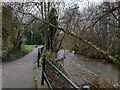
The Congleton Steamboat
by Jonathan Hutchins geograph for square SJ8563 Five years on from Link and little has... (more)
Tags:
subject:Boat
top:City, Town Centre
place:Congleton
river:Dane
Derelict Boat
top:Derelict, Disused
type:Geograph
top:Rivers, Streams, Drainage
|
|
Path by the River Dane in Congleton
by Jonathan Hutchins geograph for square SJ8563 Tags:
place:Congleton
river:Dane
Footpath
type:Geograph
subject:Path
top:Paths
River Dane
top:Rivers, Streams, Drainage
|
|
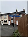
Emerging on to Dane Street, Congleton
by Jonathan Hutchins geograph for square SJ8563 Tags:
place:Congleton
type:Geograph
top:Housing, Dwellings
top:Paths
Pedestrian Signpost
top:Roads, Road Transport
subject:Signpost
top:Suburb, Urban Fringe
|

|
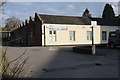
Congleton - a ghastly pastiche
by Chris Allen geograph for square SJ8563 I understand this vessel was a club but has been disused for some time. I was... (more)
Tags:
top:City, Town Centre
place:Congleton
Former Nightclub
type:Geograph
top:Rivers, Streams, Drainage
subject:Ship
|
|
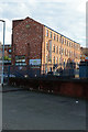
Victoria Mill, Congleton
by Chris Allen geograph for square SJ8663 The main part of the mill is a brick four storey block dating from 1858. This 13... (more)
Tags:
place:Congleton
type:Geograph
top:Historic Sites and Artefacts
top:Industry
subject:Mill
former:Silk Mill
former:Textile Mill
Weaving Shed
|
|
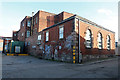
Victoria Mill, Foundry Bank, Congleton
by Chris Allen geograph for square SJ8663 Silk mill of 1858 with four storey, 12 bays long and originally steam powered.... (more)
Tags:
place:Congleton
type:Geograph
top:Historic Sites and Artefacts
top:Industry
subject:Mill
former:Silk Mill
former:Textile Mill
|
|
Spindle Street Mill, Congleton
by Chris Allen geograph for square SJ8663 Brick built silk mill of the mid-19th century. From 1924 used for fustian... (more)
Tags:
place:Congleton
former:Engine House
Fustian
type:Geograph
top:Historic Sites and Artefacts
top:Industry
subject:Mill
former:Silk Mill
former:Textile Mill
|
|
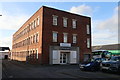
Spindle Street Mill, Congleton
by Chris Allen for square SJ8663 Brick built silk mill of the mid-19th century. From 1924 used for fustian... (more)
Tags:
place:Congleton
type:Cross Grid
Fustian
top:Industry
subject:Mill
former:Silk Mill
former:Textile Mill
|

|
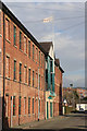
Silk weavers' cottages, Mill Street, Congleton
by Chris Allen geograph for square SJ8563 A row of four, three storey weavers' cottages. Note the top storey... (more)
Tags:
place:Congleton
subject:Cottages
type:Geograph
top:Historic Sites and Artefacts
top:Housing, Dwellings
top:Industry
former:Weavers Cottages
|
|
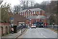
Shepherd's Mill, Worrall Street, Congleton
by Chris Allen geograph for square SJ8663 This brick built fustian cutting mill is now the offices of Plus Dane Housing... (more)
Tags:
Apartments
place:Congleton
Fustian
type:Geograph
top:Historic Sites and Artefacts
top:Housing, Dwellings
subject:Mill
former:Textile Mill
|
|
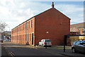
Salford Mill, Congleton
by Chris Allen geograph for square SJ8563 Early 19th century silk mill overlooking the River Dane with a central pediment... (more)
Tags:
Bridge
place:Congleton
Fish and Chip Shop
type:Geograph
top:Historic Sites and Artefacts
top:Industry
subject:Mill
former:Silk Mill
former:Textile Mill
|
|
Fair Mill, Congleton
by Chris Allen geograph for square SJ8663 On Worrall Street, a fustian cutting mill of the 1870s, one bay by 21 bays. Now converted.
Tags:
place:Congleton
Fustian
type:Geograph
top:Historic Sites and Artefacts
top:Housing, Dwellings
subject:Mill
former:Textile Mill
|
|
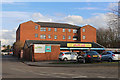
Building on the site of Meadow Mills, Congleton
by Chris Allen for square SJ8663 The big red brick multistorey building incorporated the name stone of Meadow... (more)
Tags:
Car Wash
place:Congleton
type:Cross Grid
top:Historic Sites and Artefacts
subject:Mill
Reconstructed Buildings
former:Silk Mill
|
|
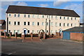
Park Mill, Congleton
by Chris Allen geograph for square SJ8662 A former silk mill built in 1825 by Charles Townley. Three storeys and 16 bays,... (more)
Tags:
place:Congleton
type:Geograph
top:Historic Sites and Artefacts
top:Housing, Dwellings
subject:Mill
former:Silk Mill
|

|
Century Mill, Worrall Street, Congleton
by Chris Allen geograph for square SJ8663 This early twentieth century brick weaving shed with north light roof and a two... (more)
|
|
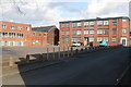
Edward Mill, Congleton
by Chris Allen geograph for square SJ8663 The building right and centre is Edward Mill. A silk processing mill of 1924... (more)
Tags:
place:Congleton
Former Textile Mill
type:Geograph
top:Housing, Dwellings
top:Industry
subject:Mill
former:Silk Mill
|
|
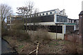
Bridge Mill, Congleton
by Chris Allen geograph for square SJ8563 Former fustian cutting mill alongside the River Dane. Brick built three storey... (more)
|

|
Beresford Mill, Congleton
by Chris Allen geograph for square SJ8663 A large silk ribbon mill of the early 20th century. Behind are a long range of... (more)
|

|
Stonehouse Green Mill, Congleton
by Chris Allen geograph for square SJ8563 Cotton spinning mill that was later a silk throwing and weaving mill. Originally... (more)
Tags:
place:Congleton
former:Cotton Mill
Former Water Mill
type:Geograph
top:Historic Sites and Artefacts
top:Housing, Dwellings
subject:Mill
former:Silk Mill
|
|
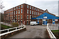
Dane Mill, Congleton
by Chris Allen geograph for square SJ8563 The modern extension spoils this somewhat. This is an early 19th century silk... (more)
Tags:
place:Congleton
Former Water Mill
type:Geograph
top:Historic Sites and Artefacts
top:Industry
subject:Mill
former:Silk Mill
|
|
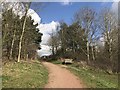
Path at Astbury Mere Country Park
by Jonathan Hutchins geograph for square SJ8462 Tags:
place:Congleton
Country Park
Footpath
type:Geograph
top:Park and Public Gardens
subject:Path
top:Paths
top:Woodland, Forest
|
|
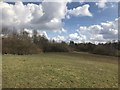
Astbury Mere Country Park
by Jonathan Hutchins geograph for square SJ8462 Tags:
place:Congleton
subject:Country Park
Country Park
type:Geograph
top:Grassland
top:Park and Public Gardens
top:Woodland, Forest
|
|
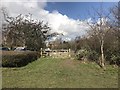
Emergency access gate at Astbury Mere Country Park
by Jonathan Hutchins geograph for square SJ8462 Tags:
place:Congleton
Country Park
Country Park Car Park
Emergency Access Gate
subject:Gate
type:Geograph
top:Grassland
top:Park and Public Gardens
top:Roads, Road Transport
|
|
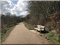
Lakeside path on Astbury Mere Country Park
by Jonathan Hutchins geograph for square SJ8462 Tags:
place:Congleton
Country Park
Footpath
type:Geograph
Memorial Bench
Memorial Seat
top:Park and Public Gardens
subject:Path
top:Paths
|
|
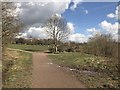
Astbury Mere Country Park
by Jonathan Hutchins geograph for square SJ8462 Tags:
place:Congleton
subject:Country Park
Country Park
Footpath
type:Geograph
top:Grassland
top:Park and Public Gardens
|
|
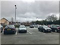
Back Park Street car park, Congleton
by Jonathan Hutchins geograph for square SJ8662 Tags:
subject:Car Park
Car Park
top:City, Town Centre
place:Congleton
type:Geograph
top:Roads, Road Transport
|

|
Car body repair shop, Congleton
by Jonathan Hutchins geograph for square SJ8662 Tags:
top:Business, Retail, Services
Car Body Workshop
top:City, Town Centre
place:Congleton
type:Geograph
subject:Motor Business
|

|
21 Lawton Street, Congleton
by Jonathan Hutchins geograph for square SJ8662 Late Georgian house of c.1820. Grade II listed, see... (more)
Tags:
top:City, Town Centre
place:Congleton
type:Geograph
Grade II Listed
Grade II Listed Building
subject:Historic Building
top:Historic Sites and Artefacts
|
