
|
Chester-le-Street: The Finchale End
by John Sutton
geograph for square NZ2850
In this view from the southern end of the Don Robson Pavilion at the Durham... (more)
|
|
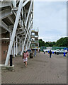
Chester-le-Street: behind the County Durham Stand
by John Sutton
geograph for square NZ2850
Spectators - masked because of the coronavirus pandemic - were taking a stroll... (more)
|

|
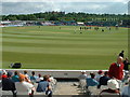
Chester-le-Street: watching Durham at The Riverside
by John Sutton
geograph for square NZ2850
Looking towards the scoreboard and the Don Robson Pavilion from seats at the... (more)
|
|
The Riverside Cricket Ground in Chester-le-Street, 2003
by Road Engineer
geograph for square NZ2850
Photo at the start of the first day of the 2nd test match between England and... (more)
|

|
A maiden century at The Riverside
by John Sutton
geograph for square NZ2850
Late on the second day of a County Championship match, Nottinghamshire's... (more)
|
|
Chester-le-Street: riverside and Riverside Cricket Ground
by John Sutton
geograph for square NZ2850
Durham's friendly Riverside Cricket Ground is close to the River Wear on... (more)
|

|
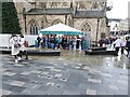
Durham Bags
by Gordon Griffiths
for square NZ2742
The view of the stalls inside Durham Indoor Market Hall.
|
|
Durham Choir
by Gordon Griffiths
geograph for square NZ2742
The view in Durham Market Square off Saddler Street.
|
|
Durham: across the Market Place
by John Sutton
geograph for square NZ2742
The picture was taken from the top of Silver Street on a cloudless evening which... (more)
|
|
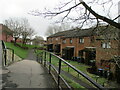
Footpath leading to houses - Crook
by Dylan Chester
geograph for square NZ1635
A footpath leading down to a row of houses in Crook
|

|
Chester-le-Street: across The Riverside
by John Sutton
geograph for square NZ2850
During the lunch interval of a County Championship Match. The day was cloudy and... (more)
|
|
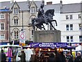
Man on a Hoss
by Gordon Griffiths
geograph for square NZ2742
The view of Durham Market Square off Saddler Street.
|
|
Dismantled railway line near South Church
by Dylan Chester
geograph for square NZ2127
A public footpath which used to be a railway, the railway went from Shildon to... (more)
|
|
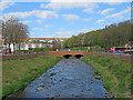
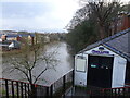
Chester-le-Street: flood alleviation
by John Sutton
geograph for square NZ2751
Chester (or Cong) Burn was culverted under the Market Place in 1962. Following... (more)
|
|
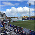
Chester-le-Street: a cricket crowd
by John Sutton
geograph for square NZ2850
Spectators at the Riverside waiting for play to recommence on a day of high... (more)
|
|
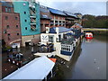
Boat Club
by Gordon Griffiths
geograph for square NZ2742
The view from Elvet Bridge of the River Wear in Durham.
|
|
Klute View
by Gordon Griffiths
geograph for square NZ2742
The view from Elvet Bridge of the River Wear in Durham.
|
|
Elvet Bridge
by Gordon Griffiths
geograph for square NZ2742
The view down the street to the river in Durham.
|
|
Saddler Street
by Gordon Griffiths
geograph for square NZ2742
The view of the street up to Durham Castle.
|
|
Gilesgate View
by Gordon Griffiths
geograph for square NZ2842
The view of St Giles Church, Gilesgate, Durham.
|
|
Old Elvit
by Gordon Griffiths
geograph for square NZ2742
The view in Durham from Elvit Bridge.
|
|
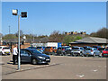
Chester-le-Street: car park and castle
by John Sutton
geograph for square NZ2850
A view towards Lumley Castle from a car park at the Riverside Cricket Ground.
|
|
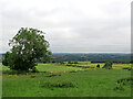
Brandon Village: view towards Durham
by John Sutton
geograph for square NZ2340
On this cloudy July morning Durham Cathedral was clearly visible to the... (more)
|
|
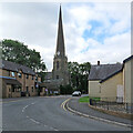
Chester-le-Street church spire
by John Sutton
geograph for square NZ2751
The 158ft/48m spire of the parish church of St Mary and St Cuthbert dates from... (more)
|
|
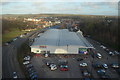
Tesco Supermarket, North Burns Road, Chester-le-Street
by Andrew Tryon
geograph for square NZ2751
View over Tesco Supermarket and car park from the East Coast Mainline railway.... (more)
|
|
Rowlands Gill War Memorial, Gateshead
by Andrew Tryon
geograph for square NZ1658
|
|
Dene Avenue in Rowlands Gill, Gateshead
by Andrew Tryon
geograph for square NZ1558
All quiet on the first morning of the new year 2017.
|
|
King William bus stop - Shildon
by Dylan Chester
geograph for square NZ2326
|
|
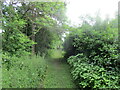
Old railway footpath, Shildon
by Dylan Chester
geograph for square NZ2326
A footpath in Shildon where an old railway line used to be.
|
|
Chester-le-Street: The Lambton Worm
by John Sutton
geograph for square NZ2752
A popular place to drink, eat and stay, on the northern edge of the town.
|
|
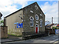
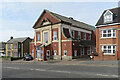
Chester-le-Street Methodist Church and schoolroom
by John Sutton
geograph for square NZ2751
A plaque explains that the Primitive Methodist Central Chapel, on the corner of... (more)
|
|
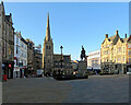
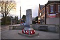
Chester-le-Street War Memorial
by John Sutton
geograph for square NZ2751
On the north side of the Market Place.
|
|
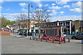
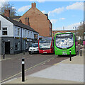
Chester-le-Street: buses and the Market Tavern
by John Sutton
geograph for square NZ2751
Newcastle and Sunderland buses at the stops on the south side of the Market... (more)
|
|
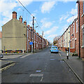
Chester-le-Street: Lindom Avenue
by John Sutton
geograph for square NZ2751
One of a number of streets of semi-detached houses off Roman Avenue.
|
|
Chester-le-Street: Bethel United Reformed Church
by John Sutton
geograph for square NZ2751
The building, on Low Chare, was remodelled in 1860.
|
|
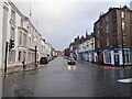
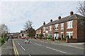
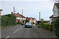
Chester-le-Street: on Newcastle Road
by John Sutton
geograph for square NZ2751
Nearing the centre of the town on an April morning.
|
|
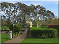
Chester-le-Street: in Riverside Park
by John Sutton
geograph for square NZ2851
A large and pleasing park by the River Wear.
|
|
Chester-le-Street: up Co-operative Street
by John Sutton
geograph for square NZ2751
A steep terraced street west of Front Street.
|
|
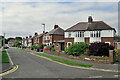
Chester-le-Street: Highfield Crescent
by John Sutton
geograph for square NZ2752
Off Newcastle Road, north of the town centre.
|
|
Chester-le-Street: Highfield Rise
by John Sutton
geograph for square NZ2752
Off Newcastle Road, north of the town centre.
|
|
Chester-le-Street: Arcadia Avenue
by John Sutton
geograph for square NZ2752
Off Newcastle Road, north of the town centre.
|
|
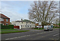
Chester-le-Street Community Centre, Newcastle Road
by John Sutton
geograph for square NZ2751
A nearby information board explains that the centre was opened on 30 November... (more)
|
|
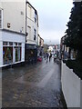
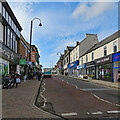
Chester-le-Street: Front Street
by John Sutton
geograph for square NZ2751
Looking south up the main shopping street in Chester-le-Street.
|
|
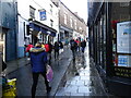
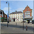
Chester-le-Street: across Front Street
by John Sutton
geograph for square NZ2751
Greene King's corporate branding eschews the apostrophe, so the Grade II... (more)
|
|
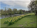
Chester-le-Street: daffodils in Riverside Park
by John Sutton
geograph for square NZ2851
Further south, daffodils are just about over, but this far north they made a... (more)
|
|
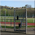
Chester-le-Street: across Riverside Leisure Complex
by John Sutton
geograph for square NZ2850
A foreshortened telephoto view across the running track and football pitch from... (more)
|
|
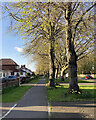
North Road on an April evening
by John Sutton
geograph for square NZ2752
On the northern edge of Chester-le-Street.
|
|
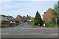
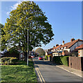
Chester-le-Street: Holmlands Park
by John Sutton
geograph for square NZ2750
Looking towards Lindom Avenue and Roman Avenue on a bright April evening.
|

|
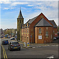
Chester-le-Street: Church Chare on an April evening
by John Sutton
geograph for square NZ2751
The tall spire of the parish church of St Mary and St Cuthbert and the red-brick... (more)
|
|
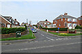
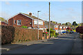
Chester-le-Street: Wear Lodge
by John Sutton
geograph for square NZ2752
North of Low Flatts Road, off North Road on the northern fringe of Chester-le-Street.
|