
|
Exeter Cathedral vaulted ceiling
by S
for square SX9292
The ceiling of Exeter Cathedral is the longest uninterrupted Medieval stone... (more)
|
|
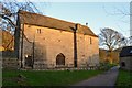
Padley Chapel, Derbyshire
by Andrew Tryon
geograph for square SK2478
|

|
Fore Street street furniture
by S
for square SX9192
|

|
St. Michael and All Angels Church, Exeter
by Andrew Tryon
geograph for square SX9192
|

|
River Avon, Tewkesbury
by S
geograph for square SO8932
|
|
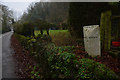
Roadside Boundary Stone in Derbyshire, UK
by Andrew Tryon
geograph for square SK2553
A stone marking the boundary between the villages of Carsington and Hopton in... (more)
|

|
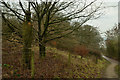
Autumn Colours in England
by Geoffrey Tryon
geograph for square SK1790
A view along the track at Hollins Clough besides the Derwent Dam in the... (more)
|

|
Thistle on Lose Hill, Derbyshire
by Andrew Tryon
geograph for square SK1585
The thistle is the national flower of Scotland. It also grows very abundantly... (more)
|
|
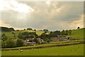
Eastern Prospect of Alsop en le Dale, Derbyshire
by Andrew Tryon
geograph for square SK1655
A view of the small settlement of Alsop en le Dale as seen when approaching on... (more)
|
|
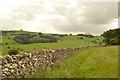
Public Footpath and Limestone Wall near Alsop, Derbyshire
by Andrew Tryon
geograph for square SK1654
View along the public footpath from Parwich to Alsop en le Dale in Derbyshire, England.
|
|
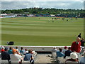
The Riverside Cricket Ground in Chester-le-Street, 2003
by Road Engineer
geograph for square NZ2850
Photo at the start of the first day of the 2nd test match between England and... (more)
|
|
Carved Wooden trunk next to the Footpath, Carsington Water, Derbyshire
by Andrew Tryon
geograph for square SK2551
A carved wooden trunk of an old tree, which almost blends into the undergrowth,... (more)
|

|
Hope Valley in the Derbyshire Peak District
by Andrew Tryon
geograph for square SK2582
Patchwork of frosty fields in the Hope Valley in the Peak District, viewed from... (more)
|
|
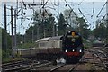
The Britannia Steam Train approaching Carlisle, England
by Andrew Tryon
geograph for square NY4055
The Britannia steam train travelling from the Settle-Carlisle line into Carlisle... (more)
|

|
Caulkleys Lane, near West Ness
by Scott Robinson
geograph for square SE6878
The bridleway runs along Caulkleys Bank offering fine views of the Howardian Hills.
|

|
England: As We Like to Picture It
by Andrew Tryon
geograph for square SY0782
Budleigh Salterton on the south coast of Devon
|
|
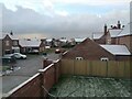
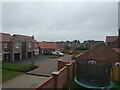
End of Reed Lane from house on Hodson Lane in Winter
by Felix Brystal
geograph for square TF0180
The south end of Reed Lane from a house on Hodson Lane on Beal Homes' new... (more)
|
|
End of Reed Lane from house on Hodson Lane
by Felix Brystal
geograph for square TF0180
The south end of Reed Lane from a house on Hodson Lane on Beal Homes' new... (more)
|

|
Platform 3 at Carlisle Citadel Railway Station, Great Britain
by Andrew Tryon
for square NY4055
|

|
Wayside Cross in Shillito Wood, Derbyshire
by Andrew Tryon
geograph for square SK2974
This weathered stone cross is situated in a small patch of woodland on the moors... (more)
|

|
Peak & Northern Footpaths Society Sign No.311 at Curbar, Derbyshire
by Andrew Tryon
geograph for square SK2573
The Peak and Northern Footpath Society is a voluntary organisation dedicated to... (more)
|

|
Inside Gaping Gill, North Yorkshire, 2019
by Andrew Tryon
for square SD7572
Cavers inside the cavernous main chamber of Gaping Gill during the Bradford... (more)
|
|
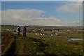
Following the Limestone Way
by Andrew Tryon
geograph for square SK2163
|

|
The Concourse of Nottingham Train Station, England
by Andrew Tryon
for square SK5739
The station concourse on a Saturday evening.
|

|
Sheepwash Bridge at Ashford in the Water, Derbyshire
by Andrew Tryon
geograph for square SK1969
|

|
Silhouette of Bakewell Church, Derbyshire
by Andrew Tryon
for square SK2168
|

|
Hope Valley Cement Works, Derbyshire
by Andrew Tryon
geograph for square SK1884
View from the southeast side of Win Hill over the Hope Valley with Hope village... (more)
|

|
Grey Street in Newcastle
by Andrew Tryon
geograph for square NZ2464
Grey Street in Newcastle's Grainger Town was once voted as the finest... (more)
|

|
Gateshead Millennium Bridge in the Snow
by Andrew Tryon
geograph for square NZ2564
Viewed from the Newcastle Quayside
|

|
The Goat Walk, Topsham, Devon
by Andrew Tryon
geograph for square SX9687
The Goat Walk is a narrow public footpath besides the Exe Estuary at Topsham in Devon.
|

|
Bristol City Centre, Great Britain
by Andrew Tryon
geograph for square ST5772
View over the city centre of Bristol from the top of the Cabot Tower in Brandon Hill Park.
|

|
Go Outdoors - A Sheffield Brand
by Andrew Tryon
for square SK3586
The 'Go Outdoors' shop in Sheffield, formerly known as CCC, is the... (more)
|
|
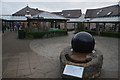
The Kugel Stone at Carsington Visitor Centre, Derbyshire, UK
by Andrew Tryon
geograph for square SK2451
This spherical lump of polished granite, weighing around one ton, is not in... (more)
|

|
Mam Tor Ridge from Lose Hill, Derbyshire
by Andrew Tryon
geograph for square SK1585
A view from the summit of Lose Hill along Mam Tor ridge. This footpath is a... (more)
|

|
Waterfront at Lympstone Village, Devon
by Andrew Tryon
geograph for square SX9884
Lympstone on the Exe Estuary, on the south coast of Devon, England.
|
|
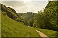
Public Footpath in Dovedale, Derbyshire
by Andrew Tryon
geograph for square SK1354
The limestone valley of Dovedale is a famous Peak District beauty spot.
|
|
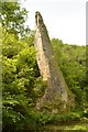
Ilam Rock in Dovedale, Staffordshire
by Andrew Tryon
for square SK1453
Ilam Rock is a limestone pinnacle within Dovedale, Staffordshire. The river... (more)
|

|
Path on South Bank of Ladybower, Derbyshire
by Andrew Tryon
geograph for square SK1885
View of part of Ladybower dam from the path running along the southern shore.
|
|
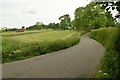
Washbrook Lane, Tissington, Derbyshire
by Andrew Tryon
geograph for square SK1651
A view of Washbrook Lane and adjacent farmland as seen from the point where... (more)
|
|
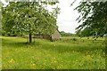
Rural Scene near Tissington, Derbyshire
by Andrew Tryon
geograph for square SK1751
Meadow flowers and a stone barn just off the Avenue in Tissington.
|
|
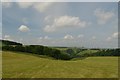
Hills above Dove Dale near Alsop, Derbyshire
by Andrew Tryon
geograph for square SK1555
View facing west down towards Dove Dale, Derbyshire. The county boundary... (more)
|
|
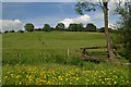
Parish Boundary of Tissington and Parwich, Derbyshire
by Andrew Tryon
geograph for square SK1853
Walkers following the Limestone Way (long distance path) will encounter this... (more)
|
|
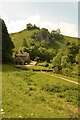
Dovedale, Derbyshire
by Andrew Tryon
geograph for square SK1455
The valley of the River Dove. The River Dove at this location forms the... (more)
|
|
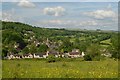
Parwich, Derbyshire
by Andrew Tryon
geograph for square SK1854
Tourists seeking a quiet and unspoiled Peak District village could do worse than... (more)
|
|
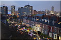
Sharrow Lantern Carnival, Sheffield
by Andrew Tryon
geograph for square SK3485
The Sharrow Lantern Carnival is an annual parade of lanterns with dancing and... (more)
|

|
Hallam Moors near Sheffield
by Andrew Tryon
geograph for square SK2783
A view over the Hallam Moors in the Peak District at 415 m (1360 ft) above sea... (more)
|

|
Riverside Path in Water-cum-Jolly Dale, Derbyshire
by Andrew Tryon
geograph for square SK1672
This riverside path can be under water when the adjacent river Wye is high.
|
|
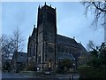
Jesmond United Reformed Church, Newcastle upon Tyne
by Andrew Tryon
geograph for square NZ2565
As seen in the cool light of a dull winter morning.
|
|
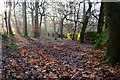
Winter in Hay Wood, Derbyshire
by Andrew Tryon
geograph for square SK2577
|
|
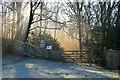
Sunshine and Frost at Hay Woods, Derbyshire
by Andrew Tryon
geograph for square SK2578
Pale winter sunshine illuminates the woodland air at Nether Padley in the... (more)
|
