
|
Ferrybridge Power Station seen from Hambleton Hough
by Alan Murray-Rust
for square SE4724
Strikingly clear, although almost 10 km distant. Yorkshire Pennines on the far... (more)
|

|
Ferrybridge and power station
by Chris Allen
geograph for square SE4824
The old stone bridge seen from underneath the flyover of the A162. Beyond is the... (more)
|

|
Ferrybridge Power Station
by Chris Allen
geograph for square SE4724
A 2000 MW coal burning power station built in the 1960s with four... (more)
|

|
Ferrybridge C Power Station
by Chris Allen
geograph for square SE4724
This is just a fraction of the site from the access road. I was visiting with a... (more)
|

|
Ferrybridge C Power Station - flue gas desulphurisation plant
by Chris Allen
geograph for square SE4724
Ferrybridge C is a now disused 2000 MW coal fired power station. Units 3 & 4... (more)
|
|
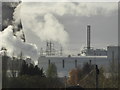
The power of steam!
by Chris Allen
for square SE4725
On the left is one of the hyperbolic cooling towers of the disused 2000 MW... (more)
|

|
Ferrybridge Power Stations - A & C
by Chris Allen
geograph for square SE4824
The red brick building is the former A station that is now workshops and a... (more)
|

|
Ferrybridge - 8 pack
by Chris Allen
geograph for square SE4724
The eight 377' high hyperbolic cooling towers at the disused 2000 MW coal... (more)
|

|
Disused infrastructure, Ferrybridge B power station
by Christine Johnstone
geograph for square SE4725
Where coal from Kellingley used to be unloaded from boats [pans propelled by tugs].
|

|
Loaded coal pans near journey's end, Ferrybridge
by Christine Johnstone
geograph for square SE4824
Each pan held 170 tons of coal. Tugs took them 6 km along the Aire and Calder... (more)
|
|
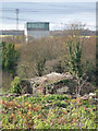
Derelict building, Brotherton
by Chris Allen
geograph for square SE4826
The main reason I took this is not the derelict building but the large structure... (more)
|

|
Ferrybridge Power Station, 1995
by Ben Brooksbank
geograph for square SE4824
View westward from A162 across the River Aire.
|

|
Pylons at Ferrybridge A power station
by Christine Johnstone
geograph for square SE4824
On the west bank of the River Aire.
|

|
Ferrybridge power station from the north-west
by Helena Hilton
for square SE4725
Taken from the A1(M).
|

|
Ferrybridge power station from the west
by Helena Hilton
geograph for square SE4724
Taken from the A1(M), passing under a bridge.
|

|
Ferrybridge power station from the north
by Helena Hilton
for square SE4725
Taken from the A1(M), crossing the Aire.
|
|
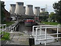
Ferrybridge Lock with the Ferrybridge Power Station Cooling Towers in the background
by John M Wheatley
geograph for square SE4824
|

|
M62 near Hensall
by Alan Murray-Rust
geograph for square SE5822
Looking west from Church Lane bridge. Ferrybridge Power Station SE4724 can... ( more) |

|
Ploughed field alongside Sudforth Lane
by Alan Murray-Rust
geograph for square SE5222
The disused Ferrybridge power station is visible in the distance.
|

|
Fairburn Ings RSPB
by Hugh Venables
geograph for square SE4427
View from the Coal Tips Trail towards the now closed Ferrybridge coal-fired power station.
|
|
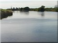
River Aire, west of Beal Bridge
by Christine Johnstone
geograph for square SE5325
Looking upstream, with Ferrybridge power station on the horizon.
|

|
Power lines crossing the River Aire near Birkin Holme
by Christine Johnstone
geograph for square SE5426
Looking upstream [locally south-west] with Ferrybridge power station on the horizon.
|

|
Pylons marching out from Ferrybridge power station
by Christine Johnstone
geograph for square SE4827
Looking south from Lunnfields Lane.
|

|
North-west lakeshore, Anglers Country Park
by Christine Johnstone
geograph for square SE3716
With Ferrybridge Power Station's cloud in the distance. This country park... (more)
|

|
Spoil banks on the lake shore, Anglers Country Park
by Christine Johnstone
geograph for square SE3715
With plumes of moist air making a column of cloud above Ferrybridge Power... (more)
|

|
The lake at Anglers Country Park, from the south
by Christine Johnstone
geograph for square SE3715
With a cloud of moist air rising from Ferrybridge Power Station on a cold day.... (more)
|

|
Farmland south-east of Knottingley
by Christine Johnstone
geograph for square SE5122
At the eastern edge of West Yorkshire. Looking north from the Womersley Road at... (more)
|
|
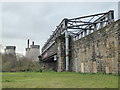
Rail bridge at Brotherton
by Chris Allen
geograph for square SE4825
This leads to the disused Ferrybridge C Power Station seen in the background.... (more)
|

|
Swans and cygnets on the River Aire
by Christine Johnstone
geograph for square SE5225
At Wood Holmes, with Ferrybridge power station on the horizon.
|

|
River Aire near Wood Holmes
by Christine Johnstone
geograph for square SE5225
Looking upstream [locally west] with Ferrybridge power station on the horizon.
|
|
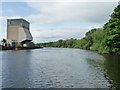
The boundary between West and North Yorkshire
by Christine Johnstone
geograph for square SE4725
The River Aire at Ferrybridge B power station. Wakefield District, West... (more)
|

|
Pipe bridge, Ferrybridge B power station
by Christine Johnstone
geograph for square SE4725
Seen from a boat heading upstream [locally north] on the River Aire.
|
|
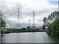
The River Aire at Ferrybridge B power station
by Christine Johnstone
geograph for square SE4725
Looking upstream, along a county and district boundary.
|

|
Mill Lane, Hambleton, looking westwards
by Christine Johnstone
geograph for square SE5530
Skirting the edge of the village. Ferrybridge power station is on the horizon,... (more)
|

|
Field boundary looking west, Maspin Moor
by Christine Johnstone
geograph for square SE5328
With Ferrybridge Power Station on the horizon, about 7 kms away.
|

|
Path on Fairburn Ings reserve
by Alan Murray-Rust
geograph for square SE4527
With Ferrybridge Power Station in the distance.
|

|
York Minster from Sheffield (Ringinglow Road nr. Hangram Lane). Pitchford Lane, Sandygate in the foreground
by R
for square SE6052
York Minster from Sheffield (Ringinglow Road nr. Hangram Lane). Houses at the... (more)
|
|
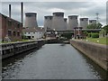
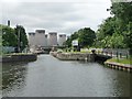
Ferrybridge Flood Lock, Aire & Calder Navigation
by Christine Johnstone
geograph for square SE4824
Connecting the artificial section of the Aire & Calder with the navigable... (more)
|
|
Bottom gates, Ferrybridge Flood Lock
by Christine Johnstone
geograph for square SE4824
Connecting the artificial section of the Aire & Calder with the navigable... (more)
|

|
The Aire & Calder Navigation at Ferrybridge
by Christine Johnstone
geograph for square SE4824
Seen from a boat heading west.
|
