Public Tags
Other tags: near:Fetcham
Showing latest 50 of 117 images tagged with place:Fetcham tag.

|
Fetcham Mill Pond
by Ian Capper geograph for square TQ1556 Fetcham Mill Pond is spring fed and used to be much larger in extent, originally... (more)
Tags:
place:Fetcham
place:Fetcham Mill Pond
type:Geograph
top:Lakes, Wetland, Bog
top:Suburb, Urban Fringe
top:Water Resources
|
|
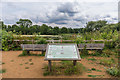
Fetcham Mill Pond
by Ian Capper geograph for square TQ1556 Seats and an interpretation board by Fetcham Mill Pond. The pond is spring fed... (more)
Tags:
place:Fetcham
place:Fetcham Mill Pond
type:Geograph
Interpretation Board
top:Lakes, Wetland, Bog
top:Suburb, Urban Fringe
top:Water Resources
|
|
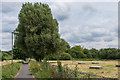
Path to Fetcham Mill Pond
by Ian Capper geograph for square TQ1556 Path leading from Cobham Road past Fetcham Mill Pond and then to Mill Lane on... (more)
Tags:
place:Fetcham
place:Fetcham Mill Pond
type:Geograph
top:Paths
top:Suburb, Urban Fringe
top:Water Resources
Water Source
Well
|

|
Fetcham Park House
by Ian Capper geograph for square TQ1555 A grade II* listed mansion, now used as offices.
It was built in around 1705... (more)
Tags:
person:Arthur Moore
top:Business, Retail, Services
person:Edward L Anson
place:Fetcham
Fetcham Park House
person:George London
Grade II(star) Listed
person:Louis Laguerre
top:Suburb, Urban Fringe
person:William Talman
|

|
Fetcham Park House
by Ian Capper geograph for square TQ1555 A grade II* listed mansion, now used as offices.
It was built in around 1705... (more)
Tags:
person:Arthur Moore
top:Business, Retail, Services
person:Edward L Anson
place:Fetcham
Fetcham Park House
person:George London
Grade II(star) Listed
person:Louis Laguerre
top:Park and Public Gardens
top:Suburb, Urban Fringe
person:William Talman
|

|
Fetcham Park House
by Ian Capper geograph for square TQ1455 A grade II* listed mansion, now used as offices.
It was built in around 1705... (more)
Tags:
person:Arthur Moore
person:Edward L Anson
place:Fetcham
Fetcham Park House
person:George London
Grade II(star) Listed
person:Louis Laguerre
top:Sport, Leisure
top:Suburb, Urban Fringe
person:William Talman
|

|
Fetcham Park House
by Ian Capper geograph for square TQ1455 A grade II* listed mansion, now used as offices.
It was built in around 1705... (more)
Tags:
person:Arthur Moore
top:Business, Retail, Services
person:Edward L Anson
place:Fetcham
Fetcham Park House
person:George London
Grade II(star) Listed
person:Louis Laguerre
top:Suburb, Urban Fringe
person:William Talman
|

|
Fetcham Park House
by Ian Capper geograph for square TQ1555 A grade II* listed mansion, now used as offices.
It was built in around 1705... (more)
Tags:
person:Arthur Moore
top:Business, Retail, Services
person:Edward L Anson
place:Fetcham
Fetcham Park House
person:George London
Grade II(star) Listed
person:Louis Laguerre
top:Suburb, Urban Fringe
person:William Talman
|
|
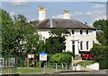
Fetcham Cottage
by Colin Smith geograph for square TQ1455 Historic Fetcham House on Bell Lane in the residential village of Fetcham, west... (more)
Tags:
place:Fetcham
type:Geograph
subject:Historic Building
top:Historic Sites and Artefacts
top:Village, Rural Settlement
|
|
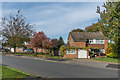
Fetcham Park Drive
by Ian Capper geograph for square TQ1555 Road connecting The Mount with the Badingham Drive estate, a development that... (more)
Tags:
school:Badingham College
place:Fetcham
type:Geograph
top:Housing, Dwellings
Road Fetcham Park Drive
top:Suburb, Urban Fringe
|

|
Laguerre mural, Fetcham Park House
by Ian Capper for square TQ1455 One of the murals by French artist Louis Laguerre in Fetcham Park House (see TQ1455 : Fetcham Park House).
Tags:
top:Business, Retail, Services
place:Fetcham
Fetcham Park House
person:Louis Laguerre
Mural
top:Suburb, Urban Fringe
|
|
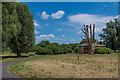
SES Water service building
by Ian Capper geograph for square TQ1556 A service building next to Fetcham Mill Pond, owned by SES Water. In the left... (more)
Tags:
place:Fetcham
place:Fetcham Mill Pond
type:Geograph
top:Suburb, Urban Fringe
Water Company
top:Water Resources
|
|
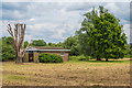
SES Water service building
by Ian Capper geograph for square TQ1556 A service building next to Fetcham Mill Pond, owned by SES Water.
Tags:
place:Fetcham
place:Fetcham Mill Pond
type:Geograph
top:Suburb, Urban Fringe
Water Company
top:Water Resources
|
|
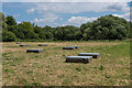
Water wells
by Ian Capper geograph for square TQ1556 A group of water wells next to Fetcham Mill Pond, used by SES Water as a water source.
Tags:
place:Fetcham
place:Fetcham Mill Pond
type:Geograph
top:Suburb, Urban Fringe
Water Company
top:Water Resources
Water Source
Well
|

|
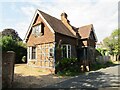
Fetcham Lodge
by Colin Smith geograph for square TQ1456 Historic building (built 1799-1803) in the residential village of Fetcham, west... (more)
|
|
Fetcham - Well House
by Colin Smith geograph for square TQ1455 Old Street - Fetcham Conservation Area - historic house named after a nearby well.
|

|
Fetcham Village Infant School
by Ian Capper geograph for square TQ1456 Buildings of Fetcham Village Infant School in School Lane. The building in the... (more)
|
|
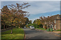
Badingham Drive
by Ian Capper geograph for square TQ1555 Housing forming part of a development that started in 1968 on the former playing... (more)
Tags:
school:Badingham College
road:Badingham Drive
place:Fetcham
type:Geograph
top:Housing, Dwellings
top:Suburb, Urban Fringe
|
|
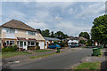
Cannon Way
by Ian Capper geograph for square TQ1556 c1960s housing on the edge of Fetcham. In the centre of the photo is the former... (more)
|

|
Fetcham Guide Hall
by Ian Capper geograph for square TQ1556 Guide headquarters off Cannon Grove, opened in 1978. As well as being the base... (more)
Tags:
road:Cannon Grove
top:Educational Sites
place:Fetcham
type:Geograph
Guide Hut
Pre-School
top:Sport, Leisure
top:Suburb, Urban Fringe
|
|
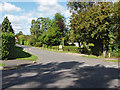
Meadow Way, Fetcham
by Alan Hunt geograph for square TQ1355 The junction of Meadow Way with Eastwick Drive in this residential area of Fetcham.
|
|
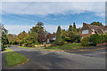
The Mount
by Ian Capper geograph for square TQ1555 Upmarket development of land previously forming part of the Fetcham Park estate,... (more)
Tags:
place:Fetcham
type:Geograph
top:Housing, Dwellings
Place
top:Suburb, Urban Fringe
road:The Mount
|
|
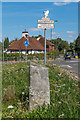
Milestone, Hawk's Hill
by Ian Capper geograph for square TQ1555 Early 19th Century milestone on the B2122 Hawk's Hill/Guildford Road as it... (more)
Tags:
road:B2122
place:Fetcham
type:Geograph
Grade II Listed
road:Guildford Road
road:Hawks Hill
place:Leatherhead
Milestone
top:Roads, Road Transport
top:Suburb, Urban Fringe
Town Sign
|
|
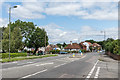
Guildford Road
by Ian Capper for square TQ1556 The B2122 Guildford Road as it leaves Fetcham and enters Leatherhead. The... (more)
Tags:
road:B2122
type:Cross Grid
place:Fetcham
road:Guildford Road
place:Leatherhead
top:Roads, Road Transport
|

|
Fetcham - Village Infant School
by Colin Smith geograph for square TQ1455 The primary sits at crossroads in the village centre.
The old fingerposts are... (more)
|

|
Fetcham - Garden Cottage
by Colin Smith geograph for square TQ1456 The Street - historic building, thought to have been developed from a lime kiln,... (more)
Tags:
place:Fetcham
type:Geograph
subject:Historic Building
top:Historic Sites and Artefacts
top:Village, Rural Settlement
|
|
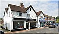
Fetcham - St Clements
by Colin Smith geograph for square TQ1456 The Street - built 1860s when a forge, two cottages and a shop. Rebuilt ca 1932... (more)
Tags:
top:Business, Retail, Services
place:Fetcham
type:Geograph
subject:Shop
top:Village, Rural Settlement
|
|
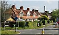
Fetcham - Cobham Road
by Colin Smith geograph for square TQ1556 Residential street on the Cobham to Leatherhead road.
|
|
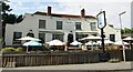
Fetcham - The Bell
by Colin Smith geograph for square TQ1455 Popular village crossroads pub, built 1937, architect Joseph Hill.
|
|
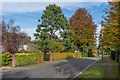
The Mount
by Ian Capper geograph for square TQ1555 Upmarket development of land previously forming part of the Fetcham Park estate,... (more)
|
|
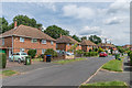
Pound Crescent
by Ian Capper geograph for square TQ1456 1950s housing on the edge of Fetcham on land which was originally part of Pound Farm.
Tags:
place:Fetcham
type:Geograph
top:Housing, Dwellings
road:Pound Crescent
top:Suburb, Urban Fringe
|
|
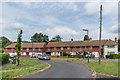
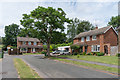
Pound Crescent
by Ian Capper geograph for square TQ1456 1950s housing on the edge of Fetcham on land which was originally part of Pound Farm.
Tags:
place:Fetcham
type:Geograph
top:Housing, Dwellings
road:Pound Crescent
top:Suburb, Urban Fringe
|
|
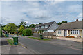
Cannon Way
by Ian Capper geograph for square TQ1556 c1970s housing on the edge of Fetcham.
|
|
Cannon Way
by Ian Capper geograph for square TQ1556 c1970s housing on the edge of Fetcham.
|

|
Cannon Way
by Ian Capper geograph for square TQ1556 c1960s housing on the edge of Fetcham.
|

|
Cannon Grove
by Ian Capper geograph for square TQ1556 c1970s housing on the edge of Fetcham.
|

|
Cannon Grove
by Ian Capper geograph for square TQ1556 c1970s housing on the edge of Fetcham on the site of a former piggery.
|

|
Cannon Grove
by Ian Capper geograph for square TQ1556 c1970s housing on the edge of Fetcham on the site of a former piggery.
|

|
River Mole
by Ian Capper geograph for square TQ1457 The River Mole at the site of Old Mill. The footbridge carries River Lane over the river.
|

|
River Lane
by Ian Capper geograph for square TQ1456 Housing in the southern section of River Lane.
|
|
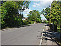
Eastwick Drive, Fetcham
by Alan Hunt geograph for square TQ1355 A residential road developed during the 1950s and 60s on the land of the former... (more)
|
|
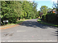
Elmfield, Fetcham
by Alan Hunt geograph for square TQ1355 The junction of Elmfield, a residential cul-de-sac, with Meadow Way.
|
|
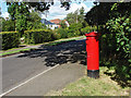
Eastwick Drive, Fetcham
by Alan Hunt geograph for square TQ1355 A postbox on Eastwick Drive near the fishing lakes.
|

|
St Mary's Church, Fetcham
by Ian Capper geograph for square TQ1455 Saxon origins, with an 11th century nave and 12th and 13th century aisles and... (more)
|

|
Fetcham - Font
by Colin Smith for square TQ1455 Historic font bowl (1632) within St Mary's Church.
Link
 Tags:
type:Close Look
place:Fetcham
subject:Font
top:Historic Sites and Artefacts
type:Inside
top:Religious Sites
church:St Marys
|
|
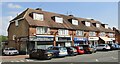
Fetcham - Shopping Parade
by Colin Smith geograph for square TQ1456 Cobham Road - village shops (roofing contractor, barber shop, betting shop) with... (more)
Tags:
top:Business, Retail, Services
place:Fetcham
type:Geograph
top:Housing, Dwellings
subject:Shop
top:Village, Rural Settlement
|

|
Fetcham Parish
by Colin Smith for square TQ1455 Detail of the parish map within St Mary's Church.
Link
Tags:
type:Close Look
place:Fetcham
top:Historic Sites and Artefacts
subject:Historical
Map
church:St Marys
|

|
Fetcham Church - Vincent Memorial
by Colin Smith for square TQ1455 The historic parish church contains a memorial to Henry Vincent (d.1631) - a... (more)
Tags:
type:Close Look
place:Fetcham
top:Historic Sites and Artefacts
type:Inside
subject:Memorial
top:Religious Sites
church:St Marys
|
