About tags on Geograph

Public Tags

Related Tags | Coverage Map
Prefix: place    Tag:  Flamborough·Head  
Other tags: Flamborough Head    

Showing latest 50 of 203 images tagged with place:Flamborough Head tag.

View all tagged images - In Browser
:

TA2570 : Flamborough Head Lighthouse by Lauren Flamborough Head Lighthouse by Lauren
geograph for square TA2570
The Flamborough Head Lighthouse was built in 1806 at a cost of £8,000, and marks... (more)
Tags: place:Beach   Beach   top:Business, Retail, Services   top:Coastal   top:Estuary, Marine   Flamborough Head   place:Flamborough Head   type:Geograph   building type:Lighthouse   Lighthouse   subject:Lighthouse  
TA2471 : Breil Nook Views, Flamborough by Scott Robinson Breil Nook Views, Flamborough by Scott Robinson
geograph for square TA2471
The view along the coast towards Flamborough Head taking in Breil Head and Cradle Head.
Tags: subject:Cliff   Coast   subject:Coast   top:Coastal   Coastline   East Yorkshire   country:England   top:Estuary, Marine   place:Flamborough   place:Flamborough Head   ldp:Headland Way   place:North Sea   top:Rocks, Scree, Cliffs   View   Water   place:Yorkshire  
TA2570 : Flamborough Head by Scott Robinson Flamborough Head by Scott Robinson
geograph for square TA2570
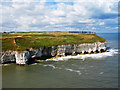
The view across Selwicks Bay to Flamborough Head and Cough Hole. The fog signal... (more)
Tags: Bay   Chalk   subject:Cliff   subject:Coast   top:Coastal   Coastline   East Yorkshire   country:England   top:Estuary, Marine   place:Flamborough   place:Flamborough Head   ldp:Headland Way   place:North Sea   top:Rocks, Scree, Cliffs   Sea Stack   subject:Seaside   View   subject:View   Water   place:Yorkshire  
TA2369 : South Landing, Flamborough by Scott Robinson South Landing, Flamborough by Scott Robinson
geograph for square TA2369
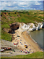
The view from East Nook of the South Landing on Flamborough Head.
Tags: subject:Beach   Chalk   subject:Coast   top:Coastal   Coastline   East Yorkshire   country:England   top:Estuary, Marine   place:Flamborough   place:Flamborough Head   ldp:Headland Way   Low Tide   place:North Sea   top:Rocks, Scree, Cliffs   subject:Seaside   subject:View   Water   place:Yorkshire  
TA2570 : Flamborough Head Wispy Skies by Scott Robinson Flamborough Head Wispy Skies by Scott Robinson
geograph for square TA2570
The back towards Flamborough Lighthouse from behind the fog signal station.
Tags: top:Air, Sky, Weather   Blue Skies White Clouds   subject:Coast   top:Coastal   Coastline   East Yorkshire   country:England   place:Flamborough   place:Flamborough Head   subject:Fog Horn   Fog Signal Station   top:Grassland   ldp:Headland Way   Lighthouse   subject:Seaside   View   place:Yorkshire  
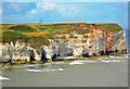
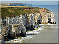
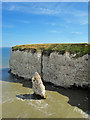
TA2570 : Selwicks Bay, Flamborough Head by Andy Stephenson Selwicks Bay, Flamborough Head by Andy Stephenson
geograph for square TA2570
On Britain's hottest day, a cool place to observe the cliff scenery!
Tags: top:Air, Sky, Weather   Bay   subject:Bay   Chalk Cliffs   subject:Cliff   top:Coastal   top:Estuary, Marine   Flamborough Head   place:Flamborough Head   type:Geograph   top:Geological Interest   Hot Day   Hot Days on Holiday   North Sea   top:Rocks, Scree, Cliffs   weather:Summer   season:Summer  
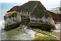
TA2570 : High Stacks by Lauren High Stacks by Lauren
geograph for square TA2570
High Stacks from Headland Walk
Tags: Beach   place:Beach   subject:Coast   Coast   top:Coastal   Coastline   top:Estuary, Marine   Flamborough Head   place:Flamborough Head   type:Geograph   subject:Geological Feature   Geological Feature   top:Geological Interest   Geological Interest   Geology   footpath:Headland Way   top:Rocks, Scree, Cliffs   Sea   subject:Sea  
TA2570 : Green Stacks Pinnacle by Lauren Green Stacks Pinnacle by Lauren
geograph for square TA2570
Green Stacks Pinnacle from Headland Walk
Tags: place:Beach   subject:Coast   top:Coastal   Coastline   top:Estuary, Marine   Flamborough Head   place:Flamborough Head   type:Geograph   subject:Geological Feature   Geological Feature   top:Geological Interest   Geological Interest   Geology   footpath:Headland Way   top:Rocks, Scree, Cliffs   Sea   subject:Sea  
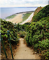
TA2570 : Weathered steps by Lauren Weathered steps by Lauren
geograph for square TA2570
Weathered steps between Selwicks Bay and Flamborough Head car park
Tags: place:Beach   Beach   top:Coastal   Flamborough Head   place:Flamborough Head   type:Geograph   top:Geological Interest   Rocks   top:Rocks, Scree, Cliffs   subject:Steps   Steps  
TA2570 : Flamborough Head by Mat Fascione Flamborough Head by Mat Fascione
geograph for square TA2570
Tags: Cliffs   subject:Coast   top:Coastal   place:Flamborough Head   type:Geograph   Lighthouse   top:Rocks, Scree, Cliffs  
TA2570 : High Stacks, Flamborough Head by Scott Robinson High Stacks, Flamborough Head by Scott Robinson
geograph for square TA2570
Tags: subject:Bay   Chalk   subject:Cliff   subject:Coast   top:Coastal   Coastline   East Yorkshire   country:England   top:Estuary, Marine   place:Flamborough   place:Flamborough Head   ldp:Headland Way   place:North Sea   top:Rocks, Scree, Cliffs   subject:Seaside   subject:View   Water   place:Yorkshire  
TA2571 : Stottle Bank Nook by Scott Robinson Stottle Bank Nook by Scott Robinson
for square TA2571
A closer view of the Nook taken from across Selwicks Bay on Flamborough Head.
Tags: subject:Bay   Chalk   subject:Cliff   subject:Coast   top:Coastal   Coastline   East Yorkshire   country:England   top:Estuary, Marine   place:Flamborough   place:Flamborough Head   ldp:Headland Way   place:North Sea   top:Rocks, Scree, Cliffs   subject:Seaside   subject:View   View   Water   place:Yorkshire  
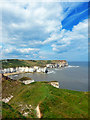
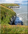
TA2570 : Selwicks Bay by Scott Robinson Selwicks Bay by Scott Robinson
geograph for square TA2570
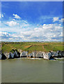
A different view across Selwicks Bay, Flamborough Head.
Tags: top:Air, Sky, Weather   subject:Bay   Chalk   subject:Cliff   subject:Coast   top:Coastal   Coastline   East Yorkshire   country:England   top:Estuary, Marine   place:Flamborough   place:Flamborough Head   ldp:Headland Way   place:North Sea   top:Rocks, Scree, Cliffs   subject:Seaside   View   subject:View   Water   place:Yorkshire  
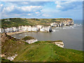
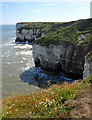
TA2570 : Selwicks Bay, Flamborough Head by Scott Robinson Selwicks Bay, Flamborough Head by Scott Robinson
geograph for square TA2570
The view back along the coastline across Selwicks Bay to Stottle Bank Nook in... (more)
Tags: top:Air, Sky, Weather   subject:Bay   Bay   Chalk   subject:Cliff   subject:Coast   top:Coastal   Coastline   East Yorkshire   country:England   top:Estuary, Marine   place:Flamborough   place:Flamborough Head   ldp:Headland Way   place:North Sea   top:Rocks, Scree, Cliffs   subject:Seaside   View   subject:View   Water   place:Yorkshire  
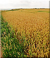
TA2569 : Wheat Field, Headland Way, Flamborough Head by Scott Robinson Wheat Field, Headland Way, Flamborough Head by Scott Robinson
geograph for square TA2569
Tags: subject:Coast   top:Coastal   Coastline   subject:Crop   East Yorkshire   country:England   top:Farm, Fishery, Market Gardening   place:Flamborough   place:Flamborough Head   ldp:Headland Way   subject:Seaside   subject:View   crop:Wheat   Wheatfield   place:Yorkshire  
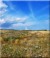
TA2570 : Flora, Flamborough Head by Scott Robinson Flora, Flamborough Head by Scott Robinson
geograph for square TA2570
The view back towards the lighthouse from the southern stretch of coastline.
Tags: top:Air, Sky, Weather   Blue Skies White Clouds   subject:Coast   top:Coastal   Coastline   East Yorkshire   country:England   place:Flamborough   place:Flamborough Head   subject:Flora   ldp:Headland Way   Lighthouse   subject:Lighthouse   subject:Seaside   subject:View   top:Wild Animals, Plants and Mushrooms   place:Yorkshire  
TA2372 : Thornwick Nab Cave by Scott Robinson Thornwick Nab Cave by Scott Robinson
geograph for square TA2372
A view of the narrow cave formed in Thornwick Nab, Flamborough Head.
Tags: Caves   rock:Chalk   Cliff Erosion   Cliffs   Clifftop   top:Coastal   East Coast   East Yorkshire   country:England   top:Estuary, Marine   place:Flamborough   place:Flamborough Head   ldp:Headland Way   North Sea   top:Rocks, Scree, Cliffs   Sea   Shoreline   View   Yorkshire  
TA2372 : Thornwick Nab by Scott Robinson Thornwick Nab by Scott Robinson
geograph for square TA2372
Thornwick Bay, Flamborough Head
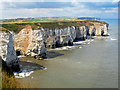
TA2570 : Flamborough Head by Richard Croft Flamborough Head by Richard Croft
geograph for square TA2570
Selwick's Bay at Flamborough Head
Tags: Cliffs   top:Coastal   place:Flamborough Head   type:Geograph   top:Rocks, Scree, Cliffs  
TA2471 : Strata in the chalk, the Saddle, Flamborough Head by Christine Johnstone Strata in the chalk, the Saddle, Flamborough Head by Christine Johnstone
geograph for square TA2471
The cliffs on the north side of Flamborough Head are more heavily eroded than... (more)
Tags: Chalk Cliffs   subject:Cliff   top:Coastal   place:Flamborough Head   type:Geograph  
TA2471 : Saddle Nook, Flamborough Head by Christine Johnstone Saddle Nook, Flamborough Head by Christine Johnstone
geograph for square TA2471
The cliffs on the north side of Flamborough Head are more heavily eroded than... (more)
Tags: Chalk Cliffs   subject:Cliff   Cliff Erosion   top:Coastal   place:Flamborough Head   type:Geograph  
TA2571 : Headland Way at Flamborough Head by Mat Fascione Headland Way at Flamborough Head by Mat Fascione
geograph for square TA2571
Tags: Cliff Top   subject:Coast   top:Coastal   place:Flamborough Head   type:Geograph   Long Distance Path   top:Paths  
TA2570 : Farmland on Flamborough Head by Mat Fascione Farmland on Flamborough Head by Mat Fascione
geograph for square TA2570
The Headland Way is running along the cliff top.
Tags: top:Coastal   top:Farm, Fishery, Market Gardening   Farmland   subject:Farmland   place:Flamborough Head   type:Geograph   Long Distance Path   top:Paths  
TA2569 : Headland Way at Flamborough Head by Mat Fascione Headland Way at Flamborough Head by Mat Fascione
geograph for square TA2569
Tags: Cliff Top   top:Coastal   place:Flamborough Head   type:Geograph   Long Distance Path   subject:Path   top:Paths  
TA2469 : Oil seed rape at Flamborough Head by Mat Fascione Oil seed rape at Flamborough Head by Mat Fascione
geograph for square TA2469
The Headland Way is running along the edge of the clifftop.
Tags: Cliff Top   top:Coastal   subject:Crop   top:Farm, Fishery, Market Gardening   place:Flamborough Head   type:Geograph   Long Distance Path   crop:Oil Seed Rape   top:Paths  
TA2469 : Headland Way on Flamborough Head by Mat Fascione Headland Way on Flamborough Head by Mat Fascione
geograph for square TA2469
Tags: Cliff Top   top:Coastal   Farmland   place:Flamborough Head   type:Geograph   Long Distance Path   top:Paths   top:Rocks, Scree, Cliffs  
TA2570 : Coastguard Station at Flamborough Head by Graham Robson Coastguard Station at Flamborough Head by Graham Robson
geograph for square TA2570
The Coastguard Station near to the lighthouse and visitor facilities at Flamborough Head.
TA2570 : Houses at Flamborough Head by Graham Robson Houses at Flamborough Head by Graham Robson
geograph for square TA2570
A line of bungalows at Flamborough Head with views out across the headland.
Tags: place:Flamborough Head   type:Geograph   Houses   top:Housing, Dwellings  
TA2570 : Road approaching Flamborough Head lighthouse by Graham Robson Road approaching Flamborough Head lighthouse by Graham Robson
geograph for square TA2570
Looking along the final stretch of road approaching Flamborough Head Lighthouse... (more)
Tags: place:Flamborough Head   type:Geograph   Road   top:Roads, Road Transport  
TA2570 : Public toilets at Flamborough Head by Graham Robson Public toilets at Flamborough Head by Graham Robson
geograph for square TA2570
Public toilets in the car park at Flamborough Head.
TA2570 : Lighthouse at Flamborough Head by Graham Robson Lighthouse at Flamborough Head by Graham Robson
geograph for square TA2570
The lighthouse at the well known headland of Flamborough Head.
TA2570 : Shop at Flamborough Head by Graham Robson Shop at Flamborough Head by Graham Robson
geograph for square TA2570
A busy shop selling gifts to visitors to Flamborough Head.
Tags: top:Business, Retail, Services   place:Flamborough Head   type:Geograph   Shop  
TA2570 : Flamborough Head foghorn station by Graham Robson Flamborough Head foghorn station by Graham Robson
geograph for square TA2570
The foghorn at Flamborough Head is situated nearer the cliff edge than the... (more)
TA2570 : Clifftops at Flamborough Head by Graham Robson Clifftops at Flamborough Head by Graham Robson
geograph for square TA2570
The top of the cliffs at Flamborough Head, looking westwards towards the... (more)
Tags: Clifftop   top:Coastal   place:Flamborough Head   type:Geograph  
TA2570 : Pigeon Hole Caves by Lauren Pigeon Hole Caves by Lauren
geograph for square TA2570
Pigeon Hole Caves from Headland Walk
TA2169 : Dykes End, Danes Dyke by Scott Robinson Dykes End, Danes Dyke by Scott Robinson
geograph for square TA2169
The steps down to the beach from Cliff Plantation, Danes Dyke, Flamborough.
Tags: subject:Coast   top:Coastal   Coastline   East Yorkshire   country:England   top:Estuary, Marine   place:Flamborough   place:Flamborough Head   ldp:Headland Way   Low Tide   place:North Sea   top:Paths   top:Rocks, Scree, Cliffs   subject:Seaside   subject:Steps   subject:View   Water   place:Yorkshire  
TA2472 : Natural Arches, Flamborough North Landing by Scott Robinson Natural Arches, Flamborough North Landing by Scott Robinson
for square TA2472
A close up view of Natural Arches taken from Breil Nook. Bempton Cliffs can be... (more)
Tags: Chalk   subject:Cliff   subject:Coast   top:Coastal   Coastline   East Yorkshire   country:England   top:Estuary, Marine   place:Flamborough   place:Flamborough Head   ldp:Headland Way   place:North Sea   top:Rocks, Scree, Cliffs   View   Yorkshire   place:Yorkshire  
TA2471 : Breil Nook View, Flamborough by Scott Robinson Breil Nook View, Flamborough by Scott Robinson
geograph for square TA2471
The view looking north west from Breil Nook taking in The Saddle, Carter Lane... (more)
Tags: Chalk   subject:Cliff   Coast   top:Coastal   Coastline   East Yorkshire   country:England   top:Estuary, Marine   place:Flamborough   place:Flamborough Head   ldp:Headland Way   place:North Sea   top:Rocks, Scree, Cliffs   View   Water   Yorkshire   place:Yorkshire  
TA2471 : Queen Rock Sea Stack, Breil Nook, Flamborough by Scott Robinson Queen Rock Sea Stack, Breil Nook, Flamborough by Scott Robinson
geograph for square TA2471
Taken along the LDP Headland Way.
Tags: top:Air, Sky, Weather   Bay   Chalk   subject:Cliff   subject:Coast   top:Coastal   Coastline   East Yorkshire   country:England   top:Estuary, Marine   place:Flamborough   place:Flamborough Head   ldp:Headland Way   place:North Sea   top:Rocks, Scree, Cliffs   Sea Stack   View   Water   place:Yorkshire  
TA2472 : Flora & Fauna on East Scar, Flamborough by Scott Robinson Flora & Fauna on East Scar, Flamborough by Scott Robinson
geograph for square TA2472
Looking north west across the mouth of the North Landing bay towards North Cliff... (more)
Tags: top:Air, Sky, Weather   Bay   Chalk   subject:Cliff   subject:Coast   Coast   top:Coastal   Coastline   East Yorkshire   country:England   top:Estuary, Marine   place:Flamborough   place:Flamborough Head   ldp:Headland Way   place:North Sea   top:Rocks, Scree, Cliffs   View   Water   top:Wild Animals, Plants and Mushrooms   place:Yorkshire  
TA2472 : East Scar View, Flamborough by Scott Robinson East Scar View, Flamborough by Scott Robinson
geograph for square TA2472
The view in an easterly direction towards Breil Nook
Tags: top:Air, Sky, Weather   Bay   Chalk   subject:Cliff   subject:Coast   top:Coastal   Coastline   East Yorkshire   country:England   top:Estuary, Marine   place:Flamborough   place:Flamborough Head   ldp:Headland Way   place:North Sea   top:Rocks, Scree, Cliffs   View   Water   place:Yorkshire   Yorkshire  
TA2372 : North Landing, Flamborough by Scott Robinson North Landing, Flamborough by Scott Robinson
geograph for square TA2372
Tags: top:Air, Sky, Weather   Bay   Chalk   Clouds   Coast   subject:Coast   top:Coastal   Coastline   East Yorkshire   country:England   top:Estuary, Marine   place:Flamborough   place:Flamborough Head   ldp:Headland Way   place:North Sea   top:Rocks, Scree, Cliffs   Sky   View   Water   place:Yorkshire   Yorkshire  
TA2372 : Flamborough Cliffs Nature Reserve by Scott Robinson Flamborough Cliffs Nature Reserve by Scott Robinson
geograph for square TA2372
Tags: top:Air, Sky, Weather   Bay   Chalk   Clouds   subject:Coast   Coast   top:Coastal   Coastline   East Yorkshire   country:England   top:Estuary, Marine   place:Flamborough   place:Flamborough Head   ldp:Headland Way   place:North Sea   top:Rocks, Scree, Cliffs   Sky   View   Water   place:Yorkshire  
TA2469 : Barley Field, South Cliff, Flamborough by Scott Robinson Barley Field, South Cliff, Flamborough by Scott Robinson
geograph for square TA2469
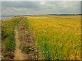
Walking along the Headland Way LDP.
Tags: crop:Barley   subject:Coast   top:Coastal   Coastline   subject:Crop   East Yorkshire   country:England   top:Farm, Fishery, Market Gardening   place:Flamborough   place:Flamborough Head   ldp:Headland Way   top:Paths   subject:Seaside   subject:View   place:Yorkshire  
TA2372 : Chalk Cliffs, North Landing Flamborough by Scott Robinson Chalk Cliffs, North Landing Flamborough by Scott Robinson
geograph for square TA2372
The chalk in these cliffs was laid down millions of years ago when the last of... (more)
Tags: Chalk   subject:Cliff   subject:Coast   top:Coastal   Coastline   East Yorkshire   country:England   top:Estuary, Marine   place:Flamborough   place:Flamborough Head   ldp:Headland Way   place:North Sea   top:Rocks, Scree, Cliffs   View   Water   Yorkshire  
TA2372 : North Landing Beach, Flamborough by Scott Robinson North Landing Beach, Flamborough by Scott Robinson
geograph for square TA2372
Tags: top:Air, Sky, Weather   Bay   subject:Beach   Beach   Chalk   Clouds   top:Coastal   East Yorkshire   country:England   top:Estuary, Marine   place:Flamborough   place:Flamborough Head   ldp:Headland Way   top:Rocks, Scree, Cliffs   Sky   View   place:Yorkshire  
TA2570 : Fog Signal Station at Flamborough Head by Pauline E Fog Signal Station at Flamborough Head by Pauline E
geograph for square TA2570
The fog signal is a nautophone, an electronic device which came into use here in... (more)
TA2570 : Fog Signal Station, Flamborough Head by Pauline E Fog Signal Station, Flamborough Head by Pauline E
geograph for square TA2570
The fog signal is a nautophone, an electronic device which came into use here in... (more)
TA2173 : Puffin sculpture at Dykes End by Mat Fascione Puffin sculpture at Dykes End by Mat Fascione
geograph for square TA2173
The path on the right is the Headland Way.
Tags: Cliff Top   top:Coastal   place:Flamborough Head   type:Geograph   Long Distance Path   top:Paths   subject:Sculpture   Sculpture  
TA2369 : Steps on the Headland Way by Mat Fascione Steps on the Headland Way by Mat Fascione
geograph for square TA2369
A small stream has carved out a steep gully known as Sand Hole along the... (more)
Tags: top:Coastal   place:Flamborough Head   type:Geograph   Gully   Long Distance Path   top:Paths   top:Rocks, Scree, Cliffs   Steps   subject:Steps  
View more in the Image Search or in Browser
View images matching 'Flamborough Head' anywhere in the tags
Don't click these: PotMel 1 PotMel 2