Geograph - photograph every grid square
About tags on Geograph
Tags
Geographical Context
Subjects
Types
Other Prefixes
Public Tags
Related Tags
|
Coverage Map
Prefix:
place
Tag:
Froncysyllte
Showing images tagged with
place:
Froncysyllte
tag.
View all tagged images
-
In Browser
Search within these images
:
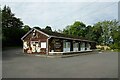
Froncysyllte Community Centre
by
Jeff Buck
geograph for square
SJ2641
Froncysyllte Community Centre is a useful stopping place for walkers in need of... (
more
)
Tags:
Community Centre
place:
Froncysyllte
type:
Geograph
top:
Village, Rural Settlement
country:
Wales
county:
Wrexham
The Llangollen Canal, Froncysyllte
by
Adrian Taylor
geograph for square
SJ2741
The canal basin at Froncysyllte is used as a winding hole to turn tourist boats... (
more
)
Tags:
subject:
Canal Basin
Canal Basin
top:
Canals
place:
Froncysyllte
type:
Geograph
canal:
Llangollen
Winding Hole
Wrexham County Borough
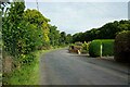
Offa's Dyke Path (B5434) at Froncysyllte
by
Jeff Buck
geograph for square
SJ2641
Looking north along the B5434, also part of Offa's Dyke Path, outside... (
more
)
Tags:
road:
B5434
place:
Froncysyllte
type:
Geograph
long distance path:
Offas Dyke
Offas Dyke Path
Road
top:
Roads, Road Transport
country:
Wales
county:
Wrexham
A tight turn, Llangollen Canal, Froncysyllte
by
Robin Drayton
geograph for square
SJ2741
Following the outbound trip across the Pontcysyllte Aqueduct, narrowboat Eirlys... (
more
)
Tags:
subject:
Canal
top:
Canals
place:
Froncysyllte
type:
Geograph
canal:
Llangollen
Narrowboat
top:
Village, Rural Settlement
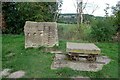
Art Installation beside the Llangollen Canal at Froncysyllte
by
Jeff Buck
geograph for square
SJ2741
This art installation at Froncysyllte is situated just a little way south of the... (
more
)
Tags:
Art Installation
Artwork
top:
Canals
place:
Froncysyllte
type:
Geograph
Llangollen Canal
Memorial
Monument
top:
People, Events
country:
Wales
county:
Wrexham
Froncysyllte Drawbridge
by
Jeff Buck
geograph for square
SJ2741
Froncysyllte Drawbridge on the Llangollen Canal. Wikipedia Llangollen Canal... (
more
)
Tags:
Canal
Canal Drawbridge
top:
Canals
Cycle and Footpath
Cycle Path
Drawbridge
Footpath
place:
Froncysyllte
type:
Geograph
Llangollen Canal
Towpath
country:
Wales
county:
Wrexham
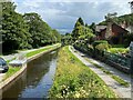
The Llangollen Canal, Froncysyllte
by
Adrian Taylor
geograph for square
SJ2741
Tags:
subject:
Canal
Canal Towpath
top:
Canals
place:
Froncysyllte
type:
Geograph
canal:
Llangollen
Llangollen Canal
Playing field near Froncysyllte
by
Adrian Taylor
geograph for square
SJ2741
The Pontcysyllte Aqueduct on the Llangollen Canal is in the background.
Tags:
top:
Boundary, Barrier
Fence
Football Pitch
place:
Froncysyllte
type:
Geograph
subject:
Playing Field
Pontcysyllte Aqueduct
top:
Sport, Leisure
The Llangollen Canal at Froncysyllte
by
Jeff Buck
geograph for square
SJ2741
Wikipedia Llangollen Canal
Link
Tags:
Canal
top:
Canals
Cycle and Footpath
Cycle Path
Cycle Route
Footpath
place:
Froncysyllte
type:
Geograph
Llangollen Canal
top:
Paths
Towpath
country:
Wales
county:
Wrexham
Lane towards Fron Uchaf
by
Jeff Buck
geograph for square
SJ2740
A lane heading south from Froncysyllte towards Fron Uchaf.
Tags:
place:
Froncysyllte
type:
Geograph
Lane
Road
top:
Roads, Road Transport
country:
Wales
county:
Wrexham
The Llangollen Canal, Froncysyllte
by
Adrian Taylor
geograph for square
SJ2741
The Llangollen Canal runs on a high tree-covered embankment on the southern... (
more
)
Tags:
subject:
Canal Embankment
Canal Embankment
top:
Canals
Embankment
place:
Froncysyllte
type:
Geograph
Llangollen Canal
canal:
Llangollen Canal
Near Pontcysyllte Aqueduct
Fron Lift Bridge
by
Gerald England
geograph for square
SJ2741
The modern hydraulic pump lift bridge (28W) over the Llangollen canal at... (
more
)
Tags:
Canal Lift Bridge
Canal Lifting Bridge
top:
Canals
Fron Lift Bridge
place:
Froncysyllte
type:
Geograph
Llangollen Canal
Canal lift bridge, Froncysyllte
by
Robin Drayton
geograph for square
SJ2741
On the Llangollen Canal. Guide Dog Oakley
Link
and... (
more
)
Tags:
subject:
Bridge
Canal Lift Bridge
top:
Canals
place:
Froncysyllte
type:
Geograph
Guide Dog
Narrowboat
top:
Rivers, Streams, Drainage
Afon Dyfrdwy (River Dee) seen from the Pontcysyllte Aqueduct
by
Jeff Buck
for square
SJ2741
Looking east down into the Vale of Llangollen and along the Afon Dyfrdwy (River... (
more
)
Tags:
Afon
Afon Dyfrdwy
type:
Cross Grid
place:
Froncysyllte
top:
Historic Sites and Artefacts
place:
Pontcysyllte Aqueduct
Pontcysyllte Aqueduct
River
River Dee
river:
River Dee
River Dee (Afon Dyfrdwy)
top:
Rivers, Streams, Drainage
Unesco World Heritage Site
country:
Wales
county:
Wrexham
On Pontcysyllte Aqueduct
by
Jeff Buck
geograph for square
SJ2741
Beside the Llangollen Canal on the Pontcysyllte Aqueduct. Wikipedia... (
more
)
Tags:
top:
Canals
Footpath
place:
Froncysyllte
type:
Geograph
top:
Historic Sites and Artefacts
Llangollen Canal
Pontcysyllte Aqueduct
place:
Pontcysyllte Aqueduct
Towpath
country:
Wales
county:
Wrexham
Repairing the railings
by
Adrian Taylor
geograph for square
SJ2741
Repairs are underway to the cast iron railings of the Pont-Cysyllte aqueduct.... (
more
)
Tags:
subject:
Aqueduct
Canal Aqueduct
Canal Maintenance Boat
aqueduct:
Canal Over River
top:
Canals
place:
Froncysyllte
type:
Geograph
top:
Historic Sites and Artefacts
canal:
Llangollen Canal
Maintenance Boat
Pontcysyllte Aqueduct
View more in the Image Search
or
in Browser
View images matching 'Froncysyllte' anywhere
in
the tags
Don't click these:
PotMel 1
PotMel 2
☰
Home
View
Search
Marked Images
Maps
Browser
Explore
Showcase
New Images
Collections
Interact
Games
Discussions
Blog
Contributors
Submit
Statistics
Leaderboards
General
FAQ
Help Pages
Sitemap
Contact Us
Support Us
sponsored by
🔍︎
What to search:
Photos
Enter keywords or a location/postcode to search nearby images
Enter a Grid Reference
Placenames
Collections
Website Pages
Everything
Others:
Advanced Search
|
Image Browser
Or:
Coverage Map
|
Searchable Map
You are not logged in
|
login
|
register