Public Tags
Other tags: Gourock
Showing latest 50 of 182 images tagged with place:Gourock tag.
|
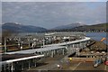
Gourock Train Station viewed from the upper deck of MV Bute at Gourock ferry terminal
by Garry Cornes geograph for square NS2477 A view of the train station at Gourock taken from the deck of the Calmac vessel... (more)
Tags:
Calmac
CalMac Ferry
top:Docks, Harbours
Ferry Terminal
place:Gourock
subject:Railway
subject:Railway Station
top:Railways
Train
|
|
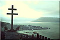
Gourock from Lyle Hill
by Colin Smith for square NS2477 Taken from the Lyle Hill viewpoint with its celebrated Cross of Lorraine, a Free... (more)
Tags:
top:City, Town Centre
estuary:Clyde
river:Clyde
Cross of Lorraine
top:Defence, Military
top:Estuary, Marine
Free French
place:Gourock
Memorial WWII
|
|
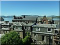
View north from the Kempock Stone, Gourock
by Christine Johnstone geograph for square NS2477 Until about 200 years ago, the 4,000 year old standing stone NS2477 : The Kempock stone, Burgh Walk, Gourock would... (more)
|
|
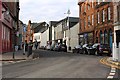
Kempock Street in Gourock
by Garry Cornes geograph for square NS2477 Kempock Street in Gourock is the main street that runs through the town and is... (more)
Tags:
top:Business, Retail, Services
top:City, Town Centre
top:Coastal
place:Gourock
Inverclyde
Pub
top:Roads, Road Transport
subject:Street
|
|
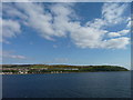
Gourock from the Firth
by James Allan for square NS2176 The west end of Gourock.
Tags:
top:City, Town Centre
subject:Coast
top:Coastal
top:Estuary, Marine
Firth of Clyde
place:Gourock
|
|
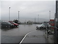
Gourock ferry terminal
by M J Richardson geograph for square NS2176 On wet day - cars from Hunter's Quay leaving the ferry at Mc Inroy's Point.
Tags:
top:Air, Sky, Weather
Argyll and Bute
top:Coastal
subject:Ferry
Ferry Terminal
place:Gourock
Gourock-Dunoon Ferry
top:Roads, Road Transport
top:Village, Rural Settlement
|
|
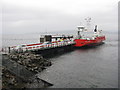
Ferry at McInroy's Point
by M J Richardson geograph for square NS2176 Western Ferries 'Sound of Scarba' from Hunter's Quay unloading at Gourock.
Tags:
Argyll and Bute
top:Business, Retail, Services
top:Coastal
top:Estuary, Marine
subject:Ferry
Ferry Terminal
place:Gourock
Gourock-Dunoon Ferry
top:Roads, Road Transport
top:Village, Rural Settlement
Western Ferries
|
|
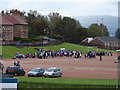
Gourock High School Sports Day
by Thomas Nugent geograph for square NS2376 The final sports day of Gourock High as the name will be lost when the school... (more)
|
|
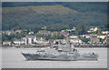
Swedish Navy vessel off Kirn
by Thomas Nugent for square NS1877 Swedish Navy minesweeper M74 HMS Kullen passing the Kirn/Dunoon boundary. Viewed... (more)
Tags:
river:Clyde
top:Defence, Military
place:Dunoon
top:Estuary, Marine
place:Gourock
top:Housing, Dwellings
place:Kirn
top:Suburb, Urban Fringe
top:Uplands
|
|
Hunters Quay from Gourock
by Thomas Nugent for square NS1879 The ferry terminal and two Western Ferries can be seen in this view from Doune Gardens.
Tags:
river:Clyde
top:Docks, Harbours
top:Estuary, Marine
place:Gourock
place:Hunters Quay
place:Kilcreggan
top:Rivers, Streams, Drainage
top:Uplands
top:Village, Rural Settlement
|
|
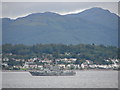
Swedish Navy vessel off Kirn
by Thomas Nugent for square NS1878 Jim Crow rock NS1878 : Jim Crow can be seen just in front of the bow of Swedish Navy... (more)
Tags:
river:Clyde
top:Defence, Military
top:Estuary, Marine
place:Gourock
place:Kirn
top:Rivers, Streams, Drainage
top:Suburb, Urban Fringe
top:Uplands
|
|
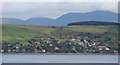
Firth of Clyde and Kilcreggan
by Thomas Nugent for square NS2480 The pier is visible on the right in this view from Turnberry Avenue in Gourock.
Tags:
river:Clyde
top:Docks, Harbours
top:Estuary, Marine
top:Farm, Fishery, Market Gardening
place:Gourock
place:Kilcreggan
top:Rivers, Streams, Drainage
top:Village, Rural Settlement
top:Woodland, Forest
|
|
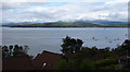
Firth of Clyde and Kilcreggan
by Thomas Nugent for square NS2380 Viewed from Turnberry Avenue in Gourock.
Tags:
river:Clyde
top:Estuary, Marine
top:Farm, Fishery, Market Gardening
place:Gourock
top:Housing, Dwellings
place:Kilcreggan
top:Rivers, Streams, Drainage
top:Village, Rural Settlement
|
|
Firth of Clyde and Kilcreggan
by Thomas Nugent geograph for square NS2276 Viewed from Turnberry Avenue in Gourock.
Tags:
river:Clyde
top:Estuary, Marine
place:Gourock
top:Housing, Dwellings
place:Kilcreggan
top:Rivers, Streams, Drainage
top:Suburb, Urban Fringe
top:Uplands
|

|
Strone and Strone Point
by Thomas Nugent for square NS1980 Viewed from Cowal View in Gourock.
Tags:
river:Clyde
top:Estuary, Marine
place:Gourock
top:Rivers, Streams, Drainage
place:Strone
top:Uplands
top:Village, Rural Settlement
|

|
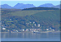
Firth of Clyde and Strone
by Thomas Nugent geograph for square NS2276 Viewed from Cowal View in Gourock.
Tags:
river:Clyde
top:Estuary, Marine
place:Gourock
top:Housing, Dwellings
top:Rivers, Streams, Drainage
place:Strone
top:Suburb, Urban Fringe
top:Uplands
|
|
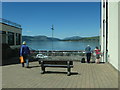
Kilcreggan Bay and pier
by Thomas Nugent for square NS2480 Viewed from Tower Hill in Gourock.
Tags:
top:Docks, Harbours
top:Estuary, Marine
place:Gourock
place:Kilcreggan
top:Rivers, Streams, Drainage
top:Uplands
top:Village, Rural Settlement
|
|
Admiring the view off Kempock Street, Gourock
by Christine Johnstone geograph for square NS2477 Not the car park on the sea shore, but the Firth of Clyde beyond.
Tags:
Bench Seat
top:City, Town Centre
Firth of Clyde
type:Geograph
place:Gourock
subject:Open Area
Viewpoint
|
|
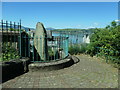
The Kempock stone, Burgh Walk, Gourock
by Christine Johnstone geograph for square NS2477 A 4,000 year old standing stone, now protected by railings. Someone carved their... (more)
Tags:
date:1814
period:Bronze Age
type:Geograph
place:Gourock
top:Historic Sites and Artefacts
Iron Railings
subject:Standing Stone
|
|
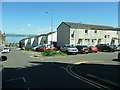
Houses on Burgh Walk and Bath Street, Gourock
by Christine Johnstone geograph for square NS2477 Late 20th century whitewashed terraces.
|
|
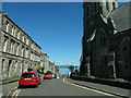
View down Bath Street, Gourock
by Christine Johnstone geograph for square NS2477 Towards the railway station and the Firth of Clyde.
Tags:
road:Bath Street
top:City, Town Centre
Double Yellow Lines
type:Geograph
place:Gourock
subject:Street
|
|
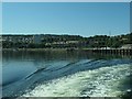
The shore of Gourock Bay, near Darroch Park
by Christine Johnstone geograph for square NS2477 Seen from a ferry departing for Dunoon.
|

|
This way to Dunoon [and Kilcreggan]
by Christine Johnstone geograph for square NS2477 The ferry terminal at Gourock.
|
|
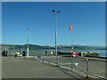
Windsock at the ferry terminal, Gourock
by Christine Johnstone geograph for square NS2477 On the far shore of the Firth of Clyde, the village of Kilcreggan, which is... (more)
|
|
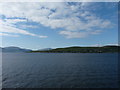
West Bay, Gourock
by James Allan geograph for square NS2377 Seen from a passing ship.
Tags:
top:City, Town Centre
subject:Coast
top:Coastal
top:Estuary, Marine
Firth of Clyde
place:Gourock
|
|
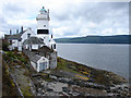
Cloch Lighthouse
by Thomas Nugent geograph for square NS2075 A famous landmark on the Firth of Clyde between Gourock and Inverkip.
Tags:
river:Clyde
top:Docks, Harbours
top:Estuary, Marine
place:Gourock
Lighthouse
top:Rivers, Streams, Drainage
top:Suburb, Urban Fringe
|
|
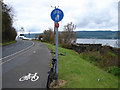
Cloch Lighthouse
by Thomas Nugent geograph for square NS2075 On the A770 Cloch Road between Gourock and Inverkip.
Tags:
top:Estuary, Marine
place:Gourock
Lighthouse
top:Paths
top:Roads, Road Transport
top:Suburb, Urban Fringe
|
|
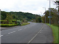
A770 Cloch Road Gourock
by Thomas Nugent geograph for square NS2176 Looking towards the site of the former Gantock Hotel, the Firth of Clyde is just... (more)
|
|
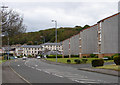
A770 Cloch Road Gourock
by Thomas Nugent geograph for square NS2176 At the west end of the town on the coast road to Inverkip.
|
|
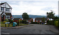
Blair Gardens
by Thomas Nugent geograph for square NS2176 1980s housing off Tantallon Avenue in Gourock.
|

|
Swedish Navy vessel off Gourock
by Thomas Nugent for square NS2277 Minesweeper M74 HMS Kullen is being buzzed by an inflatable gun boat. A short... (more)
Tags:
river:Clyde
top:Defence, Military
top:Estuary, Marine
place:Gourock
top:Rivers, Streams, Drainage
|
|
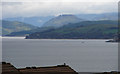
Firth of Clyde and Loch Long
by Thomas Nugent for square NS2276 Viewed over the rooftops from Doune Gardens in Gourock. The large shed at RNAD... (more)
Tags:
river:Clyde
top:Defence, Military
top:Estuary, Marine
place:Gourock
top:Rivers, Streams, Drainage
top:Uplands
|
|
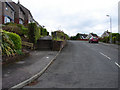
St Andrews Drive
by Thomas Nugent geograph for square NS2276 In Trumpethill, Gourock.
|
|
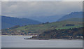
Barons Point and Loch Long
by Thomas Nugent for square NS2281 Barons Point is on the Rosneath Peninsula. Viewed from Cowal View in Gourock.
|
|
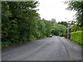
Cowal View
by Thomas Nugent geograph for square NS2276 Heading down the hill past Gourock Golf Club to Trumpethill.
|

|
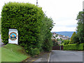
Sign at Gourock Golf Club
by Thomas Nugent for square NS2276 Depicting the tower at Tower Hill in times gone by NS2377 : The tower on Tower Hill.
|
|
Cowal View
by Thomas Nugent geograph for square NS2276 At Gourock Golf Club. Trumpethill is in the distance.
|
|
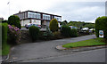
Gourock Golf Club
by Thomas Nugent geograph for square NS2276 The entrance and clubhouse on Cowal View.
|

|
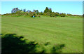
The tower on Tower Hill
by Thomas Nugent geograph for square NS2377 A prominent landmark on the hill above Gourock.
|
|
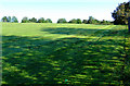
Field at Tower Hill
by Thomas Nugent geograph for square NS2377 Behind Gourock High School.
|
|
Field at Tower Hill
by Thomas Nugent geograph for square NS2377 Just over the fence from Gourock High School.
|

|
Swingpark at Tower Hill
by Thomas Nugent geograph for square NS2377 Between Jacobs Drive and the soon to be closed Gourock High School on Fletcher Avenue.
|

|
Firth of Clyde Townscape : Rear of 6 to 14 (even) Kempock Street, Gourock
by Richard West for square NS2477 Thinks : Casa del Fascio, Como (Giuseppe Terragni, 1934).
Also thinks : slab... (more)
Tags:
Block of Flats
subject:Building
top:City, Town Centre
top:Coastal
type:Cross Grid
place:Gourock
top:Housing, Dwellings
street:Kempock Street
Rear Elevation
|
|
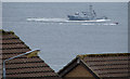
Swedish Navy vessel off Gourock
by Thomas Nugent for square NS2277 Minesweeper M74 HMS Kullen is being buzzed by an inflatable gun boat. A short... (more)
Tags:
river:Clyde
top:Estuary, Marine
place:Gourock
top:Housing, Dwellings
top:Industry
top:Rivers, Streams, Drainage
top:Suburb, Urban Fringe
|

|
Former WWII lookout post
by Thomas Nugent geograph for square NS2076 On Cloch Road, just north of Cloch Lighthouse. An anti-submarine net stretched... (more)
Tags:
river:Clyde
place:Dunoon
top:Estuary, Marine
place:Gourock
top:Historic Sites and Artefacts
place:Kirn
top:Rivers, Streams, Drainage
top:Suburb, Urban Fringe
top:Uplands
|

|
Postbox on Cowal View
by Thomas Nugent for square NS2276 Near Bellisle Place.
|

|
Bellisle Place
by Thomas Nugent geograph for square NS2276 Viewed from Cowal View.
|

|
Cowal View
by Thomas Nugent geograph for square NS2276 With Bellisle Place in the distance.
|

|
Glenbervie Place
by Thomas Nugent geograph for square NS2276 Viewed from Cowal View.
|

|
Sycamore Place
by Thomas Nugent geograph for square NS2376 Off Finnart Crescent.
|
