Public Tags
Other tags: Great Barrow
Showing latest 50 of 52 images tagged with place:Great Barrow tag.
|
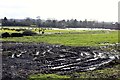
Waterlogged Farmland near Great Barrow
by Jeff Buck geograph for square SJ4668 Waterlogged farmland to the south east of Great Barrow. The effects of months of... (more)
Tags:
place:Barrow
county:Cheshire
country:England
top:Farm, Fishery, Market Gardening
Farmland
place:Great Barrow
Waterlogged
Waterlogged Farmland
Waterlogged Fields
|
|
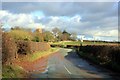
The B5132 (Barrow Lane) approaching Great Barrow
by Jeff Buck geograph for square SJ4668 The tower of St Bartholomew's Church can be seen in the distance.... (more)
Tags:
B Road
road:B5132
place:Barrow
county:Cheshire
country:England
place:Great Barrow
top:Roads, Road Transport
top:Village, Rural Settlement
|

|
Barrow Cricket Club (The Croft), Barrow
by Jeff Buck geograph for square SJ4768 Barrow Cricket Club was founded in 1890.
Barrow CC... (more)
Tags:
place:Barrow
county:Cheshire
Cricket Club
Cricket Field
Cricket Green
Cricket Ground
Cricket Pavilion
country:England
place:Great Barrow
top:Sport, Leisure
top:Village, Rural Settlement
|
|
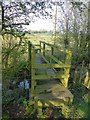
Footbridge over Milton Brook
by Dave Dunford geograph for square SJ4667 Beyond the bridge the public footpath heads north-east across a low-lying boggy... (more)
|
|
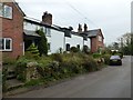
Cottages in Great Barrow
by Dave Dunford geograph for square SJ4768 Cottages in Mill Lane, Great Barrow.
Tags:
subject:Cottages
type:Geograph
place:Great Barrow
top:Housing, Dwellings
top:Village, Rural Settlement
|

|
War memorial and church, Great Barrow
by Dave Dunford geograph for square SJ4668 War memorial in churchyard of St Bartholomew's Church, Great Barrow.
|

|
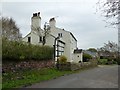
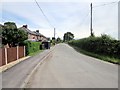
Lane near Great Barrow
by Jeff Buck geograph for square SJ4868 Heading north west towards Great Barrow with Hollowmoor Heath on the right.
|
|
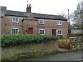
The White House, Great Barrow
by Dave Dunford geograph for square SJ4768 A Grade-II-listed house... (more)
Tags:
type:Geograph
Grade II Listed
place:Great Barrow
subject:House
top:Housing, Dwellings
building material:Timber Frame and Brick
top:Village, Rural Settlement
|
|
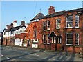
Cottages next to village hall, Great Barrow
by Dave Dunford geograph for square SJ4768 A Grade-II-listed building... (more)
Tags:
type:Geograph
Grade II Listed
place:Great Barrow
subject:House
top:Housing, Dwellings
top:Village, Rural Settlement
|

|
View From Dalegarth
by Peter Trimming geograph for square NY1700 Looking across the Brook House and up the valley, with Great Barrow to the left... (more)
Tags:
place:Boot
county:Cumbria
place:Eskdale Valley
type:Geograph
top:Grassland
place:Great Barrow
top:Uplands
subject:View
top:Village, Rural Settlement
|

|
View From Dalegarth
by Peter Trimming geograph for square NY1700 Looking across the Brook House and up the valley, with Great Barrow to the left... (more)
Tags:
place:Boot
county:Cumbria
place:Eskdale Valley
type:Geograph
place:Great Barrow
top:Uplands
subject:View
top:Village, Rural Settlement
|
|
Former chapel, Great Barrow
by Dave Dunford geograph for square SJ4668 I'm guessing this is the former Methodist Chapel on Barrow Lane mentioned... (more)
|
|
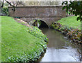
Mill bridge, Great Barrow
by Dave Dunford geograph for square SJ4768 Brick-built bridge carrying Mill Lane over the mill leat near Barrow Mill.
Tags:
subject:Bridge
type:Geograph
place:Great Barrow
former:Mill Leat
top:Rivers, Streams, Drainage
top:Roads, Road Transport
|

|
Stile near Great Barrow
by Dave Dunford geograph for square SJ4768 The start of Barrow FP15, part of the Longster Trail.
Tags:
type:Geograph
place:Great Barrow
top:Paths
subject:Stile
long distance path:The Longster Trail
stile:Wooden Step-Over
|
|
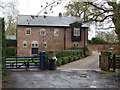
Barrow Mill
by Dave Dunford geograph for square SJ4768 A former watermill at the end of Mill Lane, Great Barrow. A footpath leads... (more)
Tags:
type:Geograph
place:Great Barrow
top:Housing, Dwellings
subject:Mill
top:Village, Rural Settlement
former:Watermill
|

|
Inns at Boot
by Peter Trimming geograph for square NY1700 View towards the village, with the Boot Inn on the left and the Brook House Inn... (more)
Tags:
place:Boot
top:Business, Retail, Services
county:Cumbria
type:Geograph
place:Great Barrow
Inn
subject:View
top:Village, Rural Settlement
|
|
Hollowmoor Heath near Great Barrow
by Jeff Buck geograph for square SJ4869 Irons Lane at Hollowmoor Heath.
|

|
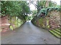
Ferma Lane
by Dave Dunford geograph for square SJ4668 A pleasant walk from Great Barrow down into the Gowy valley.
|
|
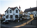
Rock-cut drive in Great Barrow
by Dave Dunford geograph for square SJ4668 A driveway cut into red Cheshire sandstone beside the church gate.
|
|
The White Horse Inn, Great Barrow
by Jeff Buck geograph for square SJ4768 Taken from outside the village shop/PO on Mill Lane.... (more)
|

|
Electricity substation near Great Barrow
by Jeff Buck geograph for square SJ4768 |

|
Lane near Swinfordmill Farm
by Jeff Buck geograph for square SJ4869 |

|
Footpath near Swinfordmill Farm
by Jeff Buck geograph for square SJ4869 |

|
Road junction at Great Barrow
by Jeff Buck geograph for square SJ4768 The junction of Heath Lane and Hollowmoor Heath.
|
|
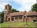
St Bartholomew's Church, Great Barrow
by Jeff Buck geograph for square SJ4668 St Bartholomew's Church has been designated by English Heritage as a Grade... (more)
|
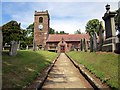
|
St Bartholomew's Church, Great Barrow
by Jeff Buck geograph for square SJ4668 St Bartholomew's Church has been designated by English Heritage as a Grade... (more)
|

|
Ornate brick house in Great Barrow
by Dave Dunford geograph for square SJ4768 Ornate brickwork on rather grand three-storey house on Village Road, dated 1878.... (more)
Tags:
date:1878
type:Geograph
place:Great Barrow
subject:House
top:Housing, Dwellings
top:Village, Rural Settlement
|
|
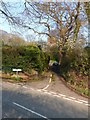
Road to St Bartholomew's
by Dave Dunford geograph for square SJ4668 Sunken lane (partly cut through sandstone bedrock) to St Bartholomew's... (more)
Tags:
road:B5132
subject:Church
type:Geograph
place:Great Barrow
top:Religious Sites
top:Roads, Road Transport
|
|
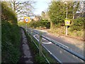
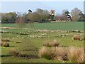
Approaching Great Barrow
by Dave Dunford geograph for square SJ4668 Turning to St Bartholomew's church on the right; note the raised pavement... (more)
Tags:
30mph Speed Limit Sign
road:B5132
type:Geograph
place:Great Barrow
subject:Road
top:Roads, Road Transport
|
|
Great Barrow Church
by Dave Dunford geograph for square SJ4668 From footpath near Milton Brook.
|

|
Ferma Lane
by Dave Dunford geograph for square SJ4668 Attractive path from Great Barrow into the Gowy valley.
|

|
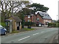
Longster Trail at Great Barrow
by Dave Dunford geograph for square SJ4668 The Longster Trail goes straight on where the track (Ferma Lane) bends right,... (more)
Tags:
type:Geograph
place:Great Barrow
top:Paths
long distance path:The Longster Trail
subject:Track
|
|
Great Barrow Primary School
by Dave Dunford geograph for square SJ4668 At the junction of Ferma Lane with B5132.
Tags:
road:B5132
top:Educational Sites
type:Geograph
place:Great Barrow
Primary School
subject:School
top:Village, Rural Settlement
|
|
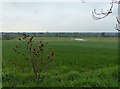
Valley of Milton Brook
by Dave Dunford geograph for square SJ4668 From near the church in Great Barrow.
Tags:
top:Farm, Fishery, Market Gardening
subject:Farmland
type:Geograph
place:Great Barrow
top:Rivers, Streams, Drainage
|

|
Permitted path to Stamford Bridge
by Dave Dunford geograph for square SJ4768 Although it was a bit muddy after recent rain, this delightful hollow-way is... (more)
|

|
Permitted path to Great Barrow
by Dave Dunford geograph for square SJ4768 This delightful permitted path is clearly a route of some antiquity.
|

|
Mill stream off Milton Brook
by Dave Dunford geograph for square SJ4768 From a permitted path between Stamford Bridge and Great Barrow.
|

|
Kissing gate and footbridge on permitted path
by Dave Dunford geograph for square SJ4768 Bridge over a millstream on an excellent permitted path between Stamford Bridge... (more)
Tags:
subject:Bridge
bridge:Footbridge
type:Geograph
place:Great Barrow
gate:Metal Kissing
top:Paths
Permitted Path
top:Rivers, Streams, Drainage
|

|
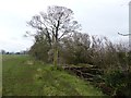
Owl box by Milton Brook
by Dave Dunford geograph for square SJ4767 On a permitted path between Stamford Bridge and Great Barrow.
Tags:
type:Geograph
place:Great Barrow
subject:Nest
Owl Nesting Box
Permitted Path
top:Wild Animals, Plants and Mushrooms
|
|
Permitted path along Milton Brook
by Dave Dunford geograph for square SJ4667 A useful and attractive permitted path runs east along Milton Brook and then... (more)
Tags:
Farm Bridge
type:Geograph
place:Great Barrow
subject:Path
top:Paths
Permitted Path
top:Rivers, Streams, Drainage
|
|
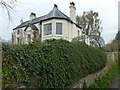
The Old Rectory, Great Barrow
by Dave Dunford geograph for square SJ4768 A Grade-II-listed building, from the adjacent footpath. Listing at... (more)
Tags:
type:Geograph
Grade II Listed
place:Great Barrow
subject:House
top:Housing, Dwellings
former:Rectory
top:Village, Rural Settlement
|
|
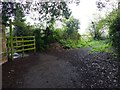
Permitted path to Stamford Bridge
by Dave Dunford geograph for square SJ4768 A useful and attractive route from Great Barrow to Stamford Bridge, this... (more)
|
|
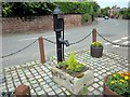
Great Barrow village pump
by Jeff Buck geograph for square SJ4768 |
|
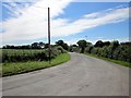
Irons Lane at Hollowmoor Heath
by Jeff Buck geograph for square SJ4869 |
|
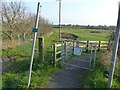
Footpath to Stamford Bridge
by Dave Dunford geograph for square SJ4668 Note the permitted path alongside the road to the right.
|

|
Ferma Lane
by Dave Dunford geograph for square SJ4669 Running along the western edge of Ferma Wood.
Tags:
plant:Blackthorn
type:Geograph
place:Great Barrow
top:Paths
Public Footpath
top:Woodland, Forest
|

|
Ferma Wood
by Dave Dunford for square SJ4669 A community woodland, winner of the Cheshire Countryside Award for 2005. This is... (more)
|

|
Ferma Lane near Ferma Wood
by Dave Dunford geograph for square SJ4669 Shortly before Ferma Wood, Ferma Lane (which up till now has been a broad track)... (more)
|

|
Greysfield
by Dave Dunford geograph for square SJ4668 Large mock-Tudor house, formerly retirement flats, currently (spring 2016) up for let.
|

|
Heath Road near Old Hall Farm
by Jeff Buck geograph for square SJ4868 Old Hall Farm can be seen ahead.
|
