
|
Path to Great Haywood Cliff Quarry
by Rod Grealish
geograph for square SJ9921
The cliffs are formed from an abandoned quarry. The quarry sits near the Colwich... (more)
|

|
Turret of St John the Baptist RC Church, Great Haywood
by Rod Grealish
geograph for square SJ9922
The view is taken from Trent Close. The turret is octagonal in cross-section.... (more)
|

|
Bridge No 109 at start of Staffs and Worcs canal, Haywood Junction
by Rod Grealish
geograph for square SJ9922
Bridge No 109 is the "last" bridge on the Staffordshire and... (more)
|

|
Fingerpost at Haywood Junction, Great Haywood
by Rod Grealish
geograph for square SJ9922
The fingerpost is situated at the north end of bridge 109 of the Staffordshire... (more)
|

|
Great Haywood Cliff Quarry face and caves
by Rod Grealish
geograph for square SJ9921
The former quarry face is about 10 metres high. The caves are on the right.
|

|
Milepost on Main Road, Great Haywood
by Rod Grealish
for square SJ9922
The A51 originally ran through Great Haywood along Main Road. A bypass was... (more)
|

|
George V Wall Letter Box, Trent Lane, Great Haywood
by Rod Grealish
for square SJ9922
This letter box is in the wall of the old Post Office, now a house, at the... (more)
|

|
Bridge 72A over the Trent and Mersey Canal, Great Haywood
by Rod Grealish
geograph for square SJ9922
The bridge was part of a longer bridge which carried the drive from Shugborough... (more)
|

|
Grave ledger of 2nd Earl of Lichfield in St Stephen's churchyard, Great Haywood
by Rod Grealish
for square SJ9922
St Stephens was the family church of the Earls of Lichfield as well as the... (more)
|

|
The Clifford Arms, Great Haywood
by Rod Grealish
geograph for square SJ9922
The pub is named after the Clifford family. They owned the nearby Tixall Hall... (more)
|

|
St John the Baptist RC church, Great Haywood
by Rod Grealish
geograph for square SJ9922
The church was built for the Clifford family as a family chapel at Tixall Hall... (more)
|

|
Burial plot of 3rd Earl of Lichfield in St Stephen's churchyard, Great Haywood
by Rod Grealish
geograph for square SJ9922
St Stephens was the family church of the Earls of Lichfield as well as the... (more)
|

|
View from St Stephen's Churchyard to Congregational Chapel
by Rod Grealish
geograph for square SJ9922
Mount Zion Chapel, Great Haywood, was built in 1845 as a Congregational Chapel.... (more)
|

|
Uncovered polytunnels, full of plants, Great Haywood
by Christine Johnstone
geograph for square SJ9923
On the east bank of the Trent & Mersey Canal. A canalside road gives access... (more)
|

|
Canalside buildings at Great Haywood
by Stephen Craven
geograph for square SJ9922
I did not notice at the time the man taking a photo of me. Snap!
|

|
Canal bridge at Great Haywood
by Stephen Craven
geograph for square SJ9922
The bridge, over the Trent and Mersey canal, carries the ancient bridleway known... (more)
|
|
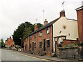
Main Road,Great Haywood
by Stephen Craven
geograph for square SJ9922
A row of terraced houses in the village centre. I had thought the plaque on the... (more)
|

|
Dead Pedunculate oak in Great Haywood
by Rod Grealish
geograph for square SK0021
This tree is entered in the Ancient Tree Inventory run by the Woodland Trust. It... (more)
|

|
Narrowboats on the Trent and Mersey canal, Great Haywood
by Rod Grealish
geograph for square SJ9922
Smoke drifts from the moored narrowboats in the still morning air.
|

|
Narrow boats awaiting hire
by Rod Grealish
geograph for square SJ9922
The narrow boats are moored on the Staffordshire and Worcestershire canal near... (more)
|

|
Three cottages, The Square, Great Haywood
by Rod Grealish
geograph for square SJ9922
These cottages are on The Square which bisects Main Road. The middle cottage is... (more)
|

|
The Old Post Office, Great Haywood
by Rod Grealish
geograph for square SJ9922
This is now a dwelling, the post office having moved elsewhere in the village.... (more)
|

|
Wall near perimeter of St Stephen's Churchyard, Great Haywood
by Rod Grealish
geograph for square SJ9922
The wall stands back a few metres from the churchyard boundary on the right,... (more)
|

|
Trent Lodge, Shugborough Park, Great Haywood
by Rod Grealish
geograph for square SJ9922
An entrance lodge on the eastern edge of Shugborough Park. It sits at the south... (more)
|

|
The confluence of the River Sow and the River Trent
by Rod Grealish
geograph for square SJ9922
The picture was taken from the Essex Bridge, Great Haywood. The River Sow is on... (more)
|

|
St Stephen's Church, Great Haywood
by Rod Grealish
geograph for square SJ9922
St Stephen's Church was designed by Thomas Trubshaw (1802-1842), an... (more)
|

|
Former toll office, Great Haywood
by Christine Johnstone
geograph for square SJ9922
At the northern end of the Staffs & Worcs Canal, close to the junction with... (more)
|

|
Entrance to Great Haywood marina
by Christine Johnstone
geograph for square SJ9923
The marina opened in 2007 and can hold 200 boats.
|

|
A field of buttercups in Shugborough Park
by Graham Hogg
geograph for square SJ9821
Covering the hill below the Arch of Hadrian
|

|
Buttercups and trees in Shugborough Park
by Graham Hogg
geograph for square SJ9822
The field leads to the Dark Lantern, a folly that can be glimpsed through a gap... (more)
|

|
The River Sow on Shugborough Estate
by Graham Hogg
geograph for square SJ9922
A branch of the river has been widened here to provide a water feature next to... (more)
|

|
Chinese House and Red Bridge on the Shugborough Estate
by Graham Hogg
geograph for square SJ9922
The bridge carries a footpath over a branch of the River Sow
|

|
The Trent & Mersey Canal at Great Haywood
by Graham Hogg
geograph for square SJ9922
|

|
The Clifford Arms, Great Haywood
by Stephen Craven
geograph for square SJ9922
A pub on the corner of Trent Lane. In front of it is a bus stop on route 841... (more)
|

|
Great Haywood Post Office
by Stephen Craven
geograph for square SJ9922
A village post office in a period house (early 19th century) with Georgian... (more)
|

|
Pendolino at Great Haywood
by Stephen Craven
geograph for square SJ9922
|

|
Crossing the Essex Bridge
by Stephen Craven
geograph for square SJ9922
The bridge over the River Trent at its confluence with the River Sow at Great... (more)
|

|
West side of the Essex Bridge
by Stephen Craven
geograph for square SJ9922
The bridge over the River Trent at its confluence with the River Sow at Great... (more)
|

|
South end of the Essex Bridge
by Stephen Craven
geograph for square SJ9922
The bridge over the River Trent at its confluence with the River Soww at Great... (more)
|

|
Shugborough Park
by Jeff Buck
geograph for square SJ9822
Shugborough Park to the west of the hall.
|

|
Footbridge over the River Sow
by Jeff Buck
geograph for square SJ9822
Footbridge over the River Sow at Shugborough Park.
|

|
The River Sow at Shugborough Park
by Jeff Buck
geograph for square SJ9822
The River Sow, a tributary of the River Trent as it flows through Shugborough Park.
|

|
Bridge 73 on the Trent and Mersey Canal
by Jeff Buck
geograph for square SJ9922
Bridge 73 carries the Staffordshire Way from the towpath through the Shugborough Estate.
|

|
The River Trent seen from Essex Bridge
by Jeff Buck
geograph for square SJ9922
Looking west along the River Trent from Essex Bridge.
|

|
Essex Bridge, Staffordshire
by Jeff Buck
geograph for square SJ9922
Essex Bridge spanning the River Trent is a Grade I listed packhorse bridge.... (more)
|

|
Essex Bridge, Staffordshire
by Jeff Buck
geograph for square SJ9922
Essex Bridge spanning the River Trent is a Grade I listed packhorse bridge.... (more)
|

|
Essex Bridge, Staffordshire
by Jeff Buck
geograph for square SJ9922
Essex Bridge spanning the River Trent is a Grade I listed packhorse bridge.... (more)
|

|
Essex Bridge, Staffordshire
by Jeff Buck
geograph for square SJ9922
Essex Bridge spanning the River Trent is a Grade I listed packhorse bridge.... (more)
|

|
Essex Bridge over the River Trent
by Graham Hogg
geograph for square SJ9922
A grade I listed packhorse bridge, said to be the longest remaining packhorse... (more)
|

|
Approach to Shugborough Hall
by Graham Hogg
geograph for square SJ9922
|

