Geograph - photograph every grid square
About tags on Geograph
Tags
Geographical Context
Subjects
Types
Other Prefixes
Public Tags
Related Tags
|
Coverage Map
Prefix:
place
Tag:
Howdon
Showing images tagged with
place:
Howdon
tag.
View all tagged images
-
In Browser
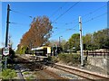
Howdon Station
by
Adrian Taylor
geograph for square
NZ3266
The Tyne and Wear Metro platforms at Howdon Station are staggered either side of... (
more
)
Tags:
80kph Speed Limit Sign
top:
City, Town Centre
type:
Geograph
place:
Howdon
subject:
Metro
Metro Line
Metro Station
top:
Railways
Station
Tyne and Wear Metro
railway:
Tyne and Wear Metro
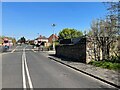
Howdon Lane
by
Adrian Taylor
geograph for square
NZ3266
Howdon Lane near Howdon Station and the level crossing over the Tyne and Wear... (
more
)
Tags:
Bench Mark
Benchmark
top:
City, Town Centre
Cut Bench Mark
Cut Benchmark
Double White Lines
type:
Geograph
place:
Howdon
Level Crossing
Ordnance Survey
top:
Railways
top:
Roads, Road Transport
subject:
Street
Tyne and Wear Metro
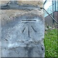
Benchmark, Howdon Lane, Goods Yard Wall
by
Adrian Taylor
for square
NZ3266
Detail of the Ordnance Survey cut benchmark on the corner of the former railway... (
more
)
Tags:
Bench Mark
subject:
Benchmark
type:
Close Look
Cut Bench Mark
Cut Benchmark
top:
Historic Sites and Artefacts
place:
Howdon
Ordnance Survey
Ordnance Survey Bench Mark
Ordnance Survey Benchmark
Tyne and Wear
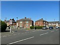
Junction of Hazelwood Terrace and Howdon Lane
by
Adrian Taylor
geograph for square
NZ3267
Tags:
Car Parked on Pavement
Cars Parked on Pavement
top:
City, Town Centre
type:
Geograph
Houses
top:
Housing, Dwellings
place:
Howdon
North Tyneside
top:
Roads, Road Transport
subject:
Street
Street Junction
Tyne and Wear
Weight Limit 7.5 Tonnes Except for Access Sign
Weight Limit 7.5 Tonnes Sign
Weight Limit Sign
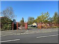
Howdon Children's Centre entrance gates
by
Adrian Taylor
geograph for square
NZ3267
The Children’s Centre provides help and advice on child and family health,... (
more
)
Tags:
top:
Boundary, Barrier
Children & Families Centre
Childrens Centre
top:
City, Town Centre
Gates and Railings
subject:
Gateway
type:
Geograph
place:
Howdon
North Tyneside
Tyne and Wear
Allotment access road
by
Adrian Taylor
geograph for square
NZ4441
This small road provides access to some of the allotments behind First Street.... (
more
)
Tags:
Access Road
subject:
Allotment
Allotment Entrance
Allotments Entrance
Allotments Perimeter Fence
top:
Boundary, Barrier
County Durham
type:
Geograph
Horden
place:
Howdon
fence:
Metal Palisade
Metal Palisade Fence
Razor Wire
top:
Roads, Road Transport
top:
Suburb, Urban Fringe
View more in the Image Search
or
in Browser
View images matching 'Howdon' anywhere
in
the tags
Don't click these:
PotMel 1
PotMel 2
☰
Home
View
Search
Marked Images
Maps
Browser
Explore
Showcase
New Images
Collections
Interact
Games
Discussions
Blog
Contributors
Submit
Statistics
Leaderboards
General
FAQ
Help Pages
Sitemap
Contact Us
Support Us
sponsored by
🔍︎
What to search:
Photos
Enter keywords or a location/postcode to search nearby images
Enter a Grid Reference
Placenames
Collections
Website Pages
Everything
Others:
Advanced Search
|
Image Browser
Or:
Coverage Map
|
Searchable Map
You are not logged in
|
login
|
register