|
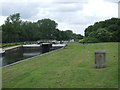
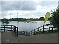
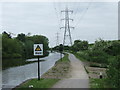
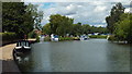
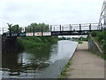
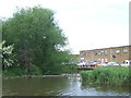
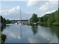
River Lee Navigation at Waltham Abbey
by Malc McDonald
geograph for square TL3700
A lock on the River Lee Navigation in the Lee Valley Country Park at Waltham... (more)
|
|
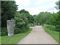
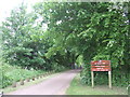
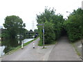
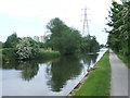
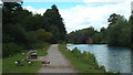
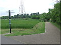
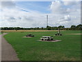
Lee Valley Country Park, near Waltham Abbey
by Malc McDonald
geograph for square TL3700
This path through the Lee Valley Country Park is shared by walkers and cyclists.
|
|
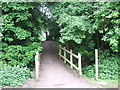
Lee valley Country Park, near Waltham Abbey
by Malc McDonald
geograph for square TL3702
|
|
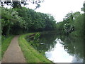
Lee Valley Country Park, near Waltham Abbey
by Malc McDonald
geograph for square TL3702
|
|
Lee Valley Country Park, near Waltham Abbey
by Malc McDonald
geograph for square TL3703
|
|
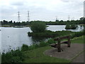
Lea Valley Park at Nazeing Meads
by Malc McDonald
geograph for square TL3807
|
|
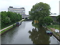
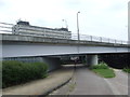
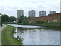
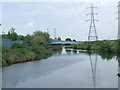
River Lee Navigation at Edmonton
by Malc McDonald
geograph for square TQ3592
London's North Circular Road crosses the River Lee Navigation at the bridge... (more)
|
|
River Lee Navigation at Edmonton
by Malc McDonald
geograph for square TQ3591
A view north along the River Lee Navigation in North London. A number of... (more)
|
|
Paths next to the River Lee Navigation, Edmonton
by Malc McDonald
geograph for square TQ3592
The towpath alongside the waterway is shared by cyclists and pedestrians. The... (more)
|
|
Under the North Circular, Edmonton
by Malc McDonald
geograph for square TQ3592
This bridge carries london's North Circular Road across the River Lee... (more)
|
|
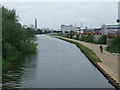
River Lee Navigation near Edmonton
by Malc McDonald
geograph for square TQ3693
The River Lee Navigation, looking south from Pickett's Lock.
|
|
Pickett's Lock, near Edmonton
by Malc McDonald
geograph for square TQ3693
Pickett's Lock is on the River Lee Navigation, near Edmonton in North... (more)
|
|
River Lee Navigation near Edmonton
by Malc McDonald
geograph for square TQ3693
The towpath is a shared path for walking and cycling. It forms part of National... (more)
|
|
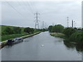
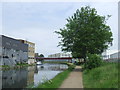
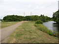
River Lee Navigation near Enfield
by Malc McDonald
geograph for square TQ3694
The River Lee Navigation in outer North London.
The towpath is shared by... (more)
|
|
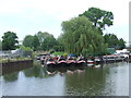
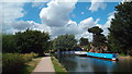
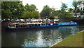
Narrowboats on the River Lee Navigation, Ponders End
by Malc McDonald
geograph for square TQ3695
Narrowboats moored on the River Lee Navigation.
|
|
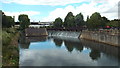
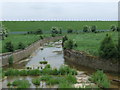
Weir on the River Lee Navigation near Ware
by Malc McDonald
geograph for square TL3514
|
|
River Lee Navigation at St. Margaret's
by Malc McDonald
geograph for square TL3811
|
|
River Lee Navigation at St. Margaret's
by Malc McDonald
geograph for square TL3811
|
|
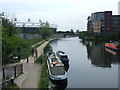
River Lee Navigation at Hackney Wick
by Malc McDonald
geograph for square TQ3784
In the background to the left is the stadium built for the London 2012 Olympic... (more)
|
|
River Lee Navigation at Hackney Wick
by Malc McDonald
geograph for square TQ3784
The path, which is shared by cyclists and walkers, is part of National Cycle... (more)
|
|
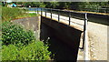
Bridge over the River Lee Navigation, Edmonton
by Malc McDonald
geograph for square TQ3591
The towpath and bridge both form part of National Cycle Network route 1.
|
|
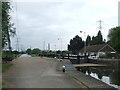
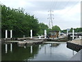
Ponders End Lock
by Malc McDonald
geograph for square TQ3695
Ponders End Lock, on the River Lee Navigation in outer North London.
|
|
Overflow channel at Ponders End
by Malc McDonald
geograph for square TQ3695
This overflow channel has been built alongside the River Lee Navigation (itself... (more)
|
|
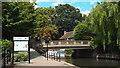
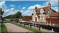
Lee Valley Country Park
by Stephen Craven
geograph for square TL3700
One of the entrances to this extensive area of open land in the Lee Valley, this... (more)
|
|
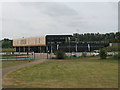
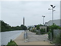
Olympic aquatics centre, Lee Valley
by Stephen Craven
geograph for square TL3700
This building is the "main stand" referred to in the... (more)
|
|
River Lee Navigation near Ware
by Malc McDonald
geograph for square TL3614
|
|
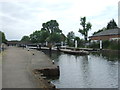
Stanstead Lock, River Lee Navigation
by Malc McDonald
geograph for square TL3812
The towpath alongside the River Lee Navigation is shared by walkers and... (more)
|
|
River Lee Navigation, Edmonton
by Malc McDonald
geograph for square TQ3591
A view south along the River Lee Navigation in North London. The towpath is... (more)
|
|
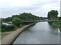
River Lee Navigation at Ponders End
by Malc McDonald
geograph for square TQ3695
The channel ahead branches off the River Lee Navigation (which flows out to the... (more)
|
|
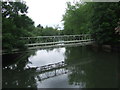
Aqueduct, River Lee Navigation
by Malc McDonald
geograph for square TL3704
This aqueduct carries the River Lee Navigation, a man-made waterway, over a... (more)
|
|
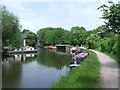
Stonebridge Locks, near Tottenham
by Malc McDonald
geograph for square TQ3590
Stonebridge Locks on the River Lee Navigation in North London.
|
|
River Lee Navigation at Ponders End
by Malc McDonald
geograph for square TQ3695
The River Lee Navigation at Ponders End, in North London's outer suburbs.... (more)
|
|
River Lee Navigation at Brimsdown
by Malc McDonald
geograph for square TQ3696
|
|
Geese on the towpath, near Ware
by Malc McDonald
geograph for square TL3712
Geese at a picnic site alongside the River Lee Navigation.
|
|
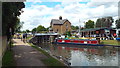
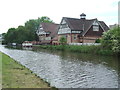
Navigation Inn, Ponders End
by Malc McDonald
geograph for square TQ3695
The Navigation Inn on the bank of the River Lee Navigation, at Ponders End in... (more)
|
|
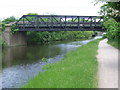
Bridge over the River Lee Navigation at Enfield Lock
by Malc McDonald
geograph for square TQ3798
This bridge used to carry a railway across the River Lee Navigation. It is... (more)
|
|
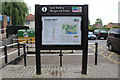
Information Board, Lee Valley Regional Park
by Christine Matthews
for square TL3808
Close to the footpath along the River Lee Navigation towards Broxbourne.
|
|
Hardmead Lock, River Lee Navigation near Ware
by Malc McDonald
geograph for square TL3713
|
|
Towpath Road, Edmonton
by Malc McDonald
geograph for square TQ3591
Beyond the metal gate is Towpath Road. This road provides access to a number of... (more)
|
|
River Lee Navigation at Enfield Island Village
by Malc McDonald
geograph for square TQ3798
The towpath is shared by walkers and cyclists. It is part of National Cycle... (more)
|
|
River Lea at St. Margaret's
by Malc McDonald
geograph for square TL3811
The River Lee Navigation (to the left) and the River Lea (or Lee, to the right)... (more)
|
|
Lee Valley Country Park, near Waltham Abbey
by Malc McDonald
geograph for square TL3701
The small blue signs on the signpost indicate the route of National Cycle... (more)
|
|
Path in the Lee Valley Park near Waltham Abbey
by Malc McDonald
geograph for square TL3703
The blue marker on the wooden post indicates the route of National Cycle Network... (more)
|
|
River Lee Navigation near Broxbourne
by Malc McDonald
geograph for square TL3706
The waterway forms the border between the counties of Essex (on this bank) and... (more)
|
|
Broad Mead Picnic Area Tottenham Marshes Lee Valley
by PAUL FARMER
geograph for square TQ3590
|
|
River Lee Navigation near Hackney Wick
by Malc McDonald
geograph for square TQ3685
The towpath is shared by walkers and cyclists. It forms part of National Cycle... (more)
|
|
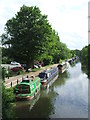
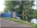
River Lee Navigation near Hoddesdon
by Malc McDonald
geograph for square TL3808
Narrowboats moored on the bank of the River Lee Navigation in Hertfordshire.... (more)
|
|
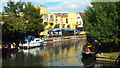
River Lea, Ware
by Malc McDonald
geograph for square TL3514
The River Lea (or Lee) passing through the Hertfordshire town of Ware.
|
|
Water Bus Stop on the River Lea, Ware
by Malc McDonald
geograph for square TL3514
A "bus stop" for boats on the River Lea (or Lee) at Ware.
|
|
Clearwater Canal Boat on Lee Navigation
by PAUL FARMER
geograph for square TQ3590
|