|
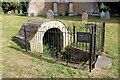
St Michael's Well, Longstanton
by Martin Tester
for square TL4065
The church of St Michael's is Grade II* listed... (more)
|
|
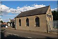
Old railway station, Longstanton (2)
by Martin Tester
geograph for square TL3968
Longstanton station saw its last passengers in October 1970 with goods trains... (more)
|
|
Old railway station, Longstanton (1)
by Martin Tester
geograph for square TL3968
Longstanton station saw its last passengers in October 1970 with goods trains... (more)
|
|
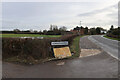
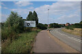
Entering Longstanton on B1050
by Hugh Venables
geograph for square TL3968
With the coming of the new town of Northstowe, a rearrangement of parish... (more)
|
|
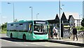
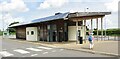
The Longstanton Guided Busway Park & Ride stop
by Martin Tester
geograph for square TL4067
Seen as a bus bound for St Ives arrives. The name is perhaps a bit misleading -... (more)
|
|
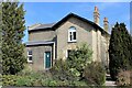
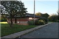
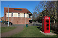
Longstanton GP surgery
by Hugh Venables
geograph for square TL4066
Part of Willingham Medical Practice. Serving Longstanton and Northstowe.
|
|
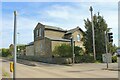
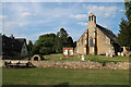
St Michael's Church, Longstanton
by Hugh Venables
geograph for square TL4065
On older maps Longstanton is split into Long Stanton All Saints and Long Stanton... (more)
|
|
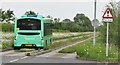
Longstanton - B is for Bus
by Colin Smith
geograph for square TL4067
Stagecoach Route B bus going from Cambridge to Huntingdon stops at Longstanton... (more)
|
|
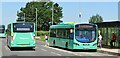
Longstanton - From A to B
by Colin Smith
geograph for square TL4067
Stagecoach buses on Routes A and B pass each other at Longstanton on the... (more)
|
|
Longstanton - Cambridgeshire Guided Busway
by Colin Smith
geograph for square TL4067
The northern section of the Busway follows the old course of the Cambridge to... (more)
|
|
Longstanton - Cambridgeshire Guided Busway
by Colin Smith
geograph for square TL4067
The northern section of the Busway follows the old course of the Cambridge to... (more)
|
|
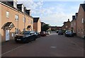
Fews Lane, Longstanton
by Hugh Venables
geograph for square TL3967
Formerly on the edge of Longstanton, now surrounded by the large expansion of the village.
|
|
Collingwood Drive, Longstanton
by Hugh Venables
geograph for square TL3967
Driving is OK in Longstanton, it's the parking that's the problem.
|
|
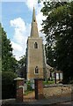
St Michael's Church, Longstanton
by Martin Tester
geograph for square TL4065
A remarkable Grade II* listed thatched church, mostly dating from the early... (more)
|
|
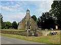
All Saints Church, Longstanton
by Martin Tester
geograph for square TL3966
A Grade I listed building, mostly mid-late C14th, see:... (more)
|
|
Magdalene College Cottage, St Michael's Lane, Longstanton
by Martin Tester
geograph for square TL4065
A Grade II listed building dating back to the late C17th, see... (more)
|
|
Longstanton Spice Museum
by Hugh Venables
for square TL3967
An Alan Partridge joke made real, with permission from Steve Coogan. The... (more)
|
|
Longstanton Spice Museum and Co-op
by Hugh Venables
geograph for square TL3967
An Alan Partridge joke made real, with permission from Steve Coogan. The... (more)
|
|
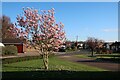
Longstanton - Park & Ride
by Colin Smith
geograph for square TL4067
Parking facility for travellers on the Cambridgeshire Guided Busway. This... (more)
|
|
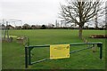
Closed play area, Longstanton
by Hugh Venables
geograph for square TL4066
Along with so many other places, closed to control the spread of the coronavirus.
|
|
Closed play area, Longstanton
by Hugh Venables
geograph for square TL3966
Along with so many other places, closed to control the spread of the coronavirus.
|
|
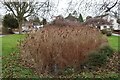
Reedy pond, Longstanton
by Hugh Venables
geograph for square TL3967
|
|
Sheepwash Way, Longstanton
by Hugh Venables
geograph for square TL3967
|
|
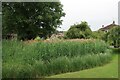
Reedy pond, Longstanton
by Hugh Venables
geograph for square TL3967
|
|
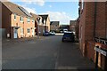
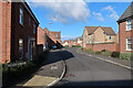
Mitchcroft Road, Longstanton
by Hugh Venables
geograph for square TL3967
|
|
Longstanton Recreation Ground
by Hugh Venables
geograph for square TL3966
|
|
Prentice Close, Longstanton
by Hugh Venables
geograph for square TL3966
|
|
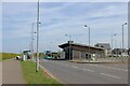
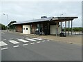
Waiting room and information centre, Longstanton Park and Ride
by David Smith
geograph for square TL4067
|
|
New Marque, Longstanton
by Hugh Venables
geograph for square TL3966
Car dealership selling specialist cars.
|
|
Nelson Crescent, Longstanton
by Hugh Venables
geograph for square TL3967
|
|
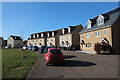
Open area in the new part of Longstanton
by Hugh Venables
geograph for square TL3967
|
|
Open area in the new part of Longstanton
by Hugh Venables
geograph for square TL3967
|
|
Hatton House, Longstanton
by Hugh Venables
geograph for square TL3967
|
|
Edge of Longstanton
by Hugh Venables
geograph for square TL3967
|
|
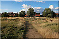
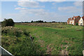
Open ground on the edge of Longstanton
by Hugh Venables
geograph for square TL3967
Between the recent houses and the bypass.
|
|
Mitchcroft Road, Longstanton
by Hugh Venables
geograph for square TL3967
|
|
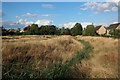
Open ground on the edge of Longstanton
by Hugh Venables
geograph for square TL3967
|
|
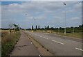
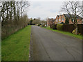
Home Farm Road into Longstanton
by Hugh Venables
geograph for square TL3966
|
|
Hattons Road junction
by Hugh Venables
geograph for square TL3966
Two routes into Longstanton.
|
|
Lofthouse Way, Longstanton
by Hugh Venables
geograph for square TL3967
|
|
Lofthouse Way, Longstanton
by Hugh Venables
geograph for square TL3967
Towards the end of the significant expansion of the village.
|
|
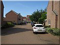
Linden compound, Longstanton
by Hugh Venables
geograph for square TL3967
One of many housebuilders on site for the significant expansion of the village.
|
|
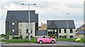
David Wilson Homes sales office
by Hugh Venables
geograph for square TL3967
Part of the large expansion of Longstanton.
|
|
Kides Crescent, Longstanton
by Hugh Venables
geograph for square TL3967
Towards the end of the significant expansion of the village.
|
|
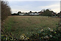
Field off Mills Lane, Longstanton
by Hugh Venables
geograph for square TL4066
|
|
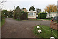
Toad Acres park home estate, Longstanton
by Hugh Venables
geograph for square TL4066
|
|
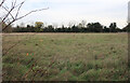
Field off Mills Lane, Longstanton
by Hugh Venables
geograph for square TL4066
|
|
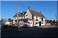
Black Bull, Longstanton
by Hugh Venables
geograph for square TL3966
|
|
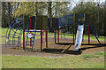
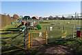
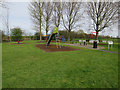
Play area, Longstanton
by Hugh Venables
geograph for square TL4066
|
|
Thatchers Wood, Longstanton
by Hugh Venables
geograph for square TL3966
|