
|
Largo Arts Week notice
by Bill Kasman
for square NO4102
This notice was on a garden shed in Main Street. Largo's first Arts Week is... (more)
|

|
Old river ford, Lower Largo
by Bill Kasman
geograph for square NO4102
This ramp, leading down to the Keil Burn near the bottom of Drummochy Road, was... (more)
|

|
Old river ford, Lower Largo
by Bill Kasman
geograph for square NO4102
This ramp (centre of the image) leading down to the Keil Burn near the bottom of... (more)
|

|
Lower Largo pier
by Bill Kasman
geograph for square NO4102
Lower Largo pier is crumbling in places and becoming dangerous. A fence is in... (more)
|

|
The Serpentine Walk, Lower Largo
by Bill Kasman
geograph for square NO4202
From where the Serpentine Walk leaves Lower Largo (to the right) the road ahead... (more)
|

|
Largo Baptist Church
by Bill Kasman
for square NO4202
Seen here from the bottom of Durham Wynd. There have been Baptists worshipping... (more)
|

|
Lower Largo from South Feus, Upper Largo
by Bill Kasman
geograph for square NO4203
Much of Lower Largo can't be seen but the partially-built housing... (more)
|

|
Steps from Burnbrae Terrace, Lower Largo
by Bill Kasman
geograph for square NO4102
These steps offer pedestrian access to/from Lower Largo. Woodlands Road, Lundin... (more)
|

|
View across Lower Largo harbour
by Bill Kasman
geograph for square NO4102
The mouth of the Keil Burn serves as Lower Largo's harbour. The grassy area... (more)
|

|
Station Park, Lower Largo
by Bill Kasman
geograph for square NO4102
Station Park is on the left. Harbour Wynd runs downhill alongside the wall on... (more)
|

|
Main Street, Lower Largo
by Bill Kasman
for square NO4202
Durham Wynd is the turning to the left. It leads to the A915. The turning to the... (more)
|
|
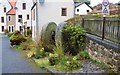
Millstones in Lower Largo
by Bill Kasman
geograph for square NO4102
These millstones in Seaton Place have an interesting history. In the early 1950s... (more)
|

|
Largo Burn, Lower Largo
by Bill Kasman
for square NO4202
|

|
Station Wynd, Lower Largo
by Bill Kasman
geograph for square NO4102
|

|
The Serpentine Walk, Lower Largo
by Bill Kasman
geograph for square NO4202
Here, the Serpentine Walk crosses a bridge over the Largo Burn. A few metres... (more)
|

|
Seatoun Place, Lower Largo
by Bill Kasman
geograph for square NO4102
These houses stand on a location which has seen multiple commercial and... (more)
|

|
Beach access, Lower Largo
by Bill Kasman
geograph for square NO4102
Off Main Street there are several places which allow public access to the beach.... (more)
|

|
Railway Viaduct, Lower Largo
by Bill Kasman
geograph for square NO4102
This long-disused railway viaduct used to carry the Fife Coast Railway. It spans... (more)
|

|
View across Lower Largo harbour
by Bill Kasman
geograph for square NO4102
The mouth of the Keil Burn serves as Lower Largo's harbour.
See Lower... (more)
|

|
Durham Wynd, Lower Largo
by Bill Kasman
geograph for square NO4103
From the A915 in Lundin Links, Durham Wynd is the turning to the right. The new... (more)
|

|
Station Park, Lower Largo
by Bill Kasman
geograph for square NO4102
To the right Station Park continues to meet Harbour Wynd. To the left (also... (more)
|

|
Station Park, Lower Largo
by Bill Kasman
geograph for square NO4102
The footpath on the left leads behind the camera down to a rough car park which... (more)
|

|
Mysterious white footprint!
by Bill Kasman
geograph for square NO4202
White footprints like this one are a feature of Lower Largo. There are several... (more)
|

|
Mysterious white footprint!
by Bill Kasman
geograph for square NO4202
White footprints like this one are a feature of Lower Largo. There are several... (more)
|

|
Harbour Wynd, Lower Largo
by Bill Kasman
geograph for square NO4103
Off the A915 in Lundin Links this turning to the right is Harbour Wynd which... (more)
|

|
Keilburn, Lower Largo
by Bill Kasman
for square NO4103
One of several cul-de-sacs off the no-through-road of Keilburn. The hill is... (more)
|

|
Solar Panels
by Bill Kasman
geograph for square NO4102
These two properties in The Roundel, Lower Largo, have had solar panels fitted... (more)
|

|
The Serpentine Walk, Lower Largo
by Bill Kasman
geograph for square NO4202
The Serpentine Walk approaches a bridge over the Largo Burn. The bridge... (more)
|

|
The Serpentine Walk, Lower Largo
by Bill Kasman
geograph for square NO4202
The Serpentine Walk crosses the Largo Burn by an almost unnoticeable bridge!... (more)
|

|
The Serpentine Walk, Lower Largo
by Bill Kasman
geograph for square NO4202
The Serpentine Walk enters Lower Largo at the most easterly of its two branches.... (more)
|

|
Station Wynd, Lower Largo
by Bill Kasman
geograph for square NO4102
A few yards after leaving Main Street the footpath of Station Wynd turns left to... (more)
|

|
Fife Coastal Path, Lower Largo
by Bill Kasman
for square NO4202
This notice is at the side of the Fife Coastal Path as it leaves Lower Largo.... (more)
|

|
Main Street, Lower Largo
by Bill Kasman
for square NO4202
Looking towards the junction with Durham Wynd. The white building on the right... (more)
|

|
Water treatment facility, Lower Largo
by Bill Kasman
for square NO4202
Between Main Street and the beach, opposite Temple car park, this is part of... (more)
|

|
Memorial plaque, Lower Largo
by Bill Kasman
for square NO4202
Not a memorial plaque as such but this metal plate inset into the road verge... (more)
|

|
Lower Largo beach
by Bill Kasman
geograph for square NO4202
Lower Largo beach is mainly shingle with sandy stretches here and there.
See... (more)
|

|
Lower Largo beach
by Bill Kasman
geograph for square NO4102
Lower Largo beach is predominantly shingle. The steps provide access from a... (more)
|

|
Rough car park, Lower Largo
by Bill Kasman
geograph for square NO4102
This rough car park is the site of the former Lower Largo railway station.
See... (more)
|

|
Rough car park, Lower Largo
by Bill Kasman
geograph for square NO4102
This rough car park was the site of the former Lower Largo Railway Station. It... (more)
|

|
Sign for private house
by Bill Kasman
for square NO4102
'Belmont House' (to the right) is a recently-built property in Lower... (more)
|

|
Station Park, Lower Largo
by Bill Kasman
geograph for square NO4102
This part of Station Park leads to a rough car park which was previously the... (more)
|

|
Road junction, Lower Largo
by Bill Kasman
geograph for square NO4102
Harbour Wynd runs downhill to the right towards the Crusoe Hotel. The turning to... (more)
|

|
Track to Drum Park, Lower Largo
by Bill Kasman
geograph for square NO4102
As Drummochy Road starts downhill from Lundin Links towards Lower Largo (left) a... (more)
|

|
The Serpentine Walk, Lower Largo
by Bill Kasman
for square NO4202
This information board is located at the southern end of the most easterly of... (more)
|

|
The Serpentine Walk, Lower Largo
by Bill Kasman
geograph for square NO4202
The Serpentine Walk leaves Lower Largo. This is the most easterly of the two... (more)
|

|
The Serpentine Walk, Lower Largo
by Bill Kasman
geograph for square NO4202
The Serpentine Walk approaches Lower Largo. This is the most easterly of two... (more)
|
|
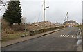
Demolition site, Lower Largo
by Bill Kasman
geograph for square NO4102
A few hundred metres up Harbour Wynd from the Crusoe Hotel this pile of rubble... (more)
|
|
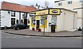
Corner shop, Lower Largo
by Bill Kasman
geograph for square NO4102
This small general store (previously a cafe) is situated at the bottom of... (more)
|

|
Road junction, Lower Largo
by Bill Kasman
geograph for square NO4102
This is the junction of Harbour Wynd (right) and Drummochy Road, which lies... (more)
|

|
The Serpentine Walk
by Bill Kasman
geograph for square NO4203
Seen from the A915 this is the Upper Largo end of the Serpentine Walk, an old... (more)
|
