
|
Market Place, Market Weighton
by Pauline E
geograph for square SE8741
|

|
North-east side of the market place, Market Weighton
by Christine Johnstone
geograph for square SE8741
A chapel, a pub and what looks like a house.
|

|
New bridge over Weighton Beck
by Christine Johnstone
geograph for square SE8741
Part of the infrastructure for a new housing estate between the centre of Market... (more)
|

|
Tanks at Market Weighton waste water treatment works
by Christine Johnstone
geograph for square SE8640
On the south bank of Weighton Beck. Built since 1950.
|

|
A glimpse of the church, Market Weighton
by Pauline E
geograph for square SE8741
All Saints is tucked away behind the Market Place.
|

|
York Road, Market Weighton
by Pauline E
geograph for square SE8741
A market town in the East Riding of Yorkshire.
|
|
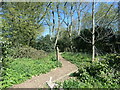
Wildlife area, off Londesborough Road
by Christine Johnstone
geograph for square SE8742
A disused graveyard on the north side of Market Weighton has been turned into a... (more)
|

|
Carving of Britain's tallest ever man
by Pauline E
for square SE8741
William Bradley was born in Market Weighton in 1787 and grew to 7 feet 9 inches... (more)
|

|
Housing, Market Weighton
by Pauline E
geograph for square SE8741
The Archway, a short road behind the church.
|
|
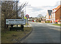
the heart of east yorkshire
by Pauline E
geograph for square SE8841
So reads the sign - would have preferred upper case where required. Sancton Road... (more)
|

|
Lane heading north to Market Weighton's High Street
by Christine Johnstone
geograph for square SE8741
Perhaps an alley, but it looks as if you can drive down it.
|

|
Play area south of the High Street, Market Weighton
by Christine Johnstone
geograph for square SE8741
Created as a war memorial.
|

|
Construction site, off Hawling Road
by Christine Johnstone
geograph for square SE8741
New houses are filling the gap between Market Weighton and its by-pass.
|

|
New houses off Hawling Road
by Christine Johnstone
geograph for square SE8741
Houses filling the gap between Market Weighton and its by-pass.
|

|
Construction site, off Holme Road
by Christine Johnstone
geograph for square SE8741
Houses filling the gap between Market Weighton and its by-pass.
|

|
Footpath signpost on the Hudson Way
by Christine Johnstone
geograph for square SE8842
The public footpath crosses the former Market Weighton - Driffield line near... (more)
|

|
New housing along The Archway, Market Weighton
by Christine Johnstone
geograph for square SE8741
Just behind the High Street, on the east side.
|

|
Church Lane, Market Weighton
by Christine Johnstone
geograph for square SE8741
Heading north from the High Street, along the east side of the churchyard.
|

|
Weir on Weighton Beck
by Christine Johnstone
geograph for square SE8741
Just east of the by-pass. Tiny, but mapped.
|

|
Small bridge over Weighton Beck
by Christine Johnstone
geograph for square SE8741
Underneath all the ivy. Shown on the earliest large-scale OS map, surveyed in 1850.
|

|
The public footpath is safely fenced off
by Christine Johnstone
geograph for square SE8741
To keep beckside walkers out of the construction site.
|
