Public Tags
Showing images tagged with place:Matlock tag.
|
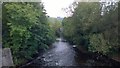
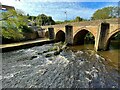
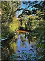
View down Matlock Bridge
by Steven Haslington geograph for square SK2960 The River Derwent at Matlock, Derbyshire, as viewed from Matlock Bridge.
Tags:
DerbyshireX
place:DerbyshireX
county:DerbyshireX
river:DerwentX
river:Derwent (Derbyshire)X
place:Matlock
top:Rivers, Streams, DrainageX
|
|
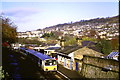
Train at Matlock Station
by Malc McDonald geograph for square SK2960 A diesel multiple unit at Matlock station. When this image was taken in 1984,... (more)
Tags:
county:DerbyshireX
Diesel Multiple UnitX
place:Matlock
Railway StationX
Railway TrainX
top:RailwaysX
StationX
|
|
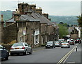
Wellington Street, Matlock
by Andrew Hill geograph for square SK3060 A view down the road which slants across the hillside to the top of the steep... (more)
|
|
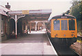
Train from Matlock to Derby
by Stephen Craven geograph for square SK2960 Category: Railway station Matlock has long been the terminus of the British / National Rail branch, though... (more)
|
|
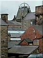
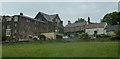
Buildings in Matlock
by Andrew Hill geograph for square SK3060 Looking across the end of Hopewell Road to buildings on Smedley Street.
|
|
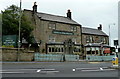
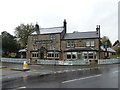
Duke of Wellington pub, Matlock
by Andrew Hill geograph for square SK3060 At the top end of Wellington Street by the junction with the A632 Chesterfield Road.
|
|
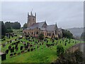
St Giles Church
by Pierre Marshall geograph for square SK3059 St Giles Church photographed on an overcast day from the top floor of a house on... (more)
|
|
The River Derwent at Matlock Bridge
by Graham Hogg geograph for square SK2960 Tags:
BridgeX
type:GeographX
place:Matlock
subject:RiverX
River DerwentX
top:Rivers, Streams, DrainageX
top:Village, Rural SettlementX
|
|
The River Derwent at Old Matlock
by Graham Hogg geograph for square SK3059 Tags:
type:GeographX
place:Matlock
subject:RiverX
River DerwentX
top:Rivers, Streams, DrainageX
top:Village, Rural SettlementX
|
|
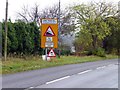
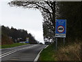
Road signs at the top of Lime Tree Hill
by Graham Hogg geograph for square SK3061 A very steep hill taking the A632 Chesterfield Road into Matlock
Tags:
place:Matlock
Road SignX
top:Roads, Road TransportX
subject:SignX
Steep HillX
top:Suburb, Urban FringeX
|
|
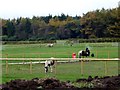
Ponies grazing at Matlock Farm Park
by Graham Hogg geograph for square SK3064 Tags:
top:Business, Retail, ServicesX
Farm ParkX
top:GrasslandX
place:Matlock
PoniesX
top:Sport, LeisureX
top:Wild Animals, Plants and MushroomsX
|
|
Offices and houses by Chesterfield Road, Matlock
by Andrew Hill geograph for square SK3060 Chesterfield Road climbs steeply out of the town. Chatsworth Hall on the left... (more)
Tags:
Council OfficesX
FieldX
HillsideX
HousesX
top:Housing, DwellingsX
place:Matlock
top:Public Buildings and SpacesX
|
|
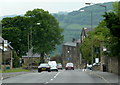
Chesterfield Road descending into Matlock
by Andrew Hill geograph for square SK3060 The A632 descends a long and steep hill into the town. The crossroads with... (more)
|
|
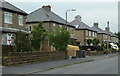
Houses on Gritstone Road
by Andrew Hill geograph for square SK3061 A residential street near the edge of Matlock.
|
|
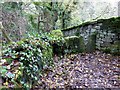
Squeeze stile in Holt Wood
by Graham Hogg geograph for square SK2963 From here there is a steep descent to Sydnop Brook.
|
|
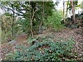
Footpath and track junction in Holt Wood
by Graham Hogg geograph for square SK2962 The footpath on the left continues to Sydnop Brook. The track to the right goes... (more)
|
|
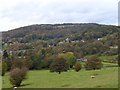
Looking over Two Dales
by Graham Hogg geograph for square SK2862 From the footpath in Hill Wood
Tags:
top:GrasslandX
place:Matlock
top:Suburb, Urban FringeX
subject:ViewX
top:Village, Rural SettlementX
top:Woodland, ForestX
|
|
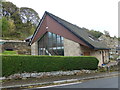
The Old Mission Church
by Graham Hogg geograph for square SK2861 The front wall incorporates a stone dating the building to 2013 though it has... (more)
|
|
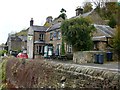
The Laburnum Inn
by Graham Hogg geograph for square SK2961 A suburban pub which was not trading at the time of this visit but has since... (more)
Tags:
top:Business, Retail, ServicesX
place:Matlock
Public HouseX
subject:Public HouseX
top:Suburb, Urban FringeX
|
|
The Duke of Wellington
by Graham Hogg geograph for square SK3060 Tags:
top:Business, Retail, ServicesX
place:Matlock
subject:Public HouseX
Public HouseX
top:Suburb, Urban FringeX
|
|
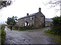
Sandy Lane Farm
by Graham Hogg geograph for square SK3061 |
|
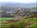
Derelict barn above Bentley Brook
by Graham Hogg geograph for square SK3061 |
|
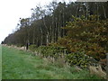
Autumn colour in Cuckoostone Dale
by Graham Hogg geograph for square SK3062 |
|
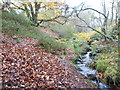
Bentley Brook
by Graham Hogg geograph for square SK3162 |
|
Field boundary on Middle Moor
by Graham Hogg geograph for square SK3163 |
|
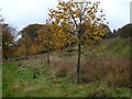
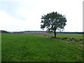
Solitary tree on Middle Moor
by Graham Hogg geograph for square SK3063 |
|
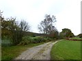
Footpath near Shooters Lea Farm
by Graham Hogg geograph for square SK3164 |
|
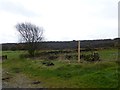
New public footpath sign
by Graham Hogg geograph for square SK3165 Where the public footpath crosses Hodge Lane
|
|
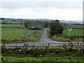
Road signs on B5057
by Graham Hogg geograph for square SK3065 Approaching the junction with Screetham Lane
|
|
Hodge Lane junction with B5057
by Graham Hogg geograph for square SK3065 |
|
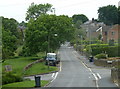
Asker Lane
by Andrew Hill geograph for square SK3060 A side street off Chesterfield Road with houses on one side, towards the top of the town.
|