|
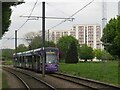
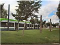
Tram in New Addington
by Malc McDonald
geograph for square TQ3762
A tram in New Addington, in south London's outer suburbs. The tram system... (more)
|
|
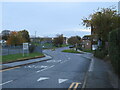
Fieldway, New Addington
by Malc McDonald
geograph for square TQ3863
Fieldway in New Addington, on the outer fringe of south London.
This image... (more)
|
|
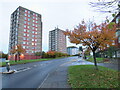
Fieldway, New Addington
by Malc McDonald
geograph for square TQ3763
Tower blocks stand tall over Fieldway in New Addington, on the outer fringe of... (more)
|
|
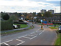
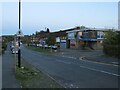
Headley Drive, New Addington
by Malc McDonald
geograph for square TQ3863
Headley Drive in New Addington, on the outer fringe of south London.
This... (more)
|
|
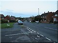
Headley Drive, New Addington
by Malc McDonald
geograph for square TQ3863
Headley Drive in New Addington, on the outer fringe of south London.
This... (more)
|
|
Headley Drive, New Addington
by Malc McDonald
geograph for square TQ3863
Headley Drive in New Addington, on the outer fringe of south London.
This... (more)
|
|
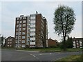
Block of flats in New Addington
by Malc McDonald
geograph for square TQ3861
A block of flats in New Addington, on the outskirts of south London.
|
|
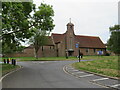
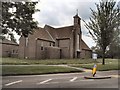
St. Edward's Church, New Addington
by Malc McDonald
geograph for square TQ3861
St. Edward's Church in New Addington, on the outskirts of south London.
|
|
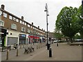
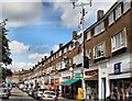
Central Parade, New Addington
by Malc McDonald
geograph for square TQ3862
Central Parade is a shopping parade in the centre of New Addington, on the... (more)
|
|
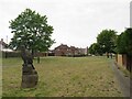
Path and sculpture, New Addington
by Malc McDonald
geograph for square TQ3862
A public footpath along the side of open space, along with a carved sculpture of... (more)
|
|
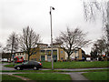
New Addington Health Centre
by Malc McDonald
geograph for square TQ3862
The health centre in the middle of New Addington, in south London's outer... (more)
|
|
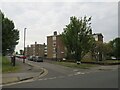
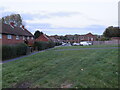
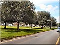
North Downs Crescent, New Addington
by Malc McDonald
geograph for square TQ3762
North Downs Crescent is a residential road in New Addington.
|
|
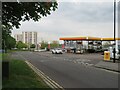
Parkway, New Addington
by Malc McDonald
geograph for square TQ3762
Parkway forms part of the main "spine" road through New Addington.
|
|
Burford Way, New Addington
by Malc McDonald
geograph for square TQ3863
A view taken at dusk on a November afternoon. The road ahead is called Burford Way.
|
|
Roundabout at the end of Central Parade
by Stephen Craven
geograph for square TQ3861
Central Parade is a long axial road on the planned New Addington estate. This... (more)
|
|
Central Parade, New Addington
by Paul Gillett
geograph for square TQ3862
New Addington's main street decorated in bunting in preparation for the Olympics
|
|
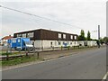
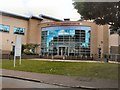
CALAT New Addington Centre
by Paul Gillett
geograph for square TQ3861
CALAT stands for Croydon Adult Learning and Training Centre... (more)
|
|
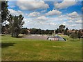
Recreation ground, New Addington
by Paul Gillett
geograph for square TQ3862
|
|
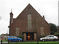
St Edward's Church, New Addington
by Paul Gillett
geograph for square TQ3861
Church website: Link |
|
Parkway, New Addington
by Paul Gillett
geograph for square TQ3862
|
|
Tram at New Addington
by Paul Gillett
geograph for square TQ3862
at the end of the route from Wimbledon and Croydon
|
|
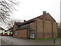
St Edward's church hall
by Stephen Craven
geograph for square TQ3861
The present hall on Cleves Crescent was built in 1992 to replace an earlier facility.
|
|
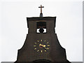
Clock and bell of St Edward's church
by Stephen Craven
for square TQ3861
|
|
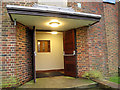
Entrance to St Edward's church
by Stephen Craven
for square TQ3861
|
|
West end of St Edward's church
by Stephen Craven
geograph for square TQ3861
The liturgical west end (geographically south-west) of this Anglican parish... (more)
|