About tags on Geograph

Public Tags

Related Tags | Coverage Map
Prefix: place    Tag:  Old·Harry·Rocks  
Other tags: Old Harry Rocks    

Showing images tagged with place:Old Harry Rocks tag.

View all tagged images - In Browser

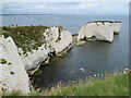
SZ0582 : Old Harry Rocks, Isle of Purbeck by Phil Champion Old Harry Rocks, Isle of Purbeck by Phil Champion
geograph for square SZ0582
St Lucas Leap, No Mans Land and Old Harry.
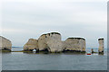
SZ0582 : Old Harry Rocks, near Swanage by Malc McDonald Old Harry Rocks, near Swanage by Malc McDonald
geograph for square SZ0582
A National Trust sign at Old Harry Rocks, indicating that the National Trust... (more)
Tags: near:Bournemouth   top:Coastal   county:Dorset   type:Geograph   place:Handfast Point   Isle of Purbeck   place:Isle of Purbeck   National Trust   National Trust Land   National Trust Sign   place:Old Harry Rocks   near:Poole   Sea Stack   Sea Stacks   near:Studland   near:Swanage   place:The Foreland   subject:View  
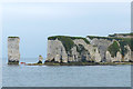
SZ0582 : Chalk cliffs and stacks at Handfast Point by Phil Champion Chalk cliffs and stacks at Handfast Point by Phil Champion
geograph for square SZ0582
St Lucas Leap, No Mans Land and Old Harry from Old Nick's Ground.
SZ0582 : Old Harry Rocks, near Swanage by Malc McDonald Old Harry Rocks, near Swanage by Malc McDonald
geograph for square SZ0582
A view of Old Harry Rocks and Poole Bay, taken on a dull and cloudy day in August 2021.
Tags: near:Bournemouth   subject:Cliff   top:Coastal   county:Dorset   top:Estuary, Marine   type:Geograph   place:Handfast Point   place:Isle of Purbeck   Isle of Purbeck   Jurassic Coast   Jurassic Coastline   place:Old Harry Rocks   near:Poole   Sea Stack   Sea Stacks   near:Studland   near:Swanage   place:The Foreland  
SZ0582 : Old Harry Rocks, near Swanage by Malc McDonald Old Harry Rocks, near Swanage by Malc McDonald
geograph for square SZ0582
Tags: near:Bournemouth   top:Coastal   county:Dorset   type:Geograph   place:Handfast Point   Isle of Purbeck   place:Isle of Purbeck   place:Old Harry Rocks   near:Poole   subject:Rock   Sea Stack   Sea Stacks   near:Studland   near:Swanage   place:The Foreland  
SZ0582 : Old Harry Rocks (from the south), Dorset by Robin Drayton Old Harry Rocks (from the south), Dorset by Robin Drayton
geograph for square SZ0582
Old Harry is the name of the rightmost stack to the left of which is the stump... (more)
Tags: top:Coastal   county:Dorset   type:Geograph   National Trust Land   place:Old Harry Rocks   top:Rocks, Scree, Cliffs   Sea Stacks  
SZ0582 : Old Harry Rocks (from the north), Dorset by Robin Drayton Old Harry Rocks (from the north), Dorset by Robin Drayton
geograph for square SZ0582
With Old Harry to the left and the stump of Old Harry's Wife which... (more)
Tags: top:Coastal   county:Dorset   type:Geograph   place:Old Harry Rocks   top:Rocks, Scree, Cliffs   Sea Stacks  
SZ0582 : Old Harry Rocks by Adam Kerr Old Harry Rocks by Adam Kerr
geograph for square SZ0582
Old Harry Rocks are three chalk formations, including a stack and a stump,... (more)
Tags: top:Coastal   county:Dorset   type:Geograph   place:Handfast Point   place:Isle of Purbeck   part of:Jurassic Coast   place:Old Harry Rocks   top:Rocks, Scree, Cliffs   near:Studland  
SZ0584 : Swash Channel by Ian Capper Swash Channel by Ian Capper
for square SZ0584
The deep water approach to Poole Harbour used by ferries and freight traffic,... (more)
Tags: type:Cross Grid   top:Estuary, Marine   Marker Buoy   place:Old Harry Rocks   place:Studland Bay   place:Swash Channel   place:The Foreland  
SZ0584 : Swash Channel Marker Buoy no 4 by Ian Capper Swash Channel Marker Buoy no 4 by Ian Capper
geograph for square SZ0584
The deep water approach to Poole Harbour used by ferries and freight traffic,... (more)
Tags: top:Estuary, Marine   type:Geograph   Marker Buoy   place:Old Harry Rocks   place:Studland Bay   place:Swash Channel   place:The Foreland  
SZ0583 : Swash Channel Marker Buoy no 2 by Ian Capper Swash Channel Marker Buoy no 2 by Ian Capper
geograph for square SZ0583
The deep water approach to Poole Harbour used by ferries and freight traffic,... (more)
Tags: top:Estuary, Marine   type:Geograph   Marker Buoy   place:Old Harry Rocks   Studland Bay   place:Studland Bay   place:Swash Channel   place:The Foreland  
SZ0582 : Old Harry Rocks by Colin Smith Old Harry Rocks by Colin Smith
geograph for square SZ0582
Famed chalky sea stacks at Handfast Point, Isle of Purbeck.... (more)
Tags: rock:Chalk   top:Coastal   place:Handfast Point   place:Old Harry Rock   Sea Stacks  
SZ0378 : Swanage Pier by Oliver Mills Swanage Pier by Oliver Mills
geograph for square SZ0378
Looking towards the dual-tiered pier head - the lower tier is a landing stage... (more)
SZ0582 : Old Harry by Colin Smith Old Harry by Colin Smith
geograph for square SZ0582
Spectacular chalky sea stacks at Handfast Point, Isle of Purbeck. Note the... (more)
Tags: rock:Chalk   top:Coastal   place:Handfast Point   place:Old Harry Rock   Sea Stacks  
SZ0582 : Old Harry Rocks, Studland by Becky Williamson Old Harry Rocks, Studland by Becky Williamson
geograph for square SZ0582
Tags: Chalk Cliffs   subject:Cliff   top:Coastal   county:Dorset   type:Geograph   place:Old Harry Rocks   Sea-Stacks  
View more in the Image Search or in Browser
View images matching 'Old Harry Rocks' anywhere in the tags
Don't click these: PotMel 1 PotMel 2