Geograph - photograph every grid square
About tags on Geograph
Tags
Geographical Context
Subjects
Types
Other Prefixes
Public Tags
Related Tags
|
Coverage Map
Prefix:
place
Tag:
Park·Street
Other tags:
Park Street
off:
Park Street
on:
Park Street
road:
Park Street
Showing images tagged with
place:
Park Street
tag.
View all tagged images
-
In Browser
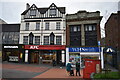
Park Street facades - Walsall, West Midlands
by
Martin Richard Phelan
geograph for square
SP0198
These two shops W H Smith at no. (number) 48 and KFC (Kentucky Fried Chicken) at... (
more
)
Tags:
top:
Business, Retail, Services
Butlers Passage
top:
City, Town Centre
type:
Geograph
Kentucky Fried Chicken
KFC
top:
Lowlands
place:
Park Street
top:
Public Buildings and Spaces
top:
Roads, Road Transport
subject:
Shopping Centre
top:
Sport, Leisure
place:
Walsall
area:
West Midlands
WHSmith
Junction of Park Street and North Row, Mayfair
by
David P Howard
geograph for square
TQ2880
Looking WSW up North Row from the junction with Park Street.
Tags:
top:
City, Town Centre
top:
Housing, Dwellings
Junction
Mayfair
place:
North Row
place:
Park Street
top:
Roads, Road Transport
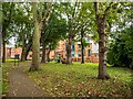
St Martin's Cemetery, Lincoln
by
Oliver Mills
geograph for square
SK9771
Located between Beaumont Fee and Park Street. The building ahead is the new... (
more
)
Tags:
Beaumont Fee
subject:
Cemetery
top:
City, Town Centre
top:
Educational Sites
type:
Geograph
Halls of Residence
top:
Historic Sites and Artefacts
top:
Housing, Dwellings
place:
Lincoln
subject:
Park
top:
Park and Public Gardens
place:
Park Street
top:
Religious Sites
Student Accommodation
top:
Suburb, Urban Fringe
subject:
Woodland
Park Street Telephone Exchange
by
David Hillas
geograph for square
TL1503
Situated on the A5183 road Frogmore, this TE appears to date from the GPO era... (
more
)
Tags:
BT Telecoms Building
BT Telephone Exchange
top:
Communications
Frogmore
type:
Geograph
near:
How Wood
place:
Park Street
Park Street
subject:
Telephone Exchange
Telephone Exchange
Telephone Exchanges in England
Urban Telephone Exchange
top:
Village, Rural Settlement
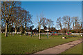
Park Street Recreation Ground
by
Ian Capper
geograph for square
TL1403
A children's playground and an adult outdoor gym in this recreation ground... (
more
)
Tags:
place:
Park Street
Park Street Recreation Ground
Recreation Ground
top:
Sport, Leisure
near:
St Albans
top:
Village, Rural Settlement
Park Street Lane
by
Ian Capper
geograph for square
TL1403
1950s housing on the outskirts of Park Street. The bridge in the background... (
more
)
Tags:
Abbey Line
top:
Housing, Dwellings
Oliver Close
place:
Park Street
Park Street Lane
top:
Railways
near:
St Albans
top:
Village, Rural Settlement
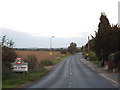
Tippendell Lane, Park Street
by
Malc McDonald
geograph for square
TL1304
Tippendell Lane entering Park Street, near St Albans.
Tags:
30mph Limit
30mph Speed Limit Sign
30mph Speed Limit Signs
near:
Chiswell Green
county:
Hertfordshire
place:
Park Street
subject:
Road
top:
Roads, Road Transport
Speed Limit 30mph
near:
St Albans
Start of the 30mph Speed Limit
2011 : Park Street, Heytesbury
by
Maurice Pullin
geograph for square
ST9342
Formerly the A36, before the welcomed bypass.
Tags:
place:
Park Street
top:
Roads, Road Transport
top:
Village, Rural Settlement
View more in the Image Search
or
in Browser
View images matching 'Park Street' anywhere
in
the tags
Don't click these:
PotMel 1
PotMel 2
☰
Home
View
Search
Marked Images
Maps
Browser
Explore
Showcase
New Images
Collections
Interact
Games
Discussions
Blog
Contributors
Submit
Statistics
Leaderboards
General
FAQ
Help Pages
Sitemap
Contact Us
Support Us
sponsored by
🔍︎
What to search:
Photos
Enter keywords or a location/postcode to search nearby images
Enter a Grid Reference
Placenames
Collections
Website Pages
Everything
Others:
Advanced Search
|
Image Browser
Or:
Coverage Map
|
Searchable Map
You are not logged in
|
login
|
register