|
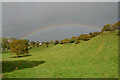
Rainbow at Priestcliffe, Derbyshire
by Andrew Tryon
geograph for square SK1471
A rainbow over the small Peak District hamlet of Priestcliffe, on a wet autumn day.
|
|
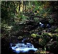
Waterfalls in Padley Gorge
by Andy Stephenson
geograph for square SK2579
A fine Peak District autumn view.
|
|
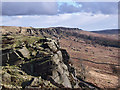
On the Edge
by Andy Stephenson
geograph for square SK2575
Curbar Edge, looking north on a fine Autumn evening. Someone is perched on a... (more)
|
|
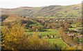
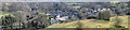
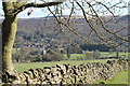
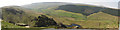
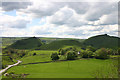
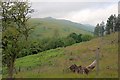
The Hope Valley
by Dave Pickersgill
for square SK1783
The village of Hope and the Hope Valley in the Peak District.
|
|
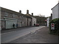
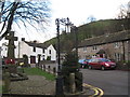
How Lane - Castleton, Derbyshire
by Martin Richard Phelan
geograph for square SK1583
A view of a corner of this Peak District village, popular year-round with... (more)
|
|
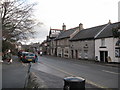
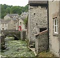
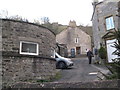
Stoney Middleton
by Dave Pickersgill
geograph for square SK2275
|
|
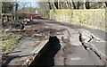
The road to Eyam
by Dave Pickersgill
geograph for square SK2276
The currently closed road to Eyam.
|
|
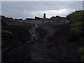
Higher Shelf Stones
by Stephen Burton
geograph for square SK0894
Triangulation point at the Higher Shelf Stones
|
|
Stoke Hall Hotel and Froggatt
by Dave Pickersgill
for square SK2476
Stoke Hall Hotel with the village of Froggatt in the background.
|
|
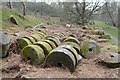
Millstones near Surprise View, Sheffield
by Andrew Tryon
geograph for square SK2479
|
|
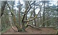
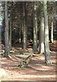
Mis-shapen tree
by Dave Pickersgill
geograph for square SE2000
|
|
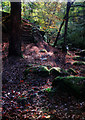
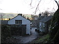
Ruined farmhouse
by Dave Pickersgill
geograph for square SK2275
A ruined farmhouse in the National Park.
|
|
Langsett Bank
by Dave Pickersgill
geograph for square SE2000
Woods on the NE shore of Langsett reservoir.
|
|
On Hen Cloud: view towards The Roaches
by Christopher Hilton
geograph for square SK0061
|
|
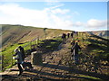
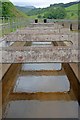
Steps in Yarncliff Wood
by Andy Stephenson
geograph for square SK2579
The beginning of the end of autumn, as the carpet of leaves is almost at its full depth.
|
|
Ridge path of the Peak - Derbyshire
by Martin Richard Phelan
geograph for square SK1283
Leaving the summit of Mam Tor behind the route ahead to Lose Hill, or... (more)
|
|
From the path to Cave Dale - Castleton, Derbyshire
by Martin Richard Phelan
geograph for square SK1582
Looking back from the path through the ravine leading to Cave Dale. Castleton is... (more)
|
|
A cold December day - Castleton, Derbyshire
by Martin Richard Phelan
geograph for square SK1583
This photo was taken on the day of a Railway Ramblers walk from Mam Tor to... (more)
|
|
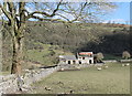
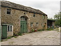
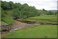
Botham's Farm
by Dave Pickersgill
geograph for square SK1881
Botham's Farm near Bradwell in the Peak District National Park.
|
|
Bradwell Brook, Bradwell
by Dave Pickersgill
geograph for square SK1781
Bradwell Brook which runs through the village of Bradwell in the Peak District... (more)
|
|
Chew Valley
by Steven Haslington
geograph for square SE0202
The Chew Valley, looking north-easterly, in Saddleworth, Greater Manchester, England.
|
|
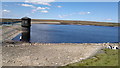
Chew Reservoir Valve Tower
by Steven Haslington
geograph for square SE0301
Chew Reservoir and its Valve Tower high on Saddleworth Moor, in Saddleworth,... (more)
|
|
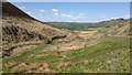
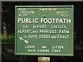
The way to Alport Castles
by Dave Pickersgill
for square SK1492
Alport Castles are a landslip feature in the Peak District of Derbyshire, said... (more)
|
|
Alport Castles
by Dave Pickersgill
for square SK1391
Alport Castles are a landslip feature in the Peak District of Derbyshire, said... (more)
|
|
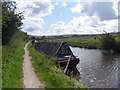
Working Narrow Boat Hadar moored near Danes Moss
by Keith Lodge
geograph for square SJ9171
Working Narrow Boat Hadar moored near Danes Moss Bridge No.46 on the... (more)
|
|
War memorial - Castleton, Derbyshire
by Martin Richard Phelan
geograph for square SK1582
The War Memorial stands in the former market place. It was unveiled by Major... (more)
|
|
Peveril Castle - Castleton, Derbyshire
by Martin Richard Phelan
geograph for square SK1482
The castle has looked down from its high perch since it was built by William... (more)
|
|
Hollins Cross and many ways - Edale, Derbyshire
by Martin Richard Phelan
geograph for square SK1384
This is a junction of paths on the ridge between the Hope Valley and the Vale of... (more)
|
|
Mam Tor one way to the top - Castleton, Derbyshire
by Martin Richard Phelan
geograph for square SK1283
There is car parking alongside this road heading towards Rushup Edge and Chapel... (more)
|
|
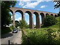
Railway viaduct
by Graham Hogg
geograph for square SK0672
The viaduct carries the mineral railway from the quarries to the south of Buxton... (more)
|
|
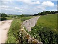
Joining the High Peak Trail
by Graham Hogg
geograph for square SK1858
The High Peak Trail is a 17-mile trail for walkers, cyclists and horse riders.... (more)
|
|
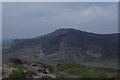
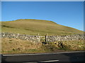
Chrome Hill
by Malcolm Neal
for square SK0767
Chrome Hill was formed under water like all the limestone hills in the Peak... (more)
|
|
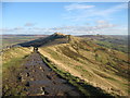
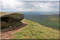
Stanage Edge
by Stephen Burton
geograph for square SK2384
Gritstone outcrop in the Peak District National Park.
|
|
View up the Woodlands Valley
by Mick Garratt
geograph for square SK1588
From behind Hagg Farm.
|
|
Boulder, near Sandy Heys
by Mick Garratt
geograph for square SK0689
Looking down into William Clough.
|
|
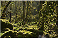
The damp and mossy underworld of Monksdale, Derbyshire
by Andrew Tryon
geograph for square SK1374
Set within a deep and damp limestone valley, the trees and stones of this peak... (more)
|
|
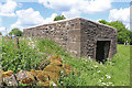
Lead Ore House - near Winster
by Chris Allen
geograph for square SK2360
This was used by the lead miners as a 'night safe' for lead ore. The... (more)
|

|
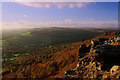
White Peak District skies
by Steve Fareham
geograph for square SK1679
In the distance is the hill that gliders take off from.
|
|
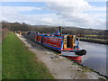
Working Narrow Boat Hadar moored below Bosley Locks.
by Keith Lodge
geograph for square SJ9065
Working Narrow Boat Hadar moored below Bosley Locks on the Macclesfield Canal, March 2012.
|
|
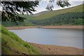
Howden Reservoir
by Mick Garratt
geograph for square SK1692
Howden Clough straight ahead.
|

|
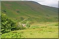
Field Near Rowlee Farm
by Mick Garratt
geograph for square SK1589
|
|
The Woodlands Valley
by Mick Garratt
geograph for square SK1589
Low Barn and Rowlee bridge.
|
|
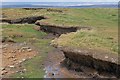
Erosion, Alport Castles
by Mick Garratt
geograph for square SK1491
A popular viewpoint for the castles. The footpath can be made out on the top.
|
|
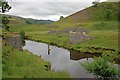
Ruins of a Bridge over the River Ashop
by Mick Garratt
geograph for square SK1489
Connected no doubt to the nearby water catchment weir upstream.
|
|
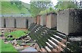
Abandoned Weir on the River Ashop
by Mick Garratt
geograph for square SK1489
|
|
Abandoned Weir on the River Ashop
by Mick Garratt
geograph for square SK1489
|
|
Confluence of the River Alport with the River Ashop
by Mick Garratt
geograph for square SK1489
|
|
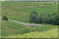
Start of the Old Road at Odin Sitch
by Mick Garratt
geograph for square SK1383
|
|
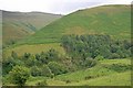
The Wicken
by Mick Garratt
geograph for square SK1289
A spur separating Blackden Brook with the River Ashop and the Woodlands Valley.
|
|
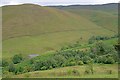
Blackden Barn
by Mick Garratt
geograph for square SK1289
Tucked away at the bottom of Blackden Brook.
|