Public Tags
Showing images tagged with place:Plush Hill tag.

|
Plush Hill
by Ian Capper geograph for square SO4497 Track on Plush Hill. In the distance are The Wrekin and The Lawley.
Tags:
near:All Stretton
type:Geograph
place:Long Mynd
top:Paths
place:Plush Hill
place:The Lawley
place:The Wrekin
top:Uplands
|

|
Plush Hill
by Ian Capper geograph for square SO4597 Sheep grazing on Plush Hill with Holly Cottage behind. In the distance is part... (more)
Tags:
near:All Stretton
type:Geograph
building:Holly Cottage
place:Long Mynd
place:Plush Hill
place:The Lawley
place:The Wrekin
top:Uplands
|
|
Plush Hill
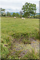
by Ian Capper geograph for square SO4596 A stream on Plush Hill, with Water Crowfoot (Ranunculus aquatilis) growing in... (more)
Tags:
near:All Stretton
type:Geograph
place:Long Mynd
place:Plush Hill
plant:Ranunculus Aquatilis
top:Rivers, Streams, Drainage
place:The Wrekin
top:Uplands
plant:Water Crowfoot
top:Wild Animals, Plants and Mushrooms
|

|
Plush Hill
by Ian Capper geograph for square SO4497 Sheep on Plush Hill with The Lawley in the background.
|

|
Plush Hill
by Ian Capper geograph for square SO4496 Sheep by a small stream on Plush Hill. In the distance is Caer Caradoc.
Tags:
near:All Stretton
place:Caer Caradoc
type:Geograph
place:Long Mynd
place:Plush Hill
top:Uplands
|

|
Plush Hill
by Ian Capper geograph for square SO4596 A stream on Plush Hill with Caer Caradoc in the distance.
Tags:
near:All Stretton
place:Caer Caradoc
type:Geograph
place:Long Mynd
place:Plush Hill
top:Rivers, Streams, Drainage
top:Uplands
|

|
Plush Hill
by Ian Capper geograph for square SO4496 Lane on Plush Hill.
Tags:
near:All Stretton
type:Geograph
place:Long Mynd
place:Plush Hill
top:Roads, Road Transport
top:Uplands
|

|
Plush Hill
by Ian Capper geograph for square SO4496 Lane on Plush Hill.
Tags:
near:All Stretton
type:Geograph
place:Long Mynd
place:Plush Hill
top:Roads, Road Transport
top:Uplands
|

|
Plush Hill
by Ian Capper geograph for square SO4496 Sheep hiding in a dry stream gully on Plush Hill.
Tags:
near:All Stretton
type:Geograph
place:Long Mynd
place:Plush Hill
top:Rivers, Streams, Drainage
top:Uplands
|

|
Plush Hill
by Ian Capper geograph for square SO4597 Lane leading off Plush Hill with Holly Cottage in the background.
Tags:
near:All Stretton
type:Geograph
building:Holly Cottage
place:Long Mynd
place:Plush Hill
top:Uplands
|

|
Roadside ditch
by Ian Capper geograph for square SO4496 Ditch alongside a lane on Plush Hill, with Water Crowfoot (Ranunculus aquatilis)... (more)
Tags:
near:All Stretton
type:Geograph
place:Long Mynd
place:Plush Hill
plant:Ranunculus Aquatilis
top:Rivers, Streams, Drainage
top:Roads, Road Transport
top:Uplands
plant:Water Crowfoot
top:Wild Animals, Plants and Mushrooms
|

|
Holly Cottage
by Ian Capper geograph for square SO4597 Cottage on the slopes of Plush Hill. The plaque reads "W Dodd 1862".
Tags:
near:All Stretton
type:Geograph
building:Holly Cottage
top:Housing, Dwellings
place:Long Mynd
place:Plush Hill
top:Uplands
|

|
Water Crowfoot and Broad-leaved Pondweed
by Ian Capper for square SO4596 Water Crowfoot (Ranunculus aquatilis) and Broad-leaved Pondweed (Potamogeton... (more)
Tags:
near:All Stretton
plant:Broad-Leaved Pondweed
type:Close Look
place:Long Mynd
place:Plush Hill
plant:Potamogeton Natans
plant:Ranunculus Aquatilis
top:Rivers, Streams, Drainage
top:Uplands
plant:Water Crowfoot
top:Wild Animals, Plants and Mushrooms
|
