Public Tags
Showing images tagged with place:Reydon tag.

|
Reydon village sign
by Adrian S Pye for square TM5077 Thank goodness for the Reydonweb otherwise I would be in trouble working out to... (more)
|

|
Reydon village sign
by Adrian S Pye for square TM5077 Thank goodness for the Reydonweb otherwise I would be in trouble working out to... (more)
Tags:
type:Close Look
place:Reydon
Reydon - Suffolk
Reydon Near Southwold
Reydon Village Sign
county:Suffolk
Suffolk
place:Suffolk
Village + Sign
Village Sign
subject:Village Sign
Village Sign - Suffolk
Village Sign Suffolk
Village Signs
top:Village, Rural Settlement
|

|
Marsh pasture, near Buss Creek, Reydon
by Roger Jones geograph for square TM5076 A distant cow enjoys the rich marsh pasture near Buss Creek, Reydon.
Tags:
Cow
top:Farm, Fishery, Market Gardening
top:Lowlands
Marsh
Marsh Pasture
Pasture
place:Reydon
county:Suffolk
|

|
Path to Reydon Church
by Roger Jones geograph for square TM4978 Path through arable land to St Margaret, Reydon.
Tags:
Arable Land
top:Farm, Fishery, Market Gardening
Hedgerow
Hedgerow Trees
top:Paths
Public Footpath
place:Reydon
county:Suffolk
|
|
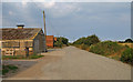
Easton Farm, Easton Bavents, Reydon
by Roger Jones geograph for square TM5078 The road is marked "private".
Easton Bavents was once a thriving... (more)
Tags:
place:Easton Bavents
Farm Buildings
top:Farm, Fishery, Market Gardening
type:Geograph
type:Geograph
top:Paths
place:Reydon
|

|
Bridge Foot Corner, Reydon
by Roger Jones geograph for square TM5077 Three roads converge at Bridge Foot Corner, the roads to Lowestoft (seen a short... (more)
|

|
Public footpath off Keens Lane, Reydon
by Roger Jones geograph for square TM4977 The main track becomes private just after the point at which the photo was... (more)
Tags:
Hedgerow
Hedgerow Trees
top:Paths
Public Footpath
place:Reydon
county:Suffolk
top:Village, Rural Settlement
|

|
Arable land near Church Farm, Reydon
by Roger Jones geograph for square TM4878 Tags:
Arable Land
top:Farm, Fishery, Market Gardening
Hedgerow
Hedgerow Trees
place:Reydon
county:Suffolk
|

|
Looking at the North Sea from Easton Cliffs
by Roger Jones geograph for square TM5178 Easton Bavents was once a thriving village, at one time extending over a mile... (more)
|

|
Crops to the Cliff Edge
by Roger Jones geograph for square TM5178 Farmland at Easton Bavents, with the cliffs and the North Sea in the distance.... (more)
Tags:
Arable Land
top:Coastal
place:Easton Bavents
top:Farm, Fishery, Market Gardening
type:Geograph
type:Geograph
North Sea
place:Reydon
|

|
The Sea Wall at Easton Marshes, near Southwold
by Roger Jones geograph for square TM5177 You can see Southwold Pier in the distance.
Easton Bavents was once a... (more)
Tags:
top:Coastal
place:Easton Bavents
type:Geograph
type:Geograph
North Sea
place:Reydon
subject:Sea Defences
Seawall
near:Southwold
|
