About tags on Geograph

Public Tags

Related Tags | Coverage Map
Prefix: place    Tag:  Scotland  
Other tags: Scotland     country:Scotland    

Showing latest 50 of 1,091 images tagged with place:Scotland tag.

View all tagged images - In Browser
:

ND1024 : Broch at Bad a' Choilich in Berriedale by Andrew Tryon Broch at Bad a' Choilich in Berriedale by Andrew Tryon
geograph for square ND1024
View east over the Bad a' Choilich Broch down Berriedale water towards the... (more)
Tags: place:Bad a Choilich   place:Berriedale   subject:Broch   Brochs of Scotland   place:Caithness   top:Historic Sites and Artefacts   place:Scotland   Scottish Brochs   place:Scottish Highlands   place:Strath Cuil   top:Uplands  
NC9218 : Strath of Kildonan, Sutherland by Andrew Tryon Strath of Kildonan, Sutherland by Andrew Tryon
geograph for square NC9218
A view east down a track near Kilearnen on the last day of summer, 2014.
NN8549 : The Plastic Footbridge, Aberfeldy, Scotland by Andrew Tryon The Plastic Footbridge, Aberfeldy, Scotland by Andrew Tryon
geograph for square NN8549
This innovative cable stayed footbridge over the River Tay at Aberfeldy golf... (more)
NC1836 : Midsummer Midnight at Loch Shark, North of Scotland by Andrew Tryon Midsummer Midnight at Loch Shark, North of Scotland by Andrew Tryon
geograph for square NC1836
This photo of the moon above Loch Shark on the west coast of Scotland shows how... (more)
NH7344 : Culloden Battlefield by Jeff Buck Culloden Battlefield by Jeff Buck
geograph for square NH7344
Camera: Canon AE-1 Program Film: Agfachrome Scanned using a CanoScan 9000F Mark II
NH7869 : Nigg Fabrication Yard, Ross-shire by Andrew Tryon Nigg Fabrication Yard, Ross-shire by Andrew Tryon
for square NH7869
Hangars at the Global Energy Group fabrication site at Nigg, on the east coast... (more)
Tags: type:Cross Grid   place:Easter Ross   place:GB   Global Energy Group   Global Energy Nigg   Global Fabrication Yard   Global Group   place:Great Britain   subject:Industrial Site   top:Industry   place:Nigg   Nigg Scotland   place:Ross-Shire   place:Scotland   place:Scottish Highlands   place:UK   place:United Kingdom  
NC8200 : View of Coast from Woods above Golspie by Andrew Tryon View of Coast from Woods above Golspie by Andrew Tryon
geograph for square NC8200
View of the east coast of Scotland as seen from the woodland above the village... (more)
Tags: place:British Coastline   top:Coastal   place:East Coast of Scotland   type:Geograph   place:Golspie   Golspie Beach   place:Moray Firth Coast   place:Scotland   place:Scottish Highlands   place:Sutherland   place:The North Sea Coast   place:UK   top:Uplands   subject:View  
NG6050 : North end of the Isle of Raasay, Scotland by Andrew Tryon North end of the Isle of Raasay, Scotland by Andrew Tryon
geograph for square NG6050
View facing south from near the summit of the hill Beinn na h-Iolaire, at the... (more)
Tags: place:British Isles   type:Geograph   place:Great Britain   subject:Island   top:Islands   place:Isle of Raasay   place:Scotland   place:Scottish Highlands   place:UK  
NN8951 : Grandtully Castle, Perthshire, Scotland  by Andrew Tryon Grandtully Castle, Perthshire, Scotland by Andrew Tryon
for square NN8951
A view of part of the roof of Grandtully Castle, sitting within the Tay valley,... (more)
Tags: subject:Castle   type:Cross Grid   Grandtully Castle   top:Housing, Dwellings   place:Perth & Kinross   place:Perth and Kinross   place:Scotland   Scottish Castle   place:Scottish Highlands   place:Tay Valley   place:Tayside   top:Uplands  
NH8199 : Hill Fire at Golspie, Scotland, 2018 by Andrew Tryon Hill Fire at Golspie, Scotland, 2018 by Andrew Tryon
geograph for square NH8199
A wild fire burning in the pine forest on the hillside of Ben Bhraggie, northern... (more)
Tags: place:Ben Bhraggie   Columns of Smoke   place:Drummuie   Fire   subject:Fire   Forest Fire   type:Geograph   place:Golspie   Hill Fire   Hillfire   top:People, Events   place:Scotland   place:Scottish Highlands   Smoke   place:Sutherland   Wild Fires 2018   Wildfire  
NH8297 : North of Scotland Kart Club, Sutherland by Andrew Tryon North of Scotland Kart Club, Sutherland by Andrew Tryon
geograph for square NH8297
A bend on the race track at the North of Scotland Kart Club (NSKC), near... (more)
Tags: Bend   type:Geograph   place:Golspie Links   place:Great Britain   Race Track   subject:Racecourse   place:Scotland   place:Scottish Highlands   top:Sport, Leisure   place:Sutherland   Tyres   place:UK   top:Uplands  
NN7899 : Falls of Tromie, Scotland by Andrew Tryon Falls of Tromie, Scotland by Andrew Tryon
geograph for square NN7899
View of the falls of Tromie from Tromie Bridge on the B970, near Kingussie,... (more)
Tags: place:Cairngorms National Park   Cascade   Flow   type:Geograph   River Bed   place:River Tromie   top:Rivers, Streams, Drainage   Rocks   place:Scotland   place:Scottish Highlands   place:Speyside   place:Strath Spey   subject:Waterfall   top:Woodland, Forest  
NO7396 : The Walled Garden at Crathes Castle, Aberdeenshire by Andrew Tryon The Walled Garden at Crathes Castle, Aberdeenshire by Andrew Tryon
geograph for square NO7396
Colourful borders within the walled garden at Crathes Castle, a National Trust... (more)
NC8300 : St. Andrew's Kirk, Golspie by Andrew Tryon St. Andrew's Kirk, Golspie by Andrew Tryon
geograph for square NC8300
NC8100 : Solar Eclipse 2015 - At Ben Bhraggie in Scotland (2) by Andrew Tryon Solar Eclipse 2015 - At Ben Bhraggie in Scotland (2) by Andrew Tryon
geograph for square NC8100
A view of the Duke of Sutherland's Monument looking southeast over the... (more)
NC8100 : Solar Eclipse 2015 - At Ben Bhraggie in Scotland (1) by Andrew Tryon Solar Eclipse 2015 - At Ben Bhraggie in Scotland (1) by Andrew Tryon
geograph for square NC8100
A view of the Duke of Sutherland's Monument looking southeast over the... (more)
NT2347 : The Great Polish Map of Scotland by M J Richardson The Great Polish Map of Scotland by M J Richardson
geograph for square NT2347
Looking southwest along the 'Great Glen' - Glen Albyn or Glen Mor -... (more)
NT2347 : The Great Polish Map of Scotland by M J Richardson The Great Polish Map of Scotland by M J Richardson
for square NT2347
Sutherland and the northern Munros.
NT2347 : The Great Polish Map of Scotland by M J Richardson The Great Polish Map of Scotland by M J Richardson
geograph for square NT2347
Duncansby Head, Caithness and the Pentland Firth.
NT2347 : The Great Polish Map of Scotland by M J Richardson The Great Polish Map of Scotland by M J Richardson
geograph for square NT2347
Sutherland and Cape Wrath.
NT2347 : The Great Polish Map of Scotland by M J Richardson The Great Polish Map of Scotland by M J Richardson
geograph for square NT2347
Lochaber and Ben Nevis. Ben Nevis is marked by the white stick.
NT2347 : The Great Polish Map of Scotland by M J Richardson The Great Polish Map of Scotland by M J Richardson
geograph for square NT2347
The Outer Hebrides -the Uists, Benbecula, Lewis and Harris.
NT2347 : The Great Polish Map of Scotland by M J Richardson The Great Polish Map of Scotland by M J Richardson
geograph for square NT2347
A slightly crumbly Mull. The white stick in the centre is on Ben Nevis.
NT2347 : The Great Polish Map of Scotland by M J Richardson The Great Polish Map of Scotland by M J Richardson
geograph for square NT2347
The Firth of Clyde, Arran and the Mull of Kintyre.
NT2347 : The Great Polish Map of Scotland by M J Richardson The Great Polish Map of Scotland by M J Richardson
geograph for square NT2347
Carrick, Arran and the Mull of Kintyre.
NT2347 : The Great Polish Map of Scotland by M J Richardson The Great Polish Map of Scotland by M J Richardson
geograph for square NT2347
Wigtown and the Mull of Galloway.
NT2347 : The Great Polish Map of Scotland by M J Richardson The Great Polish Map of Scotland by M J Richardson
geograph for square NT2347
The Scottish Borders, Lothians and Fife.
NC8501 : Railway Line near Dunrobin, Sutherland, Scotland by Andrew Tryon Railway Line near Dunrobin, Sutherland, Scotland by Andrew Tryon
geograph for square NC8501
View facing north east along the far north railway line, near to Dunrobin Castle... (more)
Tags: near:Brora   Far North Line   place:GB   type:Geograph   near:Golspie   Golspie to Brora Railway Line   subject:Railway   top:Railways   place:Scotland   ScotRail   place:Scottish Highlands   place:Sutherland   place:UK  
NC4545 : Dun Dornaigil Broch by Andrew Tryon Dun Dornaigil Broch by Andrew Tryon
geograph for square NC4545
The remains of Dun Dornaigil Broch beside the Strathmore River in Sutherland in... (more)
NC8100 : Before the Descent by Andrew Tryon Before the Descent by Andrew Tryon
geograph for square NC8100
NT2573 : The National Gallery of Scotland by Steven Haslington The National Gallery of Scotland by Steven Haslington
geograph for square NT2573
Category: Art gallery
The National Gallery of Scotland in central Edinburgh. It's built in a... (more)
NT9560 : Burnmouth phone box by Jack Clark Burnmouth phone box by Jack Clark
for square NT9560
The phone box is operated by BT and there is a sign inside saying that they were... (more)
NT9660 : Houses along Lower Burnmouth by Jack Clark Houses along Lower Burnmouth by Jack Clark
geograph for square NT9660
These houses are situated along Lower Burnmouth in the Ross community of the... (more)
Tags: Berwickshire   Berwickshire Coast   place:Burnmouth   Burnmouth Harbour   place:Burnmouth Harbour   top:Coastal   top:Docks, Harbours   type:Geograph   subject:House   building type:House   House   subject:Houses   top:Housing, Dwellings   top:Rocks, Scree, Cliffs   country:Scotland   place:Scotland   Scotland   Scottish Borders   place:Scottish Borders   top:Village, Rural Settlement  
NT2573 : Edinburgh: St Giles by Kay Williams Edinburgh: St Giles by Kay Williams
geograph for square NT2573
St Giles Cathedral as seen from West Parliament Square, just off the Royal Mile,... (more)
Tags: building type:Cathedral   subject:Cathedral   Church   Church Of Scotland Parish Church   top:City, Town Centre   place:Edinburgh   place:Edinburgh Old Town   type:Geograph   Kirk   place:Old Town   denomination:Presbyterian   church:Presbyterian   top:Public Buildings and Spaces   top:Religious Sites   place:Scotland  
NN9258 : Road near Pitlochry, Scotland by Andrew Tryon Road near Pitlochry, Scotland by Andrew Tryon
geograph for square NN9258
The road on the west shore of Loch Faskally, near Pitlochry, Scotland.
NC8600 : Pebbly Beach on the East Coast of Scotland by Andrew Tryon Pebbly Beach on the East Coast of Scotland by Andrew Tryon
geograph for square NC8600
View along the east coast of Scotland, just north of Dunrobin Castle, Sutherland.
Tags: Beach   subject:Coast   top:Coastal   Coastline   Dunrobin Castle   type:Geograph   place:Golspie   place:Scotland   place:Scottish Highlands   place:Sutherland  
NH8675 : Mermaid of the North, Balintore by Andrew Tryon Mermaid of the North, Balintore by Andrew Tryon
geograph for square NH8675
The Mermaid of the North sculpture sits on a rock on the coast at Balintore,... (more)
Tags: Beach Art   top:Coastal   place:Easter Ross   type:Geograph   place:Great Britain   place:Hilton   Mermaid   place:Moray Firth Coast   Public Art   place:Ross and Cromarty   place:Ross-Shire   place:Scotland   place:Scottish Highlands   Sculpture   subject:Sculpture   Sea Creature   place:Seaboard Villages   place:The East Coast   place:The North Sea   place:UK   place:United Kingdom  
NH7068 : MSC Meraviglia on Maiden Visit to Invergordon Port, Scotland by Andrew Tryon MSC Meraviglia on Maiden Visit to Invergordon Port, Scotland by Andrew Tryon
geograph for square NH7068
The MSC Meraviglia, with a gross tonnage of 171,600 and 4500 passengers, was the... (more)
Tags: Boat   top:City, Town Centre   place:Cromarty Firth   Cruise Liner   Cruise Ship   top:Docks, Harbours   type:Geograph   place:Port of Invergordon   place:Ross-Shire   place:Scotland   subject:Ship  
NC1010 : Stac Pollaidh, Scotland by Andrew Tryon Stac Pollaidh, Scotland by Andrew Tryon
for square NC1010
A rare full southern elevation of the popular Stac Pollaidh (612 m, 2008 ft),... (more)
Tags: place:Beinn an Eoin   place:British Isles   place:Coigach   type:Cross Grid   place:Great Britain   place:Loch Lurgainn   top:Moorland   subject:Mountain   Mountain   Outcrop   Rocky   place:Scotland   place:Sgorr Deas   Stack   place:The Assynt Geopark   place:The Scottish Highlands   place:UK   place:United Kingdom   top:Uplands  
NH5289 : The Falls of Julia, Ross-shire by Andrew Tryon The Falls of Julia, Ross-shire by Andrew Tryon
geograph for square NH5289
The falls of Julia on the Allt a' Chairn watercourse, near Strathcarron,... (more)
Tags: Falls of Julia Scotland   type:Geograph   top:Lakes, Wetland, Bog   place:Ross-Shire   place:Scotland   place:Scottish Highlands   place:Strathcarron   top:Uplands   subject:Waterfall  
NC2827 : Eas a' Chual Aluinn: Britain's Tallest Waterfall by Andrew Tryon Eas a' Chual Aluinn: Britain's Tallest Waterfall by Andrew Tryon
geograph for square NC2827
This photo shows just the top part of Britain's tallest waterfall, located... (more)
ND3240 : Whaligoe Steps, Scotland by Andrew Tryon Whaligoe Steps, Scotland by Andrew Tryon
for square ND3240
The remarkable steps at Whaligoe comprise 365 steps, 250 feet high. The steps... (more)
NJ1736 : Ballindalloch Castle, Banffshire, Scotland by Andrew Tryon Ballindalloch Castle, Banffshire, Scotland by Andrew Tryon
geograph for square NJ1736
A quintessentially Scottish scene; the home of the MacPherson-Grants pictured on... (more)
Tags: place:Ballindalloch Castle   place:Banffshire   subject:Castle   top:Country Estates   type:Geograph   place:Great Britain   top:Historic Sites and Artefacts   top:Housing, Dwellings   place:Moray   place:Scotland   place:Scottish Highlands   place:Spey Valley   place:Speyside   place:Strath Spey   place:UK   place:United Kingdom  
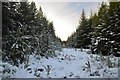
NH6981 : Forestry Fire Break in the Snow by Andrew Tryon Forestry Fire Break in the Snow by Andrew Tryon
geograph for square NH6981
A view along a fire break (clearing) within a forest in Easter Ross, Scotland.
Tags: Christmas Trees   weather:Cold   place:Easter Ross   subject:Forestry   Forestry Commission Scotland   place:Great Britain   place:Scotland   place:Scottish Highlands   weather:Snow   Snowy Pine Forest   weather:Winter   Woodland   top:Woodland, Forest  
NC8601 : Demolition Derby on the East Coast of Scotland by Andrew Tryon Demolition Derby on the East Coast of Scotland by Andrew Tryon
geograph for square NC8601
The usually quiet coastline north of Golspie is full of spectators and cars... (more)
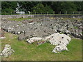
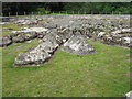
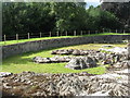
ND1024 : An Dun Broch in Berriedale by Andrew Tryon An Dun Broch in Berriedale by Andrew Tryon
for square ND1024
View south over the An Dun Broch in Berriedale. The Broch is the ruined... (more)
Tags: place:Berriedale   subject:Broch   Brochs of Scotland   place:Caithness   top:Historic Sites and Artefacts   top:Islands   top:Lakes, Wetland, Bog   place:Scotland   Scottish Brochs   place:Scottish Highlands   top:Uplands  
NH7489 : Cottages at Clashmore in Sutherland by Andrew Tryon Cottages at Clashmore in Sutherland by Andrew Tryon
geograph for square NH7489
NC8300 : Fountain Road Hall in Golspie, Sutherland by Andrew Tryon Fountain Road Hall in Golspie, Sutherland by Andrew Tryon
geograph for square NC8300
The old church building on Fountain Road currently serves primarily as a church... (more)
NT2573 : Princes Street, Edinburgh by Steven Haslington Princes Street, Edinburgh by Steven Haslington
geograph for square NT2573
Category: Shops
A view towards Princes Street from outside the National Gallery of Scotland in... (more)
Tags: BHS   Edinburgh   place:Edinburgh   place:Scotland   Scotland  
NH1293 : MV Loch Seaforth arriving at Ullapool, Highland by Adam Forsyth MV Loch Seaforth arriving at Ullapool, Highland by Adam Forsyth
for square NH1293
Caledonian MacBrayne's MV Loch Seaforth is seen arriving at Ullapool,... (more)
View more in the Image Search or in Browser
View images matching 'Scotland' anywhere in the tags
Don't click these: PotMel 1 PotMel 2