Public Tags
Showing images tagged with place:Stanwell tag.
|
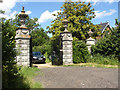
Stanwell Place gates
by Alan Hunt geograph for square TQ0574 The gates to this former manor house of Stanwell Place on the bend in Park Road.... (more)
Tags:
top:Boundary, BarrierX
top:Country EstatesX
Ornamental GatesX
place:Stanwell
Stanwell PlaceX
top:Village, Rural SettlementX
|
|
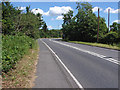
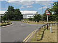
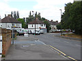
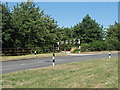
Park Road
by Alan Hunt geograph for square TQ0574 Park Road approaching the bend by Stanwell Place gates. The double bend on this... (more)
Tags:
top:Roads, Road TransportX
place:Stanwell
|
|
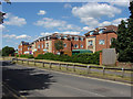
Dudley Place, Stanwell
by Alan Hunt geograph for square TQ0674 New build flats along Long Lane in Stanwell.
|
|
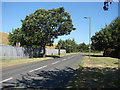
Town Lane, Stanwell
by Alan Hunt geograph for square TQ0573 The road that skirts the eastern side of Stanwell with the Staines reservoir on the left.
Tags:
top:Roads, Road TransportX
place:Stanwell
|
|
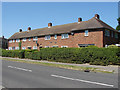
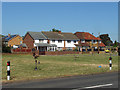
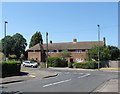
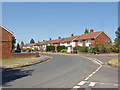
1960s housing, Stanwell
by Alan Hunt geograph for square TQ0573 A block of four houses on Clare Road, Stanwell. This area between the original... (more)
|
|
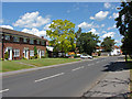
Park Road, Stanwell
by Alan Hunt geograph for square TQ0574 Looking west along Park Road.
|
|
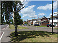
Town Lane, Stanwell
by Alan Hunt geograph for square TQ0574 Looking north along Town Lane towards the junction with Park Road.
|
|
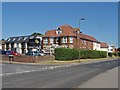
The Stanwell Hotel
by Alan Hunt geograph for square TQ0574 The hotel by the junction of Town Lane and Trinity Close.
|
|
Long Lane, Stanwell
by Alan Hunt geograph for square TQ0674 The junction of Long Lane with the Bedfont Road. One of the Heathrow based... (more)
|
|
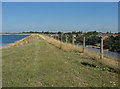
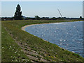
Staines reservoir
by Alan Hunt geograph for square TQ0573 The walkway along the top of the embankment with Stanwell to the right.
|
|
Jordan's Close, Stanwell
by Alan Hunt geograph for square TQ0573 Modern housing on Jordna's Close off Town Lane.
Tags:
top:Housing, DwellingsX
place:Stanwell
|
|
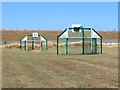
Stanwell recreation ground
by Alan Hunt geograph for square TQ0573 A basketball court in the recreation ground off Town Lane with the embankment of... (more)
|
|
Stanwell recreation ground
by Alan Hunt geograph for square TQ0573 The northern edge of the recreation ground off Town Lane.
Tags:
top:Park and Public GardensX
place:Stanwell
|
|
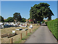
Stanwell cemetery
by Alan Hunt geograph for square TQ0573 The cemetery between Town Lane and the embankment of Staines reservoir.
Tags:
top:Burial Ground, CrematoriumX
place:Stanwell
|
|
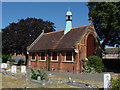
Stanwell cemetery chapel
by Alan Hunt geograph for square TQ0573 The chapel of remembrance built in 1903. The windows are currently boarded up.
Tags:
top:Burial Ground, CrematoriumX
place:Stanwell
|
|
Ravensbourne Avenue, Stanwell
by Alan Hunt geograph for square TQ0673 Looking east along Ravensbourne Avenue towards the junction with Long Lane
|
|
Long Lane, Stanwell
by Alan Hunt geograph for square TQ0673 Looking north along Long Lane with the junction of Ravensbourne Avenue in the foreground.
|
|
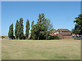
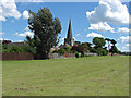
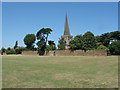
Recreation area, Stanwell
by Alan Hunt geograph for square TQ0574 The large green off Town Lane with the church of St Mary the Virgin.
Tags:
top:Park and Public GardensX
top:Religious SitesX
place:Stanwell
top:Village, Rural SettlementX
|
|
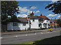
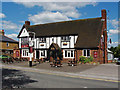
The Wheatsheaf Inn, Stanwell
by Alan Hunt geograph for square TQ0574 The Wheatsheaf Inn on the corner of Town Lane and Park Road.
|
|
St Mary the Virgin, Stanwell
by Alan Hunt geograph for square TQ0574 The parish church with the cemetery wall from the recreation ground to the south.
Tags:
Parish ChurchX
top:Park and Public GardensX
top:Religious SitesX
place:Stanwell
top:Village, Rural SettlementX
|
|
The Three Crowns, Stanwell
by Alan Hunt geograph for square TQ0674 The Three Crowns Inn, one of the more distinctive buildings on Long Lane.
|
|
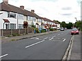
Clyde Road, Stanwell
by Alan Hunt geograph for square TQ0573 The junction between Clyde Road and Clare Road. The houses date from the 1960s.
|
|
Staines reservoir causeway
by Alan Hunt geograph for square TQ0573 The entrance to the causeway that runs across Staines Reservoir on... (more)
|
|
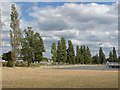
Stanwell recreation ground
by Alan Hunt geograph for square TQ0673 Sports pitches near the northern edge of the recreation ground.
|
|
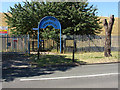
Stanwell recreation ground
by Alan Hunt geograph for square TQ0673 The entrance to the recreation ground from Cordelia Road.
|
|
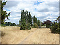
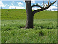
Rough ground, Stanwell
by Alan Hunt geograph for square TQ0673 An area of rough ground used for horse grazing to the north of the recreation... (more)
|
|
The corner of the reservoir
by Alan Hunt geograph for square TQ0573 The corner where the causeway leaves the embankment of the southern part of the... (more)
|
|
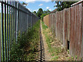
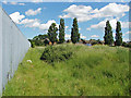
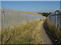
Footpath by the Staines Reservoir
by Alan Hunt geograph for square TQ0574 The footpath that follows the perimeter fence around the northeast corner of the... (more)
|
|
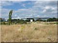
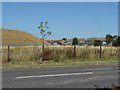
Staines Reservoir enclosure
by Alan Hunt geograph for square TQ0574 Looking across the northeast corner of the reservoir enclosure with the houses... (more)
|
|
Pipework, Staines reservoir
by Alan Hunt geograph for square TQ0573 The pipes which balance out the water across the causeway with flow meters attached.
|
|
Long and Short lane junction
by Alan Hunt geograph for square TQ0673 The junction between Long and Short Lanes from the entrance to the recreation ground.
|
|
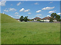
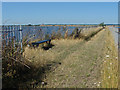
Staines Reservoir enclosure
by Alan Hunt geograph for square TQ0574 The grass covered embankment of the Staines Reservoir.
|
|
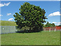
Footpath, Staines reservoir
by Alan Hunt geograph for square TQ0573 The footpath that tracks around the perimeter fence from the cemetery to Park... (more)
|
|
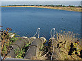
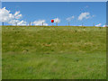
Staines reservoir embankment
by Alan Hunt geograph for square TQ0573 A life buoy holder on the embankment of the Staines Reservoir from the footpath... (more)
|
|
Green off Lauser road
by Alan Hunt geograph for square TQ0573 A small green off Lauser Road with the embankment of the Staines reservoir in... (more)
|
|
Seating area, Staines reservoir
by Alan Hunt geograph for square TQ0573 There are three benches along the length of the causeway in these small... (more)
|
|
Staines reservoir, causeway ramp
by Alan Hunt geograph for square TQ0573 The ramp from Town Lane up the embankment to the causeway that carries the... (more)
|
|
St Mary's Crescent
by Alan Hunt geograph for square TQ0573 Housing along St Mary's Crescent from the junction of Everset road with Hadrian Way.
|
|
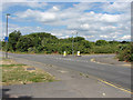
Town Lane
by Alan Hunt geograph for square TQ0573 Looking west from Town Lane with the embankment of Staines reservoir and the... (more)
|
|
Car park entrance
by Alan Hunt geograph for square TQ0573 The entrance to the small car park off Town Lane.
|