Public Tags
Other tags: near:Stanwell Moor
Showing images tagged with place:Stanwell Moor tag.
|
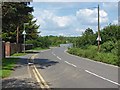
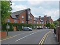
Horton Road, Stanwell Moor
by Alan Hunt geograph for square TQ0475 The Horton Road leaving the village of Stanwell Moor in the direction of... (more)
|
|
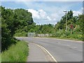
Horton Road, Stanwell Moor
by Alan Hunt geograph for square TQ0375 The Horton Road approaching the M25 junction 14. The entrance to the footpath to... (more)
Tags:
top:Roads, Road TransportX
place:Stanwell Moor
|
|
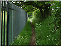
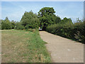
Haws Lane, Stanwell Moor
by Alan Hunt geograph for square TQ0474 Now a footpath, this used to be an access road before the King George VI... (more)
Tags:
top:PathsX
place:Stanwell Moor
|
|
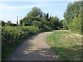
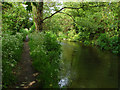
Path beside the lake
by Alan Hunt geograph for square TQ0374 The path that runs beside Hithermoor Lake, a former gravel pit near Stanwell Moor.
Tags:
top:PathsX
place:Stanwell Moor
|
|
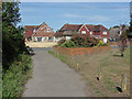
Stanwell Moor village hall
by Alan Hunt geograph for square TQ0474 The village hall on Horton Road opposite the junction with Hithermoor Road.
|
|
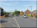
Hithermoor Road
by Alan Hunt geograph for square TQ0474 Hithermoor road in Stanwell Moor. There is a stream that runs along the east... (more)
|
|
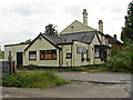
Former Hope Inn, Stanwell Moor
by Alan Hunt geograph for square TQ0474 The derelict Hope Inn on Hithermoor Road.
Tags:
top:Derelict, DisusedX
Former Public HouseX
place:Stanwell Moor
top:Village, Rural SettlementX
|
|
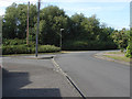
Hithermoor Road, Stanwell Moor
by Alan Hunt geograph for square TQ0374 The junction of Farmway on the left with Hithermoor Road. The path to Hithermoor... (more)
|
|
Hithermoor meadow
by Alan Hunt geograph for square TQ0374 The path that runs from Hithermoor Road in Stanwell Moor to Hithermoor Lake.
|
|
The path to Staines Moor
by Alan Hunt geograph for square TQ0374 The Hithermoor Road junction of the footpath that runs alongside the King George... (more)
|
|
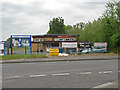
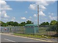
Enclosed storage area
by Alan Hunt geograph for square TQ0475 A storage bunker in a fenced enclosure by the Horton Road.
|
|
The old mill, Horton Road
by Alan Hunt geograph for square TQ0475 The former mill building on the River Colne, now used as business premises.
Tags:
top:Business, Retail, ServicesX
Former Mill ConvertedX
place:Stanwell Moor
top:Village, Rural SettlementX
|
|
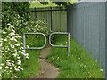
Path by King George VI reservoir
by Alan Hunt geograph for square TQ0474 Barriers along the path that runs along the northern side of the King George VI... (more)
|
|
River Colne
by Alan Hunt geograph for square TQ0375 The footpath part of Leylands Lane alongside the Colne.
|
|
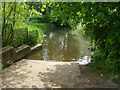
Slipway, River Colne
by Alan Hunt geograph for square TQ0374 A slipway into the non-navigable River Colne off Colne Reach.
|
|
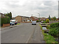
Hithermoor Road
by Alan Hunt geograph for square TQ0374 Looking north along Hithermoor Road with the junction of Russet Close on the left.
|
|
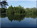
Hithermoor Lake
by Alan Hunt geograph for square TQ0374 A former gravel pit now used as a private angling lake.
Tags:
top:Lakes, Wetland, BogX
place:Stanwell Moor
|