Public Tags
Other tags: Strathconon
Showing images tagged with place:Strathconon tag.

|
Bridgend
by valenta geograph for square NH3254 The Strathconon Road does a dogleg over the River Meig, at the aptly named... (more)
Tags:
subject:Bridge
place:Bridgend
listed building:Category B
top:Country Estates
type:Geograph
top:Historic Sites and Artefacts
top:Moorland
top:Roads, Road Transport
place:Strathconon
top:Uplands
top:Woodland, Forest
|
|
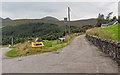
Road junction at Milton
by valenta geograph for square NH3055 Strathconon Hall to the right, while the Strathconon road continues up the... (more)
Tags:
type:Geograph
place:Milton
top:Moorland
subject:Road Junction
top:Roads, Road Transport
place:Strathconon
top:Uplands
top:Woodland, Forest
|

|
Strathconon Highland Games
by Craig Wallace geograph for square NH3054 The Strathconon Games are held in a field at Dalbreac.
A somewhat showery day,... (more)
Tags:
top:Country Estates
type:Geograph
Highland Games
top:People, Events
Pipe Band
top:Sport, Leisure
place:Strathconon
|
|
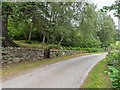
Strathconon Road at Milton
by valenta geograph for square NH3055 The path down from the Eas Mòr waterfall emerges on the road through the wooden... (more)
Tags:
top:Country Estates
type:Geograph
place:Milton
subject:Road
top:Roads, Road Transport
place:Strathconon
top:Uplands
top:Woodland, Forest
|

|
Bridge over the River Meig
by valenta geograph for square NH3254 Located at Bridgend, this early 19th-century category B listed bridge over the... (more)
Tags:
subject:Bridge
place:Bridgend
listed building:Category B
top:Country Estates
type:Geograph
top:Historic Sites and Artefacts
top:Moorland
top:Rivers, Streams, Drainage
top:Roads, Road Transport
place:Strathconon
top:Uplands
|
|
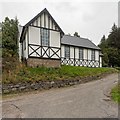
Village Hall at Milton
by valenta geograph for square NH3055 Strathconon community hall, constructed around 1900
Tags:
type:Geograph
subject:Hall
place:Milton
top:Public Buildings and Spaces
top:Roads, Road Transport
place:Strathconon
top:Uplands
top:Village, Rural Settlement
top:Woodland, Forest
|

|
Road, Strathconon
by Craig Wallace geograph for square NH2953 Approaching the old church and manse.
Tags:
type:Geograph
Minor Road
top:Roads, Road Transport
Singletrack Road
place:Strathconon
top:Uplands
|

|
Former church, Strathconon
by Craig Wallace geograph for square NH2953 After lying empty for a few years, it seems it has now been converted to a house.
Tags:
listed building:Category B
former:Church
type:Geograph
top:Historic Sites and Artefacts
top:Housing, Dwellings
top:Religious Sites
place:Strathconon
top:Uplands
|

|
Loch Beannacharain, Strathconon
by Craig Wallace geograph for square NH2351 A view west towards Scardroy.
Tags:
top:Country Estates
type:Geograph
top:Lakes, Wetland, Bog
Loch
place:Strathconon
top:Uplands
View
|

|
Loch Beannacharain, Strathconon
by Craig Wallace geograph for square NH2251 A view south-east, back down the strath.
|

|
End of Public Road, Strathconon
by Craig Wallace geograph for square NH2251 A private road continues west towards Scardroy.
Tags:
top:Country Estates
End of Public Road
type:Geograph
Private Road
top:Roads, Road Transport
place:Strathconon
top:Uplands
|

|
Harvested field, by Fairburn
by Craig Wallace geograph for square NH4653 Fields on the slopes of Strathconon.
Tags:
top:Farm, Fishery, Market Gardening
type:Geograph
Harvested Field
top:Lowlands
place:Strathconon
|

|
Eas Mòr Cottage
by valenta geograph for square NH3055 A path around the perimeter of the cottage, heading north it leads into... (more)
Tags:
top:Country Estates
type:Geograph
top:Grassland
subject:House
top:Housing, Dwellings
top:Paths
place:Strathconon
top:Uplands
top:Woodland, Forest
|

|
Path by the Allt Mòr
by valenta geograph for square NH3055 This old path runs between the river and the boundary wall of Fearn Cottage,... (more)
Tags:
top:Country Estates
Dry Stone Wall
type:Geograph
top:Grassland
subject:Path
top:Paths
place:Strathconon
top:Uplands
top:Woodland, Forest
|

|
Coille Uisge
by valenta for square NH4654 Looking across Strathconon to the low land between the River Conon and The Black... (more)
Tags:
type:Cross Grid
top:Farm, Fishery, Market Gardening
top:Grassland
top:Rivers, Streams, Drainage
Silage Harvest
place:Strathconon
top:Uplands
subject:Valley
top:Woodland, Forest
|

|
Dalbreac Bridge
by Craig Wallace geograph for square NH3055 A bridge over the River Meig, on the Strathconon Estate.
Tags:
Bridge
top:Country Estates
Estate Road
type:Geograph
River Meig
top:Rivers, Streams, Drainage
top:Roads, Road Transport
place:Strathconon
|

|
View from Cnoc Mòr
by valenta geograph for square NH4856 Just off an unmapped path around the summit of Cnoc Mòr there is a gap in the... (more)
Tags:
Cnoc Mor
type:Geograph
top:Lakes, Wetland, Bog
loch:Loch Achilty
loch:Loch Kinellan
place:Strathconon
top:Uplands
subject:View
top:Woodland, Forest
|

|
Path from the summit of Cnoc Mòr
by valenta for square NH4856 This unmapped path leads down steeply from the summit of Cnoc Mòr affording fine... (more)
Tags:
hill:Cnoc Mor
type:Cross Grid
top:Grassland
top:Paths
place:Strathconon
top:Uplands
subject:View
top:Woodland, Forest
|

|
Glenmarksie viewed from Am Fireach
by valenta for square NH3857 Possibly one of the most remote and isolated farms in Scotland
Tags:
type:Cross Grid
top:Farm, Fishery, Market Gardening
place:Glenmarksie
subject:Landscape
top:Moorland
top:Roads, Road Transport
place:Strathconon
top:Uplands
top:Woodland, Forest
|

|
Scatwell Farm
by valenta for square NH3956 View of Scatwell Farm from the Am Fireach hillside
Tags:
type:Cross Grid
subject:Farm
top:Farm, Fishery, Market Gardening
top:Roads, Road Transport
place:Scatwell Estate
place:Strathconon
top:Uplands
top:Woodland, Forest
|
|
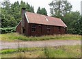
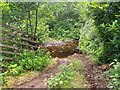
Old Sawmill at Milton
by valenta geograph for square NH3055 Tags:
top:Country Estates
type:Geograph
place:Milton
top:Roads, Road Transport
subject:Sawmill
place:Strathconon
top:Uplands
|
|
Ford over the Allt Mòr
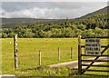
by valenta geograph for square NH3055 Ford over the Allt Mòr in Factor's Wood, just above the old mill lade weir
Tags:
river:Allt Mor
top:Country Estates
wood:Factors Wood
subject:Ford
type:Geograph
place:Milton
top:Rivers, Streams, Drainage
top:Roads, Road Transport
place:Strathconon
top:Uplands
top:Woodland, Forest
|
|
Scatwell Farm Access
by valenta geograph for square NH3956 A private road to Scatwell Farm, Fairburn Wind Farm on the horizon, three miles... (more)
Tags:
top:Energy Infrastructure
wind farm:Fairburn
top:Farm, Fishery, Market Gardening
type:Geograph
top:Grassland
top:Roads, Road Transport
place:Scatwell Estate
place:Strathconon
top:Uplands
subject:Wind Farm
top:Woodland, Forest
|

|
Am Fireach
by valenta geograph for square NH3957 Clear felled area on Am Fireach
|

|
Am Fireach
by valenta geograph for square NH3957 The forestry on this area of Am Fireach has been clear-felled, leaving a pocket... (more)
|

|
Electricity Infrastructure on Am Fireach
by valenta geograph for square NH3957 New pylons and access track on the Am Fireach hillside
Tags:
top:Energy Infrastructure
type:Geograph
top:Heath, Scrub
subject:Pylon
top:Roads, Road Transport
place:Strathconon
top:Uplands
|

|
Am Fireach
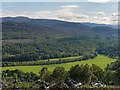
by valenta geograph for square NH3957 Pylon line junction on the Am Fireach hillside
Tags:
top:Energy Infrastructure
type:Geograph
subject:Pylon
Pylon Junction
top:Roads, Road Transport
place:Strathconon
top:Uplands
top:Woodland, Forest
|
|
River Meig
by valenta for square NH3956 Looking over the valley floor of the River Meig from Am Fireach
Tags:
type:Cross Grid
top:Grassland
top:Moorland
top:Rivers, Streams, Drainage
place:Strathconon
top:Uplands
subject:Valley
|

|
Clear Felled Am Fireach
by valenta geograph for square NH3957 An area of clear fell looking towards Fairburn Wind Farm
Tags:
top:Energy Infrastructure
wind farm:Fairburn
type:Geograph
subject:Landscape
place:Strathconon
top:Uplands
top:Woodland, Forest
|

|
Surge Shaft Luichart Power Station
by valenta geograph for square NH3957 The water from Loch Luichart that drives the turbines is fed by a tunnel to the... (more)
Tags:
top:Energy Infrastructure
type:Geograph
Hydroelectric Power Station
top:Moorland
subject:Shaft
SSE Hydro
place:Strathconon
Surge Shaft
top:Uplands
top:Woodland, Forest
|

|
River Meig Gorge
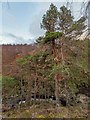
by valenta geograph for square NH3756 The Meig runs through this deep gorge, lined with mature Scots Pine and Silver Birch
Tags:
type:Geograph
subject:Gorge
Gorge
river:River Meig
top:Rivers, Streams, Drainage
top:Rocks, Scree, Cliffs
tree:Scots Pine
place:Strathconon
top:Uplands
top:Woodland, Forest
|
|
Scots Pine
by valenta geograph for square NH3856 A mature Scots Pine at the top of the River Meig gorge
Tags:
type:Geograph
Gorge
river:River Meig
top:Rocks, Scree, Cliffs
tree:Scots Pine
place:Strathconon
subject:Tree
top:Uplands
top:Woodland, Forest
|

|
Fish Trap on the River Meig
by valenta geograph for square NH3756 This old fish trap looks derelict. It was probably built as part of the Loch... (more)
Tags:
Fish Trap
subject:Fishery
type:Geograph
river:River Meig
top:Rivers, Streams, Drainage
top:Rocks, Scree, Cliffs
place:Strathconon
top:Uplands
|

|
River Meig Gorge
by valenta geograph for square NH3756 Downstream of the fish trap, the Meig runs through a deep and rocky gorge
Tags:
type:Geograph
subject:Gorge
river:River Meig
top:Rivers, Streams, Drainage
top:Rocks, Scree, Cliffs
place:Strathconon
top:Uplands
|

|
Natural Arch on the River Meig
by valenta geograph for square NH3856 The Meig runs through a deep gorge where this natural arch is marked on the OS... (more)
Tags:
subject:Arch
type:Geograph
Natural Arch
river:River Meig
top:Rivers, Streams, Drainage
top:Rocks, Scree, Cliffs
place:Strathconon
top:Uplands
|

|
Electricity Substation by the River Conon
by valenta geograph for square NH3957 Just past Luichart hydro-electric power station, the road crosses over the Conon... (more)
Tags:
subject:Electricity Infrastructure
Electricity Substation
top:Energy Infrastructure
type:Geograph
top:Moorland
top:Roads, Road Transport
place:Strathconon
top:Uplands
|

|
Fearn Cottage
by valenta geograph for square NH3055 A country house and walled garden.
Link
 Tags:
top:Country Estates
Country House
type:Geograph
top:Grassland
subject:House
top:Housing, Dwellings
place:Strathconon
top:Uplands
top:Woodland, Forest
|

|
Eas Mòr Waterfall
by valenta for square NH3055 Quite an impressive fall on the Allt Mòr, but hemmed in by fallen trees and vegetation
Tags:
river:Allt Mor
type:Close Look
top:Country Estates
top:Rivers, Streams, Drainage
place:Strathconon
top:Uplands
subject:Waterfall
top:Woodland, Forest
|

|
Weir on the Allt Mòr
by valenta for square NH3055 The weir first appears on the 1904 OS25" map. A mill lade carries water to... (more)
Tags:
river:Allt Mor
type:Close Look
top:Country Estates
top:Rivers, Streams, Drainage
place:Strathconon
top:Uplands
subject:Weir
top:Woodland, Forest
|

|
Bridge over the Allt Mòr
by valenta geograph for square NH3055 Although this substantial bridge over the Allt Mòr serves the private Eas Mòr... (more)
Tags:
river:Allt Mor
subject:Bridge
top:Country Estates
type:Geograph
place:Strathconon
top:Uplands
top:Woodland, Forest
|

|
Track from Milton
by valenta geograph for square NH3055 The track crosses over an old mill lade in the foreground
Tags:
top:Country Estates
type:Geograph
top:Roads, Road Transport
place:Strathconon
subject:Track
top:Uplands
top:Woodland, Forest
|

|
Deer Fence gate into Factor's Wood
by valenta geograph for square NH3055 The OS maps suggest a path off to the right at this location, leading to the... (more)
Tags:
top:Country Estates
wood:Factors Wood
type:Geograph
top:Roads, Road Transport
place:Strathconon
subject:Track
top:Uplands
top:Woodland, Forest
|

|
Estate bridge over the Allt a' Bhogair
by valenta geograph for square NH3254 The bridge carries a track from the tarmac road up to Dalbreac
Tags:
subject:Bridge
top:Country Estates
type:Geograph
top:Moorland
top:Rivers, Streams, Drainage
top:Roads, Road Transport
place:Strathconon
top:Uplands
top:Woodland, Forest
|

|
River Meig
by valenta geograph for square NH3355 The view just downstream from the footbridge over the Meig
Tags:
type:Geograph
top:Moorland
river:River Meig
top:Rivers, Streams, Drainage
place:Strathconon
top:Uplands
subject:View
|

|
Waterfall on the Allt na h-Annaite
by valenta geograph for square NH3354 Tags:
river:Allt Na H-Annaite
type:Geograph
top:Rivers, Streams, Drainage
place:Strathconon
top:Uplands
subject:Waterfall
top:Woodland, Forest
|

|
Woodland and power line, near Luichart Power Station
by Craig Wallace geograph for square NH3957 Looking across the mixed woodland around the River Conon. The minor road runs... (more)
Tags:
top:Energy Infrastructure
Minor Road
Power Line
top:Roads, Road Transport
place:Strathconon
top:Woodland, Forest
|
