Public Tags
Showing latest 50 of 52 images tagged with place:The Wrekin tag.

|
On Ragleth Hill
by Ian Capper geograph for square SO4592 A small patch of rock at the northern end of Ragleth Hill. In the left... (more)
Tags:
place:Caer Caradoc
type:Geograph
place:Hazler
place:Hazler Hill
place:Hope Bowdler Hill
place:Ragleth Hill
place:The Wrekin
top:Uplands
|

|
Carding Mill Valley
by Ian Capper geograph for square SO4494 Looking down on Carding Mill Valley from Burway Hill. In the right background... (more)
Tags:
place:Burway Hill
place:Caer Caradoc
place:Carding Mill Valley
type:Geograph
place:Hope Bowdler Hill
place:Long Mynd
place:The Lawley
place:The Wrekin
top:Uplands
|

|
Across Carding Mill Valley
by Ian Capper geograph for square SO4494 Looking across Carding Mill Valley to Stanyeld from Burway Hill. In the right... (more)
Tags:
place:Caer Caradoc
place:Carding Mill Valley
type:Geograph
place:Long Mynd
place:Stanyeld
place:The Lawley
place:The Wrekin
top:Uplands
|
|
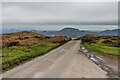
The Burway
by Ian Capper geograph for square SO4394 Road connecting Church Stretton with the summit plateau of the Long Mynd. In... (more)
Tags:
place:Caer Caradoc
near:Church Stretton
type:Geograph
place:Hope Bowdler
place:Hope Bowdler Hill
place:Long Mynd
top:Roads, Road Transport
road:The Burway
place:The Lawley
place:The Wrekin
top:Uplands
|

|
Westhope Hall and Westhope from Callow Hill
by Ian Capper for square SO4686 Looking down on Westhope Hall and Westhope from Callow Hill with The Wrekin in... (more)
Tags:
place:Callow Hill
type:Cross Grid
place:The Wrekin
top:Uplands
place:Westhope
place:Westhope Hall
|

|
Towards Bodbury Hill
by Ian Capper geograph for square SO4394 Looking across Carding Mill Valley to Bodbury Hill. In the right background is... (more)
Tags:
place:Bodbury Hill
place:Caer Caradoc
place:Carding Mill Valley
type:Geograph
place:The Lawley
place:The Wrekin
top:Uplands
|

|
North from Abdon Burf summit
by Ian Capper geograph for square SO5986 North of the communication masts at the top of Abdon Burf on Brown Clee are a... (more)
Tags:
place:Abdon Burf
place:Brown Clee
County Top
type:Geograph
Shropshire County Top
place:The Wrekin
top:Uplands
|

|
Abdon Burf summit
by Ian Capper geograph for square SO5986 North of the communication masts at the top of Abdon Burf on Brown Clee are a... (more)
Tags:
place:Abdon Burf
place:Brown Clee
County Top
type:Geograph
Shropshire County Top
place:The Wrekin
top:Uplands
|

|
Abdon Burf summit
by Ian Capper geograph for square SO5986 North of the communication masts at the top of Abdon Burf on Brown Clee are a... (more)
Tags:
place:Abdon Burf
place:Brown Clee
County Top
type:Geograph
Shropshire County Top
place:The Wrekin
top:Uplands
|

|
Pole, Ragleth Hill
by Ian Capper geograph for square SO4591 A pole on the southern summit of Ragleth Hill. In the background is the main... (more)
Tags:
place:Caer Caradoc
type:Geograph
place:Hope Bowdler Hill
place:Ragleth Hill
place:The Wrekin
top:Uplands
|

|
On Ragleth Hill
by Ian Capper geograph for square SO4592 Looking along the summit ridge of Ragleth Hill from the main summit of the hill.... (more)
Tags:
place:Caer Caradoc
type:Geograph
place:Hope Bowdler Hill
place:Ragleth Hill
place:The Wrekin
top:Uplands
|

|
On Ragleth Hill
by Ian Capper geograph for square SO4592 Looking along the summit ridge of Ragleth Hill. In the left background is Caer... (more)
Tags:
place:Caer Caradoc
type:Geograph
place:Hope Bowdler Hill
place:Ragleth Hill
place:The Wrekin
top:Uplands
|

|
On Hope Bowdler Hill
by Ian Capper geograph for square SO4894 Looking northeast from near the main summit of Hope Bowdler Hill with Willstone... (more)
Tags:
type:Geograph
place:Hope Bowdler Hill
place:The Lawley
place:The Wrekin
top:Uplands
place:Willstone Hill
|

|
Stone
by Ian Capper geograph for square SO4895 Marker stone in the low pass between Caer Caradoc and its subsidiary summit of... (more)
Tags:
place:Caer Caradoc
type:Geograph
place:Little Caradoc
place:The Lawley
place:The Wrekin
top:Uplands
|

|
Gate
by Ian Capper geograph for square SO4895 Gate in the fence across the low pass between Caer Caradoc and its subsidiary... (more)
Tags:
place:Caer Caradoc
type:Geograph
place:Little Caradoc
place:The Lawley
place:The Wrekin
top:Uplands
|

|
On Caer Caradoc
by Ian Capper geograph for square SO4795 Looking down the northeast ridge of Caer Caradoc leading to the subsidiary... (more)
Tags:
place:Caer Caradoc
type:Geograph
place:Little Caradoc
place:The Lawley
place:The Wrekin
top:Uplands
|

|
On Caer Caradoc
by Ian Capper geograph for square SO4795 Looking down the northeast ridge of Caer Caradoc leading to the subsidiary... (more)
Tags:
place:Caer Caradoc
type:Geograph
place:Little Caradoc
place:The Lawley
place:The Wrekin
top:Uplands
|

|
Plush Hill
by Ian Capper geograph for square SO4497 Track on Plush Hill. In the distance are The Wrekin and The Lawley.
Tags:
near:All Stretton
type:Geograph
place:Long Mynd
top:Paths
place:Plush Hill
place:The Lawley
place:The Wrekin
top:Uplands
|

|
Plush Hill
by Ian Capper geograph for square SO4597 Sheep grazing on Plush Hill with Holly Cottage behind. In the distance is part... (more)
Tags:
near:All Stretton
type:Geograph
building:Holly Cottage
place:Long Mynd
place:Plush Hill
place:The Lawley
place:The Wrekin
top:Uplands
|

|
Towards Bodbury Hill
by Ian Capper geograph for square SO4394 Looking across the high ground above Townbrook Valley to Bodbury Hill, with... (more)
Tags:
place:Bodbury Hill
place:Caer Caradoc
type:Geograph
place:The Lawley
place:The Wrekin
top:Uplands
|

|
On Hope Bowdler Hill
by Ian Capper geograph for square SO4893 A foxglove in flower among gorse near a minor summit of Hope Bowdler Hill with... (more)
Tags:
Foxglove
type:Geograph
Gorse
place:Hope Bowdler Hill
place:The Wrekin
top:Uplands
place:Willstone Hill
|

|
Battle Stones
by Ian Capper geograph for square SO4894 Rock outcrop by the summit of Willstone Hill, seen here with The Lawley in the... (more)
|

|
Battle Stones
by Ian Capper geograph for square SO4894 Rock outcrop by the summit of Willstone Hill, seen here with The Wrekin in the distance.
|

|
On Willstone Hill
by Ian Capper geograph for square SO4894 On the slopes of Willstone Hill with The Lawley in the background and The Wrekin... (more)
|

|
Towards The Lawley
by Ian Capper geograph for square SO4896 Looking across to The Lawley from the subsidiary hill of Caer Caradoc, Little... (more)
|

|
On Caer Caradoc
by Ian Capper geograph for square SO4795 A path through the part of the hill fort on the summit of Caer Caradoc with The... (more)
|

|
On Caer Caradoc
by Ian Capper geograph for square SO4795 A path through the part of the hill fort on the summit of Caer Caradoc with The... (more)
|

|
On Caer Caradoc
by Ian Capper geograph for square SO4795 Looking along the summit ridge of Caer Caradoc with The Lawley in the background... (more)
|

|
Above Gogbatch
by Ian Capper geograph for square SO4697 Grass and bracken covered slope above Gogbatch with The Lawley in the distance... (more)
|

|
Plush Hill
by Ian Capper geograph for square SO4596 A stream on Plush Hill, with Water Crowfoot (Ranunculus aquatilis) growing in... (more)
Tags:
near:All Stretton
type:Geograph
place:Long Mynd
place:Plush Hill
plant:Ranunculus Aquatilis
top:Rivers, Streams, Drainage
place:The Wrekin
top:Uplands
plant:Water Crowfoot
top:Wild Animals, Plants and Mushrooms
|

|
Field
by Ian Capper geograph for square SO5988 Field below Hillside in snow. In the distance is The Wrekin.
Tags:
near:Ditton Priors
top:Farm, Fishery, Market Gardening
type:Geograph
place:Hillside
near:Hillside
place:The Wrekin
|

|
On Hope Bowdler Hill
by Ian Capper geograph for square SO4893 A foxglove in flower among gorse near a minor summit of Hope Bowdler Hill with... (more)
|

|
Hope Bowdler Hill summit
by Ian Capper geograph for square SO4794 Cairn on the main summit of Hope Bowdler Hill with The Wrekin in the distance.
|

|
On Caer Caradoc
by Ian Capper geograph for square SO4795 Looking along the summit ridge of Caer Caradoc with The Wrekin in the distance.
|

|
Northeast from Callow Hill
by Ian Capper geograph for square SO4685 Looking through trees on Callow Hill with The Wrekin in the far distance.
|

|
Callow Hill
by Ian Capper geograph for square SO4685 Looking along the ridge of Callow Hill, with The Wrekin in the far left distance.
|

|
North from the slopes of Brown Clee
by Ian Capper for square SO5988 Looking north from the slopes of Brown Clee above Hillside, with snow on the... (more)
Tags:
place:Brown Clee
type:Cross Grid
near:Ditton Priors
near:Hillside
place:The Wrekin
top:Uplands
|

|
On the slopes of Brown Clee
by Ian Capper geograph for square SO5987 Gate across a path along the slopes of Brown Clee, seen here in snow. In the... (more)
|

|
On the slopes of Brown Clee
by Ian Capper geograph for square SO5887 Path along the slopes of Brown Clee, seen here in snow. In the distance is The Wrekin.
|

|
On the slopes of Brown Clee
by Ian Capper geograph for square SO5887 Path along the slopes of Brown Clee, seen here in snow. In the distance is The Wrekin.
|

|
On the slopes of Brown Clee
by Ian Capper geograph for square SO5886 Path along the slopes of Brown Clee, seen here in snow. In the distance is The Wrekin.
|

|
On the slopes of Brown Clee
by Ian Capper geograph for square SO5886 Path along the slopes of Brown Clee, seen here in snow. In the distance is The Wrekin.
|

|
On the slopes of Brown Clee
by Ian Capper geograph for square SO5886 Path along the slope sof Brown Clee, seen here in snow. In the distance is The Wrekin.
|

|
Former quarry buildings
by Ian Capper geograph for square SO5986 Former quarry buildings on Abdon Burf for the dolerite (or dhustone) quarry here... (more)
Tags:
quarry:Abdon Quarry
place:Brown Clee
top:Derelict, Disused
type:Geograph
top:Quarrying, Mining
place:The Wrekin
top:Uplands
|

|
Abdon Quarry stone crusher
by Ian Capper geograph for square SO5986 Former stone crusher on Abdon Burf for the dolerite (or dhustone) quarry here... (more)
Tags:
quarry:Abdon Quarry
place:Brown Clee
Crusher
top:Derelict, Disused
type:Geograph
top:Quarrying, Mining
Stone Crusher
place:The Wrekin
top:Uplands
|

|
The Stiperstones
by Ian Capper for square SO3799 Path on the ridge of the Stiperstones. In the far right distance is The Wrekin.
|

|
The Lawley
by Ian Capper geograph for square SO4997 Looking along the summit ridge of The Lawley to the hill's summit. In the... (more)
|

|
Weather vane, The Lawley
by Ian Capper geograph for square SO4997 Weather vane depicting a Raven on the summit of The Lawley with The Wrekin in... (more)
|

|
On The Lawley
by Ian Capper geograph for square SO4997 Looking down the ridge of The Lawley from the hill's summit with The Wrekin... (more)
|

|
The Lawley
by Ian Capper geograph for square SO4997 Looking along the summit ridge of The Lawley with the summit in the left... (more)
|
