
|
Porthkerry Viaduct
by Colin Cheesman
geograph for square ST0866
Designed and engineered by William and James Szlumper and built by the Pethick... (more)
|

|
Dyffryn House, Vale of Glamorgan
by Robin Drayton
geograph for square ST0972
Owned by the Vale of Glamorgan council, but maintained by the National Trust... (more)
|

|
Former Coastguard Station at Cold Knap, Barry
by Colin Cheesman
geograph for square ST1066
This building was erected in 1926 to serve as the cloakroom for The Lido which... (more)
|

|
Herbaceous Border, Dyffryn Gardens
by Robin Drayton
geograph for square ST0972
|

|
A wild flower area, Dyffryn Gardens
by Robin Drayton
geograph for square ST0972
|

|
Paved Court, Dyffryn Gardens
by Robin Drayton
geograph for square ST0972
|

|
An artist in the Paved Court, Dyffryn Gardens
by Robin Drayton
geograph for square ST0972
|

|
A painting of the gardens, Dyffryn Gardens
by Robin Drayton
for square ST0972
A reproduction of a watercolour painting, by Edith Adie, of the gardens as they... (more)
|

|
Reflecting Pool, Dyffryn Gardens
by Robin Drayton
geograph for square ST0972
This pool is home to very rare and endangered great crested newts. As they use... (more)
|

|
Llysworney Garage
by Colin Cheesman
geograph for square SS9673
From a different time when this road, the B4268 in the Vale of Glamorgan, was... (more)
|

|
Pysgodlyn Mawr, Hensol Forest
by Colin Cheesman
geograph for square ST0476
A Site of Special Scientific Interest and the Vale of Glamorgans only eutrophic... (more)
|

|
Church of the Blessed Virgin Mary, Penmark
by Colin Cheesman
geograph for square ST0568
One of the largest medieval churches in the Vale of Glamorgan. The church dates... (more)
|

|
Church of St Michael, Michaelston-le-Pit
by Colin Cheesman
geograph for square ST1572
Another splendid medieval church in the Vale of Glamorgan. This one dates from... (more)
|

|
Chimney at former Llangan Lead Mine
by Colin Cheesman
geograph for square SS9577
This chimney is all that is left of the Llangan Lead Mine which was active from... (more)
|

|
St.Lythans burial chamber
by Alan Hughes
geograph for square ST1072
Neolithic burial chamber, St.Lythans, Vale of Glamorgan
|

|
Track on Mynydd Portref
by John Light
geograph for square SS9985
With views over the Vale of Glamorgan and across the Bristol Channel.
|

|
Roadside Sculpture
by Guy Butler-Madden
geograph for square ST0167
The sculpture, erected in November 2016, is about ¾ of a mile (1.1km) north of the coast.
|
|
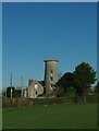
Bryn Illtud Mill, Llantwit Major
by Colin Cheesman
geograph for square SS9769
This mill was built some time around 1820 with 4 sails and a stage. Its working... (more)
|

|
Church of St Dochdwy, Llandough
by Colin Cheesman
geograph for square ST1673
A Gothic revival church in a once commanding position over Cardiff Bay now... (more)
|
|
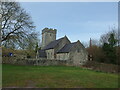
Church St Dyfan and St Teilo, Barry
by Colin Cheesman
geograph for square ST1169
C13 nave and chancel, C16 W tower, restoration of 1857 added porch, and altered... (more)
|

|
former Post office, Penarth
by Colin Cheesman
geograph for square ST1871
This was Penarth's Post Office designed by A R Myers, an HM Office of Works... (more)
|
|
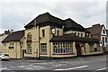
The Station - former public house
by Colin Cheesman
geograph for square ST1772
The splendid former public house was built at the turn of the 20th century.... (more)
|
|
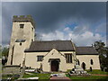
St Michaels and All Angels, Colwinston
by Colin Cheesman
geograph for square SS9375
The roots of this church are Norman with the nave, font and chancel arch dating... (more)
|
|
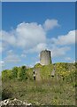
Hayes Farm Windmill and outbuildings at Sully
by Colin Cheesman
geograph for square ST1467
Hayes Farm Windmill was part of Hayes Mill model farm which was created, along... (more)
|

|
former STS Lord Nelson in Barry Dock No 2
by Colin Cheesman
geograph for square ST1267
STS Lord Nelson was a sail training ship operated by the Jubilee Sailing Trust.... (more)
|

|
Industrial complex between Palmerstown and Sully
by M J Richardson
for square ST1468
Category: Aerial photo
As seen on approach to Cardiff International Airport, about 3 minutes from landing.
|
|
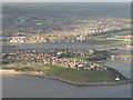
Barry Island and Nell's Point
by M J Richardson
for square ST1166
Category: Aerial photo
Looking across the harbour to the Council Offices on the centre.
|
|
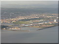
The Entrance Channel to Barry Harbour
by M J Richardson
for square ST1266
Category: Aerial photo
With Barry town and the docks beyond.
|
|
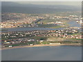
Barry Island
by M J Richardson
for square ST1166
Category: Aerial photo
Looking over Whitmore Bay towards the docks
|

|
Cold Knap Point and The Knap
by M J Richardson
for square ST1066
Category: Aerial photo
Watch House Bay and Barry Harbour to the right.
|
|
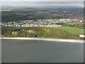
Houses above the Knap
by M J Richardson
for square ST0966
Category: Aerial photo
As seen on approach to Cardiff Interbnational Airport from the east, about two... (more)
|
|
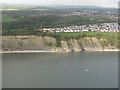
Bull Cliff, Barry
by M J Richardson
for square ST0966
Category: Cliffs
Looking across to houses at Westward Corner.
|

|
Church of St Cadoc (St Cattwg)
by Colin Cheesman
geograph for square ST0576
This church is dedicated to the 6th century Celtic Saint Cadoc or Cattwg in... (more)
|

|
Cadoxton River under the Barry Railway, Dinas Powys
by Colin Cheesman
geograph for square ST1571
Cadoxton River, or Afon Tregatwg, arises just beyond Michealston-le-Pit and... (more)
|

|
Path through overhanging trees north of St Nicholas
by David Smith
geograph for square ST0874
|

|
Footpath to St Nicholas through woodland
by David Smith
geograph for square ST0874
|

|
River Thaw at Aberthaw Power Station
by Colin Cheesman
geograph for square ST0265
This is the 'canalised' River Thaw as it makes its way through the now... (more)
|

|
Pylon in a pond
by Colin Cheesman
geograph for square ST0267
The former Aberthaw Power Station has an extensive network of connections to... (more)
|
|
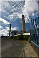
former Aberthaw Power Station
by Colin Cheesman
geograph for square ST0266
This is a view of the main stack of the former Aberthaw Power Station from just... (more)
|

|
Former Ash Plant at Aberthaw Power Station
by Colin Cheesman
for square ST0265
This building was used to grade the ash from the Aberthaw Power station. The... (more)
|
|
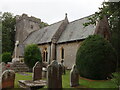
Parish Church of St Mary, Bonvilston
by Colin Cheesman
geograph for square ST0674
12th century origins with the tower added in the 15th century. Extensively... (more)
|

|
Blaen-y-cwm Corn mill, Cwm Nash Wood, Monknash
by Colin Cheesman
geograph for square SS9070
The remains of a post medieval water mill are found in Cwm Nash Wood. One wall... (more)
|
|
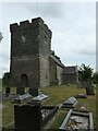
St Donats Church, Welsh St Donats
by Colin Cheesman
geograph for square ST0276
A Grade I listed building first mentioned in 1173 but the current church is... (more)
|
|
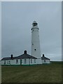
Upper (East) Lighthouse and cottages, Nash Point, St Donats
by Colin Cheesman
geograph for square SS9268
This is the upper of the two lighthouses built by Thomas Prothero in 1830 to... (more)
|
|
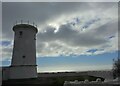
Lower (West) Lighthouse at Nash Point, St Donats
by Colin Cheesman
geograph for square SS9168
Built as an ambitious pair of lighthouses to assist navigation in the Bristol... (more)
|

|
Church of St Canna, Langan
by Colin Cheesman
geograph for square SS9577
Probably 12th century in origin and plan, with the core walling possibly... (more)
|

|
Walterstone Farm north-east of Llancarfan
by Colin Cheesman
geograph for square ST0671
Substantial farmhouse of 16th century date possibly two units which were... (more)
|

|
St Cadoc's Parish Church, Llancarfan
by Colin Cheesman
geograph for square ST0570
The parish church of Llancarfan is dedicated to St Cadoc who founded a monastery... (more)
|

|
Dovecote, Llantwit Major
by Colin Cheesman
geograph for square SS9668
A 13th century dovecote of the monastic grange at Llantwit Major which belonged... (more)
|
|
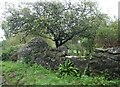
Pigsty and Stone Stile
by Colin Cheesman
geograph for square ST0372
Traditional 18th century corbelled pigsty constructed of coursed liassic... (more)
|
