Public Tags
Showing latest 50 of 54 images tagged with place:Watford tag.

|
Carriage Drive Information Board in Cassiobury Park
by David Hillas for square TQ0997 This information board is located in Carriage Drive near The Gardens entrance.... (more)
Tags:
Carriage Drive
former:Carriage Drive
Cassiobury Park
type:Close Look
Former Carriage Drive
Heritage Lottery Fund
subject:Information Board
Information Board
top:Suburb, Urban Fringe
Watford
place:Watford
Watford Borough Council
|

|
Watford station
by Malc McDonald geograph for square TQ0996 A view of the London Underground (Metropolitan Line) station at Watford in June 2012.
|
|
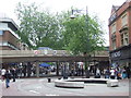
Watford High Street
by Malc McDonald geograph for square TQ1096 The High Street in Watford town centre is pedestrianised, apart from a cycle... (more)
|

|
Platform, Watford Junction Station
by Rossographer geograph for square TQ1097 Northbound platform at Watford Junction.
Tags:
top:City, Town Centre
type:Geograph
Railway
Railway Platform
subject:Railway Station
top:Railways
Watford
place:Watford
Watford Junction
|

|
The Cassiobury Gates Information Board
by David Hillas for square TQ1096 This information board is located at the east end of Cassiobury Park near... (more)
Tags:
Cassiobury Park
type:Close Look
Gates
Information Board
top:Park and Public Gardens
place:Watford
Watford
|
|
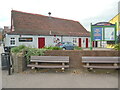
Cornerstone Church, Vicarage Road
by David Hillas geograph for square TQ1095 This photo shows the Cornerstone Church at 119a Vicarage Road WD18 0EY.... (more)
Tags:
Church
Cornerstone
Former Methodist Chapel
Former Wesleyan Methodist Chapel
type:Geograph
top:Suburb, Urban Fringe
on:Vicarage Road
road:Vicarage Road
Vicarage Road
Watford
place:Watford
in:Watford
|
|
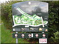
Information Board at west end of Oxhey Park
by David Hillas for square TQ1195 This information board erected by Watford Borough Council, is by the River Colne... (more)
Tags:
type:Close Look
Information Board
top:Park and Public Gardens
Park Information Board
Watford
in:Watford
place:Watford
Watford Borough Council
|

|
Santander Bank Branch in Watford Harlequin Centre
by David Hillas for square TQ1196 This photo shows the Santander Bank branch at 15-17 Queens Road WD17 2LJ... (more)
Tags:
Bank About to Close
top:City, Town Centre
type:Close Look
bank:Santander
Santander
Santander Bank
in:Watford
Watford
place:Watford
|
|
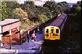
Watford West station, 1985
by Malc McDonald geograph for square TQ0995 Watford West station was on a short branch line from Watford to Croxley Green.... (more)
|
|
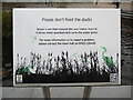
Notice by the pond in The Parade, High Street
by David Hillas for square TQ1096 This notice has been erected by Watford Borough Council in front of the pond in... (more)
Tags:
top:City, Town Centre
type:Close Look
subject:Notice
Notice
place:The Parade
road:The Parade
The Parade
Watford
in:Watford
place:Watford
|

|
Bandstand in Watford
by Malc McDonald geograph for square TQ1096 A bandstand in Watford, Hertfordshire. The building in the background is Watford Library.
|

|
Clarendon Road and Palace Theatre, Watford
by Malc McDonald geograph for square TQ1096 Clarendon Road leads into Watford town centre. Watford's Palace Theatre is... (more)
Tags:
top:City, Town Centre
listed:Grade 2
Grade 2 Listed
Grade 2 Listed Building
Grade II Listed Structure
place:Hertfordshire
Listed Building Grade II
top:Public Buildings and Spaces
top:Roads, Road Transport
Theatre
place:Watford
|

|
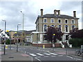
Clarendon Road, Watford
by Malc McDonald geograph for square TQ1096 Clarendon Road links Watford town cenrtre with Watford Junction railway station.
|
|
The Flag, Watford
by Malc McDonald geograph for square TQ1097 The Flag pub in Watford, Hertfordshire. The pub is next door to Watford... (more)
Tags:
top:Business, Retail, Services
top:City, Town Centre
place:Hertfordshire
Pub
Public House
place:Watford
Zebra Crossing
|
|
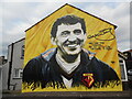
Wall Mural of Graham Taylor in Vicarage Road
by David Hillas geograph for square TQ1095 This photo is on the side wall of 119 Vicarage Road WD18 0EY and shows a mural... (more)
|
|
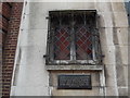
Window and Plaque in Market Street
by David Hillas for square TQ1096 This photo shows the window and plaque in Market Street near High Street where... (more)
Tags:
top:City, Town Centre
type:Close Look
Former Pub
Former Public House
Plaque
Watford
in:Watford
place:Watford
|

|
The One Bell pub, Watford
by Malc McDonald geograph for square TQ1196 The One Bell pub is located on Watford's Market Place.
Tags:
top:Business, Retail, Services
top:City, Town Centre
place:Hertfordshire
Pub
Public House
place:Watford
|

|
Welcome to Cassiobury Park Information Board
by David Hillas for square TQ1096 This information board is located at the east end of Cassiobury Park near... (more)
Tags:
Cassiobury Park
top:City, Town Centre
type:Close Look
subject:Information Board
Information Board
place:Watford
Watford
|
|
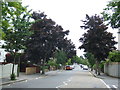
Cassiobury Park Avenue, Watford
by Malc McDonald geograph for square TQ0996 Cassiobury Park Avenue is a tree-lined residential road in Watford, Hertfordshire.
Tags:
place:Hertfordshire
Residential Road
top:Roads, Road Transport
top:Suburb, Urban Fringe
Tree Lined Road
Tree-Lined Avenue
place:Watford
|

|
The Owl Tree, Cassiobury Park, Watford
by Malc McDonald geograph for square TQ0996 The Owl Tree is a dead tree which has been carved and painted. It is located in... (more)
Tags:
Carved Tree
artwork:Carving
place:Hertfordshire
Park
top:Park and Public Gardens
place:Watford
Wood Carving
|
|
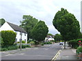
Stratford Way, Watford
by Malc McDonald geograph for square TQ0997 Stratford Way is a residential road in Watford, Hertfordshire. Trees line the... (more)
Tags:
place:Hertfordshire
Residential Road
top:Roads, Road Transport
top:Suburb, Urban Fringe
Tree Lined Road
Tree-Lined Avenue
place:Watford
|
|
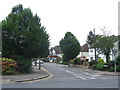
Stratford Way, Watford
by Malc McDonald geograph for square TQ0997 Stratford Way is a residential road in Watford, Hertfordshire.
Tags:
place:Hertfordshire
Residential Road
top:Roads, Road Transport
top:Suburb, Urban Fringe
place:Watford
|
|
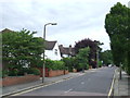
Stratford Way, Watford
by Malc McDonald geograph for square TQ1097 Stratford Way is a residential road in Watford, Hertfordshire.
Tags:
place:Hertfordshire
Residential Road
top:Roads, Road Transport
top:Suburb, Urban Fringe
place:Watford
|
|
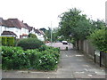
Woodland Drive, Watford
by Malc McDonald geograph for square TQ1097 Woodland Drive is a residential road in Watford, Hertfordshire. It has been... (more)
Tags:
place:Hertfordshire
No Through Road
No Through Route
Pedestrian Access
Residential Road
top:Suburb, Urban Fringe
place:Watford
|
|
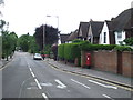
Stratford Way, Watford
by Malc McDonald geograph for square TQ1097 Stratford Way is a residential road in Watford, Hertfordshire.
Tags:
place:Hertfordshire
Residential Road
top:Roads, Road Transport
top:Suburb, Urban Fringe
place:Watford
|
|
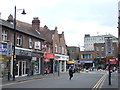
Clarendon Road, Watford
by Malc McDonald geograph for square TQ1096 Clarendon Road leads into Watford town centre.
The town centre is... (more)
Tags:
top:City, Town Centre
place:Hertfordshire
top:Roads, Road Transport
Traffic Restriction
place:Watford
|
|
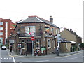
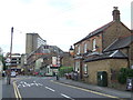
The Estcourt Tavern, Watford
by Malc McDonald geograph for square TQ1196 The Estcourt Tavern in Watford, Hertfordshire.
There is another pub nearby... (more)
|
|
Estcourt Road, Watford
by Malc McDonald geograph for square TQ1196 Estcourt Road in Watford, Hertfordshire. The Estcourt Tavern pub is on the... (more)
Tags:
place:Hertfordshire
Pub
Public House
top:Roads, Road Transport
top:Suburb, Urban Fringe
place:Watford
|
|
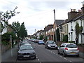
Estcourt Road, Watford
by Malc McDonald geograph for square TQ1196 Estcourt Road is a residential street near the centre of Watford, Hertfordshire.... (more)
Tags:
place:Hertfordshire
Residential Street
top:Roads, Road Transport
top:Suburb, Urban Fringe
Telephone Cables
Telephone Wires
place:Watford
|

|
The Estcourt Arms, Watford
by Malc McDonald geograph for square TQ1197 The Estcourt Arms pub in Watford, Hertfordshire.
There is another pub nearby... (more)
|

|
Watford
by Peter Trimming geograph for square TQ1097 View outside Watford Junction railway station, looking towards O'Neill's bar.
Tags:
top:Business, Retail, Services
top:City, Town Centre
type:Geograph
county:Hertfordshire
Public House
top:Roads, Road Transport
place:Watford
Watford Junction
|

|
Watford
by Peter Trimming geograph for square TQ1097 The entrance to Watford Junction railway station, lurking beneath the office... (more)
Tags:
top:Business, Retail, Services
top:City, Town Centre
type:Geograph
county:Hertfordshire
top:Railways
top:Roads, Road Transport
place:Watford
Watford Junction
|

|
Warner Bros. Studio Tour, Watford
by Rossographer geograph for square TL0900 Entrance to the Warner Bros. Studio Tour London - The Making of Harry Potter at... (more)
Tags:
type:Geograph
Harry Potter
top:Industry
top:People, Events
subject:Studio
top:Suburb, Urban Fringe
Warner Bros
place:Watford
Watford
|

|
Fullerian Crescent, Watford
by Malc McDonald geograph for square TQ0996 Fullerian Crescent is a newly-developed road in Watford, Hertfordshire. The... (more)
Tags:
Gated Community
Gated Entrance
Gated Road
place:Hertfordshire
top:Housing, Dwellings
New Housing Development
top:Suburb, Urban Fringe
place:Watford
|
|
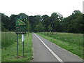
Path through Cassiobury Park, Watford
by Malc McDonald geograph for square TQ0996 This path, shared by pedestrians and cyclists, passes through Cassiobury Park in Watford.
Tags:
Cycle Path
Cyclepath
place:Hertfordshire
Park
top:Park and Public Gardens
top:Paths
Shared Path
Shared Use Path
place:Watford
|
|
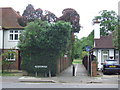
Path to Cassiobury Park, Watford
by Malc McDonald geograph for square TQ0997 This path, which is shared by pedestrians and cyclists, leads into Cassiobury... (more)
Tags:
Cycle Path
Cyclepath
Footpath
place:Hertfordshire
top:Paths
Shared Path
Shared Use Path
top:Suburb, Urban Fringe
place:Watford
|
|
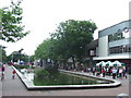
Watford High Street
by Malc McDonald geograph for square TQ1096 Watford High Street is pedestrianised. A pond has been created at the northern... (more)
Tags:
top:City, Town Centre
Cycle Path
place:Hertfordshire
High Street
Pedestrianised Area
Pedestrianised Street
Pond
Shopping Street
place:Watford
|

|
Railway bridge near Watford Junction
by Malc McDonald geograph for square TQ1197 This bridge carries the railway line over a road near Watford Junction station.... (more)
|

|
Century Retail Park, Watford
by Jim Osley geograph for square TQ1195 Among its other attractions (not immediately obvious, it is probably fair to... (more)
|

|
Watford
by Peter Trimming geograph for square TQ1197 The junction of Saint John's Road and Sotherton Road. The café has been... (more)
Tags:
top:Business, Retail, Services
former:Cafe
top:City, Town Centre
type:Geograph
county:Hertfordshire
top:Roads, Road Transport
place:Watford
|
|
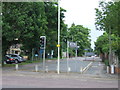
Stratford Road, Watford
by Malc McDonald geograph for square TQ1097 Stratford Road at its junction with Hempstead Road. The road has been blocked... (more)
Tags:
place:Hertfordshire
No Through Road
No Through Route
top:Roads, Road Transport
top:Suburb, Urban Fringe
place:Watford
|
|
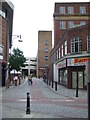
Narrow lane in Watford town centre
by Malc McDonald geograph for square TQ1096 |

|
Watford Junction railway station
by Graham Hogg geograph for square TQ1097 A London Midland train is just arriving
|

|
Pump House Theatre & Arts Centre, Watford
by Jim Osley geograph for square TQ1195 Conversion of Victorian Pumping Station.
Tags:
top:City, Town Centre
building type:Pumping Station
change of use:Pumping Station Into Theatre
place:Watford
|

|
Car parks, Watford General Hospital
by Robin Stott geograph for square TQ1095 The scale of visitor parking is a reflection of the number of people in... (more)
Tags:
type:Geograph
top:Health and Social Services
Hospital
top:Lowlands
Parking
top:Roads, Road Transport
top:Suburb, Urban Fringe
place:Watford
postcode district:WD18
|

|
Watford General Hospital
by Robin Stott geograph for square TQ1095 A typically bewildering view of a sprawling old hospital trying to rebuild... (more)
Tags:
top:Construction, Development
General Hospital
type:Geograph
top:Health and Social Services
top:Lowlands
Rebuilding
top:Suburb, Urban Fringe
place:Watford
postcode district:WD18
|

|
Watford General Hospital
by Robin Stott geograph for square TQ1095 We reached the main entrance in order to ask where to find our relative, then... (more)
Tags:
Entrance
General Hospital
type:Geograph
top:Health and Social Services
top:Lowlands
top:Suburb, Urban Fringe
place:Watford
postcode district:WD18
|

|
Footpath, Watford General Hospital
by Robin Stott geograph for square TQ1095 On the right is the Lego-like multistorey car park, as baffling as most. On the... (more)
Tags:
top:City, Town Centre
General Hospital
type:Geograph
top:Health and Social Services
top:Lowlands
Multi-Storey Car Park
top:Paths
Steps
place:Watford
|

|
Watford
by Peter Trimming geograph for square TQ1197 Housing development on the former orphanage site.
Tags:
type:Geograph
county:Hertfordshire
former:Orphanage
top:Roads, Road Transport
top:Suburb, Urban Fringe
place:Watford
|
|
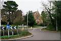
Watford
by Peter Trimming geograph for square TQ1197 Reeds Chapel, now converted to residential accommodation.
Tags:
former:Chapel
type:Geograph
county:Hertfordshire
top:Roads, Road Transport
top:Suburb, Urban Fringe
place:Watford
|
