|
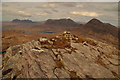
Summit of Sgorr Tuath, Ross-shire
by Andrew Tryon
geograph for square NC1107
View north from the summit of Sgorr Tuath (589 m, 1932 ft), one of the twin... (more)
|
|
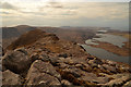
The Sgorr Tuath Ridge, Ross-shire
by Andrew Tryon
geograph for square NC1007
View west along the rocky summit ridge of Sgorr Tuath (589 m, 1932 ft) in the... (more)
|
|
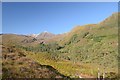
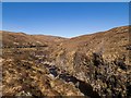
View towards Beinn Liath Mhor, Ross-shire
by Andrew Tryon
geograph for square NG9948
View northwest from Cnoc nan Eilid (knoll) over the River Lair gorge, Coire... (more)
|
|
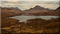
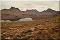
Loch Lurgainn and Mountains, Scottish Highlands
by Andrew Tryon
geograph for square NC0808
View over Loch Lurgainn from its western end. The prominent peak at the other... (more)
|
|
Loch Lurgainn and Mountains, Scottish Highlands
by Andrew Tryon
geograph for square NC0807
A view over Loch Lurgainn with mountains beyond in the Assynt region of the... (more)
|
|
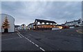
The ceilidh place Ullapool
by valenta
geograph for square NH1293
On West Argyle Street, the ceilidh place features a bookshop as well as being a... (more)
|
|
Little Loch Broom
by valenta
geograph for square NH0291
Looking down the loch from the shoreline at Badcaul
|
|
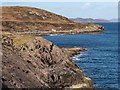
Rocky coastline at Mellon Udrigle
by valenta
geograph for square NG8996
|
|
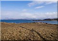
Moorland above the Old Schoolhouse
by valenta
geograph for square NG8996
A circular path from the village of Mellon Udrigle
|
|
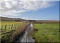
The Fèth Rabhain
by valenta
geograph for square NG8995
Draining the marginal land the Fèth Rabhain runs under the roadway and through... (more)
|
|
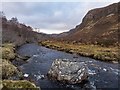
Dundonnell River
by valenta
geograph for square NH1282
Looking downstream, a large boulder in the river bed
|
|
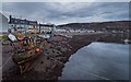
Wooden fishing boat in Ullapool Harbour
by valenta
geograph for square NH1293
An old fishing boat beached below Shore Street Ullapool
|
|
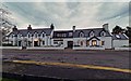
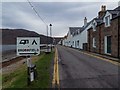
Shore Street Ullapool
by valenta
geograph for square NH1293
In the heart of Ullapool during a dismal December afternoon, the area is devoid... (more)
|
|
West Shore Street Ullapool
by valenta
geograph for square NH1293
|
|
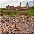
Ruin at Red Point South Beach
by valenta
geograph for square NG7367
Marked as a fishing station on the 1902 6" OS map. The rusty mooring ring... (more)
|
|
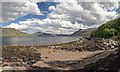
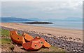
Red Point South Beach
by valenta
geograph for square NG7367
Concrete blocks on the tideline of the south beach, looking across to Eilean Tioram
|
|
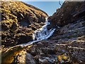
Waterfall on the Dundonnell River
by valenta
geograph for square NH1281
Just downstream of the Fain Bridge, the river drops over several falls
|
|
Dundonnell River
by valenta
geograph for square NH1281
Downstream of the waterfall at the Fain Bridge
|
|
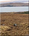
Cable drum on the moorland at Druim nam Fuath
by valenta
geograph for square NH0092
Possibly this full drum of cable escaped from the viewpoint carpark on the A832... (more)
|