Public Tags
Showing images tagged with place:Wisley tag.
|
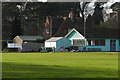
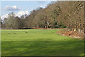
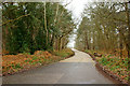
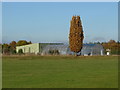
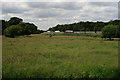
Wisley cricket club
by Alan Hunt geograph for square TQ0659 The pavilion of Wisley Cricket Club off Wisley Lane. The sign on the left... (more)
|
|
Trials Field, RHS Wisley
by Ian Capper geograph for square TQ0657 The Trials Field at Wisley, where plants are trialed by the Royal Hoerticultural... (more)
Tags:
type:GeographX
top:Park and Public GardensX
place:RHS WisleyX
Trials FieldX
Trials GroundX
place:Wisley
|
|
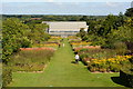
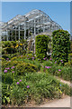
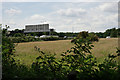
The glasshouse at RHS Wisley
by Oliver Mills geograph for square TQ0658 The main glasshouse and pathways at the RHS (Royal Horticultural Society) Wisley... (more)
Tags:
GardenX
GlasshouseX
subject:GlasshouseX
top:Park and Public GardensX
PathX
top:PathsX
place:RHS WisleyX
top:Suburb, Urban FringeX
top:Village, Rural SettlementX
place:Wisley
|
|
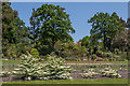
River Wey at Wisley
by Colin Smith geograph for square TQ0658 Gently flowing river between Wisley Golf Course and the RHS Wisley garden.... (more)
Tags:
Golf CourseX
top:Park and Public GardensX
River WeyX
top:Rivers, Streams, DrainageX
place:Wisley
|
|
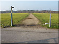
Wisley Common boundary
by Alan Hunt geograph for square TQ0659 The wooded boundary of Wisley Common with the Wisley cricket pitch.
|
|
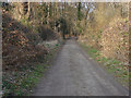
Hatch Lane, Wisley Common
by Alan Hunt geograph for square TQ0758 Looking north along Hatch Lane as it enters Wisley Common from Wisley airfield.
|
|
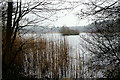
Bolder Mere, Wisley, Surrey
by Peter Trimming geograph for square TQ0758 Seen from the end of the path which leads to the disused Wisley Airfield.
|
|
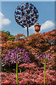
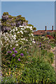
Alliums - real and in sculpture
by Ian Capper geograph for square TQ0658 Two purple Alliums in the border south of the Walled Garden at RHS Wisley, below... (more)
|
|
Purple and white Alliums
by Ian Capper geograph for square TQ0658 Purple and white Alliums in the border south of the Walled Garden at RHS Wisley,... (more)
|
|
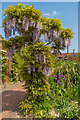
Wisteria
by Ian Capper geograph for square TQ0658 A flowering Wisteria in the border south of the Walled Garden at RHS Wisley,... (more)
|
|
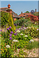
Purple and white
by Ian Capper geograph for square TQ0658 The border south of the Walled Garden at RHS Wisley, with the main house in the... (more)
|
|
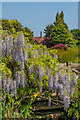
Wisteria by the stream
by Ian Capper geograph for square TQ0658 Flowering Wisteria by a bridge over the stream at RHS Wisley.
|
|
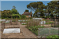
Kitchen garden
by Ian Capper geograph for square TQ0659 The kitchen garden at the north end of RHS Wisley, with Woodside in the background.
Tags:
type:GeographX
top:Housing, DwellingsX
Kitchen GardenX
top:Park and Public GardensX
place:RHS WisleyX
place:Wisley
WoodsideX
|
|
By The Glasshouse
by Ian Capper geograph for square TQ0658 Purple Alliums in the borders in front of The Glasshouse at RHS Wisley.
Tags:
AlliumX
type:GeographX
top:Park and Public GardensX
place:RHS WisleyX
The GlasshouseX
place:Wisley
|
|
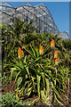
Red Hot Pokers
by Ian Capper for square TQ0658 A clump of Red Hot Pokers (Kniphofia 'Nobilis') in front of The... (more)
Tags:
type:Close LookX
KniphofiaX
top:Park and Public GardensX
Red Hot PokerX
place:RHS WisleyX
The GlasshouseX
place:Wisley
|
|
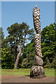
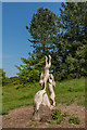
Chainsaw scultpture
by Ian Capper geograph for square TQ0658 Pinecone sculpture in the Pinetum at Wisley carved in April 2015 out of an old... (more)
Tags:
Chainsaw CarvingX
Chainsaw SculptureX
type:GeographX
top:Park and Public GardensX
person:Paul SivellX
PinetumX
place:RHS WisleyX
place:Wisley
|
|
Chainsaw scultpture
by Ian Capper for square TQ0657 Two hares in the Jubilee Arboretum at Wisley carved out of an old tree trunk by... (more)
Tags:
Chainsaw CarvingX
Chainsaw SculptureX
type:Close LookX
Jubilee ArboretumX
top:Park and Public GardensX
person:Paul SivellX
place:RHS WisleyX
place:Wisley
|
|
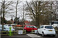
Car Park at RHS Wisley.
by Peter Trimming geograph for square TQ0658 As near as possible to the location, some 50 years ago (probably 1965), where my... (more)
|
|
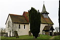
Wisley Church
by Peter Trimming geograph for square TQ0559 Wisley means marshy meadow clearing (WISC and LEAH). A building was here by... (more)
|
|
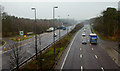
A3 at Wisley, Surrey
by Peter Trimming geograph for square TQ0658 The busy A3, seen from the footbridge which leads to RHS Wisley.
|
|
Elm Lane, Wisley, Surrey
by Peter Trimming geograph for square TQ0658 Elm Lane leads to Elm Corner, on the edge of the disused Wisley Airfield.
Tags:
top:Flat LandscapesX
top:Roads, Road TransportX
place:SurreyX
place:Wisley
top:Woodland, ForestX
|
|
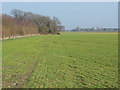
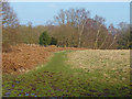
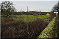
Farmland on Wisley airfield
by Alan Hunt geograph for square TQ0757 One of the large arable fields north of the runway of the former Wisley airfield.
|
|
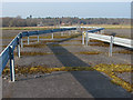
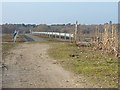
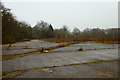
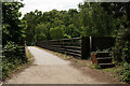
Wisley runway crossing point
by Alan Hunt geograph for square TQ0757 Barriers marking one of the footpath crossing point on the former Wisley... (more)
Tags:
top:Air TransportX
top:Boundary, BarrierX
top:Derelict, DisusedX
Former AirfieldX
top:PathsX
place:Wisley
|
|
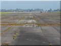
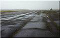
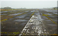
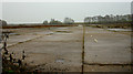
Disused runway, Wisley
by Alan Hunt geograph for square TQ0757 Looking east along the centreline of the massive runway at the former BAE... (more)
|
|
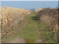
Wisley airfield
by Alan Hunt geograph for square TQ0757 Looking north along the footpath from Bridge End Farm across the runway to Wisley Common.
|
|
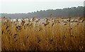
Snakehead reserve, Wisley
by Alan Hunt geograph for square TQ0757 The Surrey Wildlife Trust reserve north of Wisley airfield.
|
|
Footpath across the Wisley runway
by Alan Hunt geograph for square TQ0757 Barriers delineating one of the footpath crossing points on the former Wisley runway.
|
|
Maize, Wisley Airfield
by Alan Hunt geograph for square TQ0757 Last years maize crop in an area of former hard standings south of the Wisley runway.
|
|
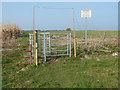
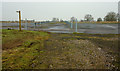
Gate to Wisley airfield
by Alan Hunt geograph for square TQ0757 One of the footpath gates into the former Wisley airfield.
|
|
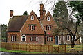
Wisley
by Peter Trimming geograph for square TQ0659 Housing on Wisley Lane.
|
|
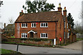
Wisley
by Peter Trimming geograph for square TQ0659 Housing on Wisley Lane.
Tags:
top:LowlandsX
top:Roads, Road TransportX
county:SurreyX
top:Village, Rural SettlementX
place:Wisley
|
|
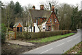
Wisley
by Peter Trimming geograph for square TQ0659 House and postbox on Wisley Lane.
|
|
Nursery, Wisley village
by Alan Hunt geograph for square TQ0659 A polytunnel to the north of the football pitch in Wisley village.
|
|
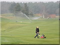
Greenkeeping at Wisley
by Colin Smith geograph for square TQ0658 Mowing and sprinkling operations at Wisley Golf Course beside the River Wey.
|
|
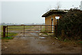
Entrance to Wisley Airfield, Surrey
by Peter Trimming geograph for square TQ0857 The airfield has been disused for many years. This was the southern entrance,... (more)
Tags:
top:Air TransportX
Disused AirfieldX
former:EntranceX
top:Flat LandscapesX
place:SurreyX
place:Wisley
|
|
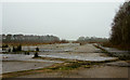
Wisley Airfield, Surrey
by Peter Trimming geograph for square TQ0757 Looking along the runway, of the disused airfield, in an easterly direction.
|
|
Wisley Airfield, Surrey
by Peter Trimming geograph for square TQ0757 Looking along the runway, on the disused airfield, in a westerly direction.
|
|
Wisley Airfield, Surrey
by Peter Trimming geograph for square TQ0757 Looking across the runway of the disused airfield.
|
|
Wisley Airfield, Surrey
by Peter Trimming geograph for square TQ0757 Looking across the disused airfield, in a north-easterly direction. The hamlet... (more)
|
|
Wisley Airfield, Surrey
by Peter Trimming geograph for square TQ0757 Looking across the disused airfield, in a south-westerly direction.
|
|
Wisley Airfield, Surrey
by Peter Trimming geograph for square TQ0757 Looking across the disused airfield, in the direction of the public bridleway.... (more)
|
|
Bolder Mere, Wisley, Surrey
by Peter Trimming geograph for square TQ0758 Seen from the footpath/cyclepath which runs beside the busy A3.
|
|
M25 Near Wisley
by Peter Trimming geograph for square TQ0759 Seen from the bridleway, south of the motorway.
|
|
M25 Near Wisley
by Peter Trimming geograph for square TQ0759 Seen from the bridleway, north of the motorway.
|
|
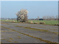
Blackthorn, Wisley airfield
by Alan Hunt geograph for square TQ0757 A lone blackthorn by the disused runway waiting for the bulldozers to arrive for... (more)
|
|
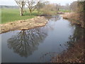
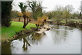
River Wey
by Peter Trimming geograph for square TQ0659 Seen from Wisley Bridge.
|
|
Wisley Bridge
by Peter Trimming geograph for square TQ0659 According to the sign, land is for sale; 'Development potential STPP'.
|
|
Bridge Over the M25
by Peter Trimming geograph for square TQ0759 Note the horse mounting block.
|