Public Tags
Other tags: near:Woldingham
Showing latest 50 of 94 images tagged with place:Woldingham tag.
|
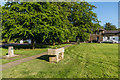
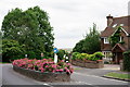
Woldingham Village Green
by Ian Capper geograph for square TQ3755 Cattle trough and drinking fountain on Woldingham Village Green. The cattle... (more)
|
|
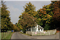
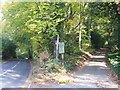
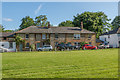
Station Lodge, Woldingham
by Peter Trimming geograph for square TQ3556 Woldingham station lies a short distance up the road, to the right of picture.... (more)
Tags:
top:LowlandsX
top:Roads, Road TransportX
county:SurreyX
top:Village, Rural SettlementX
place:Woldingham
|
|
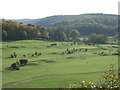
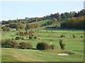
Woldingham Golf Club
by Malc McDonald geograph for square TQ3557 The clubhouse at Woldingham Golf Club.
Tags:
Club HouseX
ClubhouseX
Golf Club HouseX
Golf CourseX
top:Sport, LeisureX
place:SurreyX
place:Woldingham
|
|
Woldingham Golf Club
by Malc McDonald geograph for square TQ3557 The golf course at Woldingham Golf Club, in Surrey.
|
|
Woldingham Golf Club
by Malc McDonald geograph for square TQ3557 The clubhouse at Woldingham Golf Club in Surrey.
Tags:
Club HouseX
ClubhouseX
Golf Club HouseX
Golf CourseX
top:Sport, LeisureX
place:SurreyX
place:Woldingham
|
|
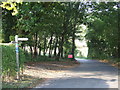
Public footpath sign, Woldingham
by Malc McDonald geograph for square TQ3557 A public footpath is signposted around the perimeter of a golf course in... (more)
|
|
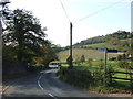
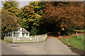
Country lane, Woldingham
by Malc McDonald geograph for square TQ3557 A country lane at Woldingham, Surrey.
|
|
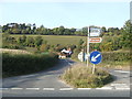
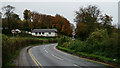
Country road, Woldingham
by Malc McDonald geograph for square TQ3557 A country road at Woldingham, Surrey.
The road is crossed at this point by... (more)
|
|
Country lanes at Woldingham
by Malc McDonald geograph for square TQ3557 A country lane and a private lane at Woldingham, Surrey.
|
|
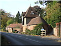
House at Woldingham, Surrey
by Malc McDonald geograph for square TQ3557 A house in Woldingham, Surrey.
The pathway leading behind the house is part... (more)
|
|
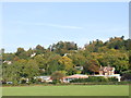
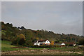
Houses at Woldingham
by Malc McDonald geograph for square TQ3556 Houses set on the hillside in Woldingham, Surrey.
|

|
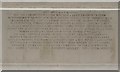
Drinking fountain, Woldingham Village Green
by Ian Capper for square TQ3755 Drinking fountain on Woldingham Village Green. The plaque reads... (more)
|
|
Church Road, Woldingham
by Peter Trimming geograph for square TQ3556 I don't know about the history of Woldingham, but the only obvious (and... (more)
Tags:
road:Church RoadX
top:LowlandsX
top:Roads, Road TransportX
county:SurreyX
top:Village, Rural SettlementX
place:Woldingham
|
|
Footpath overlooking Woldingham Golf Club
by Malc McDonald geograph for square TQ3557 A public footpath overlooking Woldingham Golf Club in Surrey.
Tags:
FootpathX
Footpath SignX
Golf CourseX
top:PathsX
sign:Public FootpathX
Public FootpathX
SignpostX
place:SurreyX
place:Woldingham
|
|
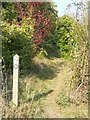
Public footpath at Woldingham
by Malc McDonald geograph for square TQ3557 A public footpath through woodland at Woldingham. This image was taken in the... (more)
Tags:
season:AutumnX
Autumn ColourX
Autumn ColoursX
Autumn Tree ColourX
FootpathX
Footpath SignX
top:PathsX
Public FootpathX
sign:Public FootpathX
SignpostX
place:SurreyX
place:Woldingham
top:Woodland, ForestX
|
|
National Cycle Network, Woldingham
by Malc McDonald geograph for square TQ3557 National Cycle Network route 21 links Greenwich with the Sussex Coast, passing... (more)
|
|
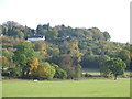
Woldingham in the autumn
by Malc McDonald geograph for square TQ3556 Autumn tree colours at Woldingham, Surrey.
Tags:
season:AutumnX
AutumnX
Autumn ColourX
Autumn ColoursX
Autumn Tree ColourX
top:LowlandsX
place:SurreyX
place:Woldingham
|
|
Signpost at Woldingham
by Malc McDonald geograph for square TQ3556 The roadway in this image is a private access drive leading to Woldingham... (more)
Tags:
rights of way:BridlewayX
BridlewayX
path:BridlewayX
Bridleway SignX
Bridleway SignpostX
National Cycle NetworkX
National Cycle Network Route 21X
National Cycle RouteX
Public BridlewayX
top:Roads, Road TransportX
place:SurreyX
place:Woldingham
|
|
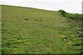
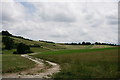
Woldingham
by Peter Trimming geograph for square TQ3757 Looking along the Vanguard Way, as the path climbs out of Woldingham.
Tags:
top:Farm, Fishery, Market GardeningX
type:GeographX
top:GrasslandX
top:PathsX
county:SurreyX
long distance path:Vanguard WayX
place:Woldingham
|
|
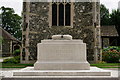
Woldingham War Memorial
by Peter Trimming for square TQ3656 The stone memorial in front of St Paul's Church in Woldingham was unveiled... (more)
Tags:
type:Close LookX
top:Religious SitesX
county:SurreyX
top:Village, Rural SettlementX
subject:War MemorialX
place:Woldingham
|
|
Woldingham War Memorial
by Peter Trimming geograph for square TQ3656 The stone memorial in front of St Paul's Church in Woldingham was unveiled... (more)
Tags:
type:GeographX
top:Religious SitesX
county:SurreyX
top:Village, Rural SettlementX
subject:War MemorialX
place:Woldingham
|
|
Woldingham village green
by Ian Capper geograph for square TQ3755 The village green in Woldingham. In the background are Tea Tree Cottages.
Tags:
type:GeographX
top:Housing, DwellingsX
Tea Tree CottagesX
Village GreenX
top:Village, Rural SettlementX
place:Woldingham
|
|
Station Lodge, Woldingham
by Peter Trimming geograph for square TQ3556 Woldingham station lies a short distance up the road, to the right of picture.
|
|
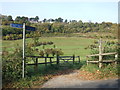
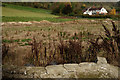
Woldingham Flood Prevention
by Peter Trimming geograph for square TQ3557 Woldingham Road, immediately behind the photographer, used to flood after heavy... (more)
Tags:
Flood AlleviationX
top:GrasslandX
county:SurreyX
top:Village, Rural SettlementX
place:Woldingham
|
|
View Towards Bug Hill, Woldingham
by Peter Trimming geograph for square TQ3557 In the foreground, excavation to accommodate flood waters can be seen.... (more)
Tags:
Flood AlleviationX
top:LowlandsX
county:SurreyX
top:Village, Rural SettlementX
place:Woldingham
|
|
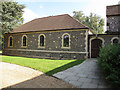
St Paul's church, Woldingham: hall
by Stephen Craven geograph for square TQ3756 The hall was built as an extension to the church c.2007. The rounded windows... (more)
|
|
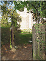
St Paul's church, Woldingham: gateway
by Stephen Craven geograph for square TQ3655 A simple arch leads from Station Road onto the church path.
|
|
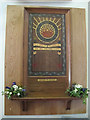
St Paul's church, Woldingham: war memorial
by Stephen Craven for square TQ3656 This small painted war memorial was originally in St Agatha's church but... (more)
|
|
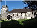
St Paul's church, Woldingham: south side
by Stephen Craven for square TQ3656 This side view shows the different styles used in the building - perpendicular... (more)
Tags:
Anglican ChurchX
Grade II ListedX
architect:Herbert BakerX
top:Religious SitesX
place:Woldingham
|
|
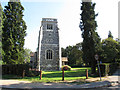
St Paul's church, Woldingham: tower
by Stephen Craven geograph for square TQ3656 The tower presents an impressive first view of the village to anyone coming up... (more)
Tags:
Anglican ChurchX
Church ClockX
Grade II ListedX
architect:Herbert BakerX
top:Religious SitesX
place:Woldingham
|
|
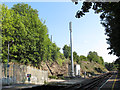
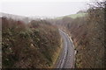
Transmitter at Woldingham Station
by Stephen Craven geograph for square TQ3556 There is poor mobile reception in the Woldingham Valley. I'm not sure... (more)
|
|
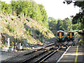
Woldingham Station: passing trains
by Stephen Craven geograph for square TQ3556 Two Southern Railway Electrostars passing in the cutting just south of... (more)
|
|
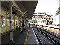
Woldingham Station: up platform
by Stephen Craven geograph for square TQ3556 Woldingham station has staggered platforms. Platform 1 is for Up trains (to London).
|
|
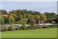
Woldingham Garden Village
by Stephen Craven geograph for square TQ3556 Viewed from the bridleway through the grounds of Woldingham School.
|
|
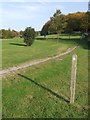
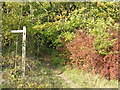
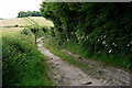
Public footpath near Woldingham
by Malc McDonald geograph for square TQ3557 The arrow on the wooden post indicates that this is a public footpath.
|
|
Golf course at Woldingham
by Malc McDonald geograph for square TQ3557 |
|
Woldingham School
by Peter Trimming geograph for square TQ3654 Catholic Boarding & Day School for girls aged 11-18, located in Marden Park.
Tags:
top:Educational SitesX
top:Farm, Fishery, Market GardeningX
type:GeographX
top:GrasslandX
place:Marden ParkX
county:SurreyX
place:Woldingham
top:Woodland, ForestX
|
|
Path through the trees, Woldingham
by Malc McDonald geograph for square TQ3557 The wooden marker post to the left of this image indicates a footpath which... (more)
Tags:
FootpathX
Footpath SignX
Footpath WaymarkerX
top:PathsX
place:SurreyX
place:Woldingham
top:Woodland, ForestX
|
|
Woldingham
by Peter Trimming geograph for square TQ3655 Looking in the direction of the railway station from above the tunnel mouth.
|
|
Knights Garden Centre
by Ian Capper geograph for square TQ3556 Garden centre on Woldingham Road, viewed from the drive to Marden Park.
Tags:
top:Business, Retail, ServicesX
Garden CentreX
type:GeographX
business:Knights Garden CentreX
place:Woldingham
|
|
Woldingham
by Peter Trimming geograph for square TQ3757 Looking back down the Vanguard Way.
Tags:
top:Farm, Fishery, Market GardeningX
type:GeographX
top:GrasslandX
top:PathsX
county:SurreyX
long distance path:Vanguard WayX
place:Woldingham
|
|
Woldingham
by Peter Trimming geograph for square TQ3757 View from the Vanguard Way.
Tags:
top:Farm, Fishery, Market GardeningX
type:GeographX
top:GrasslandX
top:PathsX
county:SurreyX
long distance path:Vanguard WayX
place:Woldingham
top:Woodland, ForestX
|
|
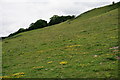
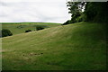
Woldingham
by Peter Trimming geograph for square TQ3757 View from the Vanguard Way, showing the steep gradients on the downland.
Tags:
top:Farm, Fishery, Market GardeningX
type:GeographX
top:GrasslandX
top:PathsX
county:SurreyX
long distance path:Vanguard WayX
place:Woldingham
|
|
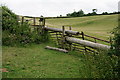
Woldingham
by Peter Trimming geograph for square TQ3757 A stile on the Vanguard Way.
Tags:
top:Farm, Fishery, Market GardeningX
type:GeographX
top:GrasslandX
top:PathsX
former:StileX
county:SurreyX
long distance path:Vanguard WayX
place:Woldingham
|
|
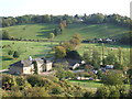
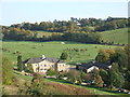
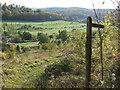
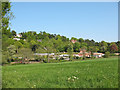
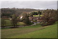
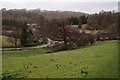
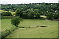
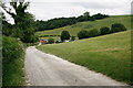
Woldingham
by Peter Trimming geograph for square TQ3756 Looking down towards Warren Barn Farm.
Tags:
top:Farm, Fishery, Market GardeningX
type:GeographX
top:Roads, Road TransportX
county:SurreyX
top:Village, Rural SettlementX
place:Woldingham
|
|
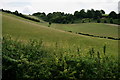
Woldingham
by Peter Trimming geograph for square TQ3756 Looking along the Vanguard Way. The long-distance path is not well defined at this point.
Tags:
top:Farm, Fishery, Market GardeningX
type:GeographX
top:PathsX
county:SurreyX
long distance path:Vanguard WayX
place:Woldingham
|
|
Woldingham
by Peter Trimming geograph for square TQ3756 View from Slines Oak Road.
Tags:
top:Farm, Fishery, Market GardeningX
type:GeographX
top:Roads, Road TransportX
county:SurreyX
place:Woldingham
|
|
Woldingham
by Peter Trimming geograph for square TQ3756 Looking along the bridleway, from Slines Oak Road.
Tags:
top:Farm, Fishery, Market GardeningX
type:GeographX
top:Roads, Road TransportX
county:SurreyX
top:Village, Rural SettlementX
place:Woldingham
|
|
Woldingham
by Peter Trimming geograph for square TQ3755 Slines Oak Road.
Tags:
type:GeographX
top:Roads, Road TransportX
county:SurreyX
top:Village, Rural SettlementX
place:Woldingham
|