|
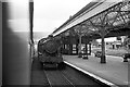
Wrexham General Station, 1960
by Alan Murray-Rust
geograph for square SJ3250
Taken from a southbound express train, passing a similar express service heading... (more)
|
|
Wrexham General Station
by Paul Gillett
geograph for square SJ3250
Viewed from Regent Street Bridge
|

|
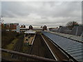
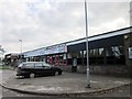
Bicks Chicks at Wrexham Industrial Estate
by Jeff Buck
geograph for square SJ3750
Bicks Chicks poultry dealers on Abenbury Way on the Wrexham Industrial Estate.... (more)
|
|
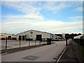
Bryn Lane, Wrexham Industrial Estate
by Jeff Buck
geograph for square SJ3850
|

|
Premier Inn - Wrexham Town Centre
by Paul Gillett
geograph for square SJ3250
The hotel is located opposite Wrexham General railway station
Website:... (more)
|
|
Queen Street, Wrexham
by Jeff Buck
geograph for square SJ3350
Looking north along Queen Street towards the old Wrexham library in Queen's Square.
|
|
Hope Street, Wrexham
by Jeff Buck
geograph for square SJ3350
The Welsh name for Hope Street, Stryd yr Hôb dates from the origins of the town... (more)
|
|
Hope Street, Wrexham
by Jeff Buck
geograph for square SJ3350
The Welsh name for Hope Street, Stryd yr Hôb dates from the origins of the town... (more)
|
|
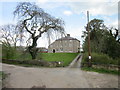
Llwyn Knottia Farm, Wrexham
by Jeff Buck
geograph for square SJ3550
Llwyn Knottia farmhouse on Cefn Road near Wrexham is a Georgian style building... (more)
|
|
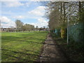
Path through The Dunks, Wrexham
by Jeff Buck
geograph for square SJ3450
A public footpath through an area of Wrexham called The Dunks. This path lies... (more)
|
|
Grove Park Theatre, Wrexham
by Jeff Buck
geograph for square SJ3350
Grove Park Theatre in Hill Street is Wrexhams oldest amateur theatre formed in... (more)
|
|
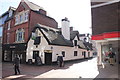
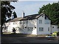
The Horse and Jockey, Wrexham
by Jeff Buck
geograph for square SJ3350
The Horse and Jockey pub is one of the oldest buildings in Wrexham town centre,... (more)
|
|
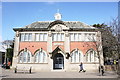
The Old Library at Wrexham
by Jeff Buck
geograph for square SJ3350
The old library in Queen's Square was built in 1907, with money donated by... (more)
|

|
Waterways Garden Centre
by Jeff Buck
geograph for square SJ3751
Waterways Garden Centre on the A534 (Wrexham Road).
|
|
The A5156 (Sesswick Way) near Cross Lanes
by Jeff Buck
geograph for square SJ3748
The A5156 (Sesswick Way) is a relatively new road not shown on the current OS... (more)
|
|
Premier Outlet, Wrexham Industrial Estate
by Jeff Buck
geograph for square SJ3949
|
|
Oak Road, Wrexham Industrial Estate
by Jeff Buck
geograph for square SJ3949
|
|
Oak Road, Wrexham Industrial Estate
by Jeff Buck
geograph for square SJ3949
|
|
Bryn Lane, Wrexham Industrial Estate
by Jeff Buck
geograph for square SJ3849
|
|
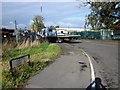
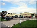
Junction of Dunster Road and Redwither Road
by Jeff Buck
geograph for square SJ3849
The junction of Dunster Road and Redwither Road on the Wrexham Industrial Estate.
|
|
Junction of Dunster Road and Redwither Road
by Jeff Buck
geograph for square SJ3849
The junction of Dunster Road and Redwither Road on the Wrexham Industrial Estate.
|
|
The Red Wither Inn (closed), Wrexham Industrial Estate
by Jeff Buck
geograph for square SJ3849
|
|
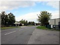
Bridge Road, Wrexham Industrial Estate
by Jeff Buck
geograph for square SJ3749
|
|
The Bridgeway Centre, Wrexham Industrial Estate
by Jeff Buck
geograph for square SJ3749
|
|
The Village Bakery on the Wrexham Industrial Estate
by Jeff Buck
geograph for square SJ3749
|
|
The Village Bakery and Juvela
by Jeff Buck
geograph for square SJ3749
The Village Bakery and Juvela bakery units on the Wrexham Industrial Estate.... (more)
|
|
Abenbury Way, Wrexham Industrial Estate.
by Jeff Buck
geograph for square SJ3750
|
|
Abenbury Way, Wrexham Industrial Estate.
by Jeff Buck
geograph for square SJ3750
|
|
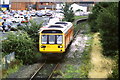
Train leaving Wrexham Central station
by Malc McDonald
geograph for square SJ3350
A Class 142 diesel multiple unit leaving Wrexham Central station. There clearly... (more)
|
|
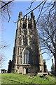
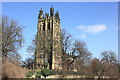
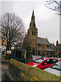
St Giles' Church, Wrexham
by Jeff Buck
geograph for square SJ3350
St Giles' Church seen from the west. St Giles is a Grade 1 listed building,... (more)
|
|
Prince Charles Road Health Centre (closed), Wrexham
by Jeff Buck
geograph for square SJ3450
The facilities at Prince Charles Road Health Centre have now transferred to the... (more)
|
|
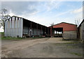
Llwyn Knottia Farm Buildings
by Jeff Buck
geograph for square SJ3550
Farm buildings at Llwyn Knottia farm near Wrexham.
|
|
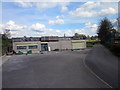
Building Renovation at the Queensway Sports Complex, Wrexham
by Jeff Buck
geograph for square SJ3450
A building, possibly once the changing rooms or the entrance to the playing... (more)
|
|
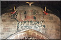
Doom Painting in St Giles' Church, Wrexham
by Jeff Buck
for square SJ3350
An early 16th century doom painting depicting the Day of Judgement above the chancel arch.
|
|
Town Hill, Wrexham
by Jeff Buck
geograph for square SJ3350
Looking north up Town Hill near St Giles' Church.
|
|
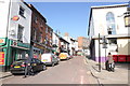
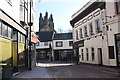
Church Street, Wrexham
by Jeff Buck
geograph for square SJ3350
Looking north along Church Street from near the entrance to St Giles' Church.
|
|
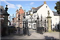
Entrance to St Giles' Church, Wrexham
by Jeff Buck
geograph for square SJ3350
The churchyard of St Giles is entered through these wrought-iron gates,... (more)
|
|
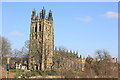
St Giles' Church, Wrexham
by Jeff Buck
geograph for square SJ3350
St Giles' Church seen from the south-west across the B5446. St Giles is a... (more)
|
|
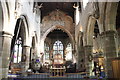
Nave and Chancel of St Giles' Church, Wrexham
by Jeff Buck
for square SJ3350
An early 16th century doom painting depicting the Day of Judgement can be seen... (more)
|
|
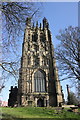
St Giles' Church, Wrexham
by Jeff Buck
geograph for square SJ3350
St Giles' Church seen from the west. St Giles is a Grade 1 listed building,... (more)
|
|
St Giles' Church, Wrexham
by Jeff Buck
geograph for square SJ3350
St Giles' Church seen from the south-west across the B5446. St Giles is a... (more)
|
|
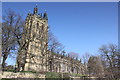
St Giles' Church, Wrexham
by Jeff Buck
geograph for square SJ3350
St Giles' Church seen from the south-west. St Giles is a Grade 1 listed... (more)
|
|
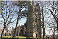
St Giles' Church, Wrexham
by Jeff Buck
geograph for square SJ3350
St Giles' Church seen through the trees from the north-west. St Giles is a... (more)
|
|
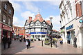
Abbot Street, Wrexham
by Jeff Buck
geograph for square SJ3350
Looking along Abbot Street towards the junction with Tower Hill. The tower of St... (more)
|
|
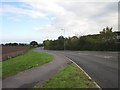
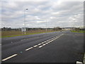
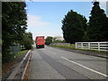
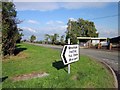
The B5130 (Holt Road) at Bowling Bank
by Jeff Buck
geograph for square SJ3948
Taken at the junction with Oak Road.
|
|
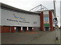
Racecourse ground - Wrexham FC
by Paul Gillett
geograph for square SJ3250
The Racecourse Ground is the largest stadium in north Wales and the fifth... (more)
|
|
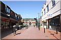
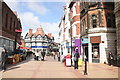
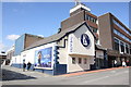
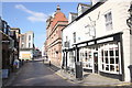
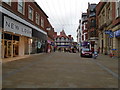
High Street Wrexham
by Paul Gillett
geograph for square SJ3350
Looking towards Boots the chemist from near St Giles's church
|
|
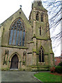
St Mary's catholic cathedral, Wrexham
by Paul Gillett
geograph for square SJ3350
|
|
St Mary's catholic cathedral, Wrexham
by Paul Gillett
geograph for square SJ3350
|
|
Wrexham Tennis Centre
by Paul Gillett
geograph for square SJ3251
The only indoor pay as you go tennis centre in North East Wales... (more)
|